We
made a loop hike in the Sedona area on 8 November 2014 by starting at
the Soldier Pass Trailhead, turning onto Jordan Trail at the Devils
Kitchen, taking the Cibola Pass Trail to connect with Brins Mesa
Trail, which we followed to Brins Mesa, and then returning on Soldier
Pass Trail.
 To
get to the trailhead we drove
north on Soldier Pass Road in Sedona for 1.5 miles, turned right on
Rim Shadows Dr. and continued for 0.2 miles to the Soldier Pass
Trailhead. There is a small parking lot at the trailhead that tends
to fill up fast but usually has space available before 0900. An
informational sign (right)
is posted at the trailhead.
To
get to the trailhead we drove
north on Soldier Pass Road in Sedona for 1.5 miles, turned right on
Rim Shadows Dr. and continued for 0.2 miles to the Soldier Pass
Trailhead. There is a small parking lot at the trailhead that tends
to fill up fast but usually has space available before 0900. An
informational sign (right)
is posted at the trailhead. From
the trailhead at the parking lot it is about 0.2 miles across Soldier
Wash to Devils Kitchen sinkhole (left).
Reference to a map at this point discloses that we are at the
beginning of a finger of National Forest land that extends into the
Red Rock Secret Mountain Wilderness. This finger of non-wilderness
land extends up Soldier Wash, becoming ever narrower, to end after
about a mile. Soldier Pass Trail runs through it up the wash on its
way to join Brins Mesa Trail at the pass.
From
the trailhead at the parking lot it is about 0.2 miles across Soldier
Wash to Devils Kitchen sinkhole (left).
Reference to a map at this point discloses that we are at the
beginning of a finger of National Forest land that extends into the
Red Rock Secret Mountain Wilderness. This finger of non-wilderness
land extends up Soldier Wash, becoming ever narrower, to end after
about a mile. Soldier Pass Trail runs through it up the wash on its
way to join Brins Mesa Trail at the pass.
Meanwhile,
Jordan Trail starts at the sinkhole and runs east, skirting the
wilderness boundary and ending at Brins Mesa Trail in Mormon Canyon.
We would hike only 0.3 miles on Jordan before turning onto Cibola
Pass Trail at the Yavapai/Coconino County line. This would take us
through Cibola Pass, which is included in a finger of wilderness area
that extends into National Forest land. We would then connect with
Brins Mesa Trail around 0.3 miles farther up Mormon Canyon than if we
followed Jordan Trail.
Before leaving Devils Kitchen, we paused to look west across Soldier Wash to Coffeepot Rock and the red rock spires to its right that adorned the skyline in the wilderness area on the other side.
 |
Red rock spires seen looking west from devils Kitchen – Coffeepot Rock is at left
|
 Leaving
the sinkhole we traveled along Jordan Trail to the Cibola Pass
Trailhead. I had hiked Jordan before without noting the trailhead
and was looking carefully so as to avoid missing it again. When we
got there, the trail was marked by a rusty, indestructible old metal
sign (right), quite prominently
displayed and obviously installed years ago. How did I ever miss it
before?
Leaving
the sinkhole we traveled along Jordan Trail to the Cibola Pass
Trailhead. I had hiked Jordan before without noting the trailhead
and was looking carefully so as to avoid missing it again. When we
got there, the trail was marked by a rusty, indestructible old metal
sign (right), quite prominently
displayed and obviously installed years ago. How did I ever miss it
before?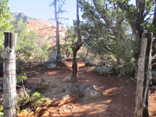 It
was only a short distance to the saddle that is Cibola Pass and that
turned out to be the most confusing part of the hike. At the very
crest is an old fence (left) with
an open pedestrian gate for the trail. Just through the gate,
however, the trail forks. Intuitively, since our goal was after all
to hike up the mountain to Brins Mesa, we took the left fork. A
decision that turned out to be wrong, although it does appear that a
social trail might eventually connect with Brins Mesa Trail further
up Mormon Canyon. Nevertheless the official Cibola Pass Trail
actually turns right here.
It
was only a short distance to the saddle that is Cibola Pass and that
turned out to be the most confusing part of the hike. At the very
crest is an old fence (left) with
an open pedestrian gate for the trail. Just through the gate,
however, the trail forks. Intuitively, since our goal was after all
to hike up the mountain to Brins Mesa, we took the left fork. A
decision that turned out to be wrong, although it does appear that a
social trail might eventually connect with Brins Mesa Trail further
up Mormon Canyon. Nevertheless the official Cibola Pass Trail
actually turns right here.
Before
leaving the saddle to descend into Mormon Canyon, we paused a few
moments to look back at the scenery behind us.
 |
Looking back across Soldier Wash from Cibola Pass
|
The
trail made a fairly steep descent into the canyon to connect with
Brins Mesa Trail. When we turned toward the mesa on that trail, we
found ourselves hiking along what was obviously on old roadbed. We
ascended gradually at first but eventually found ourselves climbing a
steep grade before we topped out on Brins Mesa.
When
we topped the rim of the mesa we found a large flat area that was
burned over in 2006, but is now well on the way to recovery. The
larger trees still stand like lonely, isolated specters, but thick,
healthy smaller plants and grass are rapidly replacing them.
The
two photographs below show Brins Mesa looking toward Soldier Pass to
the west (top) and toward Dry Creek to the northwest (bottom). They
are two halves of a panorama that I split to provide a more detailed
view of the mesa and of the hills and passes surrounding it.
 |
Looking west to the hills beyond Soldier Pass
|
 |
Looking northwest to the mountains beyond Dry Creek
|
We
met a few other hikers on the mesa and a small group were gathered at
an isolated viewpoint jutting out over Soldier Wash. We had
considered that spot as a lunch stop but, as it was already occupied,
choose to continue on and stop at a bare rock area just below Soldier
Pass. It was anyway just a bit on the chilly side and I was looking
forward to a noon nap in the sun.
The
following photograph shows the view looking south from Brins Mesa
near the junction of Soldier Pass and Brins Mesa Trails. Visible
just right of center is Coffeepot Rock.
 |
Looking south down Soldier Wash and past Coffeepot Rock
|
At
the trail junction, just before we started our descent on Soldier
Pass, we met a friendly couple from Texas and paused to chat for a
bit. Their youngest child had recently left for college and they
were enjoying their first vacation alone together in years.
The
trail descending into the wash is quite steep, one reason why I
planned a counterclockwise trip for this loop hike. Unfortunately,
Brins Mesa Trail turned out to ascend the mesa as steeply as does
Soldier Pass Trail. But at least there seemed to be less loose
gravel on Soldier Pass, making going downhill on the steep trail
fairly easy.
We
soon reached the sunny bare rock that I remembered from a 2011 hike
and stopped for lunch. I ate quickly and managed a good nap while
the other hikers chatted and enjoyed the view. Personally, I enjoy
chatting except when it is nap time and, as for views, I can take a
quick look at a scene and retain it in my memory as I drift off to
dreamland. I awoke when the other hikers started to stir and we
gathered for a photograph before continuing down the wash.
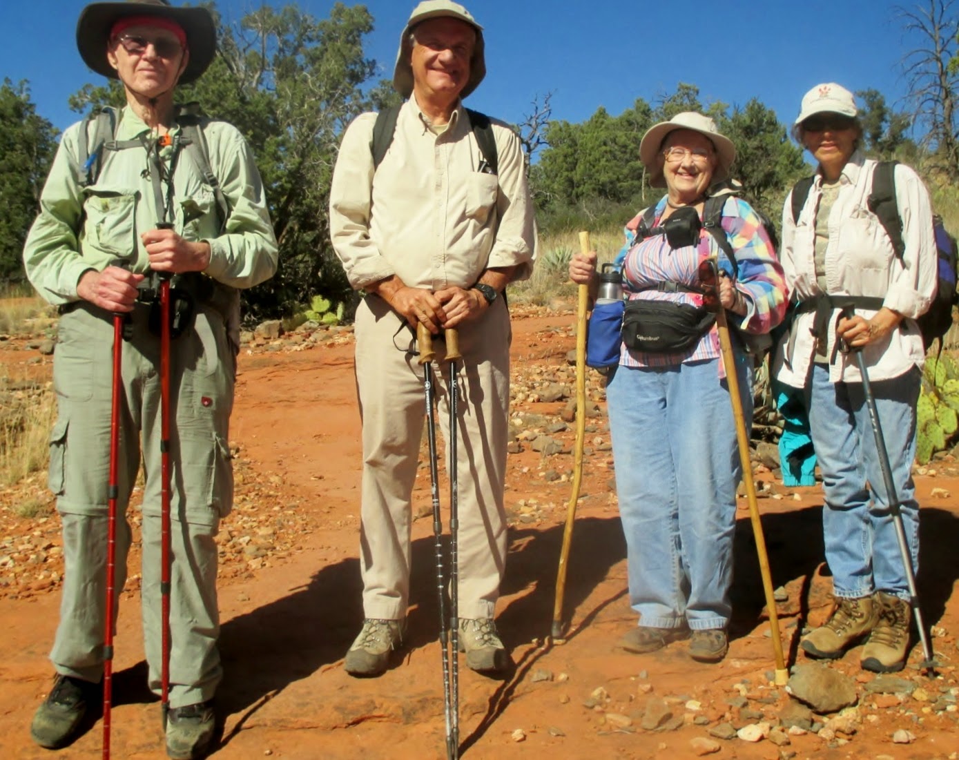 |
Left to right; The author, Jim Manning, Daisy Williams and Rita Faruki – photograph by Name Withheld
|
As
we descended, we left the wilderness area and entered into the finger
of non-wilderness land that extends up Soldier Wash. Soon we arrived
at the Seven Sacred Pools, a pretty pretentious name for a little
wash with a few pools eroded into it sandstone bed. At least one of
the Sedona Jeep tour companies refers to the pools as “The Seven
Sacred Apache Pools1,”
implying I suppose that the Apaches attached some religious
significance to them. The same source goes on to say that the pools
“only fill with rain or run-off” and that “through 2003, in the
course of recorded history, one of these pools has never dried up.”
 Although
they can't all be seen in this photograph (right),
there are indeed seven indentations, often holding water, eroded into
the sandstone. I have passed this way several times and must admit
that I have never seen them all dry. But to think that they depend
entirely on rain and run-off, yet never entirely dry up, would seem
to defy reason. If true that would appear to be a miracle, perhaps
leading to the idea that the pools are sacred.
Although
they can't all be seen in this photograph (right),
there are indeed seven indentations, often holding water, eroded into
the sandstone. I have passed this way several times and must admit
that I have never seen them all dry. But to think that they depend
entirely on rain and run-off, yet never entirely dry up, would seem
to defy reason. If true that would appear to be a miracle, perhaps
leading to the idea that the pools are sacred.
This
loop hike was 5.6 miles in length, the highest elevation was 5105
feet and the total ascent was 1357 feet.
Our
GPS track is shown in red on the included map (next
page). The short yellow track on the map shows the
way to the viewpoint overlooking Soldier Wash.

1http://www.greatventures.com/tours.aspx?id=21
No comments:
Post a Comment