The
Skyliner’s have a hike to Grandmaw’s Cave scheduled for 22
September 2011, and our leader Lila did not wish to attempt that hike
with knowing exactly how to get there. We had already tried twice
without being able to locate the cave, even though we knew we were in
the immediate vicinity. Thus it was that six stubborn Skyliners set
out on yet another scouting hike in a last ditch effort to locate the
cave before the hiking season begins in October.
The
following group photograph, taken in front of the cave, demonstrates
our success on this attempt.
 |
Left to right: George Everman, Lila Wright, John McInerney, Akemi
Tomioka, Gordon Bice and the author
– photograph by George using the authors camera
|
Lila,
John, Gordon and Ellis met at the Safeway parking lot in Cottonwood
at 0700. Kwi was missing, not having received word of the scheduled
hike. We drove to Harding Spring Trailhead at the entrance to Cave
Springs Campground on Hwy 89A where we were met by George and Akemi.
A parking lot is provided just to the right of the entrance to the
campground.
We
donned our packs, walked across Hwy 89A and headed up Harding Springs
Trail; the trailhead is marked by a rusty metal sign located very
near the sign for Cave Springs Campground.
 |
Harding Springs Trailhead sign and Cave springs Campground sign
|
We
headed up the trail at a reasonable pace so as not to tire ourselves
out too early in the hike. Harding Springs Trail is fairly steep,
climbing over 900 feet in just 0.7 miles; however, it is well
developed and a reasonably easy climb if you pace yourself.
An
old post marks the point where the trail tops out on the rim; it
probably once hosted a sign announcing the Harding Springs Trailhead.
 The old
post (right)
marks the start/end of Harding Trail at the rim. From
here a trail leads off to the southwest for about 100 yards to an
excellent overview point from which you can see back down Oak Creek
Canyon and across the way to the cliffs on the other side. A second
trail (Telephone to Cookstove) leads to the northeast along the rim
to connect with Cookstove Trail 1.4 miles away. Finally, a third
trail (also Telephone to Cookstove) leads to the southeast. One
takes this trail for approximately 0.3 miles before turning off to
the right, heading almost directly south (about 140 degrees true) to
cross a wash; emerging on the south side of the wash, the trail
(indistinct but marked by cairns along the way continues for about
another 0.1 miles (you should never be out of sight of a cairn)
before crossing another wash. It then turns to the northwest (about
292 degrees true) for around another 0.3 miles to the very tip of the
ridge you are on. At this point you are just about on top of
Grandmaw’s Cave; however, a hard scramble down the face of the
cliff along a steep, barely discernible trail to the cave opening
awaits you. (NOTE: these interim distances are approximate)
The old
post (right)
marks the start/end of Harding Trail at the rim. From
here a trail leads off to the southwest for about 100 yards to an
excellent overview point from which you can see back down Oak Creek
Canyon and across the way to the cliffs on the other side. A second
trail (Telephone to Cookstove) leads to the northeast along the rim
to connect with Cookstove Trail 1.4 miles away. Finally, a third
trail (also Telephone to Cookstove) leads to the southeast. One
takes this trail for approximately 0.3 miles before turning off to
the right, heading almost directly south (about 140 degrees true) to
cross a wash; emerging on the south side of the wash, the trail
(indistinct but marked by cairns along the way continues for about
another 0.1 miles (you should never be out of sight of a cairn)
before crossing another wash. It then turns to the northwest (about
292 degrees true) for around another 0.3 miles to the very tip of the
ridge you are on. At this point you are just about on top of
Grandmaw’s Cave; however, a hard scramble down the face of the
cliff along a steep, barely discernible trail to the cave opening
awaits you. (NOTE: these interim distances are approximate)
The
cave itself is quite large, running approximately 100 yards back into
the mountain ridge along which we had traveled. The following
picture was taken as the photographer approached the cave.
 |
Approaching the cave – photograph by George
|
Just
inside the cave mouth is located a geocache, securely chained to the
wall. The next two photographs show the cache and George
placing
a golf ball in the box. Akemi left the paper swan; not being into
geocaching, I left nothing and took nothing.
 |
Geocache box showing, among other items, Akemi’s paper swan and
George’s golf ball - by George
|
 |
George placing a golf ball in the Grandmaw’s Cave geocache
|
 |
The end of Grandmaw’s Cave – photograph by George
|
 |
Looking out from inside the cave – Gordon, Lila and John are shown
|
The
following two pictures (below) were taken as we climbed
back up the cliff from the cave.
 |
Akemi and John climbing back up the trail to the top of the ridge
after our visit to Grandmaw’s Cave
|
 |
Lila and Gordon climbing up the cliff from Grandmaw’s Cave
|
Back
on top of the ridge above Grandmaw’s Cave, I took a photograph of a
tree that grows from approximately just above the cave opening and
then found another one taken on 17 August 2011 showing the same tree.
We had almost found the cave on that trip.
 |
Photograph showing tree growing just above the mouth
of Grandmaw’s Cave
|
 |
Taken 17 August 2011 – George appears to be pointing at the tree
growing above Grandmaw’s Cave
|
As
we continued our way up the trail along the ridge from the point
above Grandmaw’s cave, I took several photographs looking back just
to remind myself what the trail looked like on the way to the cave.
 |
The trail to the ridge point above the cave leads close against the
cliff wall shown here
|
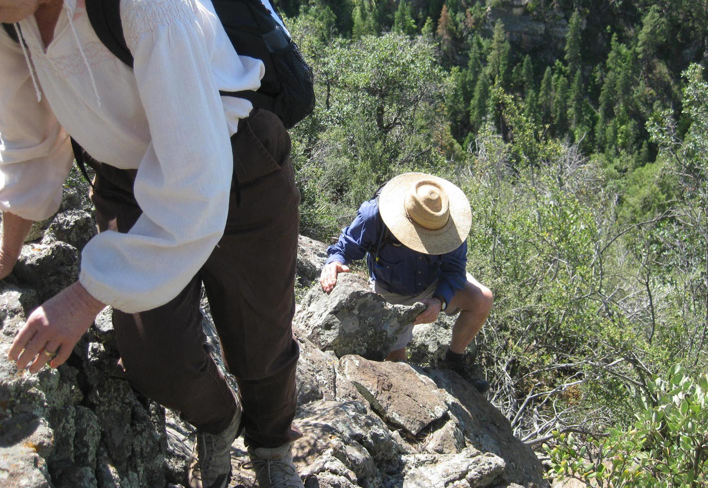
 |
The going is steep and rocky in places
|
Fortunately,
the rough part of the trail leading down to the point of the ridge
above Grandmaw’s Cave is only about 0.1 miles. The rest of the way
between there and the intersection of Harding Springs Trail and
Telephone to Cookstove Trail is an easy hike – just watch for
cairns and, if possible, load the Garmin gdb file sent along with
this report in a GPS and follow it. That will help to avoid a lot of
wondering as to whether you have taken a wrong turn.
We
arrived back at the top of Harding Springs trail in short order and
then continued the 100 odd yards out to the viewpoint to eat lunch.
After
lunch we took the Telephone to Cookstove Trail north along the rim
for about 1.4 miles to its intersection with Cookstove Trail.
 |
The blaze on the tree shown here marks the end of Cookstove Trail
at Telephone to Cookstove Trail
|
The
Arizona topo map I am using in my GPS shows Telephone to Cookstove
Trail running on north along the rim for about 0.3 miles, I think
just to a viewpoint, before it ends.
Cookstove
Trail seemed to me to be steeper than Harding Springs Trail had been.
However, when I downloaded the GPS file and examined it in the
computer, I found that we had descended about 200 feet less than we
had ascended on Harding Springs Trail. The recorded distance was
exactly the same – 0.7 miles.
The
Cookstove Trailhead at Hwy 89A is, like the Harding Springs
Trailhead, marked with a rusty metal sign (below
left). A drinking water station
(below right)
is located directly across the highway from the trailhead and just a
few yards from the north exit from Pine Flats Campground. The water
was most refreshing and we all paused for a drink and a short rest
before continuing on.
 |
Trailhead sign
|
 |
Water station
|
We
were about 1.1 miles north along Hwy 89A from where we had parked at
the Harding Springs Trailhead, and because there is hardly enough
room to walk alongside Hwy 89A in places, we took a slightly longer
(1.2 miles) route: we hiked through Pine Flat Campground to emerge at
the south exit, walked along Hwy 89A for about 100 yards and then
entered the Pine Flats community, crossed Oak Creek on a low concrete
bridge and continued straight on Bear Howard Road which soon became a
dirt road.
About
0.1 miles after leaving Hwy 89A we turned left (south) onto a trail
(apparently unnamed) that starts in the edge of a private driveway
and follows a power line across a saddle behind a hump that separates
it from Hwy 89A. Our trail then crossed back to the east side of Oak
Creek about 0.3 miles from Bear Howard Road. After crossing back
over the creek, we continued straight toward the highway for about 40
yards, turned right onto another trail and followed it for about 50
yards before turning left on still another trail which we followed
only 30 yards or so before turning right on a straight, open trail
which led us directly to our parked vehicles about 0.1 miles ahead.
Akemi
is headed back to Japan on the 27th
and this was her last hike with us this year, so while still at the
Grandmaw’s Cave we took the time to wish her well and to toast our
success in finally finding the cave
with a spot of green tea.
 |
Toasting our success in finally finding Grandmaw’s Cave with
a spot of Akemi’s green tea
|
With
the extra trip to eat lunch at the viewpoint and the searching we did
to find the Cave, my GPS indicated that we hiked 5.2 miles. The
highest elevation was 6335 feet and the total ascent was 1828 feet.
Some
distances:
Harding
Springs Trail: 0.7 miles (red).
Top
of Harding Springs Trail to Grandmaw’s Cave: 1.0 mile (magenta).
Harding
Springs Trail to Cookstove rail on rim: 1.4 miles (green).
Cookstove
Trail: 0.7 miles (red).
Cookstove
Trail to Harding Springs Trail along Oak Creek: 1.2 miles (dark
magenta).
Lookout
Point at top of Harding Spring Trail: 0.1 miles (white).
Note:
The sum of these separate tracks differ slightly from the total due
to rounding error.
The
included map (below) shows the
route we took for this hike.

No comments:
Post a Comment