It
was a beautiful, shirtsleeve-weather day when eight Skyliner hikers
set out from Cottonwood on Saturday, 16 June 2012 to hike the
Abineau-Waterline-Bear Jaw Loop on the north slope of the San
Francisco Peaks. Seven of us left Cottonwood at 0630 and drove
through Sedona to pick up Becky Fowsky.
 We
drove up Oak Creek Canyon, took I-40 at the airport exit, continued
straight on Milton when the freeway ended, passed under the railroad
overpass, took the sharp right turn and turned left onto US Hwy 180
(Humphreys Street). We drove 19.4 miles on US Hwy 180 to turn right
onto FR 151. (Note that FR 151 could also be accessed at mile marker
235 but that results in a long trip on a dirt road. Pass on by.)
About 1.6 miles after turning on FR 151, we came to a junction with
FR 418, turned slightly left onto 418 and continued for another 3.1
miles before turning right onto the road (FR 9123J) (above, right)
to the Abineau-Bear Jaw Trailhead parking lot. This road is only
about 0.6 miles long and we came to a fork just before we reached the
lot; we bore to the left and almost immediately were there.
According to my GPS, the elevation at the parking lot was about 8540
feet.
We
drove up Oak Creek Canyon, took I-40 at the airport exit, continued
straight on Milton when the freeway ended, passed under the railroad
overpass, took the sharp right turn and turned left onto US Hwy 180
(Humphreys Street). We drove 19.4 miles on US Hwy 180 to turn right
onto FR 151. (Note that FR 151 could also be accessed at mile marker
235 but that results in a long trip on a dirt road. Pass on by.)
About 1.6 miles after turning on FR 151, we came to a junction with
FR 418, turned slightly left onto 418 and continued for another 3.1
miles before turning right onto the road (FR 9123J) (above, right)
to the Abineau-Bear Jaw Trailhead parking lot. This road is only
about 0.6 miles long and we came to a fork just before we reached the
lot; we bore to the left and almost immediately were there.
According to my GPS, the elevation at the parking lot was about 8540
feet.
Access
is also possible from US Hwy 89. However, that involves a pretty
rough 13 mile trip on a dirt road. One of our hikers recently drove
both routes and recommended access from US Hwy 180.
It
was warm enough at the trailhead that we felt no need for jackets.
We donned our packs and set out up the mountain, walking about 250
feet from our parked cars to the trailhead. A sign warned that
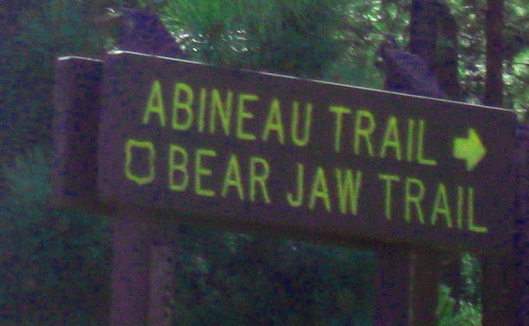
Abineau is the more difficult horse trail (a little later we were to
see why) and a map (see
next page)
of the Abineau-Bear Jaw Loop was posted
to show the way. For the first 0.4 miles the trails run together,
leading into Abineau Canyon (very shallow here). There they split,
Bear Jaw leading generally east along the foothills of Abineau and
Abineau heading generally south up Abineau Canyon. The trail map
posted at the trailhead and the sign where the trails split are shown
below.
 |
North-oriented trail map posted at the Abineau-Bear Jaw Trailhead
|
 |
Trail sign and sign-in box – the small bottom sign points right for Abineau
and left for Bear Jaw
|
Because
our hike leader remembered sliding down Abineau Trail on a previous
hike, he chose to go up it this time. After signing in, we followed
him up the trail, at this point, fairly steep but easy
to hike. The below photograph shows a typical view of the lower
portion of the trail.
 |
Lower part of Abineau Trail
|
Abineau
measures (my GPS) 2.4 miles from the trailhead to Waterline Trail.
About three quarters of a mile before we reached the top, we left the
treeline and entered an open space that stretched across the bottom
of the canyon and continued all the way to the top. Here the trail
became even steeper and was strewn with loose gravel on a hard
surface, making it very precarious. I could now understand the
warning sign for equestrians at the trailhead and why
our leader did not want to
descend on this trail.
We
were now high up the mountain slope and, once we had left the cover
of the forest and climbed far enough above the fir trees to see
through their tops, we got our first glimpse of the great views of
deserts, mountains and prairies to our north.
 |
View to the north from Abineau Trail
|
By
the time our
leader, followed closely
by me, Lyne and then Becky, reached the top of Abineau, we were all
ready to take a good rest. The other four members of our group, in
contact by walkie-talkie, had stopped for a snack along the way and
were father behind. A jumble of trail signs were posted at the
junction to show the way from here.
 |
Trail direction signs at Abineau/Waterline junction
|
The
top sign (above) points back down Abineau Trail, back
the way we had come. The lower sign points left for both Bear Jaw
and the Inner Basin Trail.
We
were actually located on the northwest slope of Abineau, with
Humphreys looming over us to the southwest (1960 true),
but a nearby sign warned that access to Humphreys from this side was
prohibited.
The
sun was warm and there was just enough wind to moderate the
temperature, so we were in no great hurry to leave this most pleasant
spot. That seemed to be a common sentiment as we were soon joined by
several other hikers. We, at one time, numbered sixteen sprawled out
on the ground and perched on the surrounding rocks as hikers came and
went. Looking to our north, we now had an unobstructed view back
down Abineau Canyon and on across the jumble of prairies mountains
and desert to the northern horizon.
 |
View from Abineau/Waterline Trails junction
|
Closer
up, on the slope just below us was a small fir tree with
extraordinary cranberry-red cones. They looked good enough to eat.
 |
Cranberry-red cones on a small fir tree
|
We
ate lunch there (but refrained from sampling the fir cones), enjoying
the balmy weather and the great view. But, too soon, it was
time
to leave, so we again donned our packs and headed down Waterline
Trail to the junction with Bear jaw, 2.1 miles (again by my GPS)
ahead.
 |
Looking down Waterline Trail toward the junction with Bear Jaw
|
While
still on Waterline Trail, we paused for a group Photograph.
 |
Left to right: Becky Fowsky, Lyne Brousseau, Kwi Johnson, Lila Wright,
Betty Wolters (front), Name Withheld and Miriam Sterling
|
This
was undoubtedly the easiest and most pleasant part of the hike, as we
found ourselves traveling gently downhill along an old road once used
to service the now abandoned waterline. Along the way, I found a
spot in the trail with a deep luxurious covering of pine needles and
was sorely tempted to stop for a nap. Unfortunately, I was overruled
and we kept going.
The
upper end of Bear Jaw was clearly marked and we had no trouble finding it. As shown in
the following photograph, the upper portion of the trail is fairly
steep and quite rocky. However, compared to the upper part of
Abineau, composed of loose gravel on a steep, hard surface, it was a
breeze and we continued to make good time.
 |
| Trail junction sign |
 |
Rocky upper portion of Bear Jaw Trail
|
The
trail descends into Bear Jaw Canyon and climbs out the other side,
runs directly north down the the west side of the canyon for a short
distance, then turns to the northwest and descends gently along the
slope of Abineau, crossing Reese Canyon on the way. Much of the way
along the slope we seemed to be following an old road, probably a
logging road. When we arrived back at the junction with Abineau
Trail, we did not pause but continued on the short additional
distance to the joint Abineau/Bear Jaw Trailhead at the parking lot
We
made the 2.6 mile (my GPS) trip from the Waterline/Bear Jaw junction
to the trailhead with only two short breaks. Our hike was done.
Lila is shown below as
she emerges at the trailhead. While the trail sign says the hike is 6.8 miles, my GPS gave the distance as 7.1.
 |
Lila ending the Abineau/Bear Jaw Loop hike
|
We
climbed into our vehicles and headed back to Cottonwood, stopping, at
Miriam's urging, at the junction of the road from the parking lot
with FR 418 to take the following photograph of prairie and
mountains. Thank you Miriam, you have a good eye.
 |
View of prairie and mountains from FR 418
|
According
to my GPS track we hiked 7.1 miles, the highest elevation was 10330
feet and the total ascent was 1879 feet.
The
GPS track for this hike, along with some additional information, is
shown on the included map (below).
At the top of the page, FR 418 is shown in magenta; the short blue
track is FR 9123J, the connector to the parking lot at Abineau
Trailhead; the GPS Track is shown in red; the green track shows the
part of Waterline Trail that was not included as part of this loop
hike; and the yellow track is the route of an old road that shows on
some maps.


