Rosemary
and I left Cottonwood early in the morning and drove to Albuquerque,
the start of a 4091-mile road trip that would take us to destinations
in West Tennessee, East Tennessee, Alabama and Missouri. The weather
was nigh perfect when we started out and remained that way for the
entire trip except for one rainy day in Joplin, MO followed by a
somewhat-foggy morning.
It
was a Sunday morning and traffic was light as we climbed the Mogollon
Rim to Flagstaff on Interstate Highway I-17 on 23 August 2015. I
adjusted the cruise control to 75 miles per hour and barely slowed at
all until the speed limit was reduced as we approached the the
airport exit. At Approaching Flagstaff, we noted the sign erected
to celebrate the 2012 Arizona Centennial. Based on the Arizona
welcome signs that are posted at the state line.
 |
Arizona State Welcome Sign – posted at state borders – photograph by Anita Jackson
|
The
primary difference is that the centennial version has a centennial
emblem replacing the star in the center of the flag. There are
several of these signs from the 2012 celebration still posted around
the state. Being so similar to the welcome signs at the state
border, they always give me the immediate impression that I am just
entering the state.
We
made a quick stop at the Trinket-littered Cracker Barrel restaurant
in Flagstaff and then headed east on I-40. The modern interstate
highway follows closely along the route taken by old Route 66, the
historic highway known as the Mother Road and enshrined in American
popular culture by song, film and television. These include such
works as Get Your Kicks on Route 66, a song composed in 1946
by Bobby Troup and recorded by Nat King Cole; The Grapes of Wrath,
a novel written by John Steinbeck and published in 1939; a 1940 film,
The Grapes of Wrath, produced by Darryl F. Zanuck; and the
1960-1964 CBS television series, Route 66, starring Martin
Milner. I never travel this way without feeling a twinge of
nostalgia for the times I drove Route 66 in the sixth and seventh
decades of the last century.
As
we passed the now closed remains of the old Twin Arrows Trading Post
just east of Flagstaff, I vividly remembered my first stop there. I
was traveling by bus along Route 66 in the 1950s and we stopped there
for a rest break. Alas, the buildings are now badly deteriorated and
about the only thing remaining are the twin arrows (photograph
below), two telephone poles embedded into the ground
at an angle with tips and feathers added. I have heard that the
historically significant property is owned by the Hopi Tribe and that
they hope to restore it as a tourist attraction. Meanwhile the name
Twin Arrows seems to have been appropriated by the nearby Twin Arrows
Navajo Casino Resort which opened in 2013. An accurately restored
Twin Arrows Trading Post should do well near the busy casino.
We
continued on our way east, soon passing the exit to Meteor Crater.
This privately-owned attraction, designated a National Historic site,
is described as follows:
“Meteor
Crater is nearly one
mile across, 2.4 miles in circumference and more than 550 feet deep.
It is an international tourist venue with outdoor observation trails,
air conditioned indoor viewing, wide screen movie theater,
Interactive Discovery Center, unique gift and rock shop, and
Astronaut Memorial Park at the Visitor Center located on the crater
rim.”
We
both had visited the site more than once. My most enjoyable
attraction was before the owners added such “improvements” as a
Subway restaurant. We passed it by on this trip without hesitating.
Below
are shown the recently restored arrows at the Twin Arrows Trading
Post (left)
and an aerial view of Meteor Crater (right).
Next
up was the town of Winslow, a city of about 1500 residents. I last
stopped there in October 2012 to eat dinner in the Restaurant at the
La Posada Hotel. Designed by Mary Coulter and built in 1929, the
11-acre site that is now the La Posada Historic District opened in
May 1930 as a part of the Harvey House chain.
 |
La Posada
|
Opened
at the beginning of the Great Depression, the La Posada was the last
of the great railroad hotels. The hotel closed sometime in the late
1950s and the facility was converted into office space by the
railroad. The complex was named to the National Register of Historic
Places in 1992 and purchased by new owners in 1997 who began its
restoration. Now known as La Posada Inn and Gardens, the historic
district includes the hotel and restaurant, gardens, museum and
trading post.
In
1972 Winslow achieved national fame with the release of Take
it Easy, a
song
written by Jackson Brown and Glen Frey and performed by the Eagles
and containing the line “standing
on a corner in Winslow, Arizona."
 |
| Standing on a corner in Winslow, Arizona |
It
was not yet time for lunch and both Rosemary and I had already stood
on the famous corner, so we continued on our way without stopping in
Winslow.
Continuing
east on the interstate highway we passed through Joseph City, an
unincorporated community of fewer than 1500 residents. It was
founded by Mormon settlers in 1876 and was first called Allen's Camp
in honor of the settler's leader, Captain William C. Allen. In 1878
it was renamed Saint Joseph to honor Mormon leader Joseph Smith.
Finally, in 1923, the name was changed to Joseph City at the request
of the Santa Fe Railway to avoid mail and freight confusion with
Saint Joseph, MO. I have driven through the area dozens of times
without ever really stopping to look around. Consequently, the only
thing that stands out in my mind is the 1021 MW Cholla coal-burning
power plant with its large artificial lake used for cooling. I must
say that I have never seen the plant spewing smoke like that seen in
the 2010 photograph shown below; usually, one sees only a whitish
wisp emanating from the smokestacks.
 |
| Cholla Power Plant at Joseph City, Arizona |
From
Joseph City it is less than a dozen miles on to Holbrook, a city with
fewer than 6000 residents, less than half the size of Winslow. It
was incorporated in 1917, having served as the county seat of Navajo
County since 1895. The semi-famous Wigwam Motel is located here and
a meteor with an estimated mass 419 pounds exploded over the town in
1912, showering the area with stones varying in weight from 6.6
kilograms to less than 0.1 grams.
The largest individual fragment, weighing about 14.5 pounds, is
currently located at the Bateman Physical Sciences Center at Arizona
State University in Tempe.
I
have never stopped to search for meteor fragments and have no desire
to stay at a motel with, insofar as I can determine, nothing to
recommend it except the experience of sleeping in a tepee. However,
I did find photographs of both the motel
and the meteor fragment.
I
once stopped in Holbrook for repairs to my Chevrolet S-10 pickup
truck. My water pump failed somewhere between Chambers and Lupton
and I had the truck towed to a repair shop in Holbrook. It was
Wednesday, 11 April 2001 and Rosemary and I were in the process of
moving from Eatonton, Georgia to Cottonwood, Arizona. I had left
Eatonton first, stopped by my new employer's office in Texas and then
worked my way up through New Mexico performing overdue boiler
inspections on the way. I planned to pick up the key for our new
house in Cottonwood and sleep on the floor in my sleeping bag until
our furniture arrived. Rosemary, driving separately, would stop to
visit her mother in Memphis and arrive in Cottonwood after the
furniture was delivered.
The
repair shop did not have a water pump and repairs would be delayed,
so I called the nearest Enterprise Rental location, in Show Low, to
have a rental car delivered to me in Holbrook. I then drove the
Enterprise driver back to Show Low and followed Hwy 260 to
Cottonwood, the first of many trips along the Mogollon Rim.
Meanwhile,
my company had been asked to provide a quote for insurance coverage
for the City of Phoenix and I had scheduled inspections of the city's
engineering facilities for the next week. I had no time to waste, so
as soon as the truck was repaired, I returned to Winslow and picked
it up. Unfortunately, the repairs lasted only a few days before the
replacement pump failed. Luckily I had traveled to Phoenix for lunch
with the Arizona Chief Inspector when this failure occurred and he
knew just where to have it repaired. We dropped it off on the way to
lunch and by the time we finished it was ready to go. The unhappy
auto repair experience is what I remember about Holbrook.
Continuing
east on I-40 from Holbrook we would pass through the Petrified Forest
National Park. Rosemary and I had both stopped there more than once.
I remember being quite impressed at all the stone tree trunks lying
about. Rosemary, on the other hand, said she was quite disappointed
on her first visit, made as a teenager with a church group from
Memphis, Tennessee. She had expected to see a forest of standing
stone trees.
Rather
than visiting Petrified Forest, I much prefer turning north on Hwy 77
in Sun Valley between Holbrook and the Petrified Forest exit and
driving deep into the Painted Desert. From there one can look back
across the beautifully-colored desert to the often snow-capped San
Francisco Peaks. On a clear day it appears that one could almost
reach out and touch the distant peaks. Alas, this day was not at all
clear and we continued on our way with no distant views at all.
We
were following along the course of the Puerco River which drains the
western slope of the Continental Divide in Northern New Mexico. The
river flows into Arizona at a mountain gap at Lupton. The below
quotation, along with the accompanying photograph, is from a report
of that trip included in my book Familiar Faces and New Places.
It
was just after 0800 when we crossed into New Mexico and I remembered
to look for traces of water in the Puerco River which runs through
the same pass used by the Interstate Highway and the Atchison, Topeka
and Santa Fe Railroad (now the Burlington Northern and Santa Fe
Railway).
The
Puerco River, not to be confused with the Rio Puerco, runs southwest
and drains into the Little Colorado at Holbrook. Rio Puerco, on the
other hand originates in northern New Mexico on the eastern side of
the continental divide and drains into the Rio Grande at Contreres,
NM south of Albuquerque.
As
I always have, the many times I have traveled this way by automobile,
I did see water; however, I am sure I will look again when next
passing this way because it just seems so unlikely.
 |
| Water in the Puerco River near Gallup, NM |
We set our clocks ahead an hour at the New Mexico border and headed for a late lunch at Applebee's Restaurant in Gallup. We found the food to be good and the service excellent. It was an easy 140 miles from Gallup to Albuquerque where we were staying that night and we stopped only once along the way. Truck traffic was surprisingly light and, judging from the many trains loaded with trailers we saw along the way, decided that the railroad must have taken a lot of the long distance rigs off the road.
Several
of the tractor-trailer rigs we did see on the road had been fitted
with “trailer tails.” These are flaps attached to the rear end
of the trailer, at the top and bottom and at each side. When not in
use they fold flat against the rear of the trailer. When in
operation they are opened to an approximate 45% angle, sloping toward
the center. The first one we saw did not have the tails extended and
we were at a loss as to what the strange contraption folded against
the rear of the trailer was. However, we soon passed a rig with the
tails extended and realized that they were being used to reduce drag
and stabilize the trailer. One manufacturer produces tails that open
automatically when the rig reaches a speed of 35 mile per hour. They
claim that their product is certified by the SAE (Society
of Automotive Engineers) to
deliver 5.54% fuel efficiency gains at 65 mph based on SAE Type II
testing.
I saw other estimates of fuel savings ranging up to 7.5%.
I
had received a text message while on the road informing us that our
room was ready, so on arrival in Albuquerque we drove directly to the
La Quinta Inn and Suites in downtown and checked in. Our
accommodations were on the ground floor a short distance from the ice
machine and breakfast room and the staff were very friendly and
attentive.
After
resting for awhile we walked about a block down the street and had
dinner at the Range Restaurant. I had eaten there many times while
working in Albuquerque and knew what to expect. However, the food
just didn't taste as good as I remembered. In retrospect I think
this was because I was a bit under the weather. I had come down with
a mild case of diarrhea a couple of days before we left home and I
had an upset stomach. I ate anyway and suffered for it the next day.
We
arose early the next morning and, after breakfast at the motel, were
soon on our way east. We were thankful that traffic was light and
that there were still relatively few trucks on I-40. Somewhere along
the way we passed four brand new highway tractors. These were
apparently being delivered to a new owner and the first tractor was
being used to tow the other three. The tow had been made up by
lifting the front ends of the three towed tractors onto the rear of
the one in front. Amusingly the towing tractor had failed and they
were parked alongside the highway with the driver pacing dejectedly
while awaiting a tow to the repair shop. Our first thought was to
wonder why in the world he was waiting for a tow. After all he had
three spares. But, on second thought, he would probably have needed
a crane to remake the tow and change to another tractor. In any case
there was certainly nothing we could do for him, so we continued on
our way toward the Texas border.
Our
goal for tonight was to reach the Oklahoma City area where we had a
reservation at the La Quinta Inn and Suites at Yukon, Oklahoma.
About
three hours into the drive we stopped for a bathroom break and, as
soon as I stepped out of the car, I knew I was in trouble. My mild
case of diarrhea had become an unstoppable urge. I barely made it to
a stall in the bathroom but didn't have time to pull my pants down
before I exploded, evacuating everything I had eaten during the last
12 hours. I wore my soiled pants back to the parking lot to retrieve
a change of clothes from the car and then hastened back to the
bathroom to clean up and change. I rinsed my soiled attire and
sealed it in a large ziploc baggie for transportation to the next
laundry stop. I took a dose of Imodium and followed that by becoming
one of Metamucil's best customers for the next several days.
Numerous
wind turbines, most of them spinning lazily in the breeze, graced the
skyline as we passed through the Texas Panhandle.
 |
| Wildorado Wind Farm |
I
think these graceful, orderly rows of turbines are quite attractive
additions to the skyline and, being particularly impressed with those
at the Wildorado Wind Ranch, I looked up the specifications for the
machines. They are identified as Siemens Siemens 2.3-MW Mk II units.
The blades are 157' and 5.75” long and rotate at speeds between 6
and 16 RPM. The rotor hubs are mounted about 230 to 262 feet from
the ground and each turbine generates 2.3 MW of electricity at 690
volts and a frequency of 50 hertz.
One
of those ubiquitous signs promising free 72-ounce steaks at the Big
Texan told us that we were nearing Amarillo. The $72 charge for the
meal, consisting of the steak itself, a bread roll with butter, a
baked potato, a shrimp cocktail, and a salad, is payable in advance,
but refunded for successful participants. I don't eat red meat and
Rosemary could live for a week on that much food, so we forewent the
delights of the Big Texan Steak Ranch and continued on past Amarillo.
 |
| Big Texan Steak Ranch |
A
little less than 50 miles east of Amarillo, as we approached Groom,
we caught sight of the Groom Cross.
The cross along with the much-photographed Leaning Tower of Groom
serve to fix this small Texas town in my memory.

The
cross, was constructed in 1995 by Steve Thomas of Pampa, Texas who,
reportedly disgusted with the huge billboards advertising XXX
pornography locations along I-40 wanted to make a public profession
of faith.
The leaning tower, originally used as a water tank by the town
of Lefors, was relocated and reinstalled at its present location on
the east side of Groom by Ralph Britten sometime around 1980.
Originally intended to supply water for Britten's truck stop and
restaurant, it was never used as such, but was instead deliberately
installed at an angle to draw attention to business. Reportedly, when
motorists stopped to report that the tower was on the verge of
collapse, they found themselves in the parking lot of Ralph Britten's
truck stop and restaurant. The truck stop is said to have closed due
to a fire about five years after the tank was installed.
Another
30 miles along Interstate 40 brought us to McLean, Texas. This is
the area where where several members of my grandmother Nana Brown
Wicker's immediate family settled in the early 1900s. McLean is also
where my mother's cousin Cecil Beatrice Roby and her husband, Albert
Roby, are buried. The Roby's had lived in California years before
when I was a single sailor, and I spent a lot of time with them. To
me they were Mamaw and Papaw and their house was always a welcome
respite from a tiring trip at sea. They had later moved to
Brownwood, Texas and had arranged to be buried at McLean, the place
where they first met.
We
had stopped to spend time with them in Brownwood several times on our
travels across the country. On one of those visits, Papaw had
drafted me for a work trip to McLean. Papaw had loaned his older
brother, Bryan, $300 years before and had never been repaid. Uncle
Bryan, as he was known to me, raised hogs for a living, and, while we
were visiting in Brownwood, he called Papaw to offer him a pregnant
sow to settle the debt. Papaw just had to drive to McLean to pick
her up. And, “Oh, by the way, could he bring the boys along to
help with catching a few boar pigs he needed to castrate.” The
“boys” were the Roby's son, Lex, and the visiting sailor. We
were both in our early forties at the time, June of 1974, but Uncle
Bryan was around 90 and, to him, we were mere striplings.
Casting
caution to the winds, we hooked a trailer, for hauling the pregnant
sow back to Brownwood, to the Roby's immaculately kept Oldsmobile
Toronado and headed north to McLean, 300 miles away. Leaving
Brownwood very early in the morning, we arrived in McLean before
noon. We planned to be back home by late afternoon.
As
it turned out, a “few boar pigs” meant 25 or 30 of the critters
and they were roaming freely all over Uncle Bryan's fenced two to
three-acre plot. That included roaming through his house (As the
reader has probably surmised by this point, Uncle Bryan was a
bachelor) and several outbuildings. It had rained recently and the
entire property was one big mudhole. By the time Lex and I had
caught all of those pigs and delivered them to Papaw for castration
(Uncle Bryan, being the older brother, supervised) it was close to
sundown.
Luckily,
a kindly lady who lived nearby, surely a family member, had agreed to
cook a meal for us to eat before we hit the road. After first
loading the pregnant sow into the trailer, we presented ourselves to
be fed. Papaw and Uncle Bryan were in decent shape, but Lex and I
were both indescribably dirty and smelly. The lady took one look or,
perhaps, sniff and promptly moved the meal out of the house and onto
the porch. Even then we were given a water hose and instructed to
wash ourselves off in the yard, clothes and all, before approaching
the porch. Of course we had not had the foresight to bring a change
of clothing, so we ate our meal in wet clothes.
By
the time we got back to Brownwood and unloaded the pregnant sow, we
were ready to eat again. This time we bathed beforehand and were
allowed to eat in the dining room.
As
for the sow, she duly delivered her litter of pigs, even producing
one more pig than she had teats. The smallest and weakest of the
pigs was thus left without a teat. Papaw named him lefty and raised
him on a bottle. However, when it came time to send the pigs to
market, he just couldn't bear to think of a stranger eating his pet
pig, so he kept Lefty and butchered him himself. The request to,
“Pass the Lefty” was for a while a familiar call at the Roby's
breakfast table, especially when there were grandchildren present to
be horrified.
Leaving
McLean, it was only 35 miles to the Texas border and another 40 miles
to Elk City, OK. I considered suggesting stopping for an early
dinner at the Portobello Grill in Elk City, but it was really still
too early, even considering that we had just set the clocks ahead an
hour when we left New Mexico. Also, Rosemary had mentioned wanting
to stop at the Cherokee Trading Post, another 70 miles east, for one
of their delicious chocolate pies, so we passed Elk City and
continued on our way. Unfortunately, when we arrived at the trading
post we found that the restaurant had been replaced by a Subway,
certainly not the place for chocolate pies.
Greatly
disappointed at the demise of a favorite eating place we continued on
to our motel, only another 30 miles ahead, at Yukon on the western
side of Oklahoma City, again having received one of those helpful La
Quinta text messages telling us that our room was ready. Our room at
this La Quinta was nice and the internet connection worked as
expected. However, nothing else was even satisfactory. The staff
were brusque, seemingly more interested in gathering just outside the
main entrance to smoke and gossip than in serving their guests, and
the breakfast next morning seemed to be whatever was left over from
previous servings. For example, there was little variety in the
oatmeal packets and the dry cereals were stale. To make matters even
worse, there are no decent nearby restaurants. This motel is no
longer on my list of possible places to stay.
After
our unsatisfactory breakfast the next morning, we left the Yukon La
Quinta behind and headed to Memphis. This would be an easy driving
day, only 510 miles to the Medical Center Holiday Inn Express in
Memphis. We were booked there for two nights so that Rosemary could
spend some time with her sister, Jeannine.
We
were still thinking of chocolate pie and frustrated that the Cherokee
Trading Post in Western Oklahoma had replaced their restaurant, a
place with some character as well as decent food, with a
cookie-cutter fast food place like Subway. But we both thought there
was another Cherokee Trading Post along I-40 in the eastern part of
the state. We checked all the road signs very carefully from
Checotah to Fort Smith in vain. There was nothing indicating another
Cherokee Trading Post. I have since searched the internet without
success, finding only the one at Exit 108. Oh, well. Even had it
existed. its restaurant would probably have been downgraded to a
Subway too.
As
we entered Arkansas, we noted that our GPS gave us a mileage
remaining of 110 miles, even though it is about 285 miles across
Arkansas and the instrument showed us traveling along I-40 for the
entire distance. We finally decided that the GPS was only measuring
the distance to the intersection with I-30 at Little Rock.
Driving
west to east on I-40 across Arkansas one passes through the hilly,
heavily wooded Ozark Mountains. Approaching Russellville, we saw the
cooling tower for Arkansas Nuclear One, a two-unit, 1776 MW
generating station, framed above the trees against the southern sky.
 |
| Arkansas Nuclear One (ANO) |
Except
for the aesthetically pleasing (at least to me) break of the nuclear
station, the view along the interstate highway between Fort Smith and
Little Rock consists of the scenic wooded hills of the Southern
Ozarks mixed with tacky roadside fast food restaurants. There are
also, of course, the typical interstate highway signs advertising
schools, museums, scenic areas and X-rated travel stops.
North
Little Rock, is usually a hectic place to pass through, often tied up
with construction activity and heavy traffic. Today was different in
that the traffic was relatively light there was very little
construction. Additionally, as had been true since leaving home,
truck traffic on the interstate was still relatively light, a little
heavier than further west, but much less than we had experienced on
previous trips. I think that, although the railways must now be
doing a lot of the coast-to-coast hauling, trucks are still handling
shorter distance haulage, such as from the coasts to the middle of
the country.
Leaving
North Little Rock behind, we found ourselves traveling through flat
farming country with only scattered woodlands. This is the section
where, in the past, we have encountered mile after mile of
construction activity with rough roads and reduced speed limits.
Today, in contrast, there were few construction zones and the speed
limits were not radically reduced. We were now out of the Ozarks and
traveling through flat east Arkansas country. All around us were
fields of soybeans, rice and sorghum.
I
was especially intrigued by the dark brownish-red fields of ripening
sorghum. I had not noticed this crop growing in Arkansas before
(perhaps because I had not traveled this way during the ripening
season) and took the time to do a little research. According to a
December 2014 article written by Mary Hightower of the University of
Arkansas,
“This type of sorghum, sometimes called milo, is grown for its
grain as opposed to sweet sorghum which is grown to make sorghum
molasses.”
Her
article also indicates that it is grown to combat pigweeds because it
is resistant to a herbicide that kills pigweed and because it can be
grown in non-irrigated fields. Hightower goes on to report that,
“Arkansans harvested 165,000 acres of grain sorghum in 2014,”
an increase of “about 40,000 acres from” the previous
year. She provides an estimated average state yield of“ 88
bushels per acre.”
The
photograph below, taken as we drove past at 70 miles per hour, shows
a field of sorghum flanked by soybeans on the left.
 |
| A field of sorghum in Arkansas – taken while driving on I-40 |
The
distance between North Little Rock and Memphis is only about 160
miles, less than three hours driving time and we were checked in at
the Holiday Inn Express in time for a quick nap before having dinner
with Rosemary's sister Jeannine Dorfman and her husband Mark at the
Cupboard, just 0.4 miles from the hotel.
The
next morning, I packed all of our accumulated soiled attire,
including my dirty change of clothes that were sealed in the ziploc
bag, and delivered Rosemary to her sister's house for a day of
whatever it is that sisters do when they get together. I then
stopped at a laundromat on the way back to the motel to do the
washing.
When
I entered the laundromat I found myself in a large ground floor room,
most of which was packed with old discarded furniture and or broken
washers and dryers. It reminded me of Fred Sanford's junk yard on
the old TV series Sanford and Son. I did find a machine that looked
serviceable and, after looking around to make sure there was an
operating dryer before committing myself, I hesitantly placed my load
in the washer. Then I couldn't figure out how to start the machine;
the coin slot was jammed. The attendant, seeing my puzzlement, came
over and started it for me, collecting payment herself instead of
having me put coins in the slot. I settled down to read the paper I
had acquired before leaving the motel and waited for the washer to do
its thing. Even it the coin slot was jammed, the timer worked as
designed and my clothes were ready for the dryer right on time.
Seeing an empty dryer, I rushed over and stuck them in. The dryer
worked just fine and I soon had the load dried and folded. I
returned to the motel feeling lucky to have gotten my clothes
finished before the whole laundromat fell apart.
I
spent the rest of that day except for a short lunch break just
lounging around the motel and reading.
After
our one-day stopover in Memphis, Rosemary drove to Pigeon Forge,
almost the length of Tennessee, the next day to meet daughter Diana
at the new Dollywood DreamMore Resort. Not having to keep my
attention of the road, I relaxed and watched the scenery flash by as
past trips played in my mind. When on recruiting duty in Memphis in
the mid 1960s, before I-40 was completed, I had made numerous trips
from Memphis to East Tennessee to visit my family. I also often
drove from Memphis to Nashville where the regional Navy Recruiting
Station was located. I sometimes combined a business trip to
Nashville with a trip on to East Tennessee so as to save on personal
travel expenses. But these trips through Tennessee while on
recruiting duty were not my most vivid memories of the route. That
spot is held by a 1959 trip from Los Angeles, California to Tellico
Plains, Tennessee. That trip, which actually started in Yokosuka,
Japan and eventually ended at the US Naval Training Center at Great
Lakes, Illinois, is best told by an excerpt from my first book, A
Little Work and Some Luck.
I
left the USS Thetis Bay (LPH-6) on October 24, 1959 in Yokosuka,
Japan, caught a flight from Naval Air Station, Atsugi, Japan to Naval
Air Station, Barbers, Point, Oahu, Hi, and then caught another flight
to Travis Air Force Base, arriving on November 1. From there I was
on my own.
I
had been authorized a 30-day delay in reporting to my new duty
station. Intending to take full advantage of that delay, I picked up
my car and pointed it toward East Tennessee for a family visit before
reporting in at Great Lakes. Leaving Los Angeles on Route 66, I
followed it all the way to Oklahoma City, then took Route 62 to
Henryetta, OK, Route 266 to Warner, OK, Route 64 to Memphis, Route 70
to Crossville, TN, and State Hwy 68 to Tellico Plains, TN where the
family were still living on the small farm that I had bought a few
years before.
Tennessee
is divided into three distinct geographic parts. These are
recognized in state law as the eastern, middle and western grand
divisions. The state constitution requires that no more than two of
the five state Supreme Court justices can be from the same division
and that the court meet regularly in each division. Additionally,
state law requires a specific number of appellate judges to be
selected from each division. Geographically, East Tennessee,
includes the the eastern slopes of the Great Smoky Mountains in the
east, the eastern Tennessee Valley, the Cumberland Mountains and most
of the Cumberland Plateau. Middle Tennessee encompasses the western
part of the Cumberland Plateau and the rolling hills and stream
valleys all the way to the Tennessee River. (Note: The Tennessee
River, formed by the conjunction of the Holston River and French
Broad River at Knoxville, flows south through East Tennessee, enters
Alabama at the Georgia border, flows west through Alabama and then
turns north to flow back through Tennessee and join the Ohio River at
Paducah, Kentucky.) West Tennessee, which includes the area between
the Tennessee River and the Mississippi River, is a part of the Gulf
Coastal Plain and is the lowest-lying of the three divisions. It has
a relatively flat topography.
The
three state divisions are represented in the state flag by three
stars.
 |
| State flag of Tennessee |
Having
left Memphis early on 27 August 2015, we found ourselves driving
through flat farmland on a good road with, surprisingly enough, very
little construction activity. Interstate 40, the road we were
following, was largely constructed during the 1950s and immediately
fell into a state of disrepair that made driving on it a nightmare.
Trucks immediately broke the pavement into pieces and, as the
poorly-compacted roadbed settled, individual sections wound up at
different levels. Every seam in the pavement became an individual
bump in the road. Whether due to poor design, shoddy workmanship or
just nature trying to return the land to its natural shape, the new
highway was tied up with repair crews for years. Now, the major
repairs having completed, it is a relatively pleasant drive.
We
drove on past Jackson, a city that hosts three of the schools (Lane
College, Union University and Lambuth University) that I had visited
in the 1950s as part of the Navy's Officer Recruitment Program.
Jackson is also where Rosemary and I had spent the first night of our
honeymoon, some 48 years ago. After passing through Jackson, the
surrounding country started to become a little more hilly and then we
dipped down into the West Tennessee Valley, crossed the Tennessee
River and were officially in Middle Tennessee. The land around us
was now composed of rolling hills with pleasant, fertile valleys
nestled among them. The geography would not change significantly
until we reached the Nashville Basin, an ancient dome that eroded to
form the basin wherein lies the capitol city of Nashville.
On
reaching Nashville it was still too early for lunch, so we continued
on to Cookeville where there are several suitable restaurants located
just off the Interstate I-40 at Exit 287. We stopped at Logan's
Roadhouse, had a good lunch and were soon on our way again. Leaving
Cookeville behind, we climbed the steep grade to the Cumberland
Plateau at Monterrey. Leaving Monterrey behind, we continued east
across the flat plateau, officially entering East Tennessee, passed
the Crossville Exit and were soon at Crab Orchard Gap, located in the
Crab Orchard Mountains which lie at the southern tip of the
Cumberland Mountains.
The
Crab Orchard community is marked by the Franklin Limestone Plant
(below left)
which dominates the south side of the gap and is known for the
production of Crab Orchard Stone, a unique, durable and very
attractive sandstone used for building purposes, for instance
Cumberland Homesteads Tower (below right).
Cumberland Homesteads was established in 1934 under the National
Industrial Recovery Act of 1933. The wages paid by the Works Project
Administration to the local workers who prepared the site for the
homesteaders virtually ended the Great Depression in Cumberland
county.
Together,
the Cumberland Mountains, with Crab Orchard Mountain at its southern
tip, and the Cumberland Plateau run northeast to southwest across
East Tennessee, from the Kentucky, Tennessee and Virginia state
boundary tripoint to the Alabama, Georgia and Tennessee state
boundary tripoint (below).
 |
Cumberland Plateau and Mountains – Tennessee and beyond
|
As
shown above, the Cumberland Mountains extend north of Tennessee and
the Cumberland Plateau extends both north and south of the state.
However, my interest here is limited to Tennessee.
The
jumbled and broken hills, valleys and streams of these mountains and
the jagged escarpments of the plateau have always held a special
fascination for me. I can still remember my father pouring over adds
in the weekly Grit Newspaper looking for property for sale on the
plateau. He seemed to have narrowed his search to the Sunbright
area, a small town at the eastern edge of the plateau at the border
with the mountains. Making the dream even more appealing to a me,
was the thought that we would pass through the town of Wartburg on
the way to Sunbright. How could a youngster of 14 not wonder at such
a name; would its origin at once be obvious upon viewing the town?
Alas, as with most of my fathers dreams, nothing ever came of the
idea of a farm on the plateau.
I
also knew, even as a small child, that the Crab Orchard “Brick”,
as we called it, often used in the construction of rich folks houses
came from somewhere in those western mountains. And never to be
forgotten was the wonderfully named Sequatchie Valley, just over
Walden Ridge. I knew it was named after a Cherokee Indian Chief and
I wondered if Indians still lived there. Would there be tepees?
Walden
Ridge is the escarpment that marks the eastern edge of the Cumberland
Plateau. To its east lies the Ridge-and-Valley Appalachian Mountains
and the Tennessee River. To the west of Walden Ridge the Sequatchie
Valley splits the Cumberland Plateau north to south. This long (116
miles), narrow (3 to 5 miles) valley starts at Crab Orchard Mountain
in the north and ends where the Sequatchie River drains into the
Tennessee River near the Alabama line. The Tennessee River,
meanwhile, having made a sharp turn to the west at Moccasin Bend and
cut through Walden Ridge, now turns south into Alabama.
About
10 or 11 miles after passing through Crab Orchard Gap, still
traveling east on Interstate 40, we crossed into the Eastern Time
Zone at mile marker 340 and then almost immediately began the long
descent along the slope of Walden Ridge into the Tennessee Valley.
Unfortunately by descending Walden Ridge on I-40, we completely
bypassed Ozone, the site of Ozone Falls State Natural Area, a lovely
43-acre nature preserve surrounding a scenic 110-foot waterfall
(below).
z
 |
| zone Falls at Ozone, Tennessee |
The
community of Ozone, marked by little other than the natural area and
a small post office, is completely bypassed by the interstate
highway. However, I have many fond memories of driving along old US
Hwy 70 (itself preceded by the even older Walton Road, a stage route)
and stopping at a small, rockwalled viewpoint located alongside the
highway. The highway clung precariously to the wall of the gorge and
there was not much room left for the viewpoint, but if a traveler
were lucky it was possible to pull over and stop to enjoy the
waterfall as it fell down the sheer cliff face at the head of the
gorge. I drove this way often while living and working in East
Tennessee during the 1980s and frequently chose to travel by way of
the old highway instead of the interstate, just so that I could pause
to view the waterfall.
At
the bottom of Walden Ridge, the traveler may exit onto US Hwy 27 and
go north to Harriman or south to Rockwood, both small towns that are
completely bypassed by the interstate highway.
Other than visiting to inspect boilers at the
County School System in the 1980s, I have no memories of Harriman.
On the other hand, I visited Rockwood numerous
times when I was a teenager. Those visits are best described by an
excerpt from my book A
Little Work and Some Luck.
From
the Montooth Farm, we moved to Grigsby Hollow in Roane County near
Kingston, TN ... where Pop and I both got jobs working in the woods
for a lumber company owned by a man named Comstock. I believe that
Pop was paid 75 cents per hour and that I made 50 cents. Mr.
Comstock purchased timber on the stump and had it cut and the logs
hauled to a sawmill in Knoxville. Along with other workers, we cut
the timber, snaked the logs to a loading area and helped to load them
on the company trucks for transport to the mill. I only worked for
the lumber company for a short period of time. I think this may have
been because I had to sign up for Social Security and the company
learned that I was only 15 years old.
My
next job after the Comstock Lumber Company was working for a
neighbor, Carl Grigsby, a WWII veteran who owned a neighboring farm
and received assistance from the Veteran’s Administration.
Following WWII, such assistance was available for formal education or
for getting started (or restarted) farming. Carl had a good-sized
stand of harvestable trees on his farm and supplemented his income by
cutting them for the production of railroad crossties. He paid me
$2.50 per day to help him. We would use a crosscut saw to cut the
trees and section them into the correct length for crossties. Then
we would load the logs onto Carl’s old Ford truck and haul them to
the sawmill at Rockwood, TN. Carl always stopped on the way back for
a Miller’s Beer at a roadside tavern and always had a second one
for the road. I never saw anyone who could get so happy on two
beers. When he got happy he always felt religious and would sing a
gospel song, always the same one: Precious
Lord Lead me on.
Although
I was not fully aware of it at the time, the year that we lived in
Roane County was a return to my family's historical roots. My
great-great-grandfather had settled in Roane County around 1807.
Before that the Prices had, since emigrating to the New World around
1620, lived in what was then Virginia and were scattered from
Jamestown to present day Jefferson County, Kentucky. Our family
history provides the following information:
John
Fox Price (son of Meredith Price) was born in 1770 in Prince Edward
(other sources say Goochland), County, Virginia. He moved to Georgia
and is shown on the Clark/Jackson County tax rolls in 1801 – 1804.
Apparently he married in Georgia and then moved to Roane County,
Tennessee by 1807.
He settled near the mouth of White's Creek on the line between Roane
and Rhea Counties. He was in the War of 1812 and fought in the
Battle of New Orleans under General Andrew Jackson. National Archive
Records indicate he was a Private in a Company commanded by Captain
John McKamy in the Regiment of East Tennessee Militia commanded by
Colonel Edward Boothe in the War with Great Britain declared June 18,
1812, that he was drafted in Roane County, Tennessee on November 10,
1814 to serve for a term of six months. He served the full six-month
term and was honorably discharged at Kingston, Tennessee on May 12,
1815. He died on January 7, 1857 in Roane County, Tennessee and is
probably buried at Shiloh Cemetery in an unmarked grave.
Records
show John Fox Price, at age 81, applying for bounty land for his
military service under “act of Congress issued September 28th
1850.”
The same source also discloses that according to county tax
lists he owned 180 acres of land in 1834, although several subsequent
entries have him owning 190 acres. It also indicates that, according
to the slave schedule of 1850, he owned 7 slaves. However, it only
lists six individuals: one 44 year-old female and five males ranging
from age I through 22. The Price family history, in common with all
other such histories, reports that the slaves were loved and
well-treated by their masters and felt themselves to be a part of the
family. If you believe that please give me a call, I can get you a
good deal on some seaside property in Arizona
Leaving
historical events behind, we now return to our trip narrative.
Another four miles east from the Rockwood/Harriman exit brought us to
the bridge across the Clinch River and a view of the TVA Kingston
Fossil Plant with its twin 1000-foot tall smokestacks. This 1.7
Megawatt steam generating station, owned by the Tennessee Valley
Authority and intended primarily to supply power to nearby Oak Ridge
National Laboratory, was the largest coal-fired power plant (below)
in the world when completed in 1955.
 |
| Kingston Fossil Plant |
It
is reported that the largest accidental release of coal fly ash in
the United States occurred at this plant in 2008. A containment dyke
failed, releasing over a billion gallons of coal fly ash slurry that
covered up to 300 acres of surrounding land, damaged homes and flowed
into nearby waterways.
The
nearby town of Kingston, is where we did our shopping when we lived
in Grigsby Hollow. I also passed through the town frequently while
hauling logs from Grigsby Hollow to the sawmill at Rockwood. We
sometimes stopped alongside the lake to watch student seaplane pilots
practice take offs and landings. The student pilots were mostly WWII
veterans using the GI Bill to pay for lessons.
Another
few miles brought us to the intersection with 75 and we continued
northeast on I-40/75 into Knoxville where I-75 turned north and we
followed I-40 east for another 22 miles before turning south on Hwy
66 toward Sevierville. This state highway serves to connect
Interstate 40 with Sevierville, Pigeon Forge, Gatlinburg and the
Great Smoky Mountain National Park. From traveling this way often
over the years, I have learned to expect nothing to remain the same
from one visit to the next. New buildings often seem to so overwhelm
old familiar ones as to render them unrecognizable, new roads may
require one to take new routes to familiar places, and rebuilt roads
become unfamiliar.
In
other words, the frenzied rush to service the hordes of vacationers
traveling from Interstate 40 along what was only a few years ago a
narrow secondary road has resulted in very rapid, constant changes in
the form of new services and road improvements. For instance,
whereas travelers, until recently, joined with US Hwy 441 at
Sevierville for the trip on to Pigeon Forge, traffic to Pigeon Forge
is now routed there by way of new State Route 449. This route serves
as a bypass around the busy Sevierville/Pigeon Forge tourist areas.
It also, thankfully, leads directly to the new Dollywood DreamMore
Resort where we were to meet our daughter, Diana. The distance from
the I-40/Hwy 66 Interchange was a scant 15 miles and we arrived at
our destination after only a 30 minute drive.
Diana
had chosen where to stay and had made the reservations and, although
our names were on the reservation, the desk clerk was unable to check
us in because she had not arrived yet. The staff were very friendly
and helpful and I am sure would quickly have come up with an
acceptable solution to the problem, but Diana arrived just at that
moment.
 |
| Dollywood's DreamMore Resort – newly opened |
We
were staying in a suite that the resort described as:
Perfect
for families and groups looking for a little more space, some suites
feature two separate sleeping quarters
including a king-size bed in one room and twin bunk beds in the
other. Some suites offer separate dual vanities and first floor
suites have patios (patio suites). All family suites include a
working desk with multiple charging stations plus full bath with tub.
The
design layout of the suite was fine, but they really fell down on one
important detail in the execution. The heating/cooling system was
designed for a single room and the only supply vent was in the master
bedroom. That pretty much guaranteed that either the occupants of
one of the sleeping rooms would be either too hot or too cold. We
resolved the problem by keeping the master bedroom very cold and just
piling on extra covers to keep warm. That arrangement worked
satisfactorily but, especially considering the resort prices we were
paying for the accommodations, should not have been necessary.
The
meals served in the dining area, a least the one meal that I ate
there, was great. However, the prices were more than I cared to
spend, so I mostly ate at the pantry. Diana and Rosemary spent most
of their time at the theme park and could always find something to
eat there and were careful to bring food back to the resort for me.
This
trip had been planned primarily as an opportunity for Rosemary and
Diana to spend some time together. That gave me the perfect excuse
to avoid visiting the theme park. I had a great time just hanging
around the resort, reading paperback mysteries and the Economist
(downloaded to my Kindle), and chatting with the resort employees. I
also spent several hours each day napping in the rocking chairs
provided, moving from front porch to back porch to catch the best
breezes (below left).
Occasionally, Between trips to the theme park, Rosemary and Diana
joined me on the porch (below right).

I
think the highlight of Rosemary's visit to Dollywood was riding the
Carousel. Her favorite mount was a white horse (below
left) with a garland of roses around its neck and she
waited for her ride until it was available. Diana (below
right) had fun posing in front of the Backstage
Restaurant, where she herself had once worked, with a cane Rosemary
had bought just for the trip, to defend herself in crowds I think.
Traveling
with Diana means looking for birds and old machines. Shown below are
a waterwheel with a counterclockwise clock (below
left), a green little green heron (top
right) and a grackle (bottom
right).
Rosemary
and I stayed four nights at DreamMore and then drove to my sister
Linda's for a two-night stay. Diana stayed another night at
Dollywood. I think she considers a visit to Dollywood a trip home.
After all she did grow up just a few miles away and worked at
Dollywood during summer breaks while attending college.
Linda
lives with her husband, Paris Lambdin, on a small farm near Rockford,
Tennessee, just a bit over 25 miles from Dollywood, so we took our
time and arrived there somewhere around the middle of the day. We
found Linda still busily engaged in her never-ending war with saw
briers. The saw brier is propagated by seed and also by rhizomes,
making it extremely hard to exterminate. It is also an evil plant in
that it seemingly deliberately grabs the passerby around the ankles
and saws away with its wicked thorns.
A
narrow strip of land leads from Nails Creek Road across a creek of
the same name to their house. This strip is wide enough for the
driveway, a small house placed there as a residence for Paris's
mother before her death, a barn and another outbuilding. That leaves
a lot of space for trees and undergrowth. Additionally, nearby
residents had for years used a drainage ditch running down the edge
of the property as a place to dump their trash -- beer bottles, tin
cans, etc. A few years ago, Linda took it on herself to clean the
accumulated junk from the ditch and Paris removed the undergrowth,
making it possible to keep the area underneath the mature trees
moved. That works well except for the pesky saw briers which grow in
nooks and crannies, near rocks and trees, that are inaccessible for
mowing.
That
sounds easy enough in theory, right? Just remove the plants when
they appear. However, in practice that is not very effective as any
portion of rhizome left in the ground will quickly sprout with hardy
new growth. Or, a bird will eat the berry from a saw brier growing
elsewhere, settle in a tree above and pass the seed, either near the
tree's trunk or close to a rock, beyond the reach of the mower.
Linda's favorite exercise involves patrolling the area for new
shoots of the evil plant and destroying them with her ever-ready
trowel.
Because
I failed to take a photograph of Linda during the visit, her
daughter, Miranda, sent one to me. However, deciding that I wanted
one that also included Paris, I recycled a photograph (below)
taken in 2013 by Laura Melillo. The location is Mr Gatti's Pizza
Restaurant, a longtime favorite of ours in nearby Maryville.
 |
Paris and Linda Price Lambdin
|
Lest
I give the impression that my sister is a single issue sort of
person, she does have interests other than the war on saw briers.
She taught school in Virginia before her children were born and then
qualified to teach in Tennessee once the children were in school.
Paris is an Entomologist at the nearby University of Tennessee and
that left her at home on the farm to chase escaped cows, repair
fences when required, and perform all the other mundane things that
call for immediate attention on a farm. I think that she fleetingly
thought that she would prefer teaching again to being home all day.
However,
at least in the 1980s, getting a teaching position in a local school,
unless one had some sort of pull, involved a lengthy period of
substitute teaching after which one might eventually be taken on
permanently. I was working in the area at the time and the nature of
my job meant that my company neither knew nor cared exactly where I
was at any particular time as long as I sent them the required
reports showing that my work was up to date. That gave me a lot of
free time and I often visited Linda when in the area. On one such
visit, knowing that she was now qualified to teach in Tennessee, I
asked her what were the prospects of getting a position.
She
responded, “Well, Ellis, I have done some substitute teaching, but
it is all just too uncertain. You never know when they are going to
call you in on short notice. Then, if you are lucky and they decide
to offer you a regular position, you have to go in all the time.”
Rosemary
and I spent a very relaxing couple of days with Linda and Paris and
then left for Dalton, Georgia. Our plan was to stop in Cleveland,
Tennessee and have lunch with my cousin, Joyce Maupin. She is the
only relative, other than my siblings, that I really know on my
fathers side of the family. We had lunch at the Cracker Barrel
Restaurant and then drove to Joyce's house for dessert, some talk of
the old days, some reminiscing about people no longer with us and a
discussion of the Republican Presidential Candidates. Joyce is
apparently a staunch supporter of Donald Trump.
After
our visit with Joyce, we drove the short distance on past Chattanooga
to Dalton, Georgia. Two of my sisters Alice and Cordiejean live near
Dalton.
Alice,
my baby sister, the youngest of the Price siblings, was born two
years after I joined the Navy. My first memory of her is recorded in
my book A Little Work and Some Luck
while I was stationed aboard the USS Norfolk (EDL-1) in 1954.
It
must have been shortly after we finished underway training that I
finally managed to go home on leave. About all that I remember of
this leave is discovering that I had a new baby sister, Alice. A
number of friends and relatives had gathered to welcome me home and
when they had all gone, I discovered that someone had left behind the
cutest little redheaded toddler I had ever seen. When I reported
this scandalous oversight to Mom, she said, “Oh, Ellis, that is
your sister Alice.” Mom insisted that she had written to tell me
when Alice was born. However, either I never got the letter or just
overlooked a new sibling as being routine. After all, pregnancy was
an event that occurred regularly (at about two-year intervals) in the
Price household.
Another
equally memorable encounter with Alice was in 1959 when I was being
transferred from the USS Thetis Bay (CVHA-1) to Great Lakes Naval
Training Center, Great Lakes Illinois.
I
don’t remember many details from this visit, except the “great
wash up” and teasing my sister Alice. Alice was at that curious
stage at the time, wandering around getting into everything, and
didn’t care to have anyone watching to see what she was doing. So
I just followed her around, staying close behind and not saying a
word. She tolerated this for a short while, then turned and said,
“Stop it!” I just remained silent and continued to follow her
until suddenly I found a rock whizzing by my head. She had concluded
that direct action was required and had started throwing rocks at me.
I decided that it was time to stop teasing her. Alice hasn’t
changed much since then, and I’m still a bit reluctant to tease her
for fear of another rock.
As
for the “great wash up,” that was caused by the ship’s laundry.
Mommy had learned that no matter what ship I was on, the laundry
didn’t measure up to her standards. after a few washings, my white
uniforms, took on a less than brilliant white hue. Now, the
comparison aboard ship was with all the other sailors who used the
same laundry, and the whites looked just fine to us -- but not to
Mommy. This trip home was in January and I was wearing my blue
winter uniform, but since I was being transferred to a new duty
station, I had my entire seabag with me. She saw that seabag, knew
that all my white uniforms and underclothes would be in there and
that they needed some attention. So it was that as soon as the hugs
were over with, I was ordered to dump my seabag and deliver up
anything white to be properly washed.
Dalton
bills itself as the Carpet Capitol of the World and Alice and her
husband, Julius Akins, had been drawn there by the promise of
employment in the carpet making industry. They bought a house in
the area and raised their two children there. Later they bought a
small plot of land nearby and built a small but very attractive and
quite cozy retirement home on it, doing most of the work themselves.
I stopped by a few times, traveling between my company's regional
office in Atlanta and our home in East Tennessee, while they were
building the house. For them this house , built largely by the labor
of their own hands, is indeed a home, and a most comfortable one.
The photograph (below) was taken by
Rosemary.
 |
| The author, Alice Price Akins and Julius Akins |
Leaving
Alice's house we drove a short distance to visit for awhile with
Cordiejean. Cordiejean is six years younger than I am and I can
remember when she was born. As with most of the Price siblings, she
was born at home and, although I am not absolutely certain, I think
that an African-American lady named Fronie was the midwife. I do
know that Fronie visited us later while we lived at the same place, a
small house located at the very edge of a wooded area that I was sure
was populated by elves and fairies … possibly even giants, on Roy
Kizer's farm. I think that visit may have been to check up on Mommy
and the new baby. I also remember the discussions about a name for
the new baby. Her first name was Reva, after our mother; The Cordie
in Cordiejean was for Aunt Cordie Morrison, but I do not remember
where the Jean came from. Everyone just called her Cordie. She
married Eugene Akins and they moved to Ohio where they raised their
children before moving to Dalton for retirement. Eugene died several
years ago and Cordie now lives alone.
Cordie
was always a very pretty girl and I found a large number of 1950s
photographs of her among my mother's collection. One of these is
shown (below left)
along with a current picture of her (below right)
with the author.
Following
our visit with Cordie, Rosemary and I returned to our hotel, the
Holiday Inn Express, in Dalton. That night we decided to eat at a
nearby Huddle House Restaurant. I had not eaten at a Huddle House
for at least 35 years and wondered how they might have changed.
Unfortunately, based on this visit, they have maintained their
standards, exactly -- the same bland food served by untrained,
perhaps untrainable, staff.
The
next morning we got a relatively early start on the trip to Arley,
Alabama for a visit with my brother Clarence, his wife Gayla and
their family. The trip to Arley involved returning north to
Chattanooga on 75 and then turning west on I-24 to pass through the
gap in Walden Ridge carved by the Tennessee River as it turns west at
Moccasin Bend. Interstate 24 dips back into Georgia for a short
distance on its way between Chattanooga and Nashville. Just before
it returns to Tennessee, I-59 branches off to the south leading to
Birmingham. In Birmingham, we would take US Hwy 78 to Jasper and
then Hwy 41 to Arley. There was a shorter route, but we decided to
follow interstate highways as much as possible. The trip, including
a couple of stops along the way, took us about five hours.
One
of our stops was at a rest area near Fort Payne for a short history
lesson (below).
 |
Sign at Fort Payne Rest Area on I-59
|
On
arrival in Jasper, we checked in at our motel and rested for a few
minutes before continuing on to Clarence's home in Arley.
Clarence
left East Tennessee as a youngster and worked at various jobs such as
roofing and dairying in Florida before moving to Alabama, where his
wife Gayla's family lived, to raise their family. They built a house
on a few acres of land near Arley and, for awhile, raised hogs for
sale. Then, drawing on his experience as a roofer in Florida,
Clarence started a roofing business of his own. Along the way he
also was ordained as a minister in the Congregational Church and has
served as a pastor for years. Our parents moved to a mobile home on
their property and spent the rest of their lives there. Our father
died in 1975 and our mother died in 2001. Their last years were made
immeasurably better by the care provided by Clarence and Gayla.
Clarence,
recently diagnosed with lung cancer, was undergoing treatment five
days per week. The treatment facility is in Cullman, about 35 miles
away, and the daily drive there and back was keeping Gayla quite
busy, so we tried to avoid placing any additional work on her.
However, she did insist on us having at least one meal there and also
on doing most of the preparation herself.
We
had a chance to visit briefly with Clarence's son Steve before he had
to leave to take care of the family business. We were able to spend
more time with daughters Victoria, Melissa, and Christi. Christi is
a teacher but lives next door and it was Saturday. Missy works for
the Postal Service but is presently spending all of her spare time
helping to look after the business, a task at which she has much
experience.
And,
always a highlight of my trips to Alabama, was the opportunity to
spend some time with Sydney, Christi's daughter. Sydney is always
bright and full of life, making even the dullest day a little less
gloomy. The followings photographs show the author with Sydney
(below left) and Gayla with
daughter Christi (below right)
I
failed to get a picture of Steve before he left for a roofing job and
Melissa was in and out so fast that I didn't manage to get a
photograph of her.
I
thought for awhile that I had also failed to take a photograph of
Christi. However, just when I was about to move on, Rosemary
informed me that she had snapped a shot of me and Christi on the
living room couch (below).
 |
| The author and Christi Price O'Rear chatting on the couch |
We
returned to Jasper for a good night's sleep before getting underway
at a reasonable hour the next day, Sunday, for Memphis. We had
decided to set a relatively leisurely travel pace for the trip home.
We would drive to Memphis the first day, an easy 200 miles, stopping
for lunch on the way and arriving in time for an early dinner with
Rosemary's sister Jeannine. We checked in at the Holiday Inn
Express, Medical Center and, for the second time this trip they tried
to put us in a room without a microwave. That might sound like a
minor matter for a one-night stay, but I like my hot tea and need a
microwave for that. Hot water heated in a pot also used for coffee
tastes terrible.
We
ate dinner with Jeannine at the Piccadilly Cafeteria on Poplar,
always a place for good food and plenty of it. We turned in early,
got a good nights sleep and left the next morning for Joplin,
Missouri. Joplin was a detour to visit our daughter, Julia. A
teacher at nearby Diamond High School, Julia would be working during
the day, but we were staying for two nights and could spend the
evenings with her and her husband Rick Allison.
Going
by way of Springfield, Missouri, the trip to Joplin would be about
350 miles. By way of Fort Smith, Arkansas, the distance is around
400 miles. The difference in drive time between the two routes is no
more than 15 or 20 minutes and almost the entire length of the Fort
Smith route is Interstate highway. Additionally, we had found on the
way east that truck traffic through Arkansas on I-40 was surprisingly
light, so we chose that route.
One
thing that Arkansas does right is interstate rest areas. I have
found that they invariably have clean, well-maintained toilet
facilities and are attractively landscaped as shown in this example
(below).
 |
Arkansas rest area along Interstate 40
|
Arkansas
also has a plentiful supply of junk food restaurants. Unfortunately,
few places to get a decent meal exist or, if they do, are
unadvertised and hidden from view. I suppose that one could find
decent restaurants in the Little Rock area, but I-40 which runs
through North Little Rock seems to miss them entirely. I have on
past trips found acceptable restaurants in some of the larger
communities, but this involved searching the web in advance and then,
in most cases, leaving the main highway and looking for them. On
this trip we started looking for a place to eat lunch somewhere
around Russellville and found nothing until we reached Bentonville,
almost in Missouri. By that time, it was hours past our normal
lunchtime and we were famished.
From
Bentonville, it was only about 50 miles further to Joplin and we
arrived in time to relax for a bit before Julia would be home from
school. We were staying at the La Quinta Inn in Joplin, a facility
that we have used numerous times before, and were sure of having a
microwave, a refrigerator and a free newspaper. After reading our
free newspaper and resting for a bit, we drove the short distance to
Julia's house for a dinner that she prepared. After dinner we
visited with Julia, Rick and two of their friends until bedtime.
We
had parked at the front of the house, the upper level as it were, and
we left the same way. Unfortunately, because the house is built on a
slope and the main living quarters are on a lower level, they usually
enter and depart from a different driveway at that level. As a
result, no one had noticed that the light for the walkway to the
front door had burned out. That left the area in darkness and I
managed to step barely on the edge of the walkway. I automatically
pitched forward to avoid twisting my ankle and managed to strike the
concrete with my head, just above the right eyebrow. It wasn't a
serious injury, but I did bleed profusely. Julia cleaned and
bandaged the wound and we were soon on our way to the motel. I took
a Tylenol just in case and slept like a baby for the entire night.
The
next day was one of rest and relaxation until Julia finished work.
They then picked us up and we all went to Cheddar's Restaurant for
dinner. We had not eaten at a Cheddar's before, although I had
noted one in Amarillo and had placed it on my list of places to try.
It turned out to be a very good choice; I, the only vegetarian in the
group, had a very tasty vegetable lasagna and everyone else had a
wide selection of dishes from which to choose.
After
dinner we visited Rick and Julia's next door neighbors, the parents
of one of the couple we had met the night before. They were a very
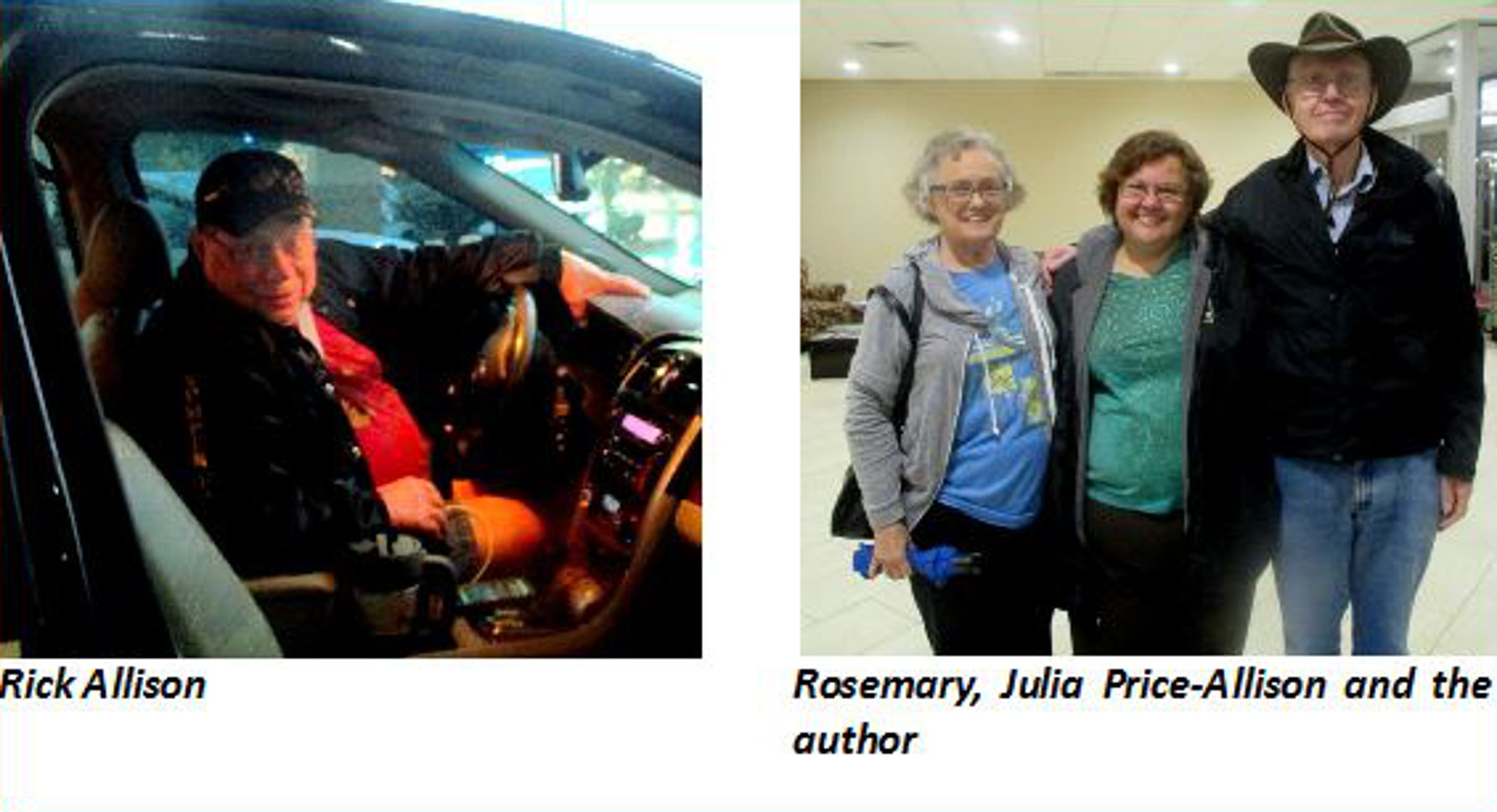
friendly and outgoing couple and we enjoyed meeting them. Rick
(below left) and Julia then
delivered us back to the motel and we had the desk clerk take a
picture of us in the lobby with Julia (below
right).

All
the visiting was now done and the drive home was all that remained.
The next morning we got a leisurely start because we were only
driving to Elk City, Oklahoma. It was around a third of the way home
and there was a good restaurant, the Portobello Grill, nearby. The
La Quinta where we would stay is located on the I-40 Business Loop at
the intersection with Hwy 34. It can actually be seen from the
interstate, but I missed it anyway because there was so much
construction going on at the intersection that I forgot to look for
the motel while concentrating on navigating around all the
construction barriers. We passed the motel and had to turn around
and come back. Even then it was not easy to enter the parking lot.
One had to drive down a side street and turn in at the very back end
of the lot. No one had seen fit to place any signage to make the way
clear. I think the local manager of this hotel must have been on
vacation.
The
Portobello Grill, a place we have stopped before, was just what we
expected and we enjoyed a good meal.
Our
next stop was Albuquerque and we had chosen a different motel for the
return trip, primarily because it would be easier to get to when we
arrived. It was also on the west side of town, making for a quick
getaway the next morning on the last leg of our trip home.
The
distance from Albuquerque to Cottonwood, about 385 miles, made for a
fairly easy final day of travel. We even stopped in Flagstaff for a
meal at the Olive Garden and still made it home in time to pick up
our accumulated mail before the Post Office closed for the day. The
date was 11 September 2015 and we had been on the road since 23
August.
Visiting
friends and relatives is nice, but it is always very good to return
home and just do nothing for a few days.