The
only descriptive information I could find when preparing for today's
hike on Goat Springs Trail was a single hike report on
HikeArizona.com. The only information provided on the Prescott
National Forest Website was the laconic comment that the “trail is
2.5 miles long. It begins at Goat Camp Spring and ends at Forest Road
9602j.” Thankfully Lila Wright, our leader, had scouted the trail
last spring in company with Gary Jacobson and Frank Lombardo.
The
day dawned bright and sunny, if a bit chilly, on 20 December 2014
when we set off for our weekly hike. We drove east on Hwy 260 to the
Oasis Road junction in Camp Verde, just 1.7 miles after crossing
I-17. Turning right onto Oasis Road we proceeded to the bottom of
the hill in Copper Canyon, turned right onto Salt Mine Road and drove
7.2 miles before turning slightly right onto a dirt road that is
labeled Forest Road 574. The signage in this area can be confusing.
The National Forest Motor Vehicle Use Map actually indicates
that FR 574 started two miles back. But, whatever the signage, we
continued another 1.1 miles after turning onto the dirt road and then
turned right onto FR 9602J. From there we drove for another 1.7
miles before parking at a convenient spot alongside the road.
Although we were still about 0.1 mile from the trailhead, we decided
that this was a better parking spot.
 To get here on FR
9602J we had entered into a parcel of private property and passed
through an old surface mine area located in a sharp bend of the road
(right). I was unable to locate
any information about the mine. The closest mine listed on
minedat.org (the site I normally use to identify mines) is Squaw Peak
Mine which is an underground mine that operated between 1944 and
1946.
To get here on FR
9602J we had entered into a parcel of private property and passed
through an old surface mine area located in a sharp bend of the road
(right). I was unable to locate
any information about the mine. The closest mine listed on
minedat.org (the site I normally use to identify mines) is Squaw Peak
Mine which is an underground mine that operated between 1944 and
1946.
Donning
our gear we hiked along the road to the clearly marked trailhead.
The trail begins by crossing an old fence through an opening formed
by two living junipers. Just to the right of the opening is posted a
trail sign (left) that informed us
that this was Trail 542, that Trail 541 (Hell Hole Trail) branched
off one mile ahead and that it was two miles to Goat Camp Springs.
We
posed for a group photograph and then were on our way down the trail.
 |
| Left to right: Betty Wolters, Gary Jacobson, Joyce Arregui, Anita Jackson, Daisy Williams, Joanne Hennings, Lila Wright, Bill Woolard, Marywave Van Deren, Collene Maktenieks, Connie Woolard and the author – photograph by Name Withheld |
 We were now just
outside the eastern boundary of the strip of private land we had
driven through. But the trail would reenter and cross it to access
the Cedar Bench Wilderness. The private strip is a little more than
0.1 mile wide, so even crossing at an angle as we did we soon entered
the wilderness (right).
We were now just
outside the eastern boundary of the strip of private land we had
driven through. But the trail would reenter and cross it to access
the Cedar Bench Wilderness. The private strip is a little more than
0.1 mile wide, so even crossing at an angle as we did we soon entered
the wilderness (right).
The
trail, lined with junipers and pinon pines, led downhill into Chasm
Creek Canyon and followed along the north slope above the creek for
about a mile. Looking downstream and out the mouth of the canyon we
could see Hackberry Mountain and Towel Peaks on the distant horizon.
 |
Looking out the mouth of Chasm Creek Canyon
|
The
trail, although rising and falling along the way, led us gradually
down the slope, ever closer to Chasm Creek. The ground was damp from
the rains we had received earlier in the week, but not really muddy
except for a couple of places where water was seeping from the
hillside.
 I
was hiking in the rear and had time to stop and look around without
obstructing anyone else. This enabled me to spend time examining the
pinon pines and their cones. I had never really noted before that
the cones are largely spherical rather than cone shaped. I found
several that still had edible nuts in them and decided to take some
home with me. Unfortunately, in the process I managed to get my
pockets all gummed up with rosin and had to clean them with alcohol
before putting my jacket in the washing machine. Nevertheless, I did
come home with a few, a very few, that were edible (left).
I
was hiking in the rear and had time to stop and look around without
obstructing anyone else. This enabled me to spend time examining the
pinon pines and their cones. I had never really noted before that
the cones are largely spherical rather than cone shaped. I found
several that still had edible nuts in them and decided to take some
home with me. Unfortunately, in the process I managed to get my
pockets all gummed up with rosin and had to clean them with alcohol
before putting my jacket in the washing machine. Nevertheless, I did
come home with a few, a very few, that were edible (left). Just
before reaching Chasm Creek, we came to a trail sign (right) that marked the
end (or start, depending on which way you are hiking it) of Trail 541
(Hell Hole Trail). The sign unhelpfully indicated with arrows that
both Trails 541 and 542 continued on toward the creek when, in fact,
Hell Hole Trail is a very faint trail leading directly up hill from
the junction. Actually, to be quite specific, the arrows really do
not point in the direction that either of the trails leads, just sort
of splits the difference between them. I wonder whether the erector
noticed that something was amiss and just decided to muddle the issue
instead of correcting his error.
Just
before reaching Chasm Creek, we came to a trail sign (right) that marked the
end (or start, depending on which way you are hiking it) of Trail 541
(Hell Hole Trail). The sign unhelpfully indicated with arrows that
both Trails 541 and 542 continued on toward the creek when, in fact,
Hell Hole Trail is a very faint trail leading directly up hill from
the junction. Actually, to be quite specific, the arrows really do
not point in the direction that either of the trails leads, just sort
of splits the difference between them. I wonder whether the erector
noticed that something was amiss and just decided to muddle the issue
instead of correcting his error. Just
a very short distance beyond the garbled sign we came to the Chasm
Creek crossing and stopped to enjoy the view while we had a
midmorning snack. We saw a unique lichen (left)
growing in a roughly circular ring on a nearby rock. To me the
inside of the circle, or donut hole if you will, looked like a house.
Or perhaps it was just my imagination.
Just
a very short distance beyond the garbled sign we came to the Chasm
Creek crossing and stopped to enjoy the view while we had a
midmorning snack. We saw a unique lichen (left)
growing in a roughly circular ring on a nearby rock. To me the
inside of the circle, or donut hole if you will, looked like a house.
Or perhaps it was just my imagination.
Meanwhile,
there was a trickle of water at our feet (right),
just enough to provide a pleasant, soothing backdrop while one
enjoyed the surrounding wilderness.
While
I was engrossed in the lichen and listening to the trickling water, a
lone hunter came down the trail riding a mule and followed by two
dogs. A friendly fellow, he stopped to chat for awhile. Being a
little far away from the rest of the group and anyway more interested
in the lichen and the trickling stream, I missed most of the
conversation. However, Lila later provided me with a recap of the
conversation. It turns out that the man was hunting mountain lions
and, having recently seen one near her house, Lila was particularly
interested in the subject. She later provided me with the following
recap of the conversation:
The
lion hunter on the mule was quite interesting. He had GPS on his
hounds and could tell that "Taco" was 150 yards in a
direction he pointed and "Pinky" was 130 yards in a
slightly different direction. He had seen lion tracks but they were
too old for the dogs to pick up the scent. My thought was that if
they got a fresh scent the lion would not have a chance with the GPS unless it got in a canyon out of GPS range. Hounds usually tree a
lion pretty quickly and that mule could go anywhere. He described
his tack to us which enabled the saddle and rider to stay in place up
and down extreme slopes.
When
we resumed our hike, we found ourselves climbing rather steeply up
the slope on the other side of the creek. We were leaving Chasm
Creek, which drains the area around Squaw Peak, behind to climb up a
side canyon that contains Goat Spring and which drains the Arnold
Mesa area.
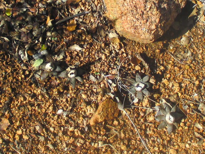 We found a string of
earthstar fungi (left) in a bare
spot alongside the trail. Look carefully and you can see the fungi
lined up in a row that extends from the upper left to the lower right
in the photograph. This fungus is hydroscopic and a dried-out
specimen will seemingly come to life before ones very eyes upon the
application of water.
We found a string of
earthstar fungi (left) in a bare
spot alongside the trail. Look carefully and you can see the fungi
lined up in a row that extends from the upper left to the lower right
in the photograph. This fungus is hydroscopic and a dried-out
specimen will seemingly come to life before ones very eyes upon the
application of water.
 Continuing
up the canyon toward Arnold Mesa we eventually crossed to the other
side of the wash and approached Goat Camp Springs from the other
side. The first hint that we were almost there was the sight of a
grove of sycamore trees ahead (right),
lifting their bare, ghostly limbs to the wintry sky .
Continuing
up the canyon toward Arnold Mesa we eventually crossed to the other
side of the wash and approached Goat Camp Springs from the other
side. The first hint that we were almost there was the sight of a
grove of sycamore trees ahead (right),
lifting their bare, ghostly limbs to the wintry sky .
When
we arrived at the spot marked by the sycamores the group decided that
it was a good place for lunch and scattered out on the large rocks in
the sunny open wash. Having a GPS track that located the actual
spring on up the wash, and accompanied by one other hiker, I
continued on. The trail became very faint after awhile but we found
our way with the aid of a few stumps and some cut branches that
indicated long-ago trail marking. We also found one cairn and a
single ribbon.

As
can be seen from the map (left), we
were traveling south up the wash and the spring is actually located
about 100 yards beyond where the main group of hikers had stopped for
lunch. At first we passed it by and came out above it on a
relatively flat spot where the wash forks, one branch leading
directly down from Arnold Mesa, the other draining the area east of
the mesa. The spring is located just about where the wash forks, but
actually in the east branch.
The
spring when we found it turned out to be a series of seeps in the bed
of the wash. I grew up in east Tennessee, in the foothills of the
Smokies, and springs there tended to be unambiguously springs. These
seeps, shown in the photograph below,
didn't look very springlike to me, but I suppose they do provide
water in a thirsty country.
 |
Goat Camp Spring
Our
curiosity satisfied, we hurried back to where we had left the rest of
the party. As shown in the below photograph, they had finished eating and were on their feet
and ready to go.
 |
Hikers at Goat Camp Spring, on their feet and ready to go
|
 On
the way back we found more colorful lichen. This one (right)
might have been some weird creature from another planet.
On
the way back we found more colorful lichen. This one (right)
might have been some weird creature from another planet.
When
we arrived back at the parking area, my GPS indicated that I had
hiked 4.5 miles, that the maximum elevation was 4714 feet and that
the total ascent was 997 feet.
Our
GPS track is shown in red on the included map (next
page). The light rectangular shape outlines private
private, traversed by both FR 9602J and by Goat Springs Trail.

No comments:
Post a Comment