On
18 April 2015 fifteen Skyliners hiked to Black Canyon Waterfall.
This hike involves following Black Canyon Trail for about 3.3 miles
from Ogden Ranch road and then turning off on a well-worn side trail
to descend steeply into the canyon at the waterfall.
We
drove from the Cottonwood Safeway parking lot to the Black Canyon
Trailhead at the end of Ogden Ranch Road and were on the trail by
shortly after 0730, having paused at the parking lot for a group
photograph.
 |
Left to right: Gary Brooks, the author, Mary Gavan, Daisy Williams, Dolly Yapp (kneeling), Phil Sullivan, Betty Wolters, Floyd Gardner, Karl Sink, George Everman, Lila Wright, Joanne Hennings and Marianna Hartsong – two hikers chose to remain anonymous and one of them used my camera to take the above photograph
|
Two or three years ago
Ogden Ranch Road was blocked off about 0.7 miles short of its
original ending at the old Black Canyon Trailhead near Quail Springs.
Concurrently, the trail was rerouted to start at a new parking area
at the end of the shortened road. The total effect of these changes
was to add one mile to the Black Canyon Trail, the one-way distance
along the trail between Ogden Ranch Road and Allen Spring Road is now
eight miles.
The trail leaves the
parking area at about the 11 o”clock position, just where Betty
Wolters and Karl Sink are standing in the above photograph. When I
last hiked this way, there was a trail sign marking the trail as #
114; however, I did not see it today. I may have overlooked it or,
more likely, it has been torn down by vandals.
From the parking lot
the trail now follows along the course of an old road, passes through
a gate and crosses Quail Springs Wash about 0.7 miles below the
springs. When the trail reaches the rim on the other side of the
wash, it leaves the old roadbed and begins a gentle climb, wending
its way across a series of ridges and joins the original Black Canyon
Trail after another 1.9 miles and an elevation gain of 1050 feet.
This new section of trail is very well engineered and a pleasure to
hike on. The hike today was especially enjoyable for those of us who
like to pause and admire flowers along the way. We had expected to
see a large number and variety and were not disappointed.
Unfortunately, about half of the group were more interested in speed
than flowers. But George Everman, who was leading the hike, solved
that problem by splitting us into two separate groups. This allowed
everyone to enjoy the hike.
George also came up
with an ingenious game to entertain us along the way. He passed out
pictures of a desert star flower and challenged us to find one, with
a prize, a fake gold bar, going to the first to do so. As it were
George himself was first to spot a desert star and, apparently
deciding it would be untoward to accept the prize himself, presented
it to Dolly in recognition for her diligent effort to photograph
flowers for him while he sorted out the disparate hikers.
The strawberry hedgehog
cactus, below left, was photographed on the way back after it was
fully opened. The water jacket plant with pale yellow to white
flowers, below right, is noticeably cool to the touch, always several
degrees below the temperature of surrounding plants. George had
searched for this plant during the entire hike and finally found it
when we were almost back to the trailhead.
 |
| Strawberry hedgehog cactus |
 |
| Water jacket plant |
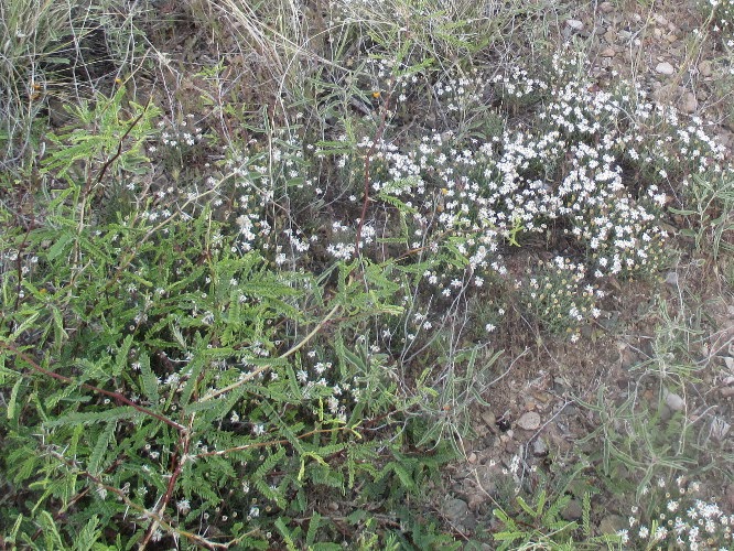
We saw several globe
mallow plants along the way. For the most these were scattered among
other plants and, too spread out to be individually noticeable, they
just blended into their surroundings. However we did find one patch,
below left, that was thick enough to make a dramatic statement all on
its own. Meanwhile, silvery goat's beard plants, sometimes alone,
sometimes in clumps of two to five plants, shouted out for attention.
 |
| Globe mallow |
 |
| Goat's beard |
After the first few
minutes we never saw the faster hikers again until we approached the
waterfall. We didn't worry about that; we were having our own hiking
experience.
 About
half way along the new section of trail I found a single larkspur
(right) hiding in the undergrowth,
the only one we saw on the entire hike.
About
half way along the new section of trail I found a single larkspur
(right) hiding in the undergrowth,
the only one we saw on the entire hike.
The
section of forest that we were passing through had apparently not
been pastured for some time and flowers nestled attractively in the
untrammeled grass. See for example the blackfoot daisies and
mariposa lilies below.
 |
Blackfoot daisies and mariposa lilies nestled in the grass
|
 |
| Yellow blossom – prickly pear cactus |
 |
| Pink blossom – prickly pear cactus |
 About 0.3 miles after passing through a second gate we reached the end of the new section of trail and continued up the canyon on old Black Canyon Trail. Apparently, there has been a problem with hikers taking the old, closed off, section of trail instead of turning onto the new section. Each time I pass this way, it appears that more brush has been placed on the old trail (left). One could now most certainly not take it in error.After
hiking for around 0.7 miles up the old trail we came to a sharp turn
in the trail. Located alongside the trail at the bend is a
good-sized tree that can always be depended upon for a bit of shade.
From here one can enjoy an expansive view out over the valley below.
I always pause here when hiking Black Canyon Trail.
About 0.3 miles after passing through a second gate we reached the end of the new section of trail and continued up the canyon on old Black Canyon Trail. Apparently, there has been a problem with hikers taking the old, closed off, section of trail instead of turning onto the new section. Each time I pass this way, it appears that more brush has been placed on the old trail (left). One could now most certainly not take it in error.After
hiking for around 0.7 miles up the old trail we came to a sharp turn
in the trail. Located alongside the trail at the bend is a
good-sized tree that can always be depended upon for a bit of shade.
From here one can enjoy an expansive view out over the valley below.
I always pause here when hiking Black Canyon Trail.
Just beyond the sharp
bend in the path we came upon a section of trail lined with colorful
California poppies. The photograph shown below was taken looking
back down the trail.
 |
| California poppies lining Black Canyon Trail |
 The
last time I saw such a profusion of poppies along this trail was in
March 2010, but I think it is likely an annual display. A close-up
photograph of this beautiful flower is shown here (right).
The
last time I saw such a profusion of poppies along this trail was in
March 2010, but I think it is likely an annual display. A close-up
photograph of this beautiful flower is shown here (right).
At about 3.3 miles from
the trailhead we left Black Canyon Trail to follow a side trail that
runs down the mountain to the waterfall at the bottom of the canyon.
The easy part of the hike was now over. From here the trail is at
first steep but well worn and easy to follow. Then, after around 0.4
miles, it becomes very steep and is rocky and sometimes hard to
follow. The below photograph shows the trail forking left and
heading for the waterfall.
 |
| Follow the left fork to the waterfall |

 The
path descends along a mountain ridge that slopes down toward the
bottom of the canyon before ending at a sharp drop off above the
narrow canyon floor. The trail follows along the left (downstream)
side of the ridge and crosses under the ridge point.
The
path descends along a mountain ridge that slopes down toward the
bottom of the canyon before ending at a sharp drop off above the
narrow canyon floor. The trail follows along the left (downstream)
side of the ridge and crosses under the ridge point.
It
then descends precariously along the upstream slope of the ridge to a
side wash (right) that feeds into
Black Canyon. A thin stream of water can be seen flowing along the
bottom of the wash. The stream shown here still has another 20 or so
feet to drop before reaching the bottom of Black Canyon. Look
closely straight ahead beyond the stream of water and close alongside
the rocky cliff at the right and you will see, faintly, the trail
that will lead us across a low ridge and down into the canyon at the
waterfall shown in the below photograph.
 |
| Black Canyon waterfall seen from where we ate lunch |
I
ate lunch resting on a soft bed of dry sand just above the trickling
stream and then drifted off to sleep admiring the stone spires rising
above the trees located just upstream.
 |
Looking upstream from Black Canyon Waterfall
|
 After
lunch we gathered our packs and headed back up the ridge, sustained,
as we climbed sections such as that shown here (right),
by the thought that once we reached Black Canyon Trail the rest of
the trip would all be downhill.
After
lunch we gathered our packs and headed back up the ridge, sustained,
as we climbed sections such as that shown here (right),
by the thought that once we reached Black Canyon Trail the rest of
the trip would all be downhill.
The
climb back to the main trail went surprisingly fast and we were soon
enough heading back downhill. We didn't spend a lot of time looking
at flowers on the way back. Mainly we just checked to see which ones
might have opened since we passed that way earlier. As already noted
George did find a desert star, in fact a large clump of them They
are shown below along with a close up of a brownfoot flower. I
cannot remember ever having seen one of these in full bloom before
and was surprised to find that the blossoms were pink.
 |
| Brownfoot closeup |
 |
| Desert star |
After
uploading my GPS track and cleaning it up a bit, I measured the hike
as being 8.4 miles. The maximum elevation was 4968 feet, the total
ascent was 1270 feet and the descent was 658 feet. These figures
were determined using the return portion of the GPS track. For some
reason the hike in was much less accurate, with a lot of signals
bouncing off canyon walls along the way.
Our
GPS Track is shown in red on the included map (below)

Someday when I am visiting my Aunt Betty in Arizona, I hope to be able to go on one of the hikes there. Last summer I passed through that part of Arizona, she wasn´t there.
ReplyDelete