Monday, December 29, 2014

Middle Verde Hike


Because of family members visiting over the holidays, I did not go on this hike. Instead, so that we might have some record of the hike for use in the future, Lila carried my GPS to record the track and provided text and pictures for the report.

The hikers parked at the intersection of Middle Verde Road and FR 119A (also known as Granada Wash Road). This is 3.5 miles from I-17. But be aware that the most recent Coconino National Forest Motor Vehicle Map shows that FR 119A begins just 0.3 miles from I-17, thus including the paved Middle Verde Road all the way to Granada Wash Road.

Lila's camera battery did not work and she didn't replace it until the hikers stopped for a snack break at the top of Granada Wash. She then had one of the hikers take a group photograph.

Left to right: Leon Girdner, Lila Wright, Loren Pritzel, Joann Hennings, Daisy Williams, Mark Purcell, Anita Jackson, Collene Maktenieks, Gary Jacobson, Betty Wolters, Jim Manning and Joyce Arregui – photograph by Name Withheld

Lila noted that there were 14 hikers in the group, two of whom are not shown in the photograph.

There was no sign identifying Granada Wash, or Granada Wash Road (now FR 119A) but one of the hikers thought it was Granado Wash. Lila later checked her map and could not find a name for the wash. She did, however, discover that Granado means pomegranate tree1, and also sometimes means noble. In fact the name of the wash turned out to be Granada (not Granado), and she also found that granada means pomegranate fruit and could also mean hand grenade. 2, 3

About 0.3 miles along from the place where the hikers stopped for a snack, they came to the junction of FR 119A with FR 119B (right). FR 119A turns to the northeast and continues on to connect with Cornville Road at the Cornville Road/Beaverhead Flat Road junction. According to Leon Girdner who grew up in this area, what is now FR 119A was once part of the main road between Camp Verde and Cornville.

About 1.2 miles after turning onto FR 119B, the hikers crawled under a fence (left), luckily one with a smooth bottom strand, and bushwhacked up to the summit of a small hill to eat lunch with a view. Hikers are shown at lower left, the summit is at upper right.

Looking north, they had a good view past Cornville and the red rock country to the snow capped San Francisco Peaks. To the northwest they could see across Oak Creek, the Verde River, Cottonwood and Jerome to the Black Hills beyond.

Looking past Cornville and the red rock country to the San Francisco Peaks

Looking across Oak Creek, the Verde River, Cottonwood and Jerome

The view directly west showed another slice of the Black Hills on the horizon. In the photograph below, Mingus Mountain is just right of center. Black Canyon, where we plan to hike next week, is located just to the left of Mingus.

The Black Hills on the horizon

On the return hike, several members of the party forsook the road part way down Granada Wash in favor of traveling down the streambed (right). Lila reported that the bottom of the wash was sandy and that the walking was easy with only a few small rock ledges that were easily descended.

The below photograph shows an overview of the streambed down the wash with sections of the forest road visible to the left and a bit of the Black Hills visible in the distance.

Looking down Granada Wash


The detour down the streambed added only 0.2 miles and about 5 minutes to the hike.

The total hike distance was 8.7 miles, the highest elevation was 3670 feet and the total ascent was 1195 feet.

The red GPS Track on the included map (next page) shows the hike in; the blue track shows the detour made on the return hike.


1http://www.spanishdict.com/translate/granado
2http://dictionary.reference.com/browse/grenade

3http://www.spanishdict.com/translate/granada

Goat Springs Trail


The only descriptive information I could find when preparing for today's hike on Goat Springs Trail was a single hike report on HikeArizona.com. The only information provided on the Prescott National Forest Website was the laconic comment that the “trail is 2.5 miles long. It begins at Goat Camp Spring and ends at Forest Road 9602j.” Thankfully Lila Wright, our leader, had scouted the trail last spring in company with Gary Jacobson and Frank Lombardo.

The day dawned bright and sunny, if a bit chilly, on 20 December 2014 when we set off for our weekly hike. We drove east on Hwy 260 to the Oasis Road junction in Camp Verde, just 1.7 miles after crossing I-17. Turning right onto Oasis Road we proceeded to the bottom of the hill in Copper Canyon, turned right onto Salt Mine Road and drove 7.2 miles before turning slightly right onto a dirt road that is labeled Forest Road 574. The signage in this area can be confusing. The National Forest Motor Vehicle Use Map actually indicates that FR 574 started two miles back. But, whatever the signage, we continued another 1.1 miles after turning onto the dirt road and then turned right onto FR 9602J. From there we drove for another 1.7 miles before parking at a convenient spot alongside the road. Although we were still about 0.1 mile from the trailhead, we decided that this was a better parking spot.

To get here on FR 9602J we had entered into a parcel of private property and passed through an old surface mine area located in a sharp bend of the road (right). I was unable to locate any information about the mine. The closest mine listed on minedat.org (the site I normally use to identify mines) is Squaw Peak Mine which is an underground mine that operated between 1944 and 1946.

Donning our gear we hiked along the road to the clearly marked trailhead. The trail begins by crossing an old fence through an opening formed by two living junipers. Just to the right of the opening is posted a trail sign (left) that informed us that this was Trail 542, that Trail 541 (Hell Hole Trail) branched off one mile ahead and that it was two miles to Goat Camp Springs.

We posed for a group photograph and then were on our way down the trail.

Left to right: Betty Wolters, Gary Jacobson, Joyce Arregui, Anita Jackson, Daisy Williams, Joanne Hennings, Lila Wright, Bill Woolard, Marywave Van Deren, Collene Maktenieks, Connie Woolard and the author – photograph by Name Withheld

We were now just outside the eastern boundary of the strip of private land we had driven through. But the trail would reenter and cross it to access the Cedar Bench Wilderness. The private strip is a little more than 0.1 mile wide, so even crossing at an angle as we did we soon entered the wilderness (right).

The trail, lined with junipers and pinon pines, led downhill into Chasm Creek Canyon and followed along the north slope above the creek for about a mile. Looking downstream and out the mouth of the canyon we could see Hackberry Mountain and Towel Peaks on the distant horizon.


Looking out the mouth of Chasm Creek Canyon

The trail, although rising and falling along the way, led us gradually down the slope, ever closer to Chasm Creek. The ground was damp from the rains we had received earlier in the week, but not really muddy except for a couple of places where water was seeping from the hillside.

I was hiking in the rear and had time to stop and look around without obstructing anyone else. This enabled me to spend time examining the pinon pines and their cones. I had never really noted before that the cones are largely spherical rather than cone shaped. I found several that still had edible nuts in them and decided to take some home with me. Unfortunately, in the process I managed to get my pockets all gummed up with rosin and had to clean them with alcohol before putting my jacket in the washing machine. Nevertheless, I did come home with a few, a very few, that were edible (left).

Just before reaching Chasm Creek, we came to a trail sign (rightthat marked the end (or start, depending on which way you are hiking it) of Trail 541 (Hell Hole Trail). The sign unhelpfully indicated with arrows that both Trails 541 and 542 continued on toward the creek when, in fact, Hell Hole Trail is a very faint trail leading directly up hill from the junction. Actually, to be quite specific, the arrows really do not point in the direction that either of the trails leads, just sort of splits the difference between them. I wonder whether the erector noticed that something was amiss and just decided to muddle the issue instead of correcting his error.

Just a very short distance beyond the garbled sign we came to the Chasm Creek crossing and stopped to enjoy the view while we had a midmorning snack. We saw a unique lichen (left) growing in a roughly circular ring on a nearby rock. To me the inside of the circle, or donut hole if you will, looked like a house. Or perhaps it was just my imagination.

Meanwhile, there was a trickle of water at our feet (right), just enough to provide a pleasant, soothing backdrop while one enjoyed the surrounding wilderness.

While I was engrossed in the lichen and listening to the trickling water, a lone hunter came down the trail riding a mule and followed by two dogs. A friendly fellow, he stopped to chat for awhile. Being a little far away from the rest of the group and anyway more interested in the lichen and the trickling stream, I missed most of the conversation. However, Lila later provided me with a recap of the conversation. It turns out that the man was hunting mountain lions and, having recently seen one near her house, Lila was particularly interested in the subject. She later provided me with the following recap of the conversation:

The lion hunter on the mule was quite interesting. He had GPS on his hounds and could tell that "Taco" was 150 yards in a direction he pointed and "Pinky" was 130 yards in a slightly different direction. He had seen lion tracks but they were too old for the dogs to pick up the scent. My thought was that if they got a fresh scent the lion would not have a chance with the GPS unless it got in a canyon out of GPS range. Hounds usually tree a lion pretty quickly and that mule could go anywhere. He described his tack to us which enabled the saddle and rider to stay in place up and down extreme slopes.

When we resumed our hike, we found ourselves climbing rather steeply up the slope on the other side of the creek. We were leaving Chasm Creek, which drains the area around Squaw Peak, behind to climb up a side canyon that contains Goat Spring and which drains the Arnold Mesa area.

We found a string of earthstar fungi (left) in a bare spot alongside the trail. Look carefully and you can see the fungi lined up in a row that extends from the upper left to the lower right in the photograph. This fungus is hydroscopic and a dried-out specimen will seemingly come to life before ones very eyes upon the application of water.

Continuing up the canyon toward Arnold Mesa we eventually crossed to the other side of the wash and approached Goat Camp Springs from the other side. The first hint that we were almost there was the sight of a grove of sycamore trees ahead (right), lifting their bare, ghostly limbs to the wintry sky .

When we arrived at the spot marked by the sycamores the group decided that it was a good place for lunch and scattered out on the large rocks in the sunny open wash. Having a GPS track that located the actual spring on up the wash, and accompanied by one other hiker, I continued on. The trail became very faint after awhile but we found our way with the aid of a few stumps and some cut branches that indicated long-ago trail marking. We also found one cairn and a single ribbon.

As can be seen from the map (left), we were traveling south up the wash and the spring is actually located about 100 yards beyond where the main group of hikers had stopped for lunch. At first we passed it by and came out above it on a relatively flat spot where the wash forks, one branch leading directly down from Arnold Mesa, the other draining the area east of the mesa. The spring is located just about where the wash forks, but actually in the east branch.

The spring when we found it turned out to be a series of seeps in the bed of the wash. I grew up in east Tennessee, in the foothills of the Smokies, and springs there tended to be unambiguously springs. These seeps, shown in the photograph below, didn't look very springlike to me, but I suppose they do provide water in a thirsty country.

                          Goat Camp Spring

Our curiosity satisfied, we hurried back to where we had left the rest of the party. As shown in the below photograph, they had finished eating and were on their feet and ready to go.

Hikers at Goat Camp Spring, on their feet and ready to go

On the way back we found more colorful lichen. This one (right) might have been some weird creature from another planet.

When we arrived back at the parking area, my GPS indicated that I had hiked 4.5 miles, that the maximum elevation was 4714 feet and that the total ascent was 997 feet.

Our GPS track is shown in red on the included map (next page). The light rectangular shape outlines private private, traversed by both FR 9602J and by Goat Springs Trail.


Lower Red Rock Loop Road to Oak Creek


It was a dreary day on 6 December 2014 when we set out to hike from Lower Red Rock Loop Road near Elmerville to Horseshoe Bend at Oak Creek. This was at least the third time I had hiked to the same place on Oak Creek. I hiked in once along Lime Kiln Trail starting from Red Rock State Park and turning off at the saddle through which a riding trail leads down a steep rocky track to the creek at a sharp curve that I call Horseshoe Bend. Although I don't think it has an official name.

We left Cottonwood at 0800, drove north on Hwy 89A, turned right onto Lower Red Rock Loop Road and continued for another 1.2 miles to park at a large horse trailer parking area at the trailhead.

The Trail we were looking for was marked on my map as Elmerville Spur R, a riding trail. However, we found it to be a dirt road signed as Forest Forest Road 9845. A little distance down the road we did finally see a riding trail sign, but it was Spur S instead of Spur R. Then about 0.5 miles from the parking lot, Spur S turned sharply to the left (east). Since the hike would otherwise be only around four miles, I decided to be a little adventurous and follow Spur S to the Lime Kiln Trail with which I knew it would intersect ahead. This resulted in our making the dogleg to the east shown in blue below from Spur S/Spur R to Spur S/Lime Kiln and back to Spur R Lime Kiln. From there it was just 0.3 miles to the Spur A/Lime Kiln turnoff that would lead us to the saddle above Horseshoe Bend on Oak Creek.

Map showing our circuitous route on the hike to Horseshoe Bend

Only slightly delayed by my detour, we soon arrived at the saddle. There we were faced with a steep, somewhat perilous 0.4 mile descent to Oak Creek. Looking down the trail, several of our hikers decided it just wasn't worth the effort and elected to climb a nearby knoll and enjoy the view until the rest of us returned.

The descent, as we started down, did look rather scary (right) but some of us had done it before and knew we could do it again.

We had to make our way slowly to avoid stepping on a rolling rock or loose gravel but we were shortly standing on a ledge overlooking the bend in the creek. In the following photograph, the banks of the creek are lined by sycamore trees, still clinging stubbornly to the last leaves of the season, lining its bank.

Sycamore trees lining the banks of Oak Creek

On arrival at the creek we found a cozy camping spot with an existing fire ring and a gaudy, out-of-place white plastic chair tucked close against the red rock cliff on the creek bank. I wondered why anyone would go to all the trouble of bringing such an out-of-place object to this isolated place when chunks of driftwood and other naturally occurring objects that would serve the same purpose were readily at hand. Somewhat less objectionable to my mind was an ancient derelict canoe, long past repair, nestled among the trees alongside the stream.

Fire ring
Derelict canoe


Before leaving the campsite, I took a last look at the peaceful views up and down the stream. I thought that this would be an ideal spot to spend time alone.


Looking upstream from the campsite

Looking downstream from the campsite

Looking back to the hidden, isolated campsite

Before starting our climb back to the gap where the other members of our party were waiting, we paused for a view of the Indian ruin perched in a fold of the red cliff on the northwest quarter of the bend. I had already explored the ruin twice before and, truth be told, there is not much to see anyway. We had found a few pottery shards, but the structure itself is not very impressive, having apparently been recently rebuilt by passing hikers.

Indian ruins in a cliff northwest of the bend

Having no desire to climb up to the ruins we turned our attention to the steep climb (left) back to the saddle. Strangely, the climb seemed less difficult than we had imagined it would be. Still it was steep and precarious, requiring careful attention to footing.

I had lagged behind to take photographs and, as a result, reached the saddle a few minutes behind the others. On arrival I found them all grouped together for lunch, so I took a group photograph before joining them.

Left to right: Mark Purcell, Jim Manning, Miriam Sterling, Marywave Van Deren, Leon Girdner, Joanne Hennings and Gary Jacobson – photograph by the author
There had been some disgruntlement about the circuitous route I had chosen on the way in so I promised that we would take the shortest route back. That would be easy because we now knew that Forest Road 9845 is also Spur S for part of its length and Spur R for the rest of the way to Lime Kiln Trail. It runs directly from the parking area to connect with Lime Kiln Trail just 0.3 miles from where we had left that trail to turn onto Spur A. We had then followed it through the saddle and down to the creek.

The sun almost came out once on the way back. We did at least get a brief glimpse of a small section of blue sky as we moved briskly along FR 9845. But the clouds quickly closed in again.
The road we were following had a few rough spots where a high clearance, 4-wheel drive vehicle would be needed, it was otherwise in good condition.

We moved right along and made good time back our vehicles, making only one brief stop to admire an especially attractive Christmas cactus (right) located in a tree-shaded spot alongside the road.

Our total hike distance was 4.4 miles as shown on the included map (next page). The red track shows our route for the return hike while the blue track discloses the detour we took on the way in. Without the detour, the hike would have been just 4 miles. The maximum elevation was 4151 feet, the total ascent was 615 feet and the total descent was 636 feet.


Indian Ruin at Black Mountain Canyon

On 29 November 2014 we hiked to an Indian Ruin at Black Mountain Canyon. Jim Manning, who had scouted the ruin several months ago, led the hike. From Cottonwood we drove east on Hwy 260, dropped one vehicle in a parking area, a wide graveled shoulder, on the north side of the highway near mile marker 233. This is the junction of Forest Road 9243C with Hwy 260, although the road is hidden behind some bushes and invisible from the highway. We then continued for about another mile and parked, again at a wide shoulder on the north side of the highway to start our hike. The first part of the hike would be on Forest Road 9243B, which was located just through a gate at the parking area. These parking arrangement are shown in the map inset (right).

Forest Road 9243B sloped gently uphill for a short distance to a crest from where we could see the rugged country on the other side. To our left was an old gravel quarry while Thirteenmile Rock Butte looms to the right.

Thirteenmile Rock Butte

This seemed as good a place as any for a group photograph, so the hikers all gathered in the grass while I snapped a shot. Possibly because it was so early in the hike and we were not yet hot, tired and dirty, everyone looked especially cheerful this morning. Only Betty was not smiling and she is always cheerful, smiling or not.

Left to right: Lila Wright, Mary Gavan (crouching), Jim Manning, Loren Pritzel, Joyce Arregui, Bill Woolard, Connie Woolard, Marywave Van Deren, Betty Wolters, Gary Jacobson, Anita Jackson, Ruth Frazier and Leon Girdner – photograph by the author

Leaving the crest we found ourselves hiking down a pretty steep road with a lot of loose rock. It was not really difficult hiking; we just had to pay close attention to our footing to avoid falls. About 0.7 miles from the highway, FR 9243B took a sharp turn to the right while we veered slightly left and continued ahead, now following, FR 9243C. I don't remember that there were any road signs along the way other than one when we left Hwy 260, so I checked the online forest road map later to determine the correct numbers.

Another 0.9 miles brought us to within sight of the promontory along the rim of Black Mountain Canyon on which the ruin is located. In the photograph below, the promontory containing the ruin is in the center and the canyon drops off below it on the right. The Black Hills form the horizon, with Copper Canyon just to the left of the promontory and Mingus Mountain and Woodchute Mountain to the right.

The promontory in the center marks the location of the ruin

This is also the point at which we left the forest road to bushwhack our way to the ruin. As bushwhacking goes, I must say this was extremely easy. We were in an open, grassy, essentially level area and the footing was good. As we drew closer, it became quite obvious that the rocks we saw ahead ahead (left) were actually manmade walls, something that had not been obvious from farther away.

The easiest way to enter the ruin is from behind the trees shown at left. It would be relatively easy to climb the wall at any point; however, I wouldn't want to try it with someone shooting arrows at me from above.

Once inside we found a sloping area enclosed on three sides by rock walls and protected on the fourth side by the steep canyon. The site had contained the remains of numerous rock-walled structures, apparently pit-house type dwellings where the lower walls were rock, perhaps with both wooden upper walls and roof supports.

At the lower end of the compound was a relatively large open area that might have served as a ceremonial area or maybe just as a community area, probably both. The photograph (right), taken from the highest point in the complex, shows this open area. The entrance from outside the walled is visible in the center just to the right of the small tree.

This photograph (left) shows some of the jumble of now overgrown rocks that must once have formed the foundations and walls of pit houses. The excavated floors within the rock walls would almost permit one to stand erect, making extensive wooden additions to walls unnecessary. Just a raised roof might suffice.

The people who lived here certainly had a splendid view. They had close-up, rugged mountain terrain to enjoy in three directions. Looking to the west, the Black Hills were their horizon.

Looking west to the Black Hills

I hung back to take most of the photographs because I didn't want too many hikers cluttering up the view. I like to show everyone in a group photograph and then just concentrate on photographing the things around me and not on people. The photograph below shows the other members of the group well away from the ruin as I finished and started after them.

Hikers departing ruin – see left center

The hike to the ruin had been 2.2 miles in length with a descent of 605 feet and an ascent of 386 feet. By way of contrast, the return hike to a different point along Hwy 260, was 2.6 miles in length with a descent of 392 feet and an ascent of 501 feet. The return was along a less steep road and was also less rock than the hike in had been, all in all, a good choice for the return route.

The total hike distance was 4.8 miles, the highest elevation was 4992 feet and the total ascent was 889 feet.

Our GPS track is shown in red on the included map (next page) and various points of interest are labeled.


Little Wolf Creek Trail


On 22 November 2014 the author and one other hiker who chose to remain unidentified left Cottonwood at 0700 to hike Little Wolf Creek Trail. Donna Goodman who lives near Prescott met us in the town of Mayer and we proceeded to the trailhead.

From Cottonwood, we drove east on Hwy 260, turned south on Interstate 17 and continued to Hwy 69 (Exit 262). We then drove north on Hwy 69 for 8.1 miles to Mayer, turned left onto E Central Avenue and stopped to pick up Donna. The three of us continued for 0.3 miles on E Central, turned left onto Miami Street and then almost immediately right onto Wicks Avenue. We continued on Wicks for 0.2 miles and turned left onto Jefferson Street. Jefferson Street soon turns into a dirt road and then becomes either Forest Road 67 or County
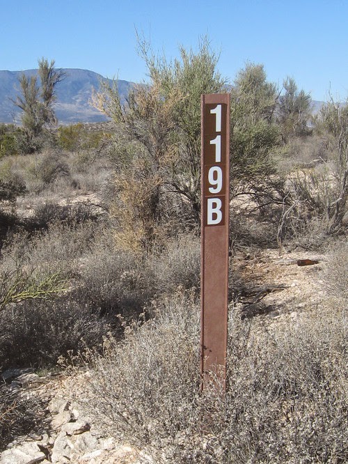
 Road 177. It is posted as County 177, but some maps I have seen label it as Forest Road 67. In any case, after first turning onto Jefferson Street, we just followed the road for 6.9 miles and parked at a hairpin turn in the road. Despite the number shown, the sign (right) does mark the lower trailhead for Little Wolf Creek Trail #304.


I think the posted trail number, #9434, is because part of the trail has a double designation as a hiking trail and for ATV use. But after about 1.2 miles, a point marked by a corral, the trail is no longer suitable for other than hikers, horseback riders and mountain bikers.

Leaving the trailhead we at first hiked along a streambed on the remains of an old road. Parts of the old road had washed out and it was very rocky in a few spots, especially when crossing the dry streambed, which we did at least twice. About 0.6 miles from the trailhead, just north of the Pipeline Canyon junction, the trail turned away from the bottom of Little Wolf Creek Canyon and we climbed along the shoulder of a high ridge that separates Pipeline Canyon from Little Wolf Creek Canyon. From here the trail then quickly descended to cross the Taft Canyon Wash and climbed another ridge on the other side between Taft Canyon and Little Wolf Creek Canyon. From the top of this ridge, we had a good view of the area ahead that we would be hiking through, including the scars of old mines on the mountain slope below Big Bug Mesa.

In the photograph below Big Bug Mesa is shown on the left, Little Mesa is on the right and between them is Coyote Spring Saddle. The two scars, one below the saddle and one to the left of it, show the locations of the old mines. Although not visible here, a third abandoned mine exists at the foot of the mountain alongside Little Wolf Creek.

Showing Big Bug Mesa, Little Mesa and the saddle between them

From our position high up on the ridge, we could also look back down Little Wolf Creek Canyon and on to the far mountains. In the center of the photograph below, the prominent formation looming just at the mouth of the canyon is Brady Butte.

Looking out the mouth of Little Wolf Creek Canyon from a ridge of Big Bug Mesa
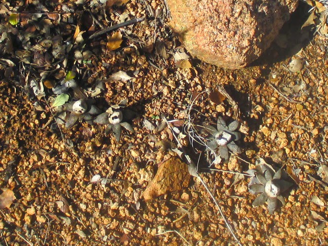
The ridge we were on was covered with scrub oak, junipers, mountain mahogany and other assorted low-growing plants. The mountain mahogany (left), having not yet released its feathery, winged seed pods was absolutely glowing in the morning sun.

The trail now descended back into Little Wolf Creek Canyon after which it would follow closely along the streambed for the rest of the way to the saddle at Coyote Spring.

Just as we approached the creek we came to the corral beyond which, the use of motorized vehicles, if not prohibited, is at least quite impractical. I say “if not prohibited” because I never did see a sign that actually said they were not allowed.

There were still vestiges of an old road as we continued along the trail above the corral, and a little later we found an abandoned mine, probably explaining the old road, located just across the creek from the trail. We did not visit the mine on this trip, but I did visit it last April and took a photograph (right) of the shaft opening. The opening appeared too small for this to have been a major operation. On the other hand there was a large tailings deposit alongside the creek, so it may have been a larger operation than the opening would seem to indicate.

A little farther up the trail was the remains of what must once have been a cozy dugout-cum-cabin (left). It was rather small, perhaps 80 square feet, but showed the remains of what would have been a quite impressive fireplace. Could this have been where the mine operator lived?

We were now traveling through a ponderosa forest that would continue until we reached the saddle at Coyote Springs. We saw some faint signs of recent usage of the trail by mountain bikers but nothing else to suggest that anyone else had passed this way for awhile. Despite this it was easy to follow. I thought that I remembered seeing evidence of usage by cattle last April. However, we now found no such signs.

Although it had been a little chilly earlier in the morning when we were lower in the canyon and the surrounding mountains had blocked the morning sun, it was now quite comfortable.

When we arrived at the saddle we looked around a bit for evidence of Coyote Spring, but saw no sign of water anywhere. The drainage from this point is to the north to Grapevine Creek, about a mile ahead, and I suppose the spring might be somewhere down that drainage. Or perhaps it dried up after the place was named.

The saddle at Coyote Springs

The saddle is the only place that it would seem possible to lose the trail. We had hesitated here when scouting the trail, but then decided that it turned left rather than crossing the fence. Once one makes the turn the trail becomes quite obvious again. Unfortunately for those averse to climbing it now attacks Big Bug Mesa head on, rising around 560 feet in 0.5 miles and crossing some rocky terrain. The photograph (right) was taken looking back down the trail. There are few switchbacks to break the climb.

I decided that some early day cowboy must have laid out the trail by leading his least favorite cow to the edge of Big Bug Mesa and pushing her over the rim. He then just followed the path she took to the bottom, the only switchbacks being where she bounced off a tree and fell sideways .

We broke the hike by stopping several times to rest and enjoy the scenery. Looking to the northeast through the saddle we had just left we could see automobile and truck traffic along Hwy 69 between Mayer and Dewey-Humboldt, probably around Poland Junction.

Looking down on the valley above Mayer from the trail ascending Big Bug Mesa

We left the ponderosas that were growing lower down the slope and were once again in an area populated by smaller plants. Mountain mahogany was again plentiful and even smaller plants such as the occasional Indian paintbrush and the colorful buckwheat shown in the photograph (left) were growing in open spaces along the trail.

When we reached the rim of the mesa, we were still 0.3 miles from the upper trailhead at Forest Road 9434. But the terrain was now essentially flat, rising only another 150 feet to the trailhead, a welcome change from the steep climb to the rim.

From the trailhead one has a good view across Big Bug Mesa to the Bradshaw Mountains beyond. The trailhead is marked by a rock cairn, essentially just a rather substantial pile of rocks alongside the road.

Bradshaw Mountains in the distance, cairn in bottom right quadrant

The inset map (right) shows our climb from Coyote Springs Pass to the end of Trail 304 on Big Bug Mesa. This was the most difficult part of the hike and several of the hikers who made the scouting hike last April took one look and chose to wait at the saddle.

Today, however, all three hikers made it all the way to the end of the trail, arriving just at lunch time. That meant that we could eat our main meal exactly half way through the hike, always a good plan. But we decided to make a slight modification due to a breeze that had arisen and hike back to the rim where we would be sheltered by the trees from the rather chilly wind.

Before we left the trailhead, Donna and I posed in front of the trailhead sign mounted under the juniper growing alongside the cairn that marked the trailhead. So, yes, the upper trailhead is marked as Trail 304 while the lower trailhead is marked as Trail 9434.

Left to right: Donna Goodman and the author – photograph by Name Withheld

The hard part of our hike was done, so we felt entitled to a leisurely lunch which we ate looking out over the valley below.

This round trip distance for this in and out hike was 7.9 miles, the highest elevation was 6876 feet and the total ascent was 1925 feet.

Our GPS track is shown in red on the included map (next page) and various points of interest are labeled. Note that both Pipeline Canyon and Taft Canyon feed in from the northwest. Also note that Taft Canyon runs parallel to Little Wolf Creek Canyon for a considerable distance before actually feeding into it.