Jim
Manning and I met at the Safeway parking lot in Cottonwood, picked
Lila Wright up at the Dollar Store in Cornville, continued on
Cornville road to I-17 and drove north to the I-17/Hwy 179 junction.
There, we exited and turned southeast on FR 618 which we followed for
5.4 miles to the sign showing the road to the Walker Basin Trailhead
where Mary Gavan and Becky Fowski were waiting for us. We then
turned east on a rough dirt road and followed it for 0.8 miles to the
trailhead.
Walker
Basin Trail starts out as an easy hike, sloping gently up the
mountain. Soon it becomes moderately rocky and the gradient
increases gradually until it becomes very noticeable. After
traveling 1.8 miles we stopped at a great viewpoint from which we
could look out over the valley spread out below and ahead to the
mountain pass through which Walker Basin Trail makes its way.
Looking to the north we could see the cliff that forms the far side
of Walker Creek Canyon.
After
a short, but very welcome, break we continued on up the trail, now
becoming ever more steep and rocky for about another 0.4 miles (2.2
miles from the trailhead). We had just climbed over a steep
ledge of rock and come out on a small flat area across which the
trail leads before rising to make its final assault on the mountain
when Mary, who had done this particular hike before and was leading
this one, decided that this was where she had left the trail before
to climb down into the canyon for the return trip. We stepped
across the remains of an old fence that had paralleled the trail most
of the way up the mountain and headed down into Walker Creek Canyon.
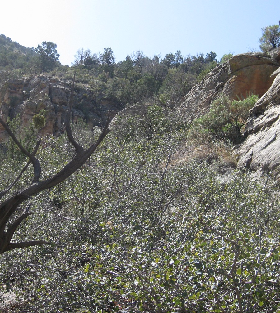
Looking across the canyon we could see the scar left by a recent,
very visible rockslide on the north wall (photograph below).
 |
Rockslide scar on north side of Walker Creek Canyon
|
 We
headed toward the canyon floor below the scar left by the rockslide.
Making our way down the canyon wall involved picking the best path
through the cactus and around rock ledges; it was slow going and is
not recommended for anyone not in good condition and sure of foot.
When we approached the bottom, the way became even more difficult and
we wound up climbing down a steep crevice and then a steep slope
littered with loose rocks to reach the bottom. Near the bottom, we
bushwhacked our way down along the slanting ledge shown here (right).
We
headed toward the canyon floor below the scar left by the rockslide.
Making our way down the canyon wall involved picking the best path
through the cactus and around rock ledges; it was slow going and is
not recommended for anyone not in good condition and sure of foot.
When we approached the bottom, the way became even more difficult and
we wound up climbing down a steep crevice and then a steep slope
littered with loose rocks to reach the bottom. Near the bottom, we
bushwhacked our way down along the slanting ledge shown here (right).
At
the end of the ledge shown above we were faced with a much steeper
climb down through a narrow crevice to reach the final descent into
the canyon.
 |
The crevice leads down past in the center of the photograph and goes
behind the tree
|
A
close inspection revealed several small, solid outcroppings that
would provide secure footing during the descent through the crevice
and the slope below, although still steep and littered with loose
rock, appeared to be passable all the way to the bottom of the
canyon. That was encouragement enough and we started the climb
down the crevice, going one at a time and leaving enough space so as
to prevent being hit by falling rocks dislodged by the hiker behind.
I
climbed down the upper part of the crevice first and waited to
receive packs and hiking poles from the other hikers and pass them
on. The upper part of the crevice is shown in the below
photograph, taken from my perch, about half way down.
 |
Upper part of the crevice we climbed down
|
Jim
is shown first exiting the last half of
the crevice and again making his way carefully down the rock-strewn slope to the canyon
bottom.
 |
| Jim exiting the last half of the crevice |
 |
Jim carefully navigating the rock-strewn slope below the
crevice
|
The below photograph was taken as I made my way carefully across the loose rock to join the rest of the party in the dry streambed below.
 |
Left to right: Mary Gavan, Jim Manning, Lila Wright and Becky Fowski
– photograph by the author
|
We
had reached the bottom just a few yards upstream from where a few
large rocks from the slide noted previously had reached the
streambed.
 |
Rocks in streambed from recent rockslide
|
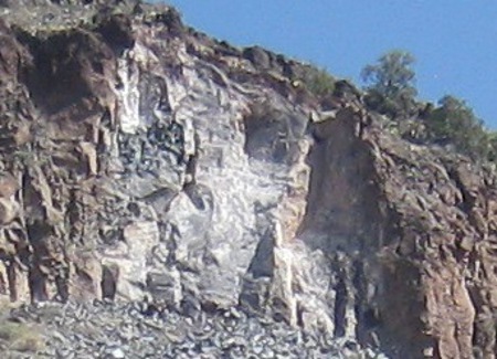 The
large red boulder shown above is from the layer that lines the very
top of the cliff above; the smaller dark gray boulder, just to the
left of Mary, is from the formation underlying the top layer (see
magnified view of the slide area, left).
The
large red boulder shown above is from the layer that lines the very
top of the cliff above; the smaller dark gray boulder, just to the
left of Mary, is from the formation underlying the top layer (see
magnified view of the slide area, left).
Although
boulder hopping was absolutely necessary, the going was at first
relatively easy after our climb down the canyon wall and we made good
time as we headed down the dry (at this point) canyon.
Along
the way we encountered a single cow. There was a pool of water
nearby and a fair amount of vegetation in the area, and we at first
thought she might have been stranded in the canyon, unable to find
her way out. However, she soon tired of our presence, crossed
the streambed and headed up a hidden trail in a side wash out of the
canyon.
 |
Lone cow in the canyon
|
In
some sections the canyon closed in, becoming very narrow. In
the photograph shown here (below)
it almost appears that the cliff walls come together above the
streambed.
 |
A very narrow section of canyon with the cliff walls almost touching
near the top
|
We
encountered several deep pools of water along the way and these
usually required a bit of effort to climb around. So, in some
places, rock hopping down the streambed became rock climbing rock
climbing around obstacles. In the photograph below hikers are
shown climbing down to a pool located in the bottom of a bowl that
the rushing water had carved in the canyon floor.
 |
Top to bottom: Becky, Lila and Jim climbing down the canyon wall to
a pool at the bottom
|
Once
down to the pool, it was still delicate going to avoid falling in
while trying to pass it while clinging to the steep wall.
 |
Climbing around the pool … very, carefully
|
Eventually
we came to a riparian section where we found springs flowing from the
canyon wall and a wide area of vegetation; for the rest of the trip
down the canyon, we had flowing water.
 |
The canyon widened and trees covered the floor
|
We
climbed up the canyon wall on the north side to check for Indian
ruins that Mary had told us about.
 |
Indian ruins on the north side of Walker Creek Canyon
|
We
continued on downstream from the ruins looking for some pictographs
Becky had seen on a previous hike. Actually, the rest of us
rested while Becky clambered over the face of the cliff looking for
them. Eventually, admitting defeat, she returned and we crossed
the canyon to make our way back to Walker Basin Trail. After
crossing Walker Creek we climbed up a steep cliff face on the other
side and soon found ourselves back on the trail. We were just
one mile from the trailhead.
According to my recorded GPS track, the
total hike distance was six miles, the maximum elevation was 5088 feet and the total ascent was 1644 feet. However, the going was pretty rough and it felt like we had climbed more.
The
GPS route for this hike is shown on the included map (below).
The section of Walker Basin Trail we used is shown in magenta, the
road from FR 618 to the trailhead is in green, the trip down into the
canyon and back to the trail is shown in light blue and a section of
FR is shown in dark blue. Note that Deadwood Trail is shown
leaving FR 618 just north of Walker Creek. It eventually ends
where Walker Basin Trail ends at Cedar Flat Tank. The estimated
length of Deadwood Trail is 8.9 miles, while Walker Basin Trail is
8.3 miles.

No comments:
Post a Comment