Seventeen
Skyliner hikers from Cottonwood and Sedona hiked Mescal Mountain
Trail on 30 March 2013. We drove to the upper parking area for Long
Canyon Trail on Long Canyon Road. From there we took the
undesignated but well-worn connector trail across a dry wash and
connected with Long Canyon Trail about 0.3 miles above the trailhead.
We then followed Long Canyon for about 0.3 miles before turning west
onto Mescal Mountain Trail (unsigned) at an old fence.
A
short distance up this trail we came to what some call the “Birthing
Cave,” supposedly used by Indian women for giving birth.
 |
Hikers standing in front of the “Birthing Cave” alongside Mescal Mountain
Trail
|
Having
already seen the cave, I stayed on the trail below. I wonder whether
Indian women went out of their way to give birth in such a place. It
may well be just another story provided for tourist consumption.
As
it headed up to a saddle in the mountain ahead, the trail became ever
steeper and we found a couple of rock ledges that we had to literally
crawl over.
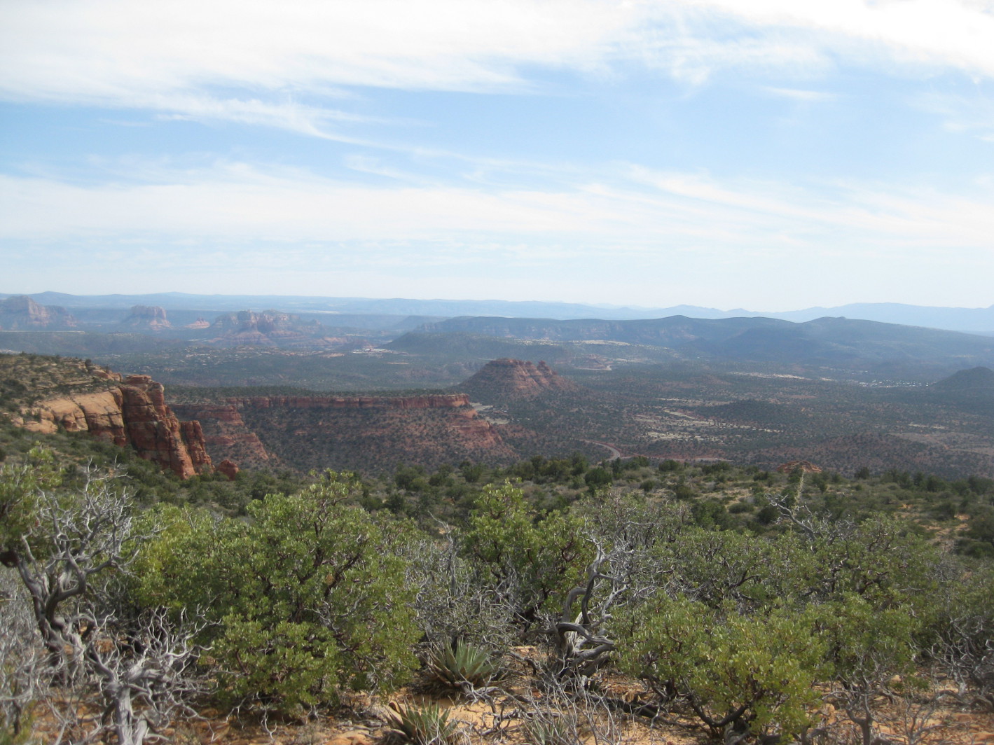
On
arriving at the first saddle we had a view across the Seven Canyons
Resort to Wilson Mountain looming in the background. Note the
distinctive red-rock sandstone base overlaid with cream-colored
Coconino sandstone. The protruding cliff (left)
of Mescal Mountain provides a closer view of the red sandstone.
 |
Seven Canyons Resort and Wilson Mountain beyond
|
Looking
to the northwest we could see bikers traveling along Deadman's Pass
Trail which links Boynton Canyon Trail to Long Canyon Trail.
Mescal
Mountain forms a ridge running generally northeast to southwest and
has an adjoining ridge protruding to the southeast. As shown in the
below photographs, our trail climbed from the first saddle, part way
up the face of the southwest running ridge and then passed close
alongside a sheer cliff wall leading to another saddle separating the
mountain proper from the ridge running to the southeast.
 |
Trail up the ridge from first saddle
|
 |
Passing close alongside the cliff
|
From
this saddle we could see Mescal Bike Trail running close along the
side of the mountain to connect with Deadman's Pass Trail on the west
side of the mountain.
We
continued on across the saddle and climbed to the top of the
southeast protruding ridge. From here we were able to see another
section of the Mescal Bike Trail as it wound its way toward us from
its trailhead at Long Canyon Road near the intersection with Dry
Creek Road before veering to the west to join Deadman's Pass Trail.
We
stopped for lunch at the top of the ridge. A gentle breeze was
blowing and the sky, as it had been all day, was thinly overcast. It
was not unpleasant but some of us did don our jackets.
Looking
straight ahead from the ridge, we could see Dry Creek Road as it made
its way back past Lizard Rock toward Sedona. In the below
photograph, Lizard Rock is barely discernible at the top of the
outcropping just to the left of the road. Thunder Mountain (the
highest formation) looms starkly against the sky farther left. Two
hikers are shown in the foreground carefully picking their way across
the rocks.
 |
Dry Creek Road, Lizard Rock and Thunder Mountain and two hikers
|
We
paused for a group photograph before heading back.
 |
Left to right (standing): David Beach, Jim Manning, Mark Purcell, Lila
Wright, Beverly Sass, Becky Fowsky, Chris Adler, Marywave Van Deren,
Miriam Sterling, Greg Mortimer, Gary Jacobson; (kneeling): the author,
Dolly Yapp, Daisy Williams, Donna Goodman, Betty Wolters
– photograph by unnamed using authors camera
|
The
trip up had been considerably more difficult than I had anticipated
and the trip back down, although faster, was also difficult. Not
having hiked this trail before, I had relied on reports by others and
I think they must have been much better hikers. Nevertheless, we did
all make it back in good shape.
This
hike was only 1.3 miles one way from where we parked. The highest
elevation was 5026 feet and the total ascent was 528 feet.
Our
GPS track is shown in red on the included map (below).
The short blue section of track shows the section of Long Canyon
Trail from the trailhead to where we entered the trail (Trl Jct) from
the upper parking lot. From there to the spot marked “Trl Jct2,”
our path is contiguous with Long Canyon Trail. The red flag shown
midway along the blue track marks the spot where (according to the
topographic map I am using) a branch of the Mescal Bike Trail
intersects with Long Canyon Trail.