On
19 April 2014 seven Skyliners hiked General Crook Trail in Copper
Canyon. We first positioned one car in Camp Verde at the Copper
Canyon Trailhead, located on Forest Road 136 about 0.9 miles from
Salt Mine Road. We then took Interstate 17 across the Black Hills to
the Hwy 169 intersection and turned east on the dirt road to Squaw
Peak (now FR 732, but possibly still numbered FR 68d). About 0.3
miles from I-17, we turned left onto FR 136 (possibly still numbered
FR 684d). This is a rough road suitable only for high-clearance or
4-wheel drive vehicles. We could have continued for another 1.4
miles on FR 732 and turned on FR 9603J to bypass the first 1.8 miles,
the roughest part, of FR 136. The route we took to park at the crest
of Copper Canyon is shown below in blue. The alternate route (FR
9603J) is shown in green.
 |
| Map showing route (and alternate route) to parking at the crest of Copper Canyon |
We
parked at the crest of the ridge at the very top of Copper Canyon,
donned our gear and then posed for a group photograph before starting
our hike.
 |
Left to right: Jim Manning, Daisy Williams, Gary Jacobson, Betty Wolters,
Kwi Johnson and Lila Wright – author not shown
|
About
200 yards below the crest we started to see flowers. The first
sightings were desert marigolds, feather daleas and 4 O'clocks.
 |
| Desert marigold/Feather dalea |
 |
| 4 0”clock |
After those first
sightings we found flowers all along the trail. The next photograph (below, right),
shows desert marigolds and feather daleas with a cliffrose shrub
as a backdrop.

The
road we were walking on, although fairly steep, did provide good
footing, allowing us to devote much of our attention to our
surroundings rather than next step. At some time in the past the old
road had been moved a few yards up the hill and the older roadbed was
clearly visible just below us. We really had no way of knowing
whether it was the route of the original General Crook Wagon Road.
However, I suspect that it may have been relocated numerous times
over the years in response to slides and washes.

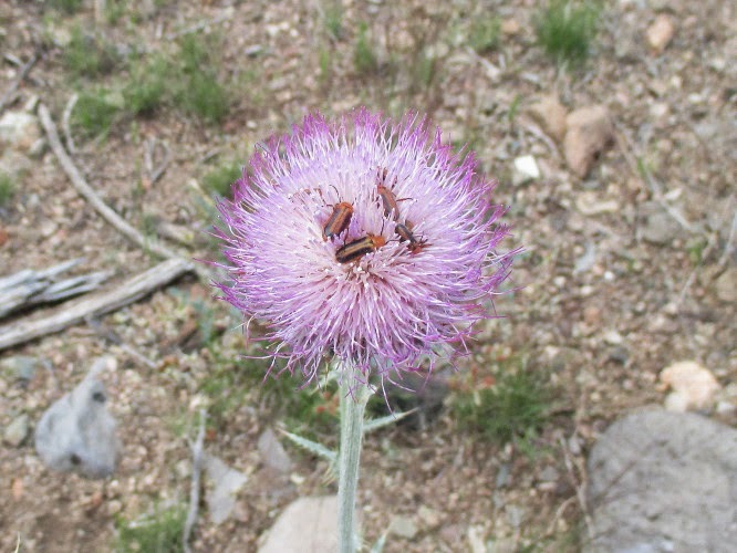
At
one point we came upon a particularly attractive clump of desert
marigolds (left) with a few sprigs of showy penstemon set among them and a
hint of globe mallow arranged above.
As
we neared the old stage station located just over a mile down from
the top of the canyon, we noted a number of colorful rocks that had
tumbled down the mountainside during construction of I-17 as the
contractor blasted away the mountain above.
 |
| Rock blasted from mountain when constructing I-17 |
We
then arrived at the old stage stop, a most pleasant place with a
grove of hackberry and Arizona walnut trees and a steady flowing
stream nearby.
 |
| Photograph taken standing near foundations of old stage stop building |
There
is a year-round spring just up a side canyon from where the old stage
stop is located and water is always flowing in the nearby stream and
on down the canyon from here. The spring is simply referred to on
all the maps I have seen as “Copper Canyon Water,” apparently
having no other name.
 |
| Wirelettuce (or Desert straw) |
 |
| Showy penstemon |
Below
the stage station flowers continued to grow in profusion,
particularly where the earth had been disturbed when constructing the
power line. Near one particular power pole we found the most
perfectly-formed clump of wirelettuce (desert straw) that I had ever
seen along with a veritable jungle of showy penstemon.
 |
| Firecracker penstemon |
 |
| Primrose |
These
were closely followed by a fiery red firecracker penstemon and a
clump of primrose just past its prime.
A
little farther down the trail was a single

 |
| Fleabane |
Just
after we had paused to admire some fleabane growing in splendid
isolation beside the road, we came upon a cave that, although having
hiked this way several times in the past, I had never before noticed.
Kwi checked it out and reported that it was about 25 feet deep and
then turned and continued for another eight or ten feet.
 |
| Cave at side of FR 136 |
 |
| Antelope horn |
We found several more flowers, all pictured here, as we drew near to the small, lovely waterfall where we planned to eat lunch.
 |
| Groundsel |
I
climbed down to the top of the waterfall and snapped a couple of
photographs before climbing back up to eat and settle in for a good
noon nap. The Copper Canyon Waterfall, seen from the top, is shown in the below photograph.
 |
| The Copper Canyon Waterfall from the top |
Gary had already found a nice soft spot in the shade of a
juniper tree and, shoving a few dried cow chips aside, I joined him
there. I really don't know how long we slept, but do know that I was
much refreshed.
It is just a little
under two miles from the waterfall to the Copper Canyon Trailhead and
we had excellent views down the road ahead, across the Verde Valley
and beyond the Mogollon Rim to the San Francisco Peaks.
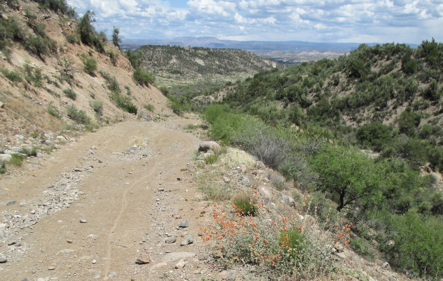
Looking
down the road ahead and across the valley to the peaks
This one-way hike was
6.1 miles, the trailhead elevation (where we parked) was 4769 feet
and the elevation difference was 1514 feet.
Our GPS track is shown
in red on the included map (below)

No comments:
Post a Comment