Skyliners
Mark Purcell, Daisy Williams, Ruth Frazier and the author hiked
Parsons Trail in Sycamore Canyon on 7 September 2013. Leaving from
the Safeway parking lot in Cottonwood, we drove through Old Town
Cottonwood on Main Street heading toward Clarkdale. Before reaching
Clarkdale, we turned right on Tuzigoot Road, crossed the Verde River
and then turned left on N Sycamore Canyon Road (Forest Road 131).
This road is paved at first but soon becomes a dirt road and proceeds
for about 10.3 miles to end at the Parsons Trailhead on the rim of
Sycamore Canyon. The driving time was about 40 minutes.
I
photographed my fellow hikers standing on the rim.
 |
Left to right: Mark Purcell, Daisy Williams and Ruth Frazier
– Sycamore Canyon in the background
|
 |
Forest Service sign posted at the Parsons Trailhead
|
 Another
very informative sign posted nearby provided some additional useful
information (photograph at right).
I was particularly pleased to know how many times we would be
crossing the stream. This would be my fourth hike on Parsons Trail
and I had always lost count of the number of crossings by the end of
the hike. The distance figure, 3.7 miles, was also welcome, because
GPS coverage in the canyon is very erratic and this would provide
something to compare my reading with.
Another
very informative sign posted nearby provided some additional useful
information (photograph at right).
I was particularly pleased to know how many times we would be
crossing the stream. This would be my fourth hike on Parsons Trail
and I had always lost count of the number of crossings by the end of
the hike. The distance figure, 3.7 miles, was also welcome, because
GPS coverage in the canyon is very erratic and this would provide
something to compare my reading with. At
the bottom of the steep descent from the canyon rim, Parsons Trail
leads north along Sycamore Creek. Packard Trail (left)
starts here, crosses the creek, climbs steeply up the rim on the
other side to Packard Mesa and continues on to join Sycamore Basin
Trail at Sycamore Tank about five miles away.
At
the bottom of the steep descent from the canyon rim, Parsons Trail
leads north along Sycamore Creek. Packard Trail (left)
starts here, crosses the creek, climbs steeply up the rim on the
other side to Packard Mesa and continues on to join Sycamore Basin
Trail at Sycamore Tank about five miles away.
Not
far up the trail we found a field of gorgeous yellow wildflowers that
we couldn't identify.
 |
Unidentified yellow flowers
|
 |
| Unidentified flower |
A
little further along we found a sacred dature plant with a single
flower being examined carefully by a lone bee. Nearby, a plant,
growing close to the creek bank, its roots practically implanted in
the water, sported fiery red flowers.
 |
Sacred datura
|
 |
Skyrocket (Scarlet gilia)
|
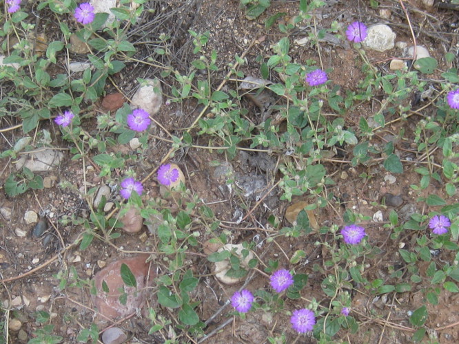
We
also found many asters and one trailing 4 o'clock along the way.
 |
| Asters |
 |
Trailing 4 o'clock
|
 Somewhere
along the way we came upon a single, lonely spiderwort (see
right) growing all by itself alongside the trail.
Somewhere
along the way we came upon a single, lonely spiderwort (see
right) growing all by itself alongside the trail.
About
1.3 miles up the trail we came to Summers Spring. I had not noticed
this spring on previous hikes but we were all looking for it this
time and found it easily. The map on the Forest Service sign at the
trailhead places the spring on the east side of the trail. However,
the trail has been rerouted to avoid a large tree that fell at the
spring some years ago and it is now on the west side of the trail.
One of the most
interesting feature of Sycamore Canyon is the large number of caves
and mining tunnels in the cliff walls. It is often hard to
differentiate between the two, but generally some of those on the
east wall near the base of the cliff appeared to be mine/prospecting
operations while everything we saw along the west wall, all higher up
appeared to be natural caves. Having heard a lot of stories about
mines tunnels, ranging from wild stories of secret government
facilities to lost gold mines, I searched around a bit and came up
with a 1966 Geological Survey Bulletin published by the Interior
Department1.
It provided the following information:
The only known mining claims in
the Sycamore Canyon Primitive Area are held by Mr. O. G. ("Jerry")
Graves and associates. These claims covering Geronimo's mine or
prospect are at the south edge of the primitive area, about 1.4 miles
north of Mr. Graves' cabin at Packard Ranch.
The legend of Geronimo's mine is
related in the "Mining Journal" of April 15th, 1946. In
brief, the legend tells how a gold deposit was found and worked by
Spanish explorers and later worked by Geronimo and other Apache
Indians. According to the legend, much of the gold bullion recovered
from the mine was buried in a secret place within the mine. Using
several lines of evidence, Mr. Graves and a former partner (now
deceased) located a cave in Sycamore Canyon, which they concluded was
Geronimo's mine, and they staked claims that covered it. The prospect
was examined on October 26, 1965, by the writers, accompanied by Mr.
Graves and Robert Raabe (U.S. Bur. Mines). The mine is a cave in the
Martin Limestone about 20 feet above Sycamore Creek. The cave is
partly filled with clay and sand. During the 20 years that Mr. Graves
and his partner worked at the mine, they excavated a T-shaped adit,
aggregating about 200 feet in length, by removing fill from the cave.
In this adit the cavern walls above the clay and sand fill are coated
with a black powdery material which Mr. Graves interprets to be soot
left from fires used by early miners for breaking the rock. Samples
of this material were identified as black manganese oxide rather than
soot. The undisturbed condition of the cave fill suggests that the
cave is natural and has never been excavated before. No evidence of
gold was found during the examination of the cave.
The
tale of the gold deposit that was supposedly “found and worked by
Spanish explorers” is elaborated on in an article I found online2.
All
in all, it appears that tales of gold in Sycamore Canyon were just
that, tales. As for the secret government facilities, the same
source of that tale also confidently informed me that the big dome
installed at the local cement plant to reduce air pollution was part
of a another secret government operation. Needless to say, neither
of these tales merit any serious consideration.
 We
did find what certainly appeared to be the opening of a man-made
tunnel (see left). It had been
walled up at one time to prevent entry, something often required by
regulatory authorities, but vandals have since removed most of the
rock wall. Although this cave appears to be man-made and does run
back into the cliff for a considerable, although undetermined by us,
distance, I didn't think it was the site referred to in the 1966
Geological Survey Bulletin quoted above. For one thing, there was no
black coating visible.
We
did find what certainly appeared to be the opening of a man-made
tunnel (see left). It had been
walled up at one time to prevent entry, something often required by
regulatory authorities, but vandals have since removed most of the
rock wall. Although this cave appears to be man-made and does run
back into the cliff for a considerable, although undetermined by us,
distance, I didn't think it was the site referred to in the 1966
Geological Survey Bulletin quoted above. For one thing, there was no
black coating visible. On
our way up the canyon I lost the trail and led the party awry. The
trail actually veered sharply to the east and slightly uphill at that
point and recent rains had pretty much washed out any visible sign of
it. Meanwhile, we had been heading generally toward the creek before
the sharp turn and it looked eminently crossable at that point.
After some deliberation, we crossed over and shortly found ourselves
at a dead end. This photograph (above right)
shows two of my fellow hikers gleefully pointing out the correct
trail for me.
On
our way up the canyon I lost the trail and led the party awry. The
trail actually veered sharply to the east and slightly uphill at that
point and recent rains had pretty much washed out any visible sign of
it. Meanwhile, we had been heading generally toward the creek before
the sharp turn and it looked eminently crossable at that point.
After some deliberation, we crossed over and shortly found ourselves
at a dead end. This photograph (above right)
shows two of my fellow hikers gleefully pointing out the correct
trail for me. On
up the trail, just a short distance past our wrong turn, we came to a
second cave (see left) that I
thought more likely to be the one mentioned in the Geological Survey
Bulletin. This one does, at least, show what could be the black
manganese oxide coating identified by the surveyors.
On
up the trail, just a short distance past our wrong turn, we came to a
second cave (see left) that I
thought more likely to be the one mentioned in the Geological Survey
Bulletin. This one does, at least, show what could be the black
manganese oxide coating identified by the surveyors.
There
were other caves near the trail on the east side of the canyon, but
they were not significantly different from those already shown.
Meanwhile,
across the creek in the west canyon wall we could see other caves.
The below photograph displays two of these, one partially hidden by
trees on the left and one on the right. The left most cave may have
a man-made rock wall behind the trees; we really couldn't tell for
sure. Note also the large rectangular rock perched atop the small
peak at the upper right. This rock also appears in the next photograph.
 |
Two caves visible in the west wall of Sycamore Canyon
|
 Not
far north of the two caves shown in the above photograph, we saw
another one (see right) that
definitely showed evidence of human habitation, specifically a
man-made rock wall near its entrance. The cave appears at the bottom
center of the photograph. We decided this cave had most certainly
been used by Indians. Also see the large rectangular rock sitting
atop the peak directly above the cave. This is the same rock shown
in the bottom photograph on the previous page.
Not
far north of the two caves shown in the above photograph, we saw
another one (see right) that
definitely showed evidence of human habitation, specifically a
man-made rock wall near its entrance. The cave appears at the bottom
center of the photograph. We decided this cave had most certainly
been used by Indians. Also see the large rectangular rock sitting
atop the peak directly above the cave. This is the same rock shown
in the bottom photograph on the previous page. An
enlarged view of the cave is shown here (see
left) to better display the man-made wall.
An
enlarged view of the cave is shown here (see
left) to better display the man-made wall.
We
counted the creek crossings on the way up and found that there were
indeed six. Of course we actually crossed eight times because I lost
the trail.
We
knew we had reached the end of the trail when we found ourselves in a
dry streambed. The spring is actually located at the bottom of a
steep cliff wall on the west side of the canyon and is surrounded by
a thick growth of vegetation. The sixth creek crossing is just below
the spring and one must continue about another tenth of a mile beyond
that to reach the dry streambed.
When
I downloaded the track from my GPS and cleaned it up by removing all
the extraneous signals that had bounced off the canyon walls, I found
that it showed a one-way distance of 3.8 miles. Considering that we
actually hiked a short distance beyond the spring (see
map below), that accords well with the mileage posted
at the trailhead.
 |
Map showing Parsons Spring and where we stopped for lunch
|

1
http://pubs.usgs.gov/bul/1230f/report.pdf
2
http://www.thegeozone.com/treasure/arizona/tales/az009a.jsp
No comments:
Post a Comment