On 27 March 2010, ten members of
the Skyliner's group (Lila Wright, Anita Jackson, Virginia Driscoll,
Dolly Yapp, Marvin Alt, Daisy Williams, Donna Goodman, Jim Manning,
Ellis Price and one other) hiked on Black Canyon Trail. From
Cottonwood we took Camino Real (and then Old Hwy 279) through Verde
Village to Ogden Ranch Road at Montezuma School. We turned toward the
mountain on Ogden Ranch Road and traveled three miles to the end of
the road at the Black Canyon Trailhead.
Shown below are three members of
the group as we prepare to start the hike. Look carefully and you
will the snow-covered San Francisco Peaks on the horizon.
 |
Virginia, Marvin and Lila with the Mogollon Rim and the San Francisco
Peaks in the background
|
One enters the trail from the
trailhead by passing through a barrier erected to block all-terrain
vehicles and then walks alongside a wash for just less than one-tenth
of a mile before dipping into and crossing the wash. The turn into
the wash is not obvious and the trail appears to continue along the
bank of the wash. I have temporarily lost the trail at this point
more than once and others have told me of having the same experience.
After crossing the wash, the trail follows along a hillside for
something like one-third of a mile and then dips down to cross
another wash. After that it passes through two wire gates fairly
close together and continues a steady, but rather gentle climb up the
mountain. We paused frequently along the way to look at flowers and
take in the view back across Verde Valley to the Mogollon Rim and the
San Francisco Peaks beyond. The only clouds in the sky were hovering
just above the rim, clustered mostly around the peaks.
 |
Clouds clustered around the San Francisco Peaks – zoom shot
|
Although the height of the flower
season was yet to arrive, we did find Primroses, Deer Vetch, Filaree,
Desert Hyacinths, Indian Paint Brush and Ceanothus along the way.
 |
Primrose Deer Vetch
|
In the left photograph the
primrose has two current blossoms, three buds can be seen (middle top
to center) waiting their turn for glory and two old, shriveled
blossoms are visible (upper right and bottom center). A couple of
stray Filaree blossoms (reddish purple color) are faintly visible in
the lower right. The Deer Vetch shown in the right photograph
appears again in the left photograph below
 |
Filaree plant Desert Hyacinth
|
In the left photograph above, the
reddish purple at bottom center is new growth Filaree. Deer Vetch is
visible to the upper right the upper right in the photograph (See
single yellow blossom just above/behind the Filaree).
 |
Indian Paint Brush hiding in the grass Ceanothus
|
Around one and a-third miles from
the trailhead we came upon a faint trail leading down toward what
appeared to be an overlook near the bottom of the canyon and decided
to explore.
The faint trail descended some
250 feet in a distance of about a third of a mile to a point
overlooking the bottom of the canyon just opposite a side canyon with
a small waterfall.
 |
Looking across Black Canyon from the overlook to a barely discernible
waterfall (center) in a side canyon
|
We climbed back up to the main
trail and, after a pause to rest from the effort, continued on our
way toward the halfway point on Black Canyon Trail where we planned
to eat lunch and turn back. After hiking about another 1.45 miles on
up the trail, we arrived at a wash leading down the mountain to drain
into Black Canyon. I have previously determined that this spot is at
about the halfway point on Black Canyon Trail. Just after crossing
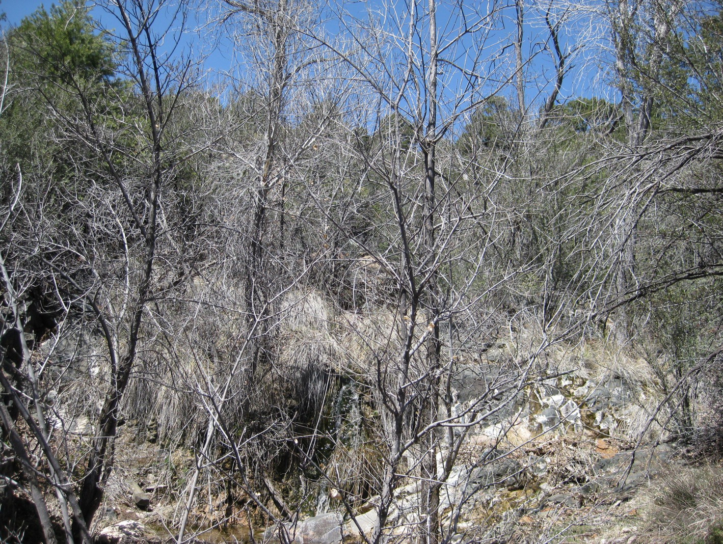
the wash on the way up the mountain, the trail enters a Manzanita
forest. There are actually two separate washes that run together at
this spot and continue on down to the canyon below. The trail
crosses both of them just upstream from the juncture, passing through
first one then, less than 50 yards further on, the other. We stopped
for lunch at the first wash. It is always a most pleasant place to
pause, with sunny exposures for the cooler months, plenty of trees
for shade during hot weather and, for a large part of the year, the
pleasant trickle of running water.
 |
Manzanita forest through which Black Canyon Trail runs
|
 |
This is a view up the wash from where we ate lunch. The rippling, greenish-
white cascade directly below center in this shot is a small waterfall.
|
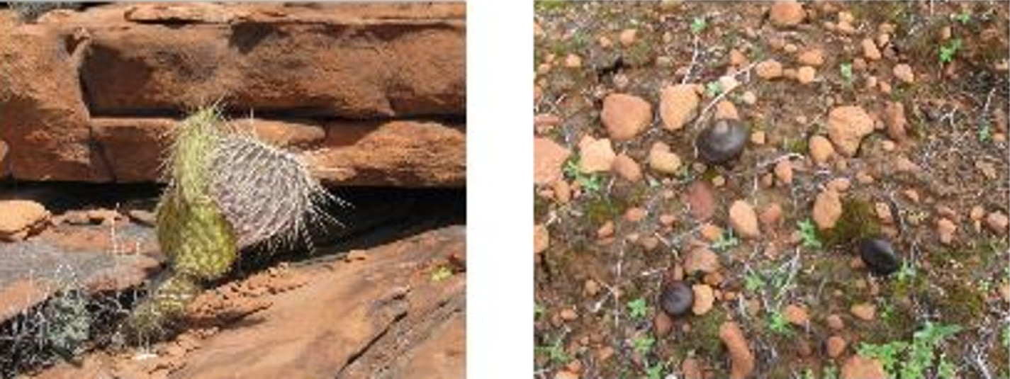
On the way back down the trail,
just below where we ate lunch, a couple of very attractive cacti
caught my attention.
 |
Large Prickly Pear Cactus Hedgehog Cactus
|
Mexican Gold Poppies, barely open
on our way up the trail, were now showing in all their glory and we
noted several more examples of Indian Paint Brush.
 |
California Or Mexican Gold Poppy Indian Paint Brush
|
In places the trail was lined
with flowers, primarily Indian Paintbrush and Mexican Gold Poppy.
 |
Indian Paint Brush lining the trail
|
 |
Mexican Gold Poppies strewn along the trail
|
The total hiking distance was,
according to my GPS, 8.5 miles. That includes the side trip (about
six-tenths of a mile down and back) on the faint trail to the
overlook near the canyon floor. Without the side trip, the hike to
the spot where we ate lunch would have been about 3.25 miles. A
rough estimate of the distance from our lunch stop to the upper
trailhead is 3.3 miles. The elevation gain for this hike was about
1325 feet from the trailhead to where we turned back. The total
ascent with the extra climbing of our side trip and climbing up and
down to cross washes was just over 1900 feet according to my GPS.
Our track is shown in red on the
included map (below)