On
3 December 2016 eight Skyliners hiked the Watson Lake Loop Trail in
Prescott. This trail traverses the highly scenic Granite Dells
region around Watson Lake. From Cottonwood we drove south on Hwy 89A
through Jerome and across Mingus Mountain to connect with US 89. We
continued 4.3 miles south on US 89, turned east on Prescott Lakes
Parkway and drove 0.4 miles before turning north on Sundog Ranch Road
and continuing for about another 0.1 miles to a dirt parking area
near the Humane Society. There is a $3.00 parking fee. The original
plan was to hike on Peavine Rail Trail, Iron King Trail and Lakeshore
Trail in that order, repeating a 27 February 2010 hike.
We
did in fact start out by hiking about 0.9 miles on Peavine Rail
Trail. However, when we came to the junction with Lakeshore Trail, we
decided to follow it along the shore of Watson Lake. Then, upon
reaching the north end of the lake, we just continued on the trail
along the shore, looping around the lake in a counterclockwise
direction.
In
the Dells, the giant granite boulders have weathered into delicately
balanced forms and fanciful shapes. Some of these are pointed out in
this report. Rock climbers like to tackle the challenging granite
formations and Joanne Hennings supplied a photograph of one such
climber rappelling down a sheer granite cliff (right).
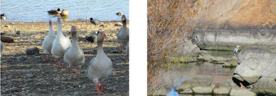
We
saw ducks along the way and, later in the hike, a flock of domestic
geese (below left)
and occasionally noted the brilliant green head of a wild male
Mallard duck sparkling in the sunlight. I snapped a photograph of
what I think was a heron (below
right). It was some distance away,
perched on a rock surrounded by striking reflections of the
rust-colored cliff on the surface of the water. Contrasting with the
reflections were a few lingering bright green leaves amidst the
greenish-brown hue of overhanging vegetation.
 |
Geese and ducks along the shore A lone heron(?) among reflections
|
After
awhile we stopped for a snack break and a group photo. This area had
everything: columns of granite reaching for the sky, water,
boulders, a deciduous tree and dark green evergreens.
 |
| Left to right: Lila Wright, Joanne Hennings, Donna Goodman (kneeling), Karl Sink, Joyce Arregui, Daisy Williams (kneeling), Chris Jensen and Betty Wolters. |
Continuing
the loop around Watson Lake we had a view of a section of the Granite
Dells and the lake with the Granite Mountain Wilderness in the
distance.
 |
Looking across Watson Lake to Granite Mountain Wilderness
|
Next
we came to an area of the Dells with fancifully-shaped rock
formations, including a delicately balanced, seal-shaped protrusion
(below left)
and an attractive dead tree set against a background of granite
(below right).
 |
Seal-shaped formation Dead tree set against a granite cliff
|
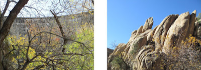
At
Granite Creek Dam we took a short spur trail to view the dam from
below (below left).
Near the dam were rock formations that resembled giant stone fish
leaping upwards into the blue sky (below
right). They looked very much like
Roundtail Chub (Gila robusta), a native Arizona fish.
 |
Granite Creek Dam from downstream Leaping fish
|
We
then climbed up to view the dam from the top. There are alternate
routes and we found a sign with one arrow pointing to a “steep”
trail and another pointing to a “steeper” trail. From the top we
could see the San Francisco Peaks in the distance.
 |
The San Francisco Peaks in the distance
|
From
our vantage point high above the lake, we could look down on the dam
itself (below left)
and on a rather large island in the lake (below
right).
 |
Granite Creek Dam from above Island in Watson Lake
|
Along
the opposite side of the lake from where we started we came to a
shore that was lined with Domestic Geese near a boat dock. This area
also included restrooms and benches.
 |
Boat ramp on the west side of Watson Lake
|
After
passing the boat ramp we were on Lower Granite Creek Discovery Trail
which leads across Granite Creek at the south end of the lake and
reconnects with Peavine Rail Trail very near where we were parked.
This section of the loop, open to hikers, runners, horseback riders
and bicyclists, is the easiest of trails with good trail surface and
minimal elevation change. This section was welcomed after all the
fun we had had following painted white dots up and over so many
granite formations and climbing the steep section of trail to the dam
overlook.
All
the other hikers were moving along rather quickly since we would soon
be back at the parking area, having nearly completed the loop around
Watson Lake. While trying to keep up with them I did not pause to
take any more photos. The trail meandered through a scenic riparian
area before crossed over Granite Creek on a bridge. The area
reminded me of the Riverfront and Jail Trails along the Verde River
in Cottonwood.
Back
at the parking lot we all said our goodbyes to Donna who lives in
Prescott Valley and thus would not be going back to Cottonwood with
us.
The
hikers did not save a GPS Track for this hike so the track shown on
the included map (below) may
deviate slightly from the path actually hiked. The red track shows
the actual loop while the blue track shows the short distance from
the Sundog parking area to the start of the loop trail.
This
loop hike itself as shown in red is 5.1 miles long, the highest
elevation is 5249 feet and the total ascent is 656 feet. The short
distance from the parking area to the loop is 0.4 miles with an
elevation gain of about 20 feet. The total hike was about 5.9 miles.
This
report was written by Daisy Williams and assembled, edited and posted
online by Ellis Price with help from Lila Wright.


No comments:
Post a Comment