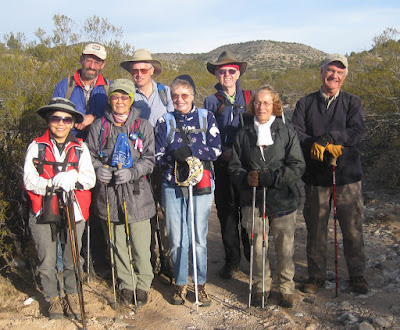
Nine
Skyliners hiked on Forest Road 9952 and 9952C from Beaverhead Flat
Road to House Mountain on 29 December 2012. From Cottonwood, we
drove north on Hwy 89A, turned right (east) on Cornville Road and
followed it for 8.2 miles, passing through Cornville, turned left
onto Beaverhead Flat Road and followed it for 2.7 miles to arrive at
the turnoff to FR 9952 (on the left). We drove for about one mile on
FR 9952 before parking to start our hike.
After
donning our packs, we paused for a group photograph.
 The
section of road shown in the photograph (right) exemplifies the condition of the road
along which we would hike all the way to the top of House Mountain.
Although it was a little rockier and a good bit steeper in places
than shown here. As
can be seen here, the road
was bathed in sunlight when we started our hike; however, that soon
changed, for the sun was blocked by a steep hill on our right as we
traveled deeper into the wash that would lead us up the mountain
toward our goal. The lack of sun coupled with a gentle, but chilly,
breeze that blew steadily at our backs caused us to move briskly
along in an effort to keep warm. As a result we made very good time
and an hour and a half from the time we started our hike we were at
Trick Tank (or as it is marked on my map, “Horse Mountain Trick
Tank”).
The
following photograph, taken from the catchment area, shows a fairly
new galvanized tank (left) and an older rusty one (right).
 |
Metal tanks located at Trick Tank
|
The
trough leading to the top of the galvanized tank carries runoff from
the catchment area; the pipe from the top of that tank carries
overflow to the rusted tank seen behind the tree. At the time of my
last previous hike to House Mountain, about six years ago, the
galvanized tank had not yet been installed and the catchment area
consisted of two long runs of metal roofing, mounted parallel to one
another on the hillside and slanted to the middle so that all water
ran to the center and then downhill to be collected in a single rusty
metal tank. The old roofing sections have since been replaced by an
expanded catchment area that is composed of a layer of asphalt, or
possibly plastic sheeting, covered with a layer of gravel and the
galvanized tank shown in the photograph (above)
has been added.
We
paused at the tank for a mid-morning snack before continuing on
toward the top of House Mountain. We still had two miles to go, one
to the FR 9952C turnoff and another to the top. We were long since
out of the shadow of the hill and it was a little warmer, but not
much, as a thin layer of clouds had drifted across the sky and now
filtered the sun. Consequently we continued to move along at a good
pace and were soon at the summit.
 |
Hiker Mark Purcell eating lunch on the summit, elevation 5154 feet
|
From
his perch on the summit (above)
Mark could see in all directions. Looking to the north, he had a
clear view of the sun-drenched, snow- capped San Francisco Peaks.
 |
Humphreys, Agassiz, Fremont and Doyle Peaks lined up left to right
– slightly enlarged photograph
|
To
the west, across the Verde Valley, Mingus Mountain brooded in the
thin sunlight that filtered its way through the overcast sky.
 |
Mingus Mountain seen from House Mountain
|
As
measured by my GPS track (see map on next page)
we had hiked 4.8 miles one way and climbed 1470 feet to reach the
summit.


No comments:
Post a Comment