The
first time I hiked in this area was as part a group led by since
deceased, long-time hiker, Ernie Hill, who was gathering data to
restore an old trail. We started at the upper trailhead of what is
now Trail 548 (Bug Hollow) and followed an old mining road past its
present-day junction with Trail 549 (Powerline). Currently,
information on the National Forest website indicates that Trail 548
still ends here17.
However, that entry provided its condition in 2010 and said that
plans existed to restore the section leading down the mountain to FR
338. The old Juniper shown below, standing at the edge of a meadow,
marked the 2010 end of the trail.
 |
Old juniper at meadow where Trail 548 (Bug Hollow) ended in 2010
|
Trail
548 now leaves the old road just before the juniper when hiking from
the upper trailhead and leads past the tree, through the meadow and
down the mountain to join with Forest Road 338 in Mescal Gulch, the
start of our hike today. It is now clear, well-marked and easy to
follow all the way. It even has a trailhead sign posted at FR 338.
On
that years ago hike led by Ernie Hill, on the other hand, we saw no
sign of the trail leading down the mountain to FR 338; it was that
grown over. We did pause to take a quick look at what we then
thought was just an old side road leading to the meadow, but is now
clearly marked as Trail 548. The road we continued on was that now
shown as Trail 549 (leaning sign near center) in the below picture.
This, now clearly-marked, junction is shown below.
 |
Road to left is Trail 548; road to right is Trail 549, both are now clearly marked
|
Having
recently hiked all of the other trails in this immediate area, six
members of our group set out on 16 November 2013 to hike on Powerline
Trail. We would access the trail by following Trail 548 from its
lower trailhead at FR 338 in Mescal Gulch. The day was chilly, a
sharp wind was blowing, clouds were rushing across the mountain and
it looked like rain at any moment. Nevertheless, we checked our
ponchos, bundled our scarves around our necks and proceeded on our
way.
 Taking
two 4-wheel drive vehicles we drove through Jerome and continued up
the mountain on 89A to Mescal Gulch There we turned down the gulch
on Forest Road 338. From 89A we drove approximately 0.3 miles down
the forest road to to reach the lower Bug Hollow Trailhead (right).
The sign is located on the right side of the forest road. The
trail, seen to the right of the sign, follows along an old road, at
first at a very gentle ascent. Soon, however, it started climbing at
a fairly steep angle. Eventually it did level out a bit for a short
distance, but then the trail left the old road and made another steep
climb up the hill to the open meadow where the old juniper tree
stands.
Taking
two 4-wheel drive vehicles we drove through Jerome and continued up
the mountain on 89A to Mescal Gulch There we turned down the gulch
on Forest Road 338. From 89A we drove approximately 0.3 miles down
the forest road to to reach the lower Bug Hollow Trailhead (right).
The sign is located on the right side of the forest road. The
trail, seen to the right of the sign, follows along an old road, at
first at a very gentle ascent. Soon, however, it started climbing at
a fairly steep angle. Eventually it did level out a bit for a short
distance, but then the trail left the old road and made another steep
climb up the hill to the open meadow where the old juniper tree
stands.
This
photograph (left) shows a hiker
making her way up the last section of trail below the meadow.
Upon
reaching the meadow we found that the trail cut a quite distinct
path, marked by cairns along the way, across it and on past the old
juniper to the junction (photo shown at beginning of report)
with Trail 549.
Surprisingly,
several late season flowers were still hanging on. The cliffrose
shrub and the thistle shown below were found along a sunny stretch of
trail below the meadow.
 |
Cliffrose
|
 |
| Thistle |
 Above
the meadow, along Trail 549, we found additional examples of late
blooming flowers, specifically several clumps of Rocky Mountain aster
(right). Someone noted that we had
recently had a good rain followed by several warm days and we decided
the flowers were confused and thought it was spring already.
Above
the meadow, along Trail 549, we found additional examples of late
blooming flowers, specifically several clumps of Rocky Mountain aster
(right). Someone noted that we had
recently had a good rain followed by several warm days and we decided
the flowers were confused and thought it was spring already. The
trail, following an old mining road, was now leading gradually uphill
and we soon entered a forested section and then, about 0.3 miles from
the junction with Trail 548, came to sharp bend in the road. There
appeared to have been some fairly extensive excavation at the area
with a large flat space created at the bend. We did not see any mine
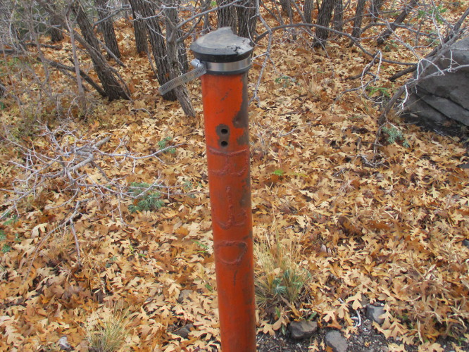
tailings; however, we did note an orange-colored pipe (left)
protruding from the ground. The notation R-31 was inscribed on the
surface of the pipe by weld bead. We were not really sure whether it
was a claim boundary marker or a vent for an abandoned underground
mine.
The
trail, following an old mining road, was now leading gradually uphill
and we soon entered a forested section and then, about 0.3 miles from
the junction with Trail 548, came to sharp bend in the road. There
appeared to have been some fairly extensive excavation at the area
with a large flat space created at the bend. We did not see any mine
tailings; however, we did note an orange-colored pipe (left)
protruding from the ground. The notation R-31 was inscribed on the
surface of the pipe by weld bead. We were not really sure whether it
was a claim boundary marker or a vent for an abandoned underground
mine.
From
the sharp bend, the trail climbed fairly steeply for a distance and
then followed closely along the 7,000 foot level along the contour of
Mingus Mountain, dipping into and out of washes along the way.
But
the hiking now became a little more difficult. We were still
following along the old mining road, and would do so until the end of
the trail. However, there were now fallen rocks in the trail, a lot
of undergrowth in the old road bed and many fallen trees to navigate
around. In a few cases the fallen trees and undergrowth constituted
such barriers that some of our party considered turning back. But we
all decided we had come too far to turn back this near the end.
We
saw another orange-colored pipe further along the trail, this one
inscribed with the notation R-30. Then still another, larger, pipe
with a hinged lid on top, along with a smaller, rusted open pipe and
a rod imbedded in a rock. We really couldn't discern the purpose of
any of the objects. The only one we could be sure was not some sort
of vent was the imbedded rod. These are all shown below.
 |
Pipe inscribed R-30
|
 |
Larger pipe with hinged top
|
 |
Smaller, rusted open pipe
|
 |
Rod imbedded in rock
|
Meanwhile,
all along the way, we had great views farther afield. Woodchute
Mountain was visible to the north and Verde Valley, dappled by the
fast moving, ever-changing clouds was spread out below us. Closer in
we noted a large, ancient fir tree growing at the shoulder of the road and wondered how it had escaped
the lumbermen.
 |
Ancient fir tree growing alongside the old road our trail followed
|
The
view across Verde Valley is shown below. The clouds, impelled by the
fast blowing wind, were moving swiftly across the sky creating an
ever-changing mosaic of shadows on the hills below.
 |
Looking out at Verde Valley from Trail 549 high on Mingus Mountain
|
The
trail dropped about 200 feet during the last 0.2 miles. The old
rock strewn, undergrowth choked, mining road that had been
crisscrossed by dead, fallen trees for some distance cleared up a bit
and then ended at the bottom of a draw. The old road's end ( as well
as the end of our trail) was emphasized by the dead trunk of an
enormous old tree that had fallen across it long ago.
Just
on the other side of the old rotting trunk is a grass-covered open
space, just big enough to let in a spot of sun. It makes a great
place for a lunch stop and we availed ourselves of the opportunity.
But it was still pretty chilly and we didn't linger after eating,
pausing just long enough to pose for a group photograph while we were
still at the end of the trail.
 |
Left to right: Ruth Frazier, Frank Lombardo, Daisy Williams, Betty Wolters
and the author – photograph by Name Withheld
|
Knowing
that Trail 105, running from FR 338 to the top of Mingus, was not far
below us, I suggested that we hike downhill from the end of Trail 549
and connect with it for the trip back to where we were parked. I had
been that way several times before and it seemed shorter to me.
Indeed, measured later it did turn out to be slightly shorter, 2.8
miles as opposed to 3.1 miles the way we had come.
Unfortunately,
on the way down the mountain, I managed to miss Trail 105 when we
crossed it. There were fresh-fallen leaves and it looked to be no
more than just another game trail. This resulted in us wandering in
the wilderness, so to speak, like Moses in the Sinai. Luckily, we
didn't spend 40 years in our wilderness, just an hour and twenty six
minutes. The extra distance was only half a mile, but I do have to
admit that it was the toughest half mile of the hike.
After
returning to Trail 105, the hiking was easy. The trail, despite our
having missed it at first, is generally easy to follow and along this
section varies little in elevation. We soon reached its end at FR
338 and then followed that route all the way back to our vehicles,
waiting at the Trail 548 Trailhead. As we neared the end of our hike
we passed a small cemetery on the left. It contains only three
graves, one appearing to be that of a child and the others adults.
The smaller grave had a marker made of a slab of stone with the
figures 1901 inscribed on it. Other than uninscribed wooden markers
of obviously more recent vintage, there were no other markers.
 |
Three graves at an old cemetery
|
 The
small sandstone (right) with 1901
carved on it appears at the head of the middle grave. I moved it to
take the photograph, then replaced it. There is an old mine shaft
just across FR 338 from the site and I wondered whether the people
buried there might have been a mining family. Or, perhaps they were
ranchers running cattle in Mescal Gulch.
The
small sandstone (right) with 1901
carved on it appears at the head of the middle grave. I moved it to
take the photograph, then replaced it. There is an old mine shaft
just across FR 338 from the site and I wondered whether the people
buried there might have been a mining family. Or, perhaps they were
ranchers running cattle in Mescal Gulch.
Continuing
along the forest road, we came to the collector tank located at
Mescal Spring and noted that it was now, unlike at earlier visits,
bone dry. I climbed up behind the tank to investigate and found that
the tunnel from which the spring previously ran is now completely
blocked off (left) in the same manner as many old mine tunnels in the area.
Perhaps it was once an old mine itself and has been blocked as part
of some mine mitigation project. In any case, there is no longer any
water flowing from it.
We
were soon back at our vehicles. It had been a tiring seven-hour hike
and we were ready to go home.
I
had used a GPS track from another source to plan the hike and came up
with a wildly excessive estimate of 10.6 miles for the round trip. I
have since reexamined that track and still cannot determine what is
wrong with it. As it were, my GPS-recorded distance turned out to be
just 6.2 miles had we returned by the route we came. With the extra
0.5 mile detour caused by difficulty in finding Trail 105 coupled
with the otherwise shorter distance the way we returned, we actually
hiked 6.4 miles. Our highest elevation was 7007 feet and the
elevation difference was 971 feet. But, considering all the ups and
downs along the way, we really climbed a total of 1320 feet.
Our
route is shown in red on the included map, except that the extra half
mile is shown in blue.

17
http://www.fs.usda.gov/recarea/prescott/recreation/fishing/recarea/?recid=67441&actid=50
No comments:
Post a Comment