Eight
Skyliners (Anita
Jackson, George Everman, Lila Wright, John McInerney, Ellis Price and
three others) hiked the Yaeger Canyon
Loop, using Trail 28, Trail 111, FR 105 and Trail 533 on Saturday, 13
November 2010.
We
drove through Jerome on Hwy 89A, crossed over the Summit of Mingus
Mountain and parked alongside the road at about mile marker 333.1.
The parking area is on the left as you travel south on 89A and is
located just at the end of a guardrail. An old road, now blocked off
with large rocks, leads down from the highway just at the end of the
guardrail.
 |
The start of Trails 28 and 533
|
We
walked past the rocks and were confronted with a choice: we could
continue straight ahead on Trail 533 or turn to the left and take
Trail 28. To complete the loop, one hikes up the canyon on one of
these two trails and returns on the other. We chose Trail 28 for the
ascent, and hiked the loop clockwise, because that trail has a lot of
loose rock and would be harder to descend on. Trail 533, on the
other hand, has a much better surface for a descent.
We
paused along the trail while George positioned his camera and set the
time delay for a group shot. The below photo was taken a bit more
than a mile from the trailhead.
Trail
28 parallels 89A for approximately half a mile, passing by the
remains of a bridge that once served the old highway. Just beyond
the old bridge, the trail turns eastward and begins to climb,
switchbacking up to the head of a side canyon. We paused on one of
the switchbacks for the group photo shown above. As you climb the
steep, rocky trail, Prescott Valley comes into view below and Hickey
Mountain can be seen to the west. The trail passes below a large
rock bluff and then ascents to cross at the top of a smaller one.
This is a good place to pause and climb out on the bluff for a rest
and a bird’s eye view of Prescott Valley. A craggy, gnarled old
dead tree stands at the edge of the bluff.
 |
Taken along Trail 28 at the top of a rock bluff and at a good viewpoint.
|
On
the trunk of the dead tree, we found wonderfully intricate patterns,
probably carved by Mountain Pine Beetles. At first no one had any
idea what had caused the patterns; however, I later found a Forest
Service publication1
showing similar damage attributed to Mountain Pine Beetles, and
assume they also caused the pattern shown in the photo shown below.
 |
Mountain Pine Beetle carvings (I think) –Photo by George
|
Someone
had left the remains of a rose bouquet atop the bluff, perhaps from a
wedding held there. We speculated as to whether Grandma was able to
make the ceremony if someone really did get married there. Then we
looked around and realized that most of us were probably Grandma’s
contemporaries. The rose bouquet was just too bedraggled for a good
picture; instead I took a picture of a perfectly formed pincushion
cactus growing atop the bluff.
 |
Hedgehog cactus
|
Looking
back from farther up the trail we could see the bluff with the dead
tree.
 |
Bluff with dead tree in center, Prescott Valley in the distance, author in
right lower corner– photograph by George
|
 |
View from near top of Trail 28. Looking across Prescott Valley. Hwy
89A is lower right
|
Nearing
the intersection of Trail 28 with Trail 111, we paused for a snack
under a great old Alligator Juniper. George had gathered some
Prickly Pear fruit along the way; some of
us sampled it and were rewarded with bright red fingers and lips, not
to mention stickers in our fingers.
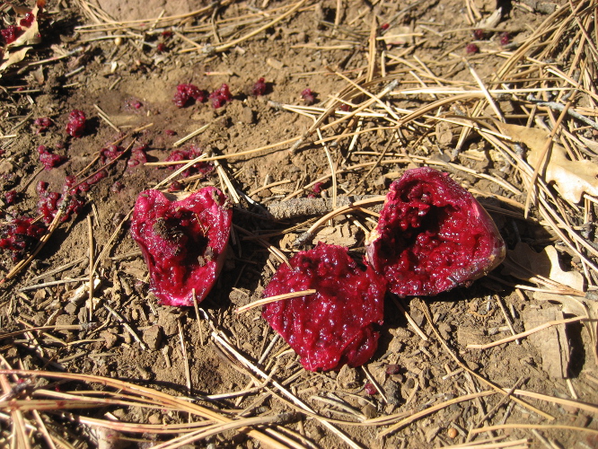 |
Cactus fruit
|
 |
Hikers enjoying a snack
|
About
two tenths of a mile, perhaps a bit less, from our snack break at the
Alligator Juniper, we came to the junction with Trail 111. I checked
later on Google Earth and found that had we continued straight ahead
instead of turning on Trail 111, we would have arrived at FR 413 in
less than four tenths of a mile.
Along
the way we found bear scat (we think) and an arrowhead.
 |
Bear scat (we think) - Photo by George
|
 |
An arrowhead (shank broken off) – Photo by George
|
Taking
Trail 111 at the intersection, we traveled generally southeast,
angling toward FR 413. About three tenths of a mile from the
intersection with Trail 28, we actually came within 110 yards of FR
413 before the trail turned to the southwest to run parallel with.
Meanwhile, John had noted a spring (Young Seep Spring) shown on the
topographic map and wanted to see if we could find it. I thought it was
probably not much as the name itself seemed to imply that it was
merely a seep. However, we came to it just before Trail 111 turned
to the southwest, and it turned out to be quite impressive for a
seep; it fed a nice patch of grass and ice from the night before was
still present.
 |
Young Seep Spring – John is shown standing on the other side
– Photo by George.
|
We
continued along Trail 111, traveling a total distance of around one
and eight tenths of a mile from Trail 28, to arrive at FR 105. We
then followed FR 105, going west, slightly south, for a bit less than
300 yards to arrive at the Trailhead for 533. We followed Trail 533
through the forest for about one quarter of a mile before coming out
in a sunny area at the head of the canyon; we stopped there to eat
lunch before heading down. I grabbed a quick lunch, drank a cup of
tea and settled in for my noon nap. When George woke me up all the
others had gone ahead, saying that it was just cold to sit still.
Perhaps my resting spot was more sheltered; I was quite comfortable.
George and I soon caught up with the rest of the party and we all
arrived back at the trailhead together.
The
hike was 6.8 miles long with an elevation change of 1475 feet (7205
minus 5730).
Our
GPS track is shown on the included map (below).

No comments:
Post a Comment