This
is a quick memo to record a 15 October hike in Upper Sycamore Canyon.
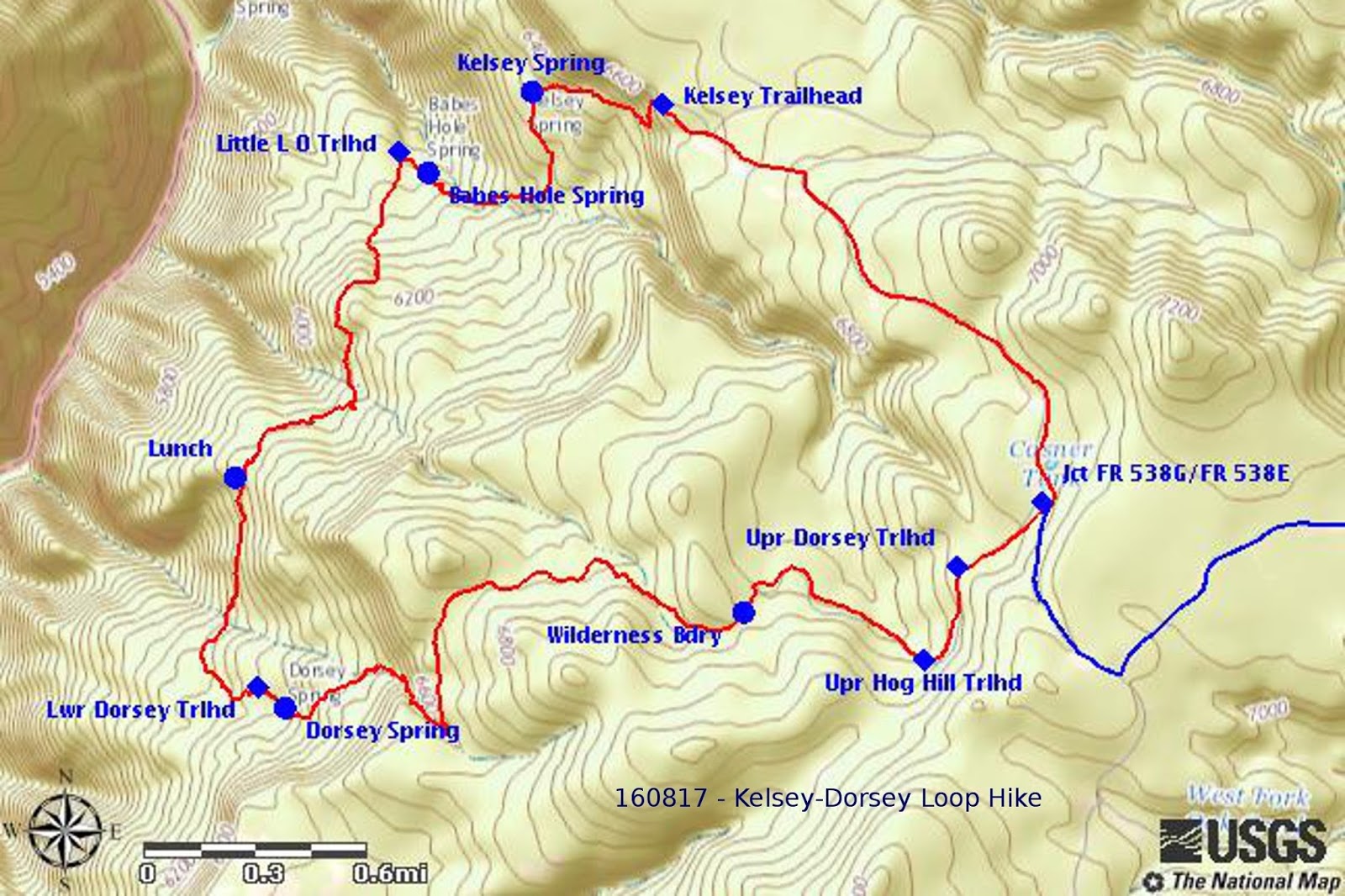
As shown on the below map, the hike utilized part of Forest Road
538G, part of Kelsey Trail, all of Dorsey Trail and a very short
section of Hog Hill Trail.
A
more complete description of the trail, based on a 17 August 2016
scouting hike, is available online at:
 |
GPS track of the Kelsey-Dorsey-Hog Hill Loop – recorded by Ellis Price on 160817
|
The
trail map included above is taken from the report of that August
scouting hike.
On
the current hike, participants reporting seeing wild turkeys and
deer; on the scouting hike we saw no wildlife other than a few birds
and perhaps a ground squirrel or two.
Ellen
McGinnis provided several photographs taken with her smartphone
during the recent hike; most of these duplicated, or were very
similar to, photographs included in the referenced scouting hike and
I have included in this report only a group photograph of the hikers
at the Dorsey Spring Trailhead and one looking across Sycamore
Canyon.
 |
| Left to right: Mark Purcell, Gary Jacobson, Jim Gibson, Ellen McGinnis, Daisy Williams and Karl Sink –hike leader Dave Beach is not shown |
The
photograph taken looking across Sycamore Canyon was an excellent shot
of a view along a ledge of loose rocks running through an opening in
the forest and showing the craggy cliffs on the other side of the
canyon. It includes a dead tree standing alone at the edge of the
forest and low-lying undergrowth with fall colors backed by the green
of the coniferous forest along the edges of the forest opening.
 |
Looking across Sycamore Canyon to the craggy cliffs on the other side
|
This
report was compiled by Ellis Price with assistance from Lila Wright
and input from Ellen McGinnis.
1http://ellisfprice.blogspot.com/2016_08_01_archive.html
No comments:
Post a Comment