Jim
Manning planned and led this hike to Cathedral Rock on 25 October
2014. It was planned as a short hike to be followed by a party at
Jim's house in honor of several hikers who had recently or soon would
be celebrating their seventieth birthday. These were Lila,
Daisy, Miriam and Jim himself.
From
Cottonwood, we drove to the Village of Oak Creek, turned west on
Verde Valley School Road and continued for about 5.2 miles before
parking in the Baldwin Trail parking area. The lot is on the left
side of the road but the trailhead is on the right, so one parks and
then crosses the road to start hiking. Of course crossing a rural
dirt road is not usually very difficult or hazardous.
Before
leaving the parking area we posed for a group photograph. We were
thirteen strong today; however, two hikers choose to remain
unidentified. The remaining eleven are shown below.
 |
| Left to right: Donna Goodman, Jim Manning, Miriam Sterling, Anita Jackson, Daisy Williams, Frank Lombardo, Betty Wolters, Dolly Yapp, Samantha Moor, the author and Gary Jacobson – photograph by Name withheld |
 We
crossed the road and found one of those old, rusted, but seemingly
indestructible metal signs (right)
marking the Baldwin Trailhead. To reach the Templeton Trailhead we
would need to hike about 0.7 miles along Baldwin.
We
crossed the road and found one of those old, rusted, but seemingly
indestructible metal signs (right)
marking the Baldwin Trailhead. To reach the Templeton Trailhead we
would need to hike about 0.7 miles along Baldwin.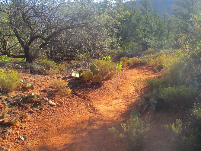
Baldwin
was a well-marked and well-used trail (left).
I would not, however, wish to hike it during wet weather. The
surface was worn into that fine, powdery dust that one sees in the
Red Rock area and which, when wet, sticks to boots like glue.
We
descended to the Oak Creek flood plain and found ourselves in a
small, lovely meadow between the creek and a red rock cliff.
 |
Small meadow in Oak Creek floodplain
|
 Today
the trail was dry, the hiking easy and we were shortly at the
clearly-marked start of Templeton Trail (right).
At this point Baldwin Trail heads up a wash that separates a
separate 4400 foot butte from Cathedral Rock proper, circles around
that butte, and returns to the starting point.
Today
the trail was dry, the hiking easy and we were shortly at the
clearly-marked start of Templeton Trail (right).
At this point Baldwin Trail heads up a wash that separates a
separate 4400 foot butte from Cathedral Rock proper, circles around
that butte, and returns to the starting point. Templeton
Trail, on the other hand, continued at an angle on toward Oak Creek.
Just past the Templeton/Baldwin Trail junction a spider had
apparently spent the night weaving an intricate web (left)
between some twigs and two strands of barbed wire. The web fairly
glistened in the morning sun and I could imagine the proprietor
sitting somewhere in the maze congratulating himself on his excellent
handiwork. Or do spiders appreciate beauty; perhaps they just take a
utilitarian view of everything.
Templeton
Trail, on the other hand, continued at an angle on toward Oak Creek.
Just past the Templeton/Baldwin Trail junction a spider had
apparently spent the night weaving an intricate web (left)
between some twigs and two strands of barbed wire. The web fairly
glistened in the morning sun and I could imagine the proprietor
sitting somewhere in the maze congratulating himself on his excellent
handiwork. Or do spiders appreciate beauty; perhaps they just take a
utilitarian view of everything. We
next came to an area where the canyon walls closed in and we were
squeezed between the cliff and the creek (right).
The trail now turned to the right and slanted up the cliff wall at a
fairly decent slope. However, it was still well-defined and the
footing was good, and there were a number of switchbacks to alleviate
the climbing. All in all, it was not a very difficult climb.
We
next came to an area where the canyon walls closed in and we were
squeezed between the cliff and the creek (right).
The trail now turned to the right and slanted up the cliff wall at a
fairly decent slope. However, it was still well-defined and the
footing was good, and there were a number of switchbacks to alleviate
the climbing. All in all, it was not a very difficult climb.
The
two photographs below show the start of the climb and the first of
the five switchbacks that would take us to the shelf running along
the foot of Cathedral Rock that was our goal.
 |
| Start of climb from Oak Creek |
 |
| First of five switchbacks |
 |
Courthouse Butte outlined against the morning sky
|
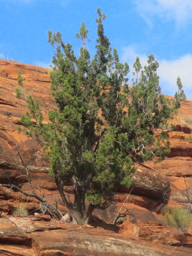
About
0.2 miles after reaching the ledge we stopped for a snack where the
trail made a sharp bend as it dipped into and back out of a deep
indentation eroded into the wall of the mountain. Just above us a
small juniper (left) clung
tenaciously to the cliff face, defying both wind and drought.
The
trail had pretty much been ours thus far. However, soon after
continuing from our snack break, we were joined by several other
hikers and also by a large number of bikers. I wondered “where did
they all so suddenly come from,” a question that was soon answered
when we came first to the Cathedral Trail crossing and then, a short
distance, away a junction with the Easybreezy Trail. Even farther
ahead is the HT Trail crossing. Hikers and bikers from all of these
feeder trails use Templeton Trail to transit from one trail to
another.
Although
we spent a great deal of time stepping off the trail to let bikers
pass and avoid bumping into other hikers, the views were well worth
it.
 |
Panoramic view of Cathedral Rock
|
After
seeing this much of Templeton Trail, I am determined to do the rest
of it in the future, perhaps even including a climb on up Cathedral
Rock Trail.
Jim
had done an excellent job by selecting a hike that would both be
enjoyable and give us a good workout while still allowing us to
finish in time to enjoy the birthday party for the bumper crop of 70
year old hikers.
According
to my GPS, the round trip hike was 5 miles, the highest elevation was
4173 feet and the total ascent was 702 feet.
Our
track is shown in red on the included map (see
next page).

No comments:
Post a Comment