On
29 September, the last Saturday before the start of the regular
Skyliner Hiking season, George Everman and I set out to hike on
Sunset Trail to the lookout tower on Mount Elden.
Three
weeks previously, the Skyliners had hiked from Buffalo Park in
Flagstaff to Elden Lookout Road on Oldham Trail; a week later a few
of us had returned to the area to hike on Brookbank Trail from Elden
Lookout Road to Sunset Trail and then followed Sunset Trail to the
junction with Little Bear before returning to Elden Lookout Road by
way of a social trail that leaves Sunset about 100 yards southeast of
the junction with Little Bear and leads down the mountain to the
road.
We
wanted to hike to the lookout tower on Sunset Trail and return by way
of Upper Oldham Trail. To do this we would follow the social trail
mentioned in the previous paragraph from Elden Lookout Road to Sunset
trail, follow Sunset Trail to the tower and then return by way of
Elden Lookout Road to the Upper Oldham Trailhead. By following Upper
Oldham Trail from there we would emerge onto the lookout road about
0.5 miles (perhaps a bit less if one follows a trail up the wash
instead of the road) below where we left it on the social trail.
We
followed US 180 W about 3.2 miles from the I-40 (Business)/Humphreys
Street Interchange in Flagstaff to Schultz Pass Road. Turning right
onto Schultz Pass Road, we followed it for about half a mile before
continuing straight ahead to take FR 557 (Eldon Lookout Road). After
traveling another 2.7 miles, we passed the Oldham Trailhead and, 0.2
miles farther on, the Brookbank Trailhead. A half-mile beyond
Brookbank (3.4 miles from Schultz Pass Road), we came to the Upper
Oldham Trailhead on the right. We decided to park here and start our
hike by taking the trail that runs up the wash below the road to the
beginning of the social trail we intended to take to join Sunset
Trail at the Little Bear junction.
Parking
was readily available in two separate areas alongside the road just
across from the Upper Oldham Trailhead. We started our hike by
following a trail running alongside the road on the opposite side
from the trailhead. However, the road soon turned sharply left to
navigate around a deep wash and we crossed over at that point to
remain in the wash that we intended to follow instead of the road.
At this point we lost our way by following a biker's trail directly
across the road and continuing up the mountain. We should, instead
have followed the road a few yards before turning on a less distinct
trail … the one we had intended to follow.
It
soon became apparent that we had gone wrong; rather than following
along the wash as planned, we were headed up the mountain on a
well-built biker's trail. However, we knew it would have to
intersect with Elden Lookout Road somewhere above where we intended
to take the social trail, so we continued on. The trail was, as
already noted, well-built. The turns were banked and numerous ramps
were constructed along the way. Wherever a log had fallen across the
path, it was simply left in place and the uphill side filled in with
dirt to form a ramp for speeding bikers. We were exceedingly careful
to keep a lookout ahead for any bikers heading downhill, but met only
two along the way. After hiking on the biker trail for eight-tenths
of a mile we emerged onto the road seven-tenths of a mile above our
goal. We had added one mile to what should have been a one-half mile
trip between the Upper Oldham Trailhead and the social trail that
would take us to Sunset.
We
were really not concerned about the extra mile or the additional time
on the trail, as we planned to have dinner in Flagstaff on the way
home and we had all day for our hike. The dinner in Flagstaff was my
idea; if left to my own devices, when hiking above Flagstaff I would
always leave home early and eat breakfast on the way through or leave
a bit later and have dinner on the way back. Unfortunately, most of
the Skyliners prefer eating at home and I am usually outvoted. This
time it was only George and me and he agreed to my plan.
The
easy seven-tenths of a mile down the road to the beginning of the
social trail went fast and we were soon following as it headed up the
gentle slope toward Sunset Trail. The section of trail shown in the
photograph below well-exemplifies it all the way to Sunset.
 |
Showing the gentle slope of the social trail between Sunset/Little Bear and
Elden Lookout Road
|
The
distance from Eldon Lookout Road to Sunset at the junction with
Little Bear along the very pleasant trail shown above is only
one-half mile and we were soon taking a break at the junction in what
I consider one of the most beautiful meadows anywhere. The area is
covered with grass seemingly designed for stretching out and taking a
nap, a gentle breeze is usually blowing, and ponderosa pines are
scattered all about.
Following
a short rest, we took up our packs and headed southeast on Sunset
Trail toward the lookout tower. The trail is at first essentially
level, but soon starts up a fairly steep slope with large rocks along
the way. We had our first really good look at fall foliage along
this section.
 |
Aspen clone showing fall colors along Sunset trail on Mount Elden
|
Neither
George nor I had hiked this way before, so each turn of the trail was
a completely new experience for us. I do love to hike old, familiar
trails; however, there is something special about hiking a new trail.
One never knows just with to expect around the next bend or over the
next hill. Although we did, given the location and season, expect to
see fall colors during this hike, we did not know in advance when or
where that might be.
After
a few switchbacks along the western slope of Little Elden Mountain
the trail brought us out on top of a north-south running ridge that
forms a saddle between Little Elden and Elden Mountains. Just at the
foot of Little Elden, Heart Trail leaves the saddle and heads down
the mountain in an easterly direction. As an aside, an unmarked bike
trail leaves Sunset Trail about 150 yards north of the Heart
Trailhead and leads west down the mountain to connect with Elden
Lookout Road just over a hundred yards from where we had ended our
hike up the bike trail from the lower end of the Upper Oldham Trail.
We
stopped for a rest and to take in the view from the heart trail
junction. We were on the east slope of the saddle and our view to
the west was blocked. However, we had an unobstructed view to the
south and the towers clustered on top of Mount Eldon.
 |
Looking south to the lookout tower on top of Mount Eldon
|
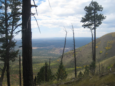
Turning
east could see across US Hwy 89 as it wound its way north Cameron to
the Indian Reservations beyond.
 |
Looking across US Hwy 89 to the Indian Reservation beyond
|
On
the slopes below us, groves of aspen defiantly strutted their fall
colors as the forest continued its slow to recovery from a
devastating 1977 fire.
 |
Recovering aspen groves along the mountain slope
|
We
continued on along the ridge, passing on the east side of Sunset
Park, crossed the crest of the ridge and hiked along the west slope
for a short distance, passing through the beautiful grove seen below.
 |
Aspen grove on the west slope of the ridge between Little Elden and Elden
|
The
trail then crossed the crest again, continued along the east side for
a distance and finally came to Elden Lookout Road at the crest about
0.5 miles below the tower and 1.2 miles from the Heart Trail
intersection.
One
map I referenced indicated that Sunset Trail continues from this
point parallel to and along the east side of the road for a short
distance and then veers off to pass just north of and below the
lookout tower. However, our goal was the tower itself and we really
didn't look for the existence of a trail; we just continued along the
road toward the tower.
We
found the following flowers along the road between the intersection
of Sunset Trail and the road to the lookout. One is an aster; the
other is an unidentified, five-petaled, yellow beauty that I decided
to include even though we were unable to identify it.
 |
Aster
|
 |
Unidentified flower
|
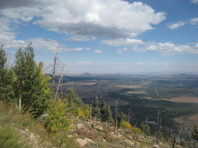
I
took a number of photographs when we reached the vicinity of the
towers (actually towers, because there are a number of communications
towers installed around the lookout tower). My favorite photograph
is shown below.
 |
Looking east from Elden Lookout
|
It
was now around 1400 and we hadn't eaten yet, so we decided to stop
for lunch before heading back. I chose to forego my usual nap in
favor of the view.
Before
starting back, I photographed the peaks from the top of Elden. We
were high enough now that we could actually a bit of Mount Humphreys
peeking up on the horizon beyond Mount Agassiz.
 |
The three most prominent peaks shown here are, from left to right, Agassiz,
Fremont and Doyle. Look closely to see the tip of Mount Humphreys Peak
on the horizon between Agassiz and Fremont
|
It
is a short 1.3 miles from the lookout tower back down the road to
Upper Oldham Trail. It is a very easy hike along the road, all
downhill except for a short climb to the Turkey Park turnoff. At
Oldham Park where the trail leaves the road, the Sunset Trail is just
about 60 yards away. In fact, Upper Oldham Trail actually just
crosses the road at this point and ends at Sunset Trail.
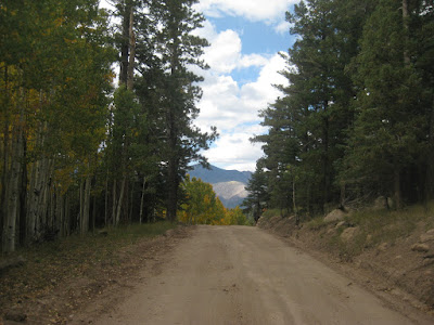
Below
is my favorite view along the road between the tower and Oldham Park.
It shows Mount Doyle in the distance, framed by the sky above,
aspens below and pines alongside.
 |
Mount Doyle in the distance
|
The
distance of our hike was 7.1 miles, the maximum elevation was 9314
feet and the total ascent was 2315 feet.
On
the included map (below),
this hike is shown in red, a previous hike on Brookbank, Sunset and
the social trail is shown in green, Oldham Trail from Buffalo Park to
Elden Lookout Road is shown in blue, a connector between Oldham and
Rocky Ridge Trails is shown in gray, a portion of Rocky Ridge Trail
is shown in magenta and a connector between Rocky Ridge and Oldham
Trails is shown in yellow. Note that there is an overlap of red and
green on the short social trail between Sunset Trail and Elden
Lookout Road.

No comments:
Post a Comment