On 22 May 2010,
having canceled a planned campout near Crown King, nine Skyliners
(Lila Wright, Miriam Sterling, Betty Wolters, George Everman, Loren
Pritzel and Daisy Williams, Ellis Price and two others) hiked Mormon
Mountain Trail 58. To get there from Cottonwood we took Hwy 260 to
Camp Verde and turned north on I-17. At Flagstaff, we took Exit 339
onto Lake Mary Road, and went 20.1 miles toward Mormon Lake. We then
turned right on Mormon Lake Road and traveled 3.7 miles before
turning right into Dairy Springs Campground. The trail starts at the
campground.
I left the gathering
place early and swung through Sedona to pick up George and we arrived
at Dairy Springs Campground shortly after the other hikers. George
said that we should look for familiar cars to locate the rest of the
group. I said, “Forget about cars; it is a nice day and they will
be milling about waiting impatiently for us to arrive.” I was
wrong. They decided that the wind was too much for them and waited
in the cars, and we sailed right on past without seeing them. They
did see us, and got out of the cars so that we saw them when we
turned around and came back.
The trail started at
an elevation of 7207 feet at the campground and climbed rapidly
through the forest, reaching an elevation of 8518 at the top (my GPS
readings). As we climbed, I lingered in the rear and stopped
frequently to look at flowers and snowdrifts and take in the view:
 |
| Canadian lousewort |
 |
| Creeping Barbary/Oregon-grape |
 |
| Rocky Mountain pussytoes |
 |
| Harebell |
We decided that one
flower we found was a “harebell.” I later learned that it is the
symbol of the MacDonald clan and, according to folklore, witches used
the plant’s juice to turn themselves into hares, hence the “hare”
in the name. I was unable to match the leaves to any plant in the
USDA Database. I think that is because the leaves we saw were basil
and the database only showed stem leaves, which are different.
 At 8000 feet
elevation we started to see scattered, unmelted snowdrifts (right).
At 8000 feet
elevation we started to see scattered, unmelted snowdrifts (right).
After we had gained
a few hundred feet in elevation from Dairy Springs Campground, we
looked back through the trees to find Mormon Lake spread out across
the landscape below.
 |
Mormon Lake, visible through the trees, spread out across the landscape
below.
|
As we approached the
end of Mormon Mountain Trail, we dipped down to enter a beautiful
meadow marking the trail’s end. (See the photograph on the next
page.)
Although
the wind was blowing strongly in the meadow and it was a bit
chilly, we decided to stop there for lunch before turning back.
George, Daisy and I found an old downed tree trunk to shelter us from
the wind. The rest of the group just sat on a log, apparently
oblivious to the strong wind. I thought that rather strange behavior
for a group that had hunkered down in their cars to wait for George
and me before starting the hike. The force of the wind at the bottom
of the trail had been a mere fraction of what is was now we were at
the top.
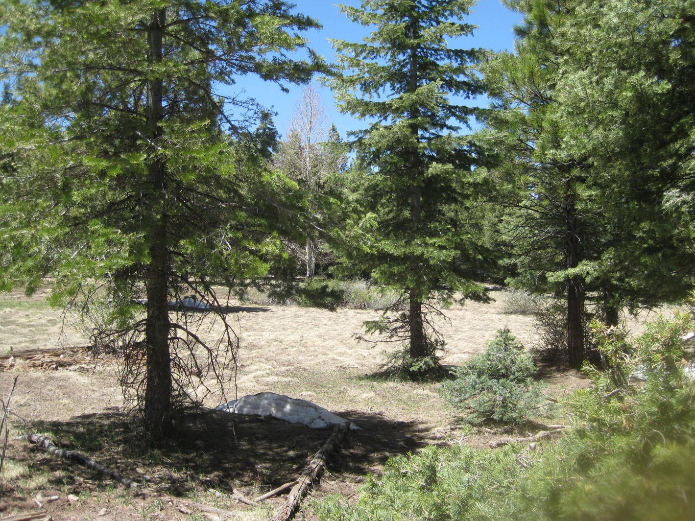 |
This is the meadow at the top of Mormon Mountain Trail. Note the small
snowdrift lingering in the shadow of the foremost tree.
|
The GPS file downloaded to my computer indicates that we hiked about 6.4 miles and climbed 1311 feet (lowest elevation of 7207; highest of 8518).
(NOTE: The described
route to Dairy Springs is all paved road. If you wish to take Forest
Roads, you can turn off at the Sedona Exit or at I-17 at Munds Park.
See Google Maps for directions using the Forest Roads.)
The GPS track for
the route we took for this hike is shown on the included map (below).


No comments:
Post a Comment