As
our first hike for the 2015/2016 season, ten Skyliners hiked HS
Canyon on 3 October 2015. We parked on Long Canyon Road at the
Chuckwagon Trail crossing, followed Chuckwagon and the Brins Mesa
Connector to Forest Road 152, continued north on FR 152 to the Secret
Canyon Trailhead and followed Secret Canyon to the HS Trailhead.
The
main group left Cottonwood Safeway parking lot and drove north on Hwy
89A to Dry Creek Road in Sedona, took Dry Creek Road to the stop
sign, turned right on Long Canyon Road (FR 152B) and continued 0.6
miles to the Chuckwagon Trail sign on the right. Having left a few
minutes early to pick George up at his house, I arrived at the
trailhead early and found a Sedona member already waiting there.
Before
starting our hike, we gathered for a group photograph at the parking
area. The photograph is by the author and one hiker, represented
below only by the extra hiking pole seen between Jim Manning and
Terry Johnson, chose to remain unidentified
 |
| Left to right: Jim Manning, Terry Johnson, Joyce Arregui, Daisy Williams, Frank Lombardo, Floyd Gardner, George Everman and Karl Sink |
The
first part of our hike, on a section of the tadpole-shaped Chuckwagon
Trail, led us southeast from Long Canyon Road across the wash that
drains Long Canyon. Then, about 0.1 miles after crossing the wash,
it turned to the northeast to pass along the slopes of Grassy
Knolls. These two grass-covered hills are lined up so that the
second, less prominent knoll, is northeast of the first, in a line
running approximately parallel to and just west of Dry Creek.
Ascending the slope of the knolls and climbing in and out of washes
along the slope turned out to be the most difficult part of the hike.
We
had crossed the Long Canyon wash in a stand of Arizona cypress trees.
However, that quickly gave way to grass, cactus and scattered
junipers.
 |
Grass, cactus and scattered junipers along the slopes of Grassy Knolls
|
Looking
ahead as we moved along the slope parallel to Dry Creek we had a
panoramic view stretching from the Grassy Knolls, across the mountain
range directly ahead to the mountains on the eastern side of the
creek.
 |
Panoramic view looking north from Chuckwagon Trail along Grassy Knolls
|
 |
Capitol Butte from Chuckwagon Trail on Grassy Knolls
|
We descended from the
Grassy Knolls and crossed Dry Creek, leaving the junipers behind and
entering another area dotted with Arizona Cypress trees. Shortly
after crossing the creek we came to the junction of Chuckwagon Trail
with Brins Mesa Connector Trail.
 |
Junction of Chuckwagon Trail with Brins Mesa Connector Trail
|
About 75 yards along
the Brins Mesa Connector Trail we crossed an old, but still used,
road that apparently leads to the Van Deren Cabin (built by
homesteader Earl Van Deren and later used in Blood on the Moon,
a film staring Robert Mitchum)1.
After following the
connector trail for about 0.3 miles from its start at Chuckwagon, we
found ourselves at FR 152. A sign (shown at right
in the following photograph) directed us to the Brins
Mesa Trailhead which is located on a loop just off the main road.
The photograph was stitched together to show the trail junction at
the forest road. The small sign (shown at left in
the following photograph) shows the end of Brins mesa
Connector. Following the sign on the right will take you about 75
yards along the short loop road to the actual Brins Mesa Trailhead.
The loop then returns you to the forest road.
 |
| The small sign mounted atop a cairn at the left marks the end of Brins Mesa connector; the somewhat larger sign at the right points the way to Brins Mesa Trailhead |
The following map,
posted at the Brins Mesa Trailhead, shows the Devil's Bridge
Trailhead about 1.1 miles to the south, the Secret Canyon Trailhead
about a mile north and the Vultee Arch/Sterling Pass Trailhead about
1.9 miles north. Also shown is the turnoff from Secret Canyon Trail
to HS Canyon Trail about 0.7 miles north of the Secret Canyon
Trailhead.
 |
Excerpt from a Forest Service map posted at the Brins Mesa Trailhead on FR 152
|
The following
photographs show the sign pointing to the trailhead (below
left) and the actual road leading
to it (below right).


About the only flowers
we had seen to this point had been a lot of broom snakeweed on Grassy
Knolls. But we now started to see a few more along the way. A
sample of the broom snakeweed along with other flowers seen later in
the hike are shown below.

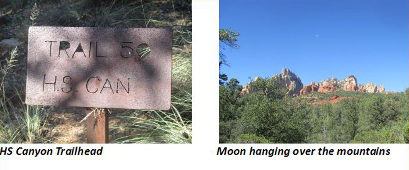
Just 0.7 miles from FR
152, we came to the HS Canyon Trailhead. The trailhead was marked by
another of those attractive, rusty old metal signs (below
left) that just seem to belong wherever they are
found. Occasionally, through a break in the tree cover we could look
ahead and see a half-moon (below right)
lurking above the mountains.
 |
Turnoff to viewpoint
|
 |
Panorama from viewpoint – stitched from photographs made in April 2015
|
 |
Our in-and-out track is
shown in red on the map below. The section of track between Long
Canyon Road and the junction of Chuckwagon Trail and Brins Mesa
Connector Trail, although shown in red because it was part of this
hike, is in reality a section of Chuckwagon Trail. It also was
previously known as Gunslinger Trail. The dark blue section of trail
is the rest of Chuckwagon Trail.

1http://thehikehouse.com/tag/van-deren-cabin
No comments:
Post a Comment