Parking at Trailhead
Location:
34°40'26.88"N; 111°42'48.49"W
Elevation: 3856
Along with five
others, I hiked part of the Bell Trail on 05 June 2010. George and
Betty suggested this hike. However, after discussing the weather and
the projected presence of “no see ums” (Ceratopogonidae, or
biting midges)
with a group of naysayers, Betty decided to sit this one out. Donna,
Gordon, Loren, John and I met at the normal gathering spot in the
Safeway parking lot and then proceeded to meet George at the I-17/Hwy
179 intersection. From there we traveled east on Forest Road 618 for
about 2¼ miles before turning left on Forest Road 121 to proceed to
the trailhead about ¼ of a mile ahead. The road turns to the right
toward a Forest Service complex after a hundred yards or so and one
must continue straight ahead to reach the trailhead. It is not hard
to find.
On reaching the
trailhead, we donned our packs and started up the trail, stopping to
read the trail information sign along the way.
 |
Forest Service Trail Description
|
As we continued on up the trail, we saw a beautiful patch of trailing four o’clocks followed immediately by one of silverleaf nightshade.
 |
| Trailing Four O’clock |
 |
Silver Leaf Nightshade
|
After admiring the
flowers we paused for a group photograph.
 |
Left to right: George Everman, Donna Goodman, Gordon Bice, Loren
Pritzel and John McInerney (Photographer: Ellis Price)
|
A raven perched high
on a dead limb alongside the trail, called a welcome to us as we
passed -- or perhaps it was a curse. I stopped for a shot of the
raven and to admire a honey mesquite bush growing nearby.
 |
| Raven sentinel posted alongside the trail |
 |
Western honey mesquite (Prosopis glandulosa)
|
John told us there
was an Indian ruin ahead and we found it, about 1.75 miles from the
trailhead, by following a faint trail leading toward the creek.
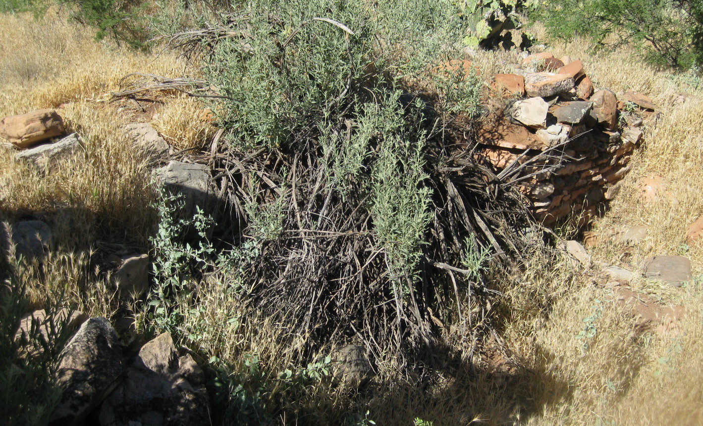 |
Indian ruin just off trail about 1¾ miles from the trailhead
|
Leaving the Indian
ruin, we continued for just over ½ of a mile further before turning
toward the creek on Weir Trail. This is an excellent place to stop
alongside the creek to rest and dangle ones feet in the water or, if
getting your feet wet is not your thing, just relax for a spell in a
shady spot and listen to the rippling stream.
 |
This is a pool just below the weir
|
 |
| I wonder if the fish will bite his toes? |
 |
Donna doing some rock hopping
|
A cable car is
installed to cross the creek at the weir. While it appears to be
maintained in good condition, we were not able to determine what it
is used for. It was locked to prevent unauthorized use, but we
decided that did not preclude a bit of posing.
 |
Ready to go, but all locked up
|
When we were ready
to continue, Gordon, George and Donna returned to Bell Trail by way
of Weir Trail. Loren, John and I took a shortcut, scrambling up the
mountain to reconnect with the trail and waited there for the rest of
the group. While waiting, we were passed by at least 35 or 40 other
hikers, many of them on a bus tour from Colorado. Apparently Bell
Trail was recently written up in Arizona Highways magazine and it is
currently much in vogue. Everyone was headed to the swimming hole at
the crossing. Most of the group from Colorado, all apparently of
high school age, were ill-prepared to for a 3½ mile hike on a day
when the temperature reached 103% F. Most of the boys were shirtless
and the girls were mainly wearing bikinis.
One poor girl
appeared to be in the early stages of heat exhaustion when they
reached where were waiting. Someone talked her into staying in the
shade with us until the group leader, wisely hiking at a more
leisurely pace, arrived. When the rest of our party arrived, the
girl still didn’t look much better, but she was now in the care of
the group leader, and we continued on our way.
The crossing area
does have a great swimming hole I one cars to dive in from a high
rock ledge; however at this particular time the tour group from
Colorado were there in full force and they sounded, as one might
expect, like a bunch of high-school students on vacation.
Nevertheless, by
continuing a short distance on up the creek, I found a shady spot on
a rock where the noise from the swimming hole was bearable and
settled in for lunch and an hour-long nap. It seemed that I had
barely dozed off when I heard the group calling me for the return
trip.
We saw the following
flowers on the stretch of trail between the Weir and the swimming
hole at the crossing.
 |
Prairie spiderwort
|
 |
Prickly Pear Cactus or Cactus apple
|
 |
| Ocotillo |
 |
Brownfoot
|
The
round trip hike was about 6.2 miles except for George, Gordon and
Donna who didn’t take the shortcut from the weir. I estimate that
they hiked about three-quarters of a mile further. The elevation
change was only about 300 feet and, while he temperature reached 1030
F,
we did not get overheated, perhaps because we stopped to rest several
times along the way.
Our
GPS track is shown on the included map (below).

No comments:
Post a Comment