Saturday, October 26, 2013

Damifino Loop Hike


We hiked the Damifino Loop on 26 October 2013. This hike actually consists of a loop starting at the Cowpies Trailhead on Schnebly Hill Road and hiking on Cowpies Trail, Hangover Trail, Damifino Trail, Casner Canyon Trail, Schnebly Hill Road and Munds Wagon Trail. But that became just too much to include in a title, so I defaulted to using just “Damifino Loop”.

We left the Cottonwood Safeway parking lot at 0700, picked up one other hiker at the end of the pavement on Schnebly Hill Road and continued on to the parking lot at Cowpies Trailhead. The road is very, very rough, requiring a high-clearance vehicle (preferably with 4-wheel drive) for all but the most reckless and foolhardy.
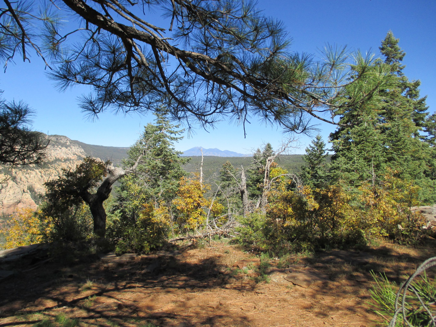
Cowpies Trail dips through a draw, actually a wash that flows into Bear Wallow Canyon, and emerges at the edge of a wide expanse of solid rock. Mitten Ridge Gap, through which we were to pass, was clearly visible and we stopped for a group photograph with it in the background.

Left to right: The author, Samantha Moor, Connie Woolard, Daisy Williams, 

Betty Wolters, Ann Urick, Frank Lombardo, Donna Goodman and Jerry 

Helfrich - photograph by Name Withheld
Small rocks have been arranged on the flat rock surface to form a large medicine wheel, a circle containing a cross. The trail itself is marked by an intermittent line of rocks leading hikers across the edge of the flat rock to another wash, the upper part of Bear Wallow Canyon. The trees in the first wash were predominantly juniper. However, as we crossed this second wash, we noted they had been largely displaced by shaggy-barked Arizona cypress trees.

After crossing the second wash one can turn left to hike across another flat expanse of rock to the cowpie formations. Despite its name, the trail itself does not turn toward these formations; instead it continues, generally northwest, for a short distance to end at the beginning of Hangover Trail (right).

The name “Hangover” is shown on some old maps I have seen and seems to coincide, at least partially with Mitten Ridge Loop (or Mitten Ridge Bear Paw) Trail. In any case it has recently been remarked and the sign shown above has been installed.

Hangover Trail runs through Mitten Ridge Gap which is where Damifino Trail, which we would follow down the other side of the ridge and on to the mouth of Casner Canyon, starts. We decided that, although on past hikes to the gap we had taken a different route, we would follow Hangover this time.

As it turned out, the major benefit to taking Hangover was that the trail was clearly marked by mountain bikers and easy to follow. Our previous route was not an official trail; we just followed one of a number of unofficial trails, sometimes marked by cairns, toward the gap, all ending with a short but very steep climb to reach the gap itself. Hangover, however, first passes below the gap and then turns back and climbs to it through a series of switchbacks; it is longer but may be a bit less strenuous.

As we traveled along the side of Mitten Ridge toward the gap we had what I consider the most definitive view of the cowpies formations, showing clearly the reason for the name.

The Cowpies seen from Mitten Ridge with Munds Mountain in the background
A section of the trail along Mitten Ridge is shown below.

Hikers trudging along the slope on the east side of Mitten Ridge
We found the trail to be clearly marked by the painted white arrows of the sort used by bikers and navigated our way easily through the series of switchbacks to reach the gap. We rested there for a few minutes before continuing our hike.

Some of us had previously hiked through the gap and turned south on the west side to follow what we then called Mitten Ridge Loop Trail but that I have since learned is also known as Mitten Ridge Bear Paw Trail. This time, however, we would turn north after crossing through the gap and follow Damifino Trail to the mouth of Casner Canyon where we would pick up Casner Canyon Trail to continue our loop. Both trails start at the north side of the gap. Mitten Ridge Loop (or Hangover, if you prefer) turns left just before reaching the dead tree trunk blocking the trail in the photograph (above left). To take Damifino Trail one just steps over the dead tree trunk and proceeds straight ahead.

We were now on a trail little used by hikers. Most of the information I was able to find in preparation for a 14 October scouting hike on it was provided by bikers. However, we saw few signs of recent biker activity, just an occasional tire mark.

The name of the trail is a puzzle. There is a story concerning the naming of Damifino Canyon (but note the difference in spelling). According to that story, the head surveyor of a 1930s survey party looking to improve Schnebly Hill Road asked the party's guide, a pioneer who had helped construct the original road, for the name of the canyon. The guide responded by saying “Damn if I know.” This sounded to the engineer like “Damifino” and he wrote it on the map. The mouth of Damifino Canyon is about 1.1 miles southwest of Mitten Ridge Gap and I assume that the name came from there. There is the matter of the difference in spelling (Damifino for the canyon, Damifino for the trail). Perhaps the person who named the trail had heard of how the canyon got its name and decided to improve the translation by making the name a bit closer to “Dam if I know.” We'll never know for sure.
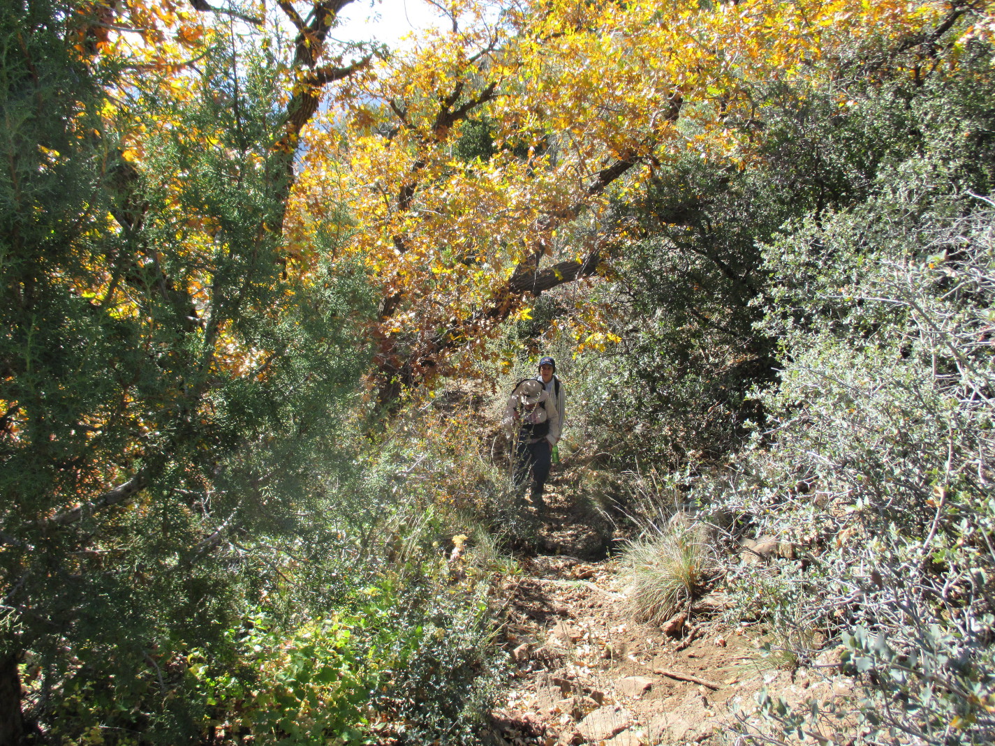
The trail was at first fairly easy to follow, if a bit precarious in places. It followed along the steep, lightly forested western slope of the ridge. The photograph (right) shows hikers on a section of it near Mitten Ridge Gap.

Shortly after we left the gap, it became obvious to Jerry Helfrich that the hike would take longer than the time he had available and he turned back. That was not a problem as he is an experienced hiker and he had driven to the trailhead by himself.

After passing through the forested area we came to an area of bare sloping rock. No trail was visible here and we just followed my GPS track from the 14 October scouting hike. One could do just about as well, however, by simply heading for the spine of the ridge that slopes down past Grasshopper Point (but on the opposite side of Oak Creek) because the trail follows it all the way to Casner Canyon.

Hiking down the spine of the ridge
The following photograph (below) shows hikers making their way down the bare sloping rock on the west side of Mitten Ridge.

Hikers descending the western slope of Mitten Ridge
Once we had made the relatively short descent on bare rock where the trail was not discernible, it once again became easy to follow. It follows along the crest of the ridge passing Grasshopper Point (left), located just across Oak Creek. Continuing on past Grasshopper Point, the trail eventually reaches the end of the ridge and descends steeply by a series of short switchbacks to the stream, usually a dry wash with just an occasional pool of water, at the lower end of Casner Canyon. The trail turns upstream for a few yards and then crosses the wash to join Casner Canyon Trail. We stopped there for a snack.

This trail, built to provide cattle grazing in pastures on the canyon rim access to water, is now used by hikers and horseback riders. From where we joined it, the trail leads sharply up the north slope of the canyon. After a short distance, it levels off a bit and continues upward at a relatively gentle slope for a large part of the way to the top, then becomes steep again. This can be seen from the following photograph taken from Schnebly Hill Road on the opposite side of the canyon. The blue line shows, roughly, the path the trail follows.

Partial tracing of Casner Canyon Trail up the north canyon wall
Just left of center at the bottom of the above photograph the canyon can be seen to split. The lower branch, not the one nearest the trail, is Casner Canyon Proper. The trail actually veers up a side canyon leading in from the north and tops out on the rim about a mile north of the head of Casner Canyon proper. Schnebly Hill Vista is approximately half way between these two points.

The trail was easy to follow, at places reinforced on the lower side by carefully placed rock walls. The peak fall flower season had passed and the sloping canyon wall was not as colorful as it had been for the scouting hike. However, the weather, defying the lateness of the season, had turned unusually warm and the going was extremely slow as we labored our way up the trail toward the rim. The following photograph, taken at the only really shady spot since leaving the bottom of the canyon, shows two of our party approaching a final steep climb, through a switchback, which comes out at an old fence marking the end of steep climbing.

Hikers nearing the end of Casner Canyon Trail
Once we reached the old fence, the trail leveled off a bit and the rest of the climb to the head of the canyon was quite gentle. We also began to see neatly-constructed, wire-bound cairns marking the way. As I had found during the scouting hike, the trail has recently been extended south along the rim to end at Schnebly Hill Vista. The pink jeep (right) shown here was a welcome sight; it meant that we had reached the end of Casner Canyon Trail and that the rest of the hike would all be downhill.

We briefly joined the pink jeep tourists for the awesome view from the vista.

The view from Schnebly Hill Vista
We then headed down Schnebly hill road toward the Munds Wagon Trailhead. Along the way I found a deep purple aster (left), valiantly holding its own against the approach of winter.

The hiking along the road was easy and we made good time, soon arriving at our trailhead. The Munds Wagon Trailhead is located on the right side of the road as you descend, just across from the Schnebly Hill Trailhead. In fact the two trails share a common origin. Each utilizes a section of the old Munds Wagon Road that provided access to Flagstaff before Schnebly Hill Road was built.

The hiking was a bit rougher on Munds Wagon Trail than it had been on the road. However, it is a considerably shorter distance than if one were to follow the road all the way back to the Cowpies Trailhead where we were parked. It circles the Merry-Go-Round formation, following along the ledge that forms what would be the platform carrying the horses on a real merry-go-round.

As we rounded the corner of the formation we encountered a wedding party in the process of assembling. I think some of our party checked to see whether drinks were available yet and were told, “not until the reception.” The wedding had not even started, so we trudged on. The below photograph of the Merry-Go-Round formation was taken looking back from further down the trail.

Merry-Go-Round formation on Schnebly Hill road above Sedona
It was only a short distance on to where we were parked. The trail crosses Schnebly Hill Road once on the way and then passes within about a hundred feet of the Cowpies Trailhead parking lot.

I recorded the hike distance as 7.9 miles, the elevation change as 1481 feet and the highest elevation as 5988 feet.

We hiked 0.5 miles on Cowpies Trail, 1.0 miles on Hangover Trail, 1.7 miles on Damifino Trail, 2.4 miles on Casner Canyon Trail, 1.2 miles on Schnebly Hill Road and 1.1 miles on Munds Wagon Trail.

The GPS track for this hike is shown in red on the attached map (below).


Thursday, October 24, 2013

South Mingus Tadpole Loop


The hike starts on Forest Road 493 at Copper Chief Mine, just 0.2 miles from FR 413 (Allen Spring Road) and takes an old jeep road that runs past Grand Island Mine and then continues south of and parallel to Allen Spring Road for two miles before joining that road just 0.3 miles short of Allen Spring. The hike then continues on Allen Spring Road for another 1.6 miles beyond Allen Spring and ascends to the top of Mingus Mountain on Coleman Trail. It then descends the mountain on what is generally referred to as Schoolmarm Trail to connect with Allen Spring Road at Twin Springs. From there it is only 1.6 miles back the parking area at Copper Chief Mine. When a track of this hike is viewed on a map, it roughly forms a tadpole shape.

On 24 October 2013, we drove from Cottonwood on FR 493 to Copper Chief Mine and parked on the narrow ridge at the beginning of the old jeep road. There, we took a few minutes to look around and enjoy the view before starting our hike. Ahead of us lay Mingus Mountain, now clad in the colors of fall, the rust-color of Gamble oaks and the bright yellow through dark red colors of maples. The peak shown in the middle of the horizon in the photograph below is where Schoolmarm Trail starts its descent from the top of the mountain.

Fall colors on Mingus
The old jeep road descended sharply for about 0.2 miles and then leveled off just as we passed Grand Island Mine. This mine is described in minedat.org as “A former underground Cu-Au mine on 14 claims.”1 It had a 520 foot deep shaft, now enclosed by a wire fence, with a cross-cut at the 200 foot level.

About a tenth of a mile beyond the mine we crossed Oak Wash, now dry, and continued south along the old road for another 1.7 miles before it ended at Allen Spring Road. We had good views all along the way, and stopped for a group photograph with the delicately painted slopes of Mingus as a backdrop.

Left to right: Frank Lombardo, Jim Manning, the author and George Everman 
– photograph by Name Withheld
We paused only briefly at Allen Spring. There really isn't much to see there, just a locked door (right, photograph from February 2013; hikers, clockwise from top right are: Becky Fowsky, Frank Lombardo, Jim Manning, Mary Gavan and George Everman) barring the way into the cave that contains the spring. I have often wondered just how far the cave extends into the mountain behind the always-locked door at Allen Spring and I finally found an answer. John Scarcella, in an article published in the Jerome Times wrote that:

Most of our water comes from the Allen Springs line. This series of 8 springs stretches out along Mingus Mountain for about 10 miles and begins with Allen Spring. A tunnel connects to a natural cave that goes over 1 mile into the mountain. The other springs, Copper Chief, Twin (two), Silver, Blowout , Baltimore and Cliff are similar to Allen Spring only smaller and with shorter or no cave connections.2

Leaving the spring behind, we continued south on Allen Spring Road, climbing gently and gaining over 500 feet in elevation in the remaining 1.6 miles to Coleman Trail. We expected to find few flowers in bloom for this hike; we were instead looking for fall colors. We were thus pleasantly surprised to find a few hardy specimens, such as a verbena plant and the brilliant yellow false goldeneyes (right) dressing up the roadside.

Verbena
Yellow false goldeneyes
When we turned off Allen Spring Road onto Coleman Trail for our climb to the top of Mingus Mountain, we were about half a mile from the upper Black Canyon Trailhead.

Coleman Trail, located at the south end of the mountain, rises steeply through a series of switchbacks to climb 600 feet in about 0.7 miles. It then levels off somewhat and rises another 350 feet in the next 1.1 miles to the point where we would turn off to bushwhack our way to the Schoolmarm Trailhead. Along the way, the trail comes within a few yards of the rim providing a great view across Verde Valley and on to the San Francisco Peaks.

Jim Manning looking out across Verde Valley to the San Francisco Peaks
As we turned back to the trail from the viewpoint, I saw a delicate looking red plant (left) growing at the base of an old tree stump. George later informed me that it is known as fetid goosefoot.

Shortly after our short pause at the rim we found ourselves traveling along an old, unused road and the alligator junipers gave way to ponderosa pine (right). The trail, as had been true all the way from Allen Spring Road, had recently been repaired and was easy to follow.

Following my GPS track from a previous hike, we left Coleman Trail at point N34 41.050/W112 06.986 and headed northeast (bearing 15% true) to reach the trailhead just 0.1 miles away.

From the Schoolmarm Trailhead, the south set of towers on Mingus (left) are only a short distance to the north. We stopped here for lunch and the other hikers kindly allowed me to take my customary 20-minute noontime nap.

Thinking about the section of trail we had just completed, I wondered where it had gotten the name 'Coleman'. I later did a quick search and came up with nothing. I can only assume that it started as a cattle trail used for summer grazing on Mingus. Indeed, judging from the numerous fresh cow pies we saw along the way, it seems to still be used for that purpose.

Likewise, I am unable to find anything on Schoolmarm, our next section of trail. However, I was once told by a now-deceased leader of the Skyliner hiking group, that its name was derived from usage by a pioneer schoolteacher who alternated her teaching duties between two schools located at different mining camps on the mountain. It is now overgrown, very hard to follow and seldom used. But it is a great fall hike when the maples and gamble oaks are in full color. Referring to the below photograph, the trail zigzags its way down the steep slope and enters the treeline on the right side of the wash just right of center. It quickly leads back across the wash, makes a sort of loop along the slope on the left side, then returns to the wash and follows alongside it it all the way to Allen spring Road, crossing once more near the end.

Looking down the mountain along the course of Schoolmarm Trail
The left photograph below shows a maple tree with unusual deep red foliage contrasting starkly with the surrounding light yellow and rust colors of other maples and gamble oaks. The photograph on the right displays a wide range of colors, from light yellow to dark orange on a single maple; the yellow-green, soon to be rust-colored, leaves in the right of the photograph are borne by a gamble oak.

Deep red color on a maple tree Maple (center) and gamble oak (right)
Although we had hiked this way just a year ago, I found myself frequently referring my GPS track to make sure we were still on the trail. Even so, I had to retrace my steps more than once.

Schoolmarm Trail ends at Twin Springs on Allen Spring Road. Copper Chief Spring, located about a tenth of a mile south of there, has a faucet installed in its discharge line and I always like to check to see that it is still operative when I am in the area. We found that the discharge line had recently been repaired to stop some leaks we had noted last year and that the faucet itself had been replaced.

Following the track I had loaded on my GPS would take us back to our car by way of a very faint, little-used trail that leads from Allen Spring Road to the old jeep trail we had started our hike on. Returning to our cars that way would be about 0.5 miles shorter than if we returned along Allen Spring Road and FR 493. However, we would descend about 100 feet and then climb back up again, so we choose to hike the extra distance.

According to the data recorded by my GPS, the hike distance was 9.0 miles, the total ascent was 2493 feet and the highest elevation was 7647 feet.

The GPS track for this hike is shown in red on the attached map (below). The short green section of track shows a very faint trail that runs between the old jeep road and Allen Spring Road.


2 http://www.jerometimes.com/watersystem.html

Saturday, October 19, 2013

Willard Springs Loop Hike


Ten Skyliners hiked in the Willard Springs area, between Interstate 17 and Oak Creek Canyon, on 19 October 2013. We call this hike, mostly along Forest Service roads, the Willard Springs Loop. It is a rather short hike with little elevation change, perfect for a day when you want to hike, but really don't want to put a lot of effort into it.

We took I-17 north to Exit 326 and turned west on Forest Road 253 which we followed for 2.1 miles before parking at the junction with FR 9497. From there, we hiked for 1.0 mile along FR 9497 before turning off the road and continuing southwest through a relatively open forest for 0.4 miles to connect with FR 9498 which we followed all the way to the upper Thomas Point Trailhead, our planned lunch stop.

Along the way we saw a number of beautiful bright yellow flowers (right) which George Everman later identified as showy goldeneye. This seemed to be the season for it because we found others wherever the trees thinned and allowed grass to grow.

As we neared the Thomas Point Trailhead we came to an opening which allowed us a view across Oak Creek Canyon to the white cliffs on the other side.

View across Oak Creek Canyon from Thomas Point
This seemed a good spot for a group photograph, so we posed on the rim of the canyon.

Left to right (front row): Betty Wolters, Kwi Johnson, Dolly Yapp, the author; 

(back row): Lila Wright, Connie Woolard, Daisy Williams, David Beach 
and Miriam Sterling – photograph by Name Withheld
The old road we were following continued on past this point for a short distance to end at a man-made rock wall (left), seemingly serving no other purpose than perhaps to mark the Thomas Point Trailhead. In any case, that is what I have always used it for. The point is just a hundred yards or so wide at this spot and when I turned from taking the photograph of the wall, I had to walk only a few yards for the following terrific view of Oak Creek Canyon looking toward Sedona.

Looking down Oak Creek Canyon toward Sedona from Thomas Point
Intrigued by the scattered spots of fall color in the above photograph, I zoomed in for a closer view (right) of one particularly noticeable area showing a range of colors.

It was just a little after 1100 and we normally don't stop for lunch on our hikes until 1200. But we would not find a better viewpoint anywhere on this hike, so we ate early and enjoyed the view.

As we were departing the point, I paused for a final look at the San Francisco Peaks prominent on the distant horizon.

The San Francisco Peaks seen from Thomas Point
On the return hike we saw, along with many more of the showy goldeneye flowers, a few asters and an isolated Indian paintbrush.

Clump of asters
Indian paintbrush
The oak trees scattered along our trail were in formal fall dress, proudly showing off their colors among the green conifers.

Oak trees in seasonal color among the conifers
Farther along the trail, we saw entire meadows peppered with showy goldeneye flowers.

Meadow peppered with showy goldeneye flowers
We arrived back at our parked cars at 1330, a few minutes over fours from the time we started the hike.

According to my GPS, the hike distance was 5.4 miles, the total ascent was 523 feet and the highest elevation was 6703 feet.

The map (below) shows the hike to Thomas Point in red and the return trip in blue. Where the tracks are coincident only blue is visible.


Saturday, October 12, 2013

Sandys Canyon, Fisher Point and Walnut Canyon


By 12 October 2013, we had begun to migrate our weekly hikes from the high country down toward the Verde Valley area for the winter season. Last weeks hike had been in the Inner Basin of the San Francisco Peaks; this week we would hike in Sandys Canyon and Walnut Canyon southeast of Flagstaff.

Following our by now normal routine of starting our hikes at 0700, I was at the meeting place and ready to go at that time. Alas, only Connie Woolard had shown up. Somewhat puzzled at the absence of other hikers, we waited an extra ten minutes, but then headed out to do the hike by ourselves. It never occurred to me to check the schedule for the starting time. After all, had I not made it out myself?

We were almost to Flagstaff when my cellphone rang. It was one of six additional hikers who had met at 0800, the time actually published in the schedule. Connie and I decided to wait at the Circle K Station located at the I-17/Lake Mary Road interchange for the others to catch up.

We thought it would be a rather boring wait, enlivened only by people watching; however, we were surprised to find a prairie dog village located between the service station and the freeway, actually within the road right of way on the ramp that exits from I-17 to I-40 heading east. The fellow shown here (right) is actually located outside the perimeter fence for the freeway right of way. However, he was closer to us and the only one I could photograph easily.

When the other hikers arrived, we immediately headed on out Lake Mary Road to the Sandys Canyon Trailhead. According to notes I had made from a previous hike, it should be located between five and six miles from the I-17 exit. We found the actual distance to the turn off from Lake Mary Road to be 9.5 miles. One still exits as before at the Canyon Vista Campground. Now, however, trailhead parking has been relocated to just outside the campground and one must walk about two tenths of a mile through the campground to the trailhead. The previous parking area which was located near the trailhead, is now blocked off by large boulders. Incongruously, a sign, not visible in the photograph (above left), is still posted warning people that parking in the lot is not permitted after 8 PM. The campground itself was deserted, apparently having been closed due to the current government shutdown.

We stopped near the trailhead at a sign describing the Arizona Trail, a bit of which we would be hiking on today, for a group photograph.

Left to right: David Beach, Frank Lombardo, Daisy Williams, Jeanmarie 'Jeannie' Haney (kneeling), 
Connie Woolard (almost hidden), the author and Betty Wolters
From the trailhead at Canyon Vista Campground, the trail runs for half a mile along the western rim of Sandys Canyon. While traveling along the rim hikers are afforded excellent views down into the canyon and all the way to the San Francisco Peaks.

Looking from the western rim of Sandys Canyon across the colorful fall foliage in the canyon 
and on to the San Francisco Peaks beyond
After traveling along the rim for about half a mile, the trail turns sharply right and descends steeply into Sandys Canyon. It might be worth noting at this point that one can avoid Canyon Vista Campground altogether by turning off Lake Mary Road onto Forest Road 9478Y about 0.7 miles short of the campground turnoff and driving about one-tenth of a mile to a large parking/turnaround area. One can park there and take a marked path about 150 yards to this point. But if you do you will miss the views along the rim of the canyon, one of the high points of the hike.

This alternate access point was explained to us by a local resident we met while he was out walking his five or six dogs. After a brief conversation, we thanked him and proceeded down into the canyon, descending about 150 feet in three-tenths of a mile. We then traveled along the canyon floor for another six-tenths of a mile to connect with the Arizona Trail which we followed for about a mile to the junction with Fay Canyon. The area is labeled on maps as both Lake Mary Valley and Skunk Canyon. In any case it is the large flat expanse where Sandys Canyon and Fay Canyon come together. Walnut Canyon starts here, at Fisher Point, carrying the runoff from Fay Canyon and Sandys Canyon.

Out of curiosity, I used Google Earth to trace Walnut Creek which flows down Sandys Canyon. The Creek starts on the north slope of Mormon Mountain and flows northwest through Upper Lake Mary and Lower Lake Mary, turns north/northwest to flow through Sandys Canyon, then east/northeast through Walnut Canyon. It crosses I-40 near Winona, continues north to pass west of Cinder Mountain and empties into the San Francisco Wash near Leupp Road north/northwest of Cinder Mountain. San Francisco Wash in turn empties into Padre Canyon which empties into Diablo Canyon. Diablo Canyon then carries the runoff to the Little Colorado River at Leupp.

Although we intended to climb to Fisher Point Vista, we decided to first follow a trail that leads down Walnut Canyon to where we thought it ended about three-tenths of a mile ahead. This was based on a hike that some of us did in 2009. However, we found a sign posted along the trail that indicated it now ended one mile ahead. We could go that far, so we continued.

On the way we stopped for a few minutes to investigate a cave formed by an ancient rockslide. The photograph (right) shows clearly how the cave must have been formed. We thought it was probably only a shallow opening, going back just a few feet. 


But when we entered we found that we could travel without difficulty, upright all the way, for at least 150 feet before we came to a very narrow section where, as shown here (left), only a very skinny person would be able to pass. We turned back.

Leaving the cave, we traveled on down the canyon, pausing frequently to admire the fall foliage and the colorful rocks of the canyon walls.

Colorful rock cliffs and fall foliage in Walnut Canyon
After hiking down the canyon for about a mile but seeing no evidence that the trail ended anywhere nearby, we wondered whether it might now extend all the way to the Walnut Canyon National Monument, about another 8.5 miles. But that was certainly not a project for today, so we found a sunny spot to eat and then turned back toward Fisher Point.

From the grama grass-covered flats below Fisher Point, it is a winding mile-long, 432-foot climb to the top. The view from the top is certainly worth the effort. We could look down into Walnut Canyon to the east while straight ahead, looking south, we had a panoramic view of Lake Mary Valley (or Skunk Canyon) over 400 feet below.

View from Fisher Point Vista showing the flats (Lake Mary Valley) below
The red dot in the above photograph indicates the intersection of the trail with the Arizona Trail which runs right up Fay Canyon from here and left up Sandys Canyon, the way we will go. The blue dot near the center of the photograph shows where a short cut leaves the trail to connect with the Arizona Trail about a hundred yards up Sandys Canyon from the junction shown by the red dot. Close inspection will show five riders on the trail at bottom left.

Just as we started our descent from the vista, we found a patch of the most colorful foliage of the entire hike, a small patch of deciduous trees nestled under the conifers.

Fall foliage beneath the conifers
It was now around 1400 and we wasted no time in making our way back down the trail to connect with the Arizona Trail for the trip up Sandys Canyon and back to the trailhead. We didn't want to be too late returning home as the days were getting shorter and dark came early. Additionally it had been a fairly long hike and we were getting hungry, or at least I was.

When I arrived home and downloaded my GPS data, I found that the first data was recorded at 0938 and that we had arrived back at our cars at 1612. In other words we had been on the trail for 6 hours and 35 minutes.

The total round trip hike distance was recorded as 9.5 miles with an elevation gain of 432 feet (highest to lowest), a total ascent of 1198 feet and a highest elevation of 7057 feet. Because of the large difference between total ascent and the highest to lowest elevation readings, the trail profile, showing all the ups and downs, is shown below.

The GPS track for this hike is shown in red on the included map (below). The map also shows the alternate access to Sandys Canyon Trail.