Saturday, December 17, 2016

Cactus Canyon from Cornville Road to Oak Creek


It was a warm and pleasant winter day when six Skyliners hiked from Cornville Road to Oak Creek on 17 December 2016. We followed Cactus Road south from Cornville Road for about 0.3 miles to the point where the road crosses a wash on a rock ledge. There is an approximate ten-foot dropoff on the downstream side of the ledge and we left the road, climbed down to the bottom of the wash and followed it all the way to Oak Creek.

Today's hikers were: Dave Beach, Lila Wright, Jim Manning, Joanne Hennings, Daisy Williams, and a one hiker, Dana Smith, new to our group, who is planning to hike on the Pacific Crest Trail in 2018 and was seeking advice on how to prepare for that adventure.

Although today's hike was routinely scheduled, this route is also a popular alternative for the Skyliners when other plans fall through. I have hiked it twice before, in 2006 and again in 2010, both times as an alternative to other hikes. A report of the 2010 hike is included in “Hiking in and Around Verde Valley”.1

This is a loop hike in that we normally follow one route to Oak Creek and another one on the return trip. One route follows Cactus Road and the other follows a wash. Today we followed a GPS track made during the 2010 hike, although in the opposite direction. For that hike we had followed Cactus Road almost to its end at a gated community and then turned down a side wash (map at right) to join the main wash (the same wash that Cactus Road crosses on the ledge with a ten-foot drop near Cornville Road) about 0.6 miles from Oak Creek; today we would follow the wash downstream to the creek and would return by way of Cactus Road.
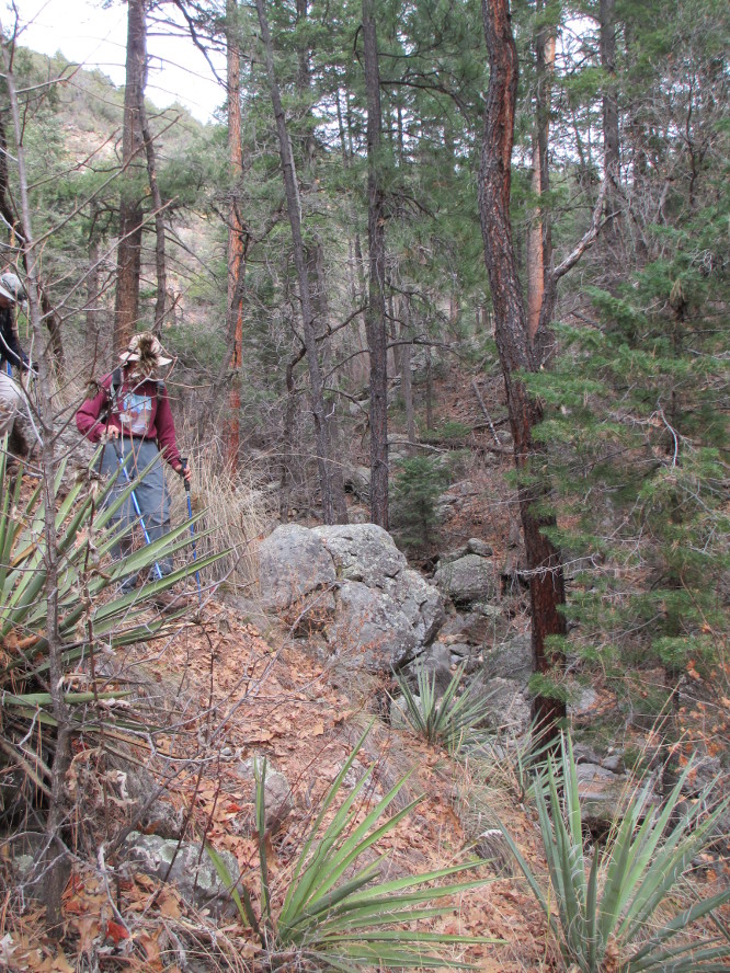
After leaving Cactus Road at the rock ledge, we climbed down a rocky bank to the dry streambed of the wash. The sides of the wash (or arroyo) varied in height and sloped from gentle to vertical as we made our way south toward Oak Creek. The wash we followed, located at the 
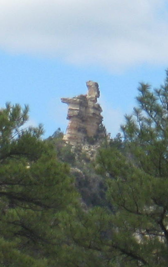
northwest end of an area called the White Hills is not named on any maps we found. We elected to call it Cactus Canyon after the Forest Service road that it parallels. It is surely deep enough and the sides close enough together to deserve the name canyon.

For much of the way we were walking in the shade of high canyon walls such as the large rock with patches of moss and a bush growing on top (below left) and the sheer water-cut cliff at right (below right).

Solid rock forming canyon wall                Sheer water-carved canyon wall
At one place in the canyon a high dropoff (sometimes called a dryfall or pour-off.) required us to climb up the canyon wall and then back down in order to detour around it and continue our journey. I was so busy climbing around the dryfall that I neglected to photograph it. The two following photographs, the lip of the dryfall in the canyon floor (below left) and one of the side wall of the canyon adjacent to the dryfall (below right) were taken in 2010.

Lip of the dryfall in Cactus Canyon          Canyon wall adjacent to the dryfall
About 1.8 miles from the point where we entered the wash, and still around 0.6 miles from Oak Creek, we passed a side wash flowing in from the west. That was the route we intended to take to reach Cactus Road for our return trip. Just a short distance below the side wash, we came to a teepee-like structure, located high atop the canyon wall, apparently used by one of the landowners in the gated community at the end of Cactus Road for an outbuilding.

Teepee atop the canyon wall near the junction of Cactus Canyon and Oak Creek
A little further along the canyon turned sharply to the west. Just beyond the bend we crossed under a fence and arrived at Oak Creek.

Oak Creek at the mouth of Cactus Canyon
We paused at a tree alongside the creek for a snack with the pleasant sound of the stream in our ears and a mesmerizing view of flowing water lulling our senses. Looking up we could see through the branches of our tree a windmill (left) standing like a sentinel outlined against the blue sky.

This was indeed a pleasant spot in which to linger and had Ellis been with us, he would surely have insisted on a nap. However, he wasn't and we soon donned our packs and resumed our hike, retracing our steps up the canyon to the side wash and climbing the hill to reconnect with Cactus Road.

On our way up the hill we passed a cluster of Soaptree Yuccas and then several Christmas Chollas (right).

Just a short distance along Cactus Road we turned onto Forest Road 9205J which leads out to a viewpoint high above Oak Creek. The below photograph, taken from the viewpoint, shows Lower Oak Creek Estates, just across the creek, Mingus Mountain (left of center) and Woodchute Mountain (right of center) in the Black Hills range. The round hump in the foreground just to the right of Woodchute is Sugarloaf.

Looking across Oak Creek and Verde Valley to the Black Hills Mountain range
Leaving the viewpoint we returned to Cactus Road and continued on to our vehicles, stopping along the way to eat lunch on a hill at a spot surrounded by crucifixion thorns.

This hike was 5.7 miles long, the highest elevation was 3504 feet and the total ascent was 494 feet.

The GPS track for this hike is shown in red on the included map (below). The yellow track at upper right is Cornville Road and the blue track at lower left shows Cactus Road as it continues to its end at a gated community overlooking Oak Creek.

This report was written by Daisy Williams and assembled, edited and posted online by Ellis Price with help from Lila Wright.


1Price, Ellis F. Hiking in and Around Verde Valley. USA: CreateSpace, n.d. Print. pp 53-58


Saturday, November 26, 2016

Grandma's Cave by way of Telephone Trail


November 26, 2016 15 Skyliners headed out of Cottonwood for Oak Creek Canyon and a hike to Grandma's Cave by way of Telephone Trail. Another hiker joined us in Sedona making a total of 16. The parking area for Telephone Trailhead is at milepost 385.1 alongside 89A. Most of us got out and waited at the Telephone Trailhead while the drivers continued to position vehicles at another parking area, located next to the Cave Springs Campground entrance. We would bushwhack down the canyon from Grandma's Cave and end our hike there, so that is where we would leave vehicles for our return to Cottonwood. The driver of a vehicle following Dave Beach's van didn't see where Dave turned off of 89A at that parking area and ended up going much further up 89A before turning around. The result was a bit of a wait before we were all together to begin our hike.

Leading this hike, Lila Wright pointed out the rusty metal sign which read, “Trail 72, Telephone,” as we faced up canyon and walked on the road shoulder above the parking area while looking uphill to our right. The trail runs parallel to the highway a short ways before really beginning the steep climb up to the east rim of Oak Creek Canyon. Fortunately this route isn't all uphill. There are sections of fairly level hiking along intermediate ridge tops with some downhill in between. Nevertheless, some hiking guide books describe Telephone Trail as hard, very steep, and for experienced hikers only.

Early in the hike we looked over at a cliff on the slope of another ridge and saw what appeared to be a window in a cliff. Betty Wolters, Daisy Williams and I all thought that the window as seen on our cameras looked heart-shaped. The photograph I took (right) shows a large rock that has fallen between two cliffs and gotten stuck part way down, leaving a heart-shaped window below.

About half an hour later we were high enough for good views of Oak Creek canyon.

Looking down Oak Creek Canyon from Telephone Trail
Joanne took an up-canyon photo for me from her better viewpoint.

Looking up Oak Creek Canyon from Telephone Trail
A short distance later we came to the main attraction on the Telephone Trail, an interesting rock formation that contains several windows called, “the Peep Holes”. Although Grandma's Cave will have more appeal to those of us who are spelunkers at heart, the Peep Holes formation is itself very interesting. The formation is about “thirty feet long and twelve feet high”, according to a description in “Sedona Hikes” by Richard & Sherry Mangum on page 218 of their revised 7th edition published in 20031. The below photographs show views through the windows and hikers moving on past the formation.

Looking through a peep hole                    Looking through a peep hole
Looking through a peep hole                    Moving on past the Peep Holes
Before following the other hikers down the trail beyond this unique formation, I paused to photograph, the “Kissing Rocks.”

The “Kissing Rocks” window or peep hole was so named by Ellis F. Price in his book, “hiking in and Around Verde Valley,” published in 2012. Ellis's photo is found on page 227 of his book2. My image of “Kissing Rocks” (left) is shown here.

Upon leaving the Peep Holes, the trail goes down over some rocks, a bit of a difficult descent. At first it looked like the trail would take us so far down that it would make the next climb up further and steeper. But it wasn't as far down as it looked.

Somewhere between the Peep Holes and the rim there are the remains of several old telephone poles. I did not see them. A hiker later told me that she had seen one of the old phone poles. Between the Peep Holes and the rim the trail is sometimes along a ridge top and sometimes goes below a ridge top. From the top of a ridge we had a good view of the rock formation known as, “the Baby Carriage” (right. 2011 photograph). Ellis has a different idea as to what that rock formation looks like. He said it “looked more like Albert the alligator, from the old Pogo comic strip, with Pogo the Possum astride his neck, than a baby carriage.”

From another location I took the following photo of snow on the San Francisco Peaks.

The San Francisco Peaks from Telephone Trail
The final climb to the top of the east rim of Oak Creek Canyon is very steep but, very rewarding because we were in a beautiful fir forest all the way. Getting across the rim area to the ridge that the cave is on was very easy and mostly on an old road. Finding our way out along that ridge and getting down to the cave definitely was not easy. For some of the way I was sure we had taken the same route as we had taken on 22 October 2011. We knew that after going a certain distance out along that ridge we would need to go more to our left before descending to the cave. First before deciding where to go to our left, we stopped to eat a snack. Gary (left) found the best seat for a really great view.

When we reached the rocky ledge located directly above Grandma's Cave, Joanne photographed Lila (right) sitting atop the ledge, saying that she looked like she was “sitting on top of the world.”

We had become separated as we made our way down the spine of the ridge, wending our way through brush and over rocks while avoiding the occasional prickly pear cactus, to the rock ledge above the cave. Lila had us wait until everyone had arrived before beginning our final descent to the cave entrance. Between the ledge where we waited and the cave entrance there was a switchback or two and also a very steep section. One hiker made a straight down descent. We posed in front of the cave for a group photograph.

Left to right: Gary Jacobson (front), Bill Thomas, Karl Sink, Frank Lombardo, Joanne Hennings, Lila Wright, George Everman (kneeling),Daisy Williams, Roger Fenske, Betty Wolters, Jim Gibson, Bob Whiting, Joyce Arregui, Dave Beach, Loren Pritzel and Peggy Thomas – photograph by George using time delay
At the cave we took plenty of time to explore, add something to the Geo Cache box found there and have something more to eat.

When we were far back in the cave Lila had us turn off all our flashlights and headlamps so that we could experience total darkness and silence. We were a large group and didn't maintain silence for more than a very short time.

The following photographs showing hikers exploring the cave (below left) and hikers outlined in the cave mouth (below right) were taken from within the cave.

Peggy, Lila and Loren exploring               Hikers outlined in the cave mouth
The rough bushwhacking down the canyon below Grandma's Cave involved very steep sections of slightly wet dirt with some very slippery spots and a canyon bottom filled with rocks and boulders to sort our way through. Eventually we found a trail (left) located on the north wall of the canyon a bit above the canyon floor and followed it most of the way back, thus avoiding the rocky bottom.

Apparently this route is well-known as a more direct route to get up to the cave. We met several young men on their way up to the cave as we were coming down. One of them told me that he had been using this route to get to the cave ever since he was thirteen years old.

This hike was 2.4 miles long, the highest elevation was 6398 feet and the total ascent was 1348 feet.

The GPS track for this hike is shown on the included map. The route taken to the cave is shown in red and the return is shown in blue.

This report was written by Daisy Williams and assembled, edited and posted online by Ellis Price with help from Lila Wright.


1 https://smile.amazon.com/Sedona-Hikes-Arizona-Revised-2003-01-02/dp/B01K13Z9D8/ref=sr_1_2?s=books&ie=UTF8&qid=1484867142&sr=1-2&keywords=sedona+hikes+2003

Saturday, November 19, 2016

Scorpion Pyramid Loop Hike

November 19, 2016

In 2015, the Scorpion and Pyramid trails were opened in West Sedona and as a local hiker I tried them out immediately. Subsequently, I hosted an event for another hiking club on this route before it was the subject of feature articles in both Arizona Highways and the Sedona Monthly magazine. Despite all of this new publicity, the Skyliners had few right-of-way interruptions during the trek.

Left to right: Jim Manning, Connie Woolard, Frank Lombardo, Roger Fenske, Chris Jensen, Joyce Arregui, Bill Woolard, Joanne, Hennings, Karl Sink, Daisy Williams, Jim Gibson, Betty Wolters, Dave Beach, Gary Jacobson - photo by Mark Purcell
As most of the Cottonwood hikers arrived to meet Mark Purcell (leader for this hike) at the trailhead, we almost immediately had a friendly visit from USFS law enforcement who may have been attracted by Dave Beach's large white van that has some resemblance to a commercial transport where a permit would be required. Yes, it may have been a humorous practical joke to "confess" to the officer that Dave "gave us a generous group rate", but for our purposes, the resultant complications would have been neither funny nor practical. In any case, we assured her that no commerce was involved and proceeded on the hike.

After a short walk to the Old Post Trailhead Parking area, we commenced a steady upward ascent on Old Post bypassing the Herkenham Trail. After approximately a mile and a half, we turned left onto Skywalker (above), another new trail that twists and turns behind properties that parallel 89A in West Sedona, including the recently opened Marriott. During this first half of the jaunt, views were stunning but only occasional.

Looking across Sedona to Capitol Butte (AKA Thunder Mountain)
At the halfway point near the high school, we stopped for a snack at the Scheurman Mountain trailhead and then proceeded onto Scorpion (left). Because this trail follows a relatively open path skirting a mountain, sight lines to Cathedral Rock (shown below) and Courthouse were consistently available. After another 1.5 mile segment, we veered onto the Pyramid trail, which evolves into a markedly different landscape. From the saddle, one can observe the Verde Valley and, after a steep descent, close encounters with sheer red rock facings predominate.

View of Cathedral Rock from Scorpion Trail
The only minor disappointment from my previous visits was the absence of large numbers of nesting ravens that would entertain with their aerobatics.

After an early completion at 12:30 p.m., we headed home. If you have capable visitors in town who are looking for a shorter version while still capturing most of the splendor, there is a section of Scorpion that we did not use that joins with Pyramid to form a three-mile loop.

The GPS track for this hike is shown on the included map (below).

This hike was organized by Jim Manning and led by Mark Purcell who also wrote the report. The report was edited and posted by Ellis Price with help from Lila Wright.


Wednesday, November 16, 2016

Jim Thompson Trail

This historic road provides great views as we hike around the base of Steamboat Rock, then the road ends where it comes down to Wilson Canyon. At this juncture, Wilson Canyon Trail, coming up from Midgley Bridge, continues on up the canyon, winding from one bank to the other bank of the dry stream bed, through beautiful Arizona cypress stands beneath towering red and buff sandstone cliffs.

Parts of these descriptions can be found in “The Hiker's Guide to Arizona” by Stewart Aitchison and Bruce Grubbs revised 1991 edition, and in “Sedona Hikes by Richard and Sherry Mangum revised 7th edition. Information in the Sedona Hikes book tells that Jim Thompson was the first settler in Oak Creek, arriving at Indian Gardens in 1876 and later establishing a second homestead in Sedona. He built this road to link his two homes. Initially it ran along the creek banks, but it was washed away by floods, causing him to build this road, far from the creek, in 1887.

On November 5, 2016, twelve Skyliners arrived in Sedona and drove to the end Jordan Road. We made a left turn onto W. Park Ridge Drive which, after going past a subdivision, turns into an unpaved road. This road, in turn, ends in a parking area inside the gate of the old shooting range, which is also the location of the trailhead.

It was a beautiful day for hiking, quite warm for this late in the year, with snow-white clouds in the sky to contrast with the red rocks. After we had been on the trail a while, the sandstone promontory (right) just to left of Steamboat Rock, known as “the Fin”,.came into view.

Approaching the base of Steamboat Rock, we passed under a powerline and came to an open area where we had a 360-degree view of the rim of Oak Creek Canyon, Mingus Mountain, Woodchute Mountain and everything else in between.

We stopped for a snack and enjoyed the panorama (below left) and the various in-between elements, which also included a nearby pinyon pine tree and agave (below right), against a backdrop of the red rock base of Steamboat Rock.

Snack with a panoramic view                                Pinon pine, agave and       
                                                                                      bluff
Before resuming our hike, we gathered for a group photo and a passing hiker was kind enough to offer to take it for us.


Skyliners who came on this hike were (L to R): Dave Beach, Joyce Arregui, Jim Manning Dolly Yapp, Jim Gibson, Karl Sink, Frank Lombardo, Donna Goodman, Chris Jensen, Daisy Williams, Gary Jacobson, and Lila Wright.
Going around the base further along the trail, a majestic view of Steamboat Rock sitting upon the top of the huge sandstone base unfolded before us.

Along the route of the trail there are several dry drainages or washes with “dryfalls” or “pouroffs” (see example, left) right at the cliff edge where there would be waterfalls after a heavy rainstorm.

We saw irises (right) growing in the wash uphill of one dryfall. A steep embank-ment rose behind, and above it we could see the top of a cottonwood tree.

On the way back, some hikers climbed the embankment, thinking that there might be remains of the foundation for a pioneer home by the cottonwood tree. However, one of them reported that there was nothing of interest up there. It is possible, though, that this might be the location of the Steamboat Tank mentioned by the Mangums in their description of Jim Thompson Trail # 124.

Wilson Mountain as seen from Jim Thompson Trail.
At the end of Jim Thompson Trail, we continued on up into Wilson Canyon using an alternate branch of the Old Jim Thompson Road which comes down and intersects with Wilson Canyon Trail #49. At this juncture, we hiked up the canyon, following the bottom and crossing back and forth along the dry streambed (left).

Along the way I saw a manzanita (right) with its small, reddish brown, berrylike fruits, and further up, a dryfall with white sand below it (below left). There were many stands of Arizona Cypress (below right), whose cones resemble miniature soccer balls.


Dryfall with white sand below                   Stand of Arizona cypress


In another area, sandstone cliffs could be seen above the trees while pools of rain water glistened in little pockets in the bedrock of the canyon floor (below left). Next was another dryfall (below right) with a small tree growing in front of it, whose leaves were starting to turn yellow.

  Cliffs, trees and pools of water                  Tree with yellow leaves in dryfall      
Shortly after that I caught up to where everyone else was already eating lunch at the end of the trail.

Lunch at the end of the trail
Upon returning down Wilson Canyon to the Jim Thompson Trail, some of our more energetic hikers completed that leg and continued down to Midgley Bridge and back, adding another mile or so to their hike. They were able to catch up to the rest of us as we were climbing up out of Wilson Canyon.

Midgley Bridge as seen from Jim Thompson Trail
On the way back I took photos of a real nice large agave (below left), a sprawling prickly pear (below center), and a soaptree yucca (below right).

Agave                                     Prickly pear                          Soaptree yucca
By doing so, I got behind the others far enough that I became confused when I came to a road that I had not seen when we were starting out on the hike. Instead of getting out my whistle, I just yelled out that I needed help. Lila called out to me and soon I was back with the group. It pays to look behind you every so often so that you can recognize the landmarks when you are returning in the opposite direction. I need to keep that in mind and recommend the same for any hiker.

Back at the parking area, I took a photo of the red rock formation that was visible in several places along the trail. This formation resembles a mitten (left) with thumbs on both sides.

We got into the vehicles and set off for Cottonwood.

This report was written by Daisy Williams, assembled by Dolly Yapp and reformatted for use online by Ellis Price

Shown in red on the attached map (below), this hike was 8.0 miles; the highest elevation was 4921 feet and the total ascent was 1059 feet.


Friday, November 11, 2016

Yaeger Canyon Loop - 161112


On a sunny and crisp day in mid-fall, ten Skyliners hiked Yaeger Canyon Loop, a very enjoyable hike on the west-facing side of Mingus Mountain with breathtaking views of Prescott Valley.

The following trails combine to complete this loop: Yaeger Canyon Trail 28, Yaeger Cabin Trail 111, and Little Yaeger Canyon Trail 533. Trails 111 and 533 are connected by a short walk along Forest Road 105. FR 105 is also known as Kendall Camp Road and continues on to Mingus Springs Ranch. Trail 111 for part of the distance parallels FR 413, a.k.a. Allen Spring Road. Trail 28, on which we started our clock­wise loop, parallels Highway 89A for about half a mile and passes the remains of a bridge (right) that once served the old highway.

Will C. Barnes, in Ari­zo­na Place Names (University of Arizona, 1935), describes Yaeger Canyon as at the south end of Woodchute Mountain about 2 miles southwest of Hickey Mountain which, in turn, is about 2 miles west of Mingus Mountain. The can­­­y­­­on was named for Louis Yaeger, a young sheepman who was killed on May 9, 1911 at the lower end of this canyon. His murderer, a drunken herder, was later caught and hanged. Hickey Mountain (left) was named after Dennis Hickey, who had a potato ranch nearby in the early Eighteen Eighties.

The Skyliners had hiked this loop before, on: May 8, 2004; October 13, 2007; and November 13, 2010. The 2010 hike was described on the Skyliners 2010 Fall Hiking Schedule as "Yaeger Loop up around and down the west side of Mingus." A report of that hike is included in Ellis Price's book Hiking In and Around Verde Valley (www.createspace.com/3996907).

In the 2004 hike I had noted that I saw a red, black and white snake which I later identified, using a Peterson Field Guide, as a Mountain King Snake. I had also taken a photo of a really large Alligator Juniper (right). I believe it was the same tree that our hike leader on this 2016 hike, Lila, said was the largest one of its kind. The tree appears just after a section of trail going over jumble of red lava boulders.

We arrived at a planned snack break at the top of a rock bluff next to an old dead tree. From this location there is a great view of Prescott Valley. Soon a couple of hikers, preceded by their dog, arrived there also. When the couple said that their dog was used to them stopping there on other occasions, Lila replied that there was plenty of room and they were wel­come to join us. However, they decided to continue up the trail.

After our break, we cont­inued our hike and came to Young Seep Spring (left), which nestled in a pretty spot near the head of a side canyon about 0.3 mile from the inter­section of Trails 28 and 111. Having hiked 2.2 miles on Trail 28, we left it behind for Trail 111, which traversed a pine-oak forest. We were surrounded by fall­-colored oak leaves set off against green pine needles.

While on Trail 111, we came to a tree that was split right down the center (right), almost to the ground. A few small dead branches were clustered at the tree's base, but the tree tops were still green. One half might have fallen to the ground had it not been leaning against another tree. Since there was no evidence of scorching, the con­sensus was that the tree was probably damaged by a windstorm rather than lightning.

We had lunch sitting on scattered logs above a slope leading out of Little Yaeger Canyon at the end of Trail 111. After eating, we walked along FR105 for less than a quarter mile. Just a few feet short of the sign for Ash Creek Head­waters Improvement Pro­ject, we took a right turn and came to Trail 533.

Along the trail we spotted what looked like two giant stone paws (left). If they were part of a sphinx, what happened to the rest of it?

Hikers on Trail 533 always looked out for the old wagon and wagon tongue, an item of interest which is not visible from the trail and easily missed. We came upon it about a quarter mile along the trail.  The remains are almost completely hidden; only an alert hiker is likely to notice them.

Old Log Wagon Remains
Trail 533 took us around Little Yaeger Canyon, then down into Yaeger Canyon along­side Highway 89A. Hwy 89A passes through Yaeger Canyon above the bottom of the canyon. In several areas we saw Mountain Mahogany (right) gone to seed, with attached fuzzy, spirally twisted tails that shimmered and glowed in the sunlight. Later Betty pointed out a bare looking spot on a cliff-face across the canyon and thought that she was seeing a cemetery with crosses in it.


And quess what I see when I magnify this photo on my camera? I see crosses. The crosses are lighter areas on the front of a buff-colored cliff and also grayish areas which might be shadows or depressions or cracks in the cliff surface.

A little further down the trail, Lila pointed out the rock bluff across the canyon on Trail 28 where we had our snack break earlier.

When we completed our loop and were back at where we parked alongside Hwy 89A, the road sign  there (leftinformed us that we were 10 miles beyond Jerome. Lila took our group photo (below) there on her phone.

Left to right: Betty Wolters Frank Lombardo, Jim Manning, Daisy Williams, Chris Jensen, Dolly Yapp, Karl Sink, Ellis Price and Joyce Arregui - Lila Wright not shown
This is an interesting hike, not too challenging, and with variety in terrain and vegetation along different sections of the route.


The total hike distance was 6.7 miles, the highest elevation was 7174 feet and the total ascent was 1627 feet. The included map (below) shows the Yeager Canyon Loop GPS track in red.


This hike report was written by Daisy Williams, layout by Dolly Yapp, with
 review and overview by Ellis Price and Lila wright.