On 29 May 2010, the Skyliners hiked
on Woody Mountain. The
hike got off to a rather rocky start as our normal hike leader. who
had planned the hike, was absent. I had previously asked her for a
description of the hike to publish in Google Calendar and learned
only that we would “drive to Woody Mountain and hike up it.”
Someone
suggested that we just hike somewhere else; however, we had arranged
to pick Loren up at Flagstaff on the way to Woody Mountain. Then
Lila showed up with a map and we learned that she had hiked in the
area some years ago. We immediately put her in charge and headed
toward Flagstaff. Unfortunately the roads had changed since Lila had
last hiked in the area and we had a lot of trouble
finding the turnoff from FR 231.
We
took I-17 north to the Flagstaff Airport exit (Exit 337). We left
the freeway there, turned back over the freeway and then turned right
on AZ 89A (going toward Flagstaff parallel to I-17). About six
tenths of a mile after turning onto AZ 89A, we turned onto Forest
Road 532 (Purple Sage Trail) and followed it for 1.8 miles before
turning left on FR 231 (Woody Mountain Road).
From
there things became rather confusing. We should have followed FR
231 for 3.1 miles and turned left on a side road to park near a tank
(Location
35°
9'10.44"N; 111°45'1.47"W).
However, we
went too far, passing FR 231C, which we later learned is the access
road to the Lookout Tower on top of the mountain. When we reached
the next turnoff beyond FR 231C, we decided that we had gone too far,
so we turned around and drove back to FR 231C. But that still didn’t
seem quite right, so we continued on until we finally came to the
unmarked road at the tank where we actually parked for the hike.
As it turned out,
although this road would have provided easy access to Woody Mountain
a few years ago, a locked gate now blocked the way a little over
one-tenth of a mile from where we parked. On encountering that
obstacle, we returned to the parking area and discussed our next
move, finally deciding that we would return to the locked gate and
follow a power line that ran along the edge of the private property
beyond the gate. We would simply go around the private property.
Finding that an ATV trail followed the power line to the edge of the
property and then turned back toward the top of the mountain we hiked
along that.
Following along the
ATV trail, we came to an aspen grove and decided to leave the trail
there to head directly toward the Lookout Tower, barely visible over
the top of the trees ahead. Soon, we came to the same old road that
had been blocked by a locked gate at the start of our hike; also we
had by now realized that we had inadvertently entered onto the plot
of private property.
However, a gate
marking the upper boundary of the private holding was visible just
ahead, so we crossed there and followed the old road on up the
mountain. It was now obvious that we could easily avoid trespassing
on the way back by turning at the gate and cutting through the open
forest to rejoin the ATV trail just a few yards beyond where we had
left it on the way up.
Continuing on up the
mountain, we soon came to a rather well traveled road and discovered
that it was FR 231C, the road that we had earlier rejected. A meadow
with a tank was located just below the junction of the roads. It was
an altogether pleasant spot and we decided to stop for a snack before
continuing our journey to the top of the mountain.
Following
our break, we continued along FR 231C on up the mountain for about
seven-tenths of a mile to reach the Lookout Tower. A plaque is
located at the foot of the tower showing that it was constructed in
1936. Another plaque indicates that it has been placed on the
National Register of Historic Places. There is an old pit type
outhouse located among the trees just north of the tower and also a
more modern toilet located nearby. Although the shack at the top of
the tower was locked we could climb as far as the next level down,
and we found that we had excellent views from there: The San
Francisco Peaks to the northeast, Rogers Lake to the west and Mingus
and Woodchute Mountains to the southwest.
 |
Looking northeast: San Francisco Peaks and Lowell Observatory (visible to
the left of and below the peaks)
|
 |
Looking west: Rogers Lake
|
 |
Looking southwest: Mingus and Woodchute
|
On
the return trip, we stopped again at the spot where we had eaten our
snack for a group photograph.
 |
Left to right: John McInerney, Loren Pritzel, Betty Wolters, Daisy Williams,
Miriam Sterling, Carol Burtt, Lila Wright, Gordon Bice and David Nelson
(Photographer: Ellis Price)
|
After
eating lunch and taking time for my customary noon nap (I think
Gordon participated, too), we headed back down the trail. When we
reached the junction of FR 231C with the old road, most of the group
decided to continue on FR 231 with the understanding that they would
be picked up at the junction of FR 231C and FR 231. I went back the
way we came to make a GPS track around the section of private
property we had crossed on the way up.
We
noted a few flowers along the way and I have included a couple of
samples below.
Those
who choose to take FR 231C arrived at the junction with FR 231 at
almost the same time we arrived back at the parking area. We
measured the distance between the two locations when we drove to the
junction to pick them up and found that they were about 1.6 miles
farther along FR 231 from where we parked.
 |
| Phlox |
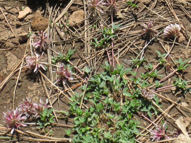 |
| Clover |
The
round trip hike was about 4.9 miles according to the GPS file I
downloaded to my computer. However, measured in Google Earth, it
appears to be only about 4 miles. Had we hiked from the junction of
FR 231 and FR 231C instead it would have not been significantly
different. The elevation change was about 750 feet. I measured the
highest elevation as 8107 feet and the lowest at 7349. The 8107-foot
reading would have been at the top of the tower.
I
have shown the route of the group who returned from the tower by FR
231 (along with the distance we drove to pick them up) in yellow on
the included map (below).
Additionally, the part of the hike that we inadvertently made on
private property is shown in blue. Note that by following the red
track on the way back we managed to avoid private property
altogether.
A
good future hike would be to park where we did this time, hike to the
tower following the red track on the included map (below) then return to
the cars by FR 231C and FR 231. That would be about 5.5 miles, or a
bit more.


