The
weather forecast for 5 April 2014 called for a slight chance of rain,
so we set out for our destination, Lower Cedar Bench Trail, along the
Verde River below Camp Verde, with one eye on the gently threatening,
partly-cloudy sky. However, the rain gods smiled on us and it turned
out to be a near perfect day for hiking. The slight cloud cover kept
the temperature down and rendered the many flowers we found along the
trail in a soft, filtered light that brought out all the glory of
their various colors.
The
flowers were a major reason that we had scheduled a hike on this
trail. Having scouted the trail in December of 2012 and determined
that it would be an excellent trail for flower viewing, we scheduled
it for last spring. That hike, however, was canceled because of
adverse weather. That actually turned out to be a lucky break for me
as I was scheduled to be on a four-day trip across the Navajo
Reservation to Rainbow Bridge at the same time.
We
left the Cottonwood Safeway parking lot, our normal gathering spot at
0700 and drove south on Hwy 260 to Camp Verde. There we exited onto
Oasis Road, just past the exit to General Crook Trail, and proceeded
to its end at Salt Mine Road. We turned south on Salt Mine Road and
continued for 15.1 miles to park at Brown Springs. The pavement
ended 7.2 miles from Oasis Road and the last 7.9 miles were on a
well-maintained dirt road. For those who have traveled this way
before, the road is tremendously improved from its condition a few
years ago.
 This
improvement is probably due to increased activity at the ranch
located at Brown Springs, now called the D-Tail Ranch (right).
New outbuildings have been erected and much work has been done to
beautify the area around the springs.
This
improvement is probably due to increased activity at the ranch
located at Brown Springs, now called the D-Tail Ranch (right).
New outbuildings have been erected and much work has been done to
beautify the area around the springs.
The
gate shown above now marks the end of Forest Road 574
(Salt Mine Road). Previously, the road continued a short distance up
the hill to end at Brown Springs. Perhaps it still does technically
continue on but, for all practical purposes, this is the end of the
road for public vehicular access.

The
end of FR 574 at D-Tail Ranch
A
spacious parking area is provided alongside Gap Creek just behind the
photographer as he stood to take the above photograph. An old road,
FR 517, runs alongside Gage Creek for the short distance to the Verde
River, permitting river assess.
 |
Showing the old road, now FR 517, running alongside Gap Creek to the Verde
River. This photograph was taken in December 2012.
|
The
sign seen faintly behind the tree branches in the above photograph
provides river access information.

River
access information sign
Although
we will start our hike here, the Lower Cedar Bench Trailhead is still
about 0.7 miles ahead. A trail sign shown here indicates that this
is the way to Oxbow Trail and Cold Water Trail but does not mention
Lower Cedar Bench Trail. In fact, only Oxbow Trail actually begins
here and the hiker follows it to the Lower Cedar Bench Trailhead and
then beyond that to Cold Water Trailhead. Knowing this, we set off
on Trail 163 (Oxbow), at first following the road on toward Brown
Springs. But after about 0.1 mile, we turned right, leaving the road
to bypass the springs. The trail here has been graded since December
2012 and can now accommodate 4-wheel drive vehicles and general ranch
equipment. This section of trail, bypassing the springs and the
improvements made there, is now apparently being used by the ranch to
service the pastures above.
As
expected, after climbing about 400 feet in the first 0.7 miles after
the parking lot, we arrived at the Lower Cedar Bench Trailhead. We
paused at the trailhead, actually on the way back, for a group
photograph.

Hikers
are, left to right: Betty Wolters, Daisy Williams, Kwi Johnson,
Ellis
Price and Ruth Frazier – photograph by Name withheld.
We
encountered flowers all along the trail, starting with evening
scented stock, growing in profusion along our path, and horehound,
which although not blooming was nevertheless quite beautiful and continuing with numerous others.
 |
| Evening scented stock |
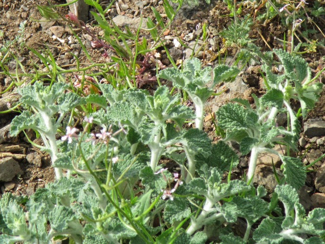 |
| Horehound |
 |
| Scarlett gauara |
 |
| Yellow primrose |
Our
flower viewing was interrupted often by pauses to take in the scenery
around us. Below is seen the view back up the Verde River.

Looking
back up the Verde River from Lower Cedar Bench Trail
About 1.47 miles, per
my GPS track, and some 800 feet higher in elevation we were on a
ridge and at the highest point of our hike. From here we could look
across the river to 13-Mile Rock Butte, Hackberry Mountain and the
Towel Mountains.

Left
to right: 13-Mile Rock Butte, Hackberry Mountain and the Towel
Mountains
We
stopped here for a short rest and a snack break. As noted, we had
climbed some 800 feet in a bit less than 1.5 miles, mostly along an
old rock-strewn roadbed, and we were ready for a breather.
But
the flower-bedecked trail descending into a large gorge just over the
ridge called us on and we were soon on our way.
 |
Desert Marigolds and firecracker
penstemons |
 |
| Firecracker penstemons |
 |
| Showy penstemon |
 |
| Blackfoot daisy |
 |
| Verbena |
 |
| Feather Dalia |

Finally, on the way
back, just as we were approaching the end of the hike, we came upon a
patch of lupine (right) we had
missed on the way in.
The trail follows along
an old wagon road that has recently seen some minor improvements that
permit it use by ranching equipment for part of the way. However,
about two miles from the parking area, the improvements end and the
rest of the way is only traversed by cattle and horses. The entire
length of this trail, from its beginning at the junction with Oxbow
Trail, is quite rocky and is very steep in places as it makes its way
up and down the ridges and gorges along the western bank of the Verde
River. However, the views and the many flowers to be seen made the
hike well worth the effort. In our case, we go plenty of rest just
by stopping to admire the flowers and plants.
According to my GPS
track, measured after I downloaded it to my computer, the round trip
hike was 7.3 miles, the trailhead elevation was 2926 feet, the
elevation difference was 918 feet and the total ascent was 1985 feet.
Our track is shown in
red on the included map (below).
The trail itself continues for about another 2.8 miles to end near
Cold Water Creek. This unhiked section of trail is shown in blue.

No comments:
Post a Comment