Wednesday, February 17, 2010

House Mountain – Indian Ruins and Cave


Five hikers participated in a hike to House Mountain to visit Indian Ruins and a cave that runs all the way through a butte. We drove to The Village of Oak Creek and turned off Hwy 179 onto Verde Valley School Road. We continued on Verde Valley School Road (and Red Rock Crossing Road - unpaved) for 4.0 miles to a rough dirt road leading off to the left. Parking is available at this point. However, we drove on the rough 4-wheel drive road for about 0.6 miles to reach the parking area at Trail 92 (Turkey Creek Trail).

Left to right: Jim Manning, Dolly Yapp, Gordon Bice and George Everman - Photographer: Ellis Price
We stopped at Turkey Creek Tank, about 1.6 miles from the trailhead, to look at some Devil’s Claw (Desert Unicorn) seed pods and wondered what the plant itself looked like. I learned later that the scientific name is Proboscides althaeifolia.

We paused to admire some soap tree yucca plants along the way. Although we were attracted at first by a small, perfectly formed sample of the plant alongside the trail, I was more intrigued by a group of more mature plants framing a hillside topped with a red rock bluff.


                 Perfectly formed soap tree yucca             Soap tree yucca plants framing                       
                                                                                          hillside view
As we continued on Turkey Creek Trail we could see the area we were aiming for to our left. The faint vapor trail on the horizon in the center of the below photograph points to the red butte where the cave is located while the Indian ruins are just beyond the butte.

Our goal is pointed out by a faint vapor trail on the horizon in the center of this photograph.
Around 1.25 miles from Turkey Creek Tank, we came to a cairn alongside the trail followed a few yards further by a second cairn

Cairn marking the spot where the trail makes a sharp right turn.
The trail takes a sharp turn to the right at the second cairn (at 34°47'8.25"N; 111°50'25.71"W). We left the trail there and followed a less distinct path to the left along the side of the mountain. Even that path ended after only a few yards and we stopped there for a snack before resuming our difficult trek along the mountainside.

Snack break                                                     Going where no trail exists
Following the contour of the mountain on our way to the area where the Indian ruins and the cave were located, we came upon a couple of very interesting cactus plants. One was a prickly pear that looked as though it were wearing a skirt. The other, we later learned, was a Paper-spined fishhook cactus, protected in Arizona. (NOTE: It is confirmed only in AZ, NM & TX.)

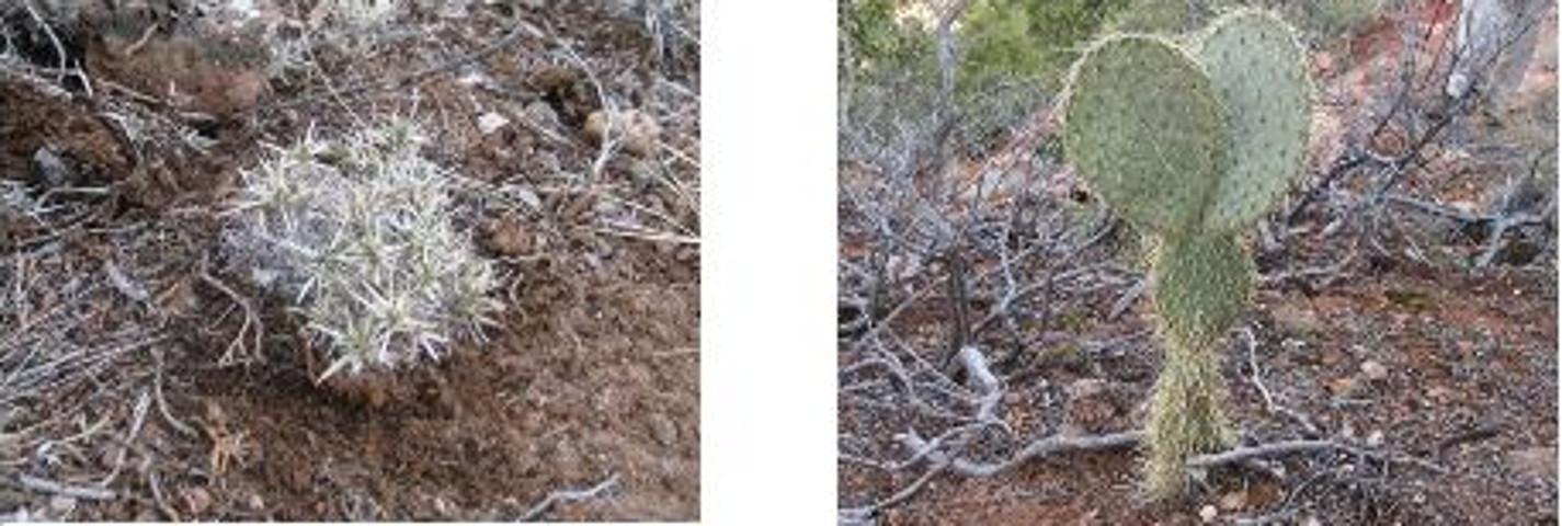
Paper-spined fishhook cactus Prickly Pear Cactus with a skirt
(endangered in AZ)
We would first visit the Indian ruins and then return to the cave in the red butte in time for lunch. To do so, we passed by the narrow saddle that connects the butte with the mountain proper.

Shot of the saddle between the mountain proper and the red butte
The saddle, capped with an erosion resistant layer of limestone, drops down sharply on both sides, leaving only a narrow path for passage to the butte.

Less than a tenth of a mile beyond the saddle leading to the butte, we arrived at the Indian ruins.

View of Indian ruins
The ruins (located at 34°47'15.81"N; 111°49'57.79"W) showed obvious signs of human habitation, by Indians and by later visitors. There were smoke stains on the walls, old pottery shards and modern graffiti. After looking the ruins over, Gordon voiced the opinion that this must have an Indian bachelors pad as no brave could have gotten away with building such a shoddy wall if his spouse were present.

Just past the ruins, I found a place where one could easily climb on up the cliff to the plateau above the ruins (below left). I paused about half way up to take a shot of hikers standing in front of the ruins (below right).

An easy (relatively speaking) path           Looking back at the hikers in front
to the top                                                       of the ruins
From the ruins, and especially from the plateau above, one is afforded spectacular views across Sedona and the surrounding red rock country. See the two following photographs as examples.

View of red rock country
After I climbed down from the plateau above and we had finished with the ruins, we turned our attention to our next objective … the red butte with the cave running all the way thru. The butte was clearly visible from the ruins and we made our way back along the mountainside until we arrived at the saddle that crosses over to it.

Red butte from the Indian ruins Crossing the saddle to the red butte
After crossing the saddle it was just a few yards to the cave opening. The opening, at the very bottom of a seam in the butte, did indeed go all the way through, a distance of about 35 feet. After some discussion of technique, George climbed through the butte and took a picture from the other side. The below pictures show the opening through the butte, a picture from the other side, George stopping for a photo on the way back and George emerging from the opening.

                                        Looking through the butte (south to       Picture from the opposite (north)                                                                                     north)                                                             opening
George starting the trip back through    George emerging from the cave
the cave                                                          in the red butte
After exploring the cave we settled down in the sun on the butte for lunch. As can be seen in the photograph below, I had a lot of company for my customary after-lunch nap (I am barely visible behind the brush at the cave opening).


Left to right: Ellis (behind the brush), Gordon, Jim and Dolly (George was the photographer)
Gordon had identified a way to descend from the bridge into the wash below, and after lunch we all followed him down the mountain. The climb down and the trip along the wash were relatively easy and we rejoined the Turkey Creek Trail where it crosses the wash about seven tenths of a mile south of Turkey Creek Tank.

When we arrived back at the parking area, my GPS showed that we had hiked 8.2 miles and that the elevation gain was around 600 feet.

The GPS Track for this hike is shown included map (below)


No comments:

Post a Comment