Saturday, September 21, 2013

Finding the Vultee Plane Crash Site


Several members of the Skyliners hiking group had long wanted to visit the site of the 1938 Vultee plane crash. A 2011 article in the Verde Independent1, a local newspaper, had whetted our interest and we had already made one unsuccessful attempt last February only to be foiled by an 18-inch snow cover on top of the mountain. Now, reinforced by the accompaniment of Bill Reller, who had visited the site a number of years ago, we set out for another attempt.

Several members of the group left from Cottonwood and drove to Sedona where we met with others at the Burger King Restaurant. From there we continued north on Hwy 89A to meet the final members of our group at Indian Gardens in Oak Creek Canyon. We then proceeded on up the canyon toward Flagstaff, turning left onto Forest Road 535 between mile markers 390 and 391. The best directions we had to the site started at the East Pocket Lookout Tower and we originally planned to start our search from there. The distance to the tower from where we first turned onto FR 535 turned out to be 23.1 miles. The first 5.5 miles (FR 535) was well maintained, the second 3.3 miles (FR 536) contained a few large mudholes that we had to maneuver around and the third section (FR 231) was well maintained but with a few rough spots. With care, the entire route could have been traversed in a normal passenger vehicle, although a high-clearance vehicle is recommended.

As noted, our original intent had been to drive all the way to the lookout tower and start our search from there. The very sketchy directions we had used the tower as a reference point. We found out later that it is not possible to drive all the way to the tower; the road is blocked by a closed gate about 0.5 miles short of it.

As it were. Bill Heller remembered turning off FR 231 for the crash site before actually reaching the tower. That was true; however, we turned off about 1.4 miles too soon. About 0.4 miles after turning off, we reached a spacious parking area, located right on the rim that, that provided an excellent view of the country below us.

From the lot where we parked – looking across Sedona and the 
red rock country
This seemed as good a place as any for a group photograph.

Left to right (standing): Jerry Showalter, Lila Wright, Miriam Sterling, Mike 

McDaniel, Bill Reller, Anita Jackson, Nancy Imus; (kneeling/sitting): 
the author, George Everman, Akemi Tomioka and Dolly Yapp
– photograph by Name Withheld
Although it was now pretty obvious that we were not as near the crash site as we had planned, we decided to leave the cars and start our hike from here anyway.

It was not as though the crash site were unknown; a good number of reports are to be found describing previous visits to it. However, nowhere in any of these reports had I found location coordinates or a good description of how to get there. I think that is partly because the place is so deceptively simple to find once you know where it is. In our case, we were sure that if we just traveled along the rim toward East Pocket, we could not fail to find it.

As we made our way east along the rim, we were constantly treated to great views out over the red rock country. The below photograph, looking across Sedona to Airport Mesa, shows faint contrails from an air show currently in progress there.

Contrails above airport, see slightly right and below center
After traveling for about half a mile along the rim we were once again very close to FR 231 on our left. It grew farther away as we continued along the rim but then grew closer again until, about 1.3 miles from the parking lot, we found ourselves actually hiking on the forest road. We continued along it for about 0.2 miles until we came to an old road, now closed to vehicular traffic, that I later learned was old FR 231, that once led to East Point Tank. Looking straight ahead on the main road (FR 231), we could see a gate across that road about a hundred yards ahead. Someone remembered the gate from a previous trip to the area and thought it was very near the crash site, so we turned south on old FR 231 road and then left it after a short distance to follow more closely along the rim.

When we had hiked far enough that we thought we should have encountered the crash site, we decided to turn northeast and hike to the tower. We could eat lunch there, reorient ourselves and get a fresh start on our search. Additionally, we had been told that the tower would be manned and that we might be able to arrange a visit to the observation booth. That turned out to be the case and the attendant was quite helpful in providing us some additional information to aid us in our search.

After everyone had visited the tower and we had eaten lunch, we headed down FR 231 to the gate and the junction with old FR 231 just beyond it. It turns out that we were actually headed in the right direction when we had previously turned south on that road. We just hadn’t gone far enough. At the tower, we were joined by a Lady from Mesa, AZ who had hiked up A B Young trail and who stayed with us for the remainder of our hike before heading back the way she had come.

The distance to the junction from the tower proved to be just 0.6 miles, as measured by GPS, and on reaching it we once again headed south along the rim. This time we followed the old roadbed for 0.3 miles, to the top of a fairly steep hill, before it veered to the east and we left it to travel south along the rim. It was a lot farther than we had expected and we were about to turn back, thinking that we had 
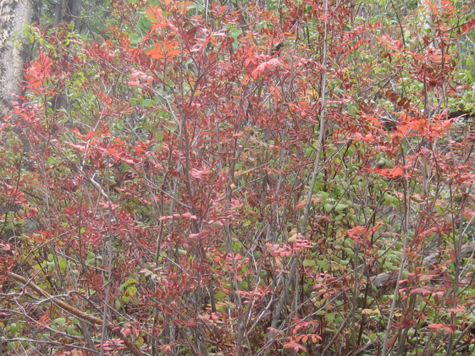
simply missed it among the numerous ferns growing along the rim and now sporting their fall rust color. Fortunately, just at that moment someone spotted the small white cross erected at the site in 2011 by Peter Vultee, Jerry's son, and his cousin John Vultee2. We had traveled, following closely along the rim as we did, some 1.3 miles from FR 231. Much farther than any of us had thought. The trip back, with no longer any need to hug the rim, was a little shorter, about 1.1 miles.

Memorial cross erected at the Vultee crash site
The blowup displayed below shows the plaque mounted in the center of the cross.

Enlarged view of plaque mounted on cross
The remains of a major part of the airframe assembly can be seen to the right of the cross in the above photograph and debris is scattered over a relatively small area extending from there to the left of the cross. This debris field is seen from another angle in the below photograph.

Vultee crash site debris field
The major part of Jerry Vultee's life and career, along with the history of the company he founded are described in an article appearing on the Davis-Monthan Aviation field Register web page3 and the aforementioned article published in the Verde Independent speculates on why he was flying in such bad weather. I will not elaborate further here, but will leave it to interested readers to review those sources themselves.

Just a few yards beyond the site, we had an exhilarating view from the rim of the Dry Creek watershed. Although we looked very hard, we could not see Vultee Arch from the rim, finally deciding it was obscured from our view by the west wall of Sterling Canyon. Later, I did determine that it is 1.5 miles from the crash site at a bearing of 1630 true. The photograph below shows the rough, beautiful country spread out below us.

Dry Creek watershed viewed from the Vultee crash site
On leaving the site, we took the most direct route back to the junction of FR 231 with old FR 231. Meanwhile, three hikers had gone on ahead to retrieve vehicles and meet us at the junction. We all then drove back to the parking area to retrieve a vehicle still parked there. What had been intended as a stroll in the woods, so to speak, become a good hike by the time we had finished and we surely would not have found the site at all without the help of Bill Reller and the information provided by the tower attendant.

The following map (below) shows the immediate area of the crash site and the fire tower. Forest Road 231 is shown in purple, the short drive from FR 231 to the rim parking lot is shown in yellow, the dark green line shows our hike to the tower and the red line shows the most direct route from FR 231 to the crash site. The light green line is A B Young Trail. It is 1.1 miles in length, so a 2.2 mile round trip hike will get you from a car parked at the junction to the site and back. The next time we will know this.

Close up map of the Vultee Crash Site and the East Pocket area
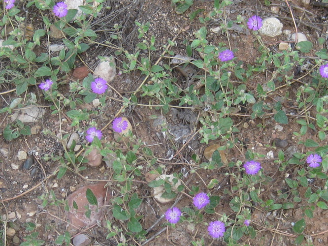
While we were rambling around searching for the crash site, I found a few colorful flowers. The most attractive of these is shown here (left). I am not sure, but I think it may be a desert dahlia.

Meanwhile, Akemi had become fixated on mushrooms. She photographed a number of different specimens, sending those she found most interesting to me for inclusion in the hike report.
Below are Akemi's mushroom photographs. The colorful, spherical one (first two photos below) is poisonous and psychoactive. It was featured in a recent issue of Arizona Highway Magazine4 and erroneously listed as edible, causing that issue to be recalled.

Fly agaric or fly amanita mushroom
Of the two photographs below the one on the left was included because it is shaped like a heart. The one on the right, on the other hand, turned out on closer examination to be the author taking a nap.

Heart-shaped mushroom
The author posing as a mushroom
We actually hiked 5.4 miles. But just hiking from the FR 231/old FR 231 junction to the crash and back would be 2.2 miles with an elevation gain of 210 feet and a highest elevation of 7025 feet.


1 http://verdenews.com/main.asp?SectionID=74&SubsectionID=114&ArticleID=43609
2 http://verdenews.com/main.asp?SectionID=74&SubsectionID=114&ArticleID=43609
3 http://www.dmairfield.com/people/vultee_je/

4 http://arizonahighways.wordpress.com/2013/09/13/arizona-highways-magazine-issues-statement-about-october-issue/   

Saturday, September 14, 2013

Inner Basin and Waterline Trails to Bearjaw


On 14 September 2013, the Skyliners hiked from Lockett Meadow to Bearjaw by way of the Inner Basin and Waterline Trails. We left Cottonwood just after 0700 and were at Locket Meadow at about 0840. The 4.5 mile stretch of dirt road from Hwy 89A to the trailhead at Locket Meadow was in better shape than we had expected. Repairs have been performed recently and, except that it is still very narrow and has some deep ruts carved by recent heavy rains, is easy to navigate.

Camping at the meadow is available only at numbered sites which are available for $6.00 for day use or $12 for overnight camping. Free parking for hikers is provided at the trailhead.

We parked at the clearly-marked trailhead, paused just long enough to review the trailhead sign (right), and quickly headed up the trail toward Jack Smith Spring where we expected to join and turn north on the Waterline Trail.

This was my first time on the Inner Basin Trail for almost a decade, well before the 2010 Schultz fire, and I noted evidence of that fire soon after we started up the trail. Fire damage was restricted to the south side of the trail and we were soon past the burned area. Despite the devastation caused by forest fires, they do have some unique and, in their own way, appealing after effects. Here, the silent dead trees still stood sentinel while below the forest was covered with new-growth aspen along with scattered wildflowers, such as the asters shown here (above left), that are seldom seen in pristine forests.

We were soon past the burn area and back into undamaged (at least by fire) forest. The trail at first continued straight up the slope toward Jack Smith Spring through a forest of mixed vegetation, primarily pine and fir. Then, we emerged into a beautiful, almost ethereal, zone of quaking aspen and grass-carpeted forest.

Quaking aspen in a grass-carpeted forest
The trail now started a series of switchbacks and I realized that this was not the route I had followed when I last hiked on the Inner Basin Trail. I have faint memories of following the traces of an old road up the mountain slope. Now, there were no traces of old road and we were following an obviously rather newly-built and well-engineered trail, designed to minimize erosion and take the drudgery out of what was, after all, a rather steep climb, rising almost 800 feet in the first 1.7 miles.

Having plotted the old trail using a dated topographic map, I was expecting to reach Waterline Trail at Jack Smith Spring after traveling 1.7 miles on Inner Basin Trail. Unexpectedly, the newly-constructed trail brought us out on Waterline Trail 0.2 miles south of the spring. A sign posted at the trail junction (right) indicated that going south would take us to Schultz Pass Road, so we knew that we were still south of the spring and would have to head north to reach it. In any case, Bearjaw was certainly still well north to the north.

Waterline Trail, following the path of a waterline serving Flagstaff, begins at Schultz Pass, runs along the northeast slope of the San Francisco Peaks into the Inner Basin and continues north and northwest to Abineau Canyon. The below sign describes it well.

Sign posted on Waterline Trail at Jack Smith Spring
We continued the short distance on Waterline Trail to Jack Smith Spring. There we saw a good chance to combine a group photograph with an informational sign.

Left to right: David Beach. Miriam Sterling, Jerry Helfrich, Lila Wright and 
Ann Urick – author not shown
Another sign (left) provided the distances to various other points. If accurate, the distance of 3 miles given to Bearjaw meant that it would have been 3.2 miles from the point we left the Inner Basin for Waterline. However, I had plotted the distance as being 3.9 miles. As it turns out, our GPS track from where we first entered Waterline Trail to Bearjaw, perhaps a few yards beyond the Bearjaw Trailhead, measured 3.1 miles.

After only a short pause at Jack Smith Spring, we continued on toward Bearjaw. We had set that point as our goal because several of us had already hiked the section of Waterline Trail between there and the trail's end at Abineau Canyon as part of the Abineau-Waterline-Bearjaw Trails loop.

The road was not quite as well-maintained along this section, but was still in very good condition. While we saw no vehicle tracks, there was ample evidence in the way of fallen trees removed from the road, that it was being maintained well enough to permit use by waterline service vehicles. That, along with the very gentle slope and the beautiful surrounding forest, made it an absolute pleasure to hike.

View of Waterline Trail north of Jack Smith Spring
Because of the heavy forest, we had only an occasional view of anything other than our immediate surroundings. There were, however, a couple of places where openings provided farther off views. The following photographs were taken from such viewpoints.

Looking down on Lockett Meadow where we started our hike from 
Waterline Trail
Looking generally northeast from Waterline Trail north of Jack Smith Spring
We arrived at the Bearjaw Trailhead (right) at about noon. The trail we were on was mostly shaded and there was a light cool wind blowing which, coupled with perspiration from the hike, made us all a bit chilly, so we continued on past the trailhead for several yards to stop for lunch in a sunny spot with several fallen logs that would serve as seating.

There was the possibility of thundershowers, a 10% chance according to the Weather Service, and the ground was still too wet from previous rains for me to take my customary noon nap, so we were soon on our way back down the trail. As always, I noticed different things on the way back. For instance, this first hint of fall color prominently displayed along the road bank (left).

We hurried along as we neared the end of the trail because heavy clouds had gathered and we could hear the rumble of thunder in the distance. Fortunately, we received nothing more than a heavy sprinkle before arriving back at the parking lot. The rain continued to hold off for the drive back along the dirt road to Hwy 89A, a fact that pleased me immensely because I had seen a gorgeous yellow flower (right) on the drive in that I wanted to stop and photograph on the way back.

The total distance for this hike as shown by the red GPS track on the included map (below) was 9.6 miles round trip, the total ascent was 1,071 feet and the highest elevation was about 9741 feet.


Saturday, September 7, 2013

Sycamore Canyon – Parsons Trail


Skyliners Mark Purcell, Daisy Williams, Ruth Frazier and the author hiked Parsons Trail in Sycamore Canyon on 7 September 2013. Leaving from the Safeway parking lot in Cottonwood, we drove through Old Town Cottonwood on Main Street heading toward Clarkdale. Before reaching Clarkdale, we turned right on Tuzigoot Road, crossed the Verde River and then turned left on N Sycamore Canyon Road (Forest Road 131). This road is paved at first but soon becomes a dirt road and proceeds for about 10.3 miles to end at the Parsons Trailhead on the rim of Sycamore Canyon. The driving time was about 40 minutes.

I photographed my fellow hikers standing on the rim.

Left to right: Mark Purcell, Daisy Williams and Ruth Frazier
– Sycamore Canyon in the background
We all carefully reviewed the informational sign posted at the trailhead before starting the steep 180-foot descent to Sycamore Creek.

Forest Service sign posted at the Parsons Trailhead
Another very informative sign posted nearby provided some additional useful information (photograph at right). I was particularly pleased to know how many times we would be crossing the stream. This would be my fourth hike on Parsons Trail and I had always lost count of the number of crossings by the end of the hike. The distance figure, 3.7 miles, was also welcome, because GPS coverage in the canyon is very erratic and this would provide something to compare my reading with.

At the bottom of the steep descent from the canyon rim, Parsons Trail leads north along Sycamore Creek. Packard Trail (left) starts here, crosses the creek, climbs steeply up the rim on the other side to Packard Mesa and continues on to join Sycamore Basin Trail at Sycamore Tank about five miles away.

Not far up the trail we found a field of gorgeous yellow wildflowers that we couldn't identify.

Unidentified yellow flowers
From a distance, I thought we were looking at a field of sunflowers. However, on closer examination of one of the flowers, it was clear that they were something else.


Unidentified flower
A little further along we found a sacred dature plant with a single flower being examined carefully by a lone bee. Nearby, a plant, growing close to the creek bank, its roots practically implanted in the water, sported fiery red flowers.

Sacred datura
Skyrocket (Scarlet gilia)
We also found many asters and one trailing 4 o'clock along the way.

Asters 
Trailing 4 o'clock
Somewhere along the way we came upon a single, lonely spiderwort (see right) growing all by itself alongside the trail.

About 1.3 miles up the trail we came to Summers Spring. I had not noticed this spring on previous hikes but we were all looking for it this time and found it easily. The map on the Forest Service sign at the trailhead places the spring on the east side of the trail. However, the trail has been rerouted to avoid a large tree that fell at the spring some years ago and it is now on the west side of the trail.

One of the most interesting feature of Sycamore Canyon is the large number of caves and mining tunnels in the cliff walls. It is often hard to differentiate between the two, but generally some of those on the east wall near the base of the cliff appeared to be mine/prospecting operations while everything we saw along the west wall, all higher up appeared to be natural caves. Having heard a lot of stories about mines tunnels, ranging from wild stories of secret government facilities to lost gold mines, I searched around a bit and came up with a 1966 Geological Survey Bulletin published by the Interior Department1. It provided the following information:

The only known mining claims in the Sycamore Canyon Primitive Area are held by Mr. O. G. ("Jerry") Graves and associates. These claims covering Geronimo's mine or prospect are at the south edge of the primitive area, about 1.4 miles north of Mr. Graves' cabin at Packard Ranch.

The legend of Geronimo's mine is related in the "Mining Journal" of April 15th, 1946. In brief, the legend tells how a gold deposit was found and worked by Spanish explorers and later worked by Geronimo and other Apache Indians. According to the legend, much of the gold bullion recovered from the mine was buried in a secret place within the mine. Using several lines of evidence, Mr. Graves and a former partner (now deceased) located a cave in Sycamore Canyon, which they concluded was Geronimo's mine, and they staked claims that covered it. The prospect was examined on October 26, 1965, by the writers, accompanied by Mr. Graves and Robert Raabe (U.S. Bur. Mines). The mine is a cave in the Martin Limestone about 20 feet above Sycamore Creek. The cave is partly filled with clay and sand. During the 20 years that Mr. Graves and his partner worked at the mine, they excavated a T-shaped adit, aggregating about 200 feet in length, by removing fill from the cave. In this adit the cavern walls above the clay and sand fill are coated with a black powdery material which Mr. Graves interprets to be soot left from fires used by early miners for breaking the rock. Samples of this material were identified as black manganese oxide rather than soot. The undisturbed condition of the cave fill suggests that the cave is natural and has never been excavated before. No evidence of gold was found during the examination of the cave.

The tale of the gold deposit that was supposedly “found and worked by Spanish explorers” is elaborated on in an article I found online2.

All in all, it appears that tales of gold in Sycamore Canyon were just that, tales. As for the secret government facilities, the same source of that tale also confidently informed me that the big dome installed at the local cement plant to reduce air pollution was part of a another secret government operation. Needless to say, neither of these tales merit any serious consideration.

We did find what certainly appeared to be the opening of a man-made tunnel (see left). It had been walled up at one time to prevent entry, something often required by regulatory authorities, but vandals have since removed most of the rock wall. Although this cave appears to be man-made and does run back into the cliff for a considerable, although undetermined by us, distance, I didn't think it was the site referred to in the 1966 Geological Survey Bulletin quoted above. For one thing, there was no black coating visible.


On our way up the canyon I lost the trail and led the party awry. The trail actually veered sharply to the east and slightly uphill at that point and recent rains had pretty much washed out any visible sign of it. Meanwhile, we had been heading generally toward the creek before the sharp turn and it looked eminently crossable at that point. After some deliberation, we crossed over and shortly found ourselves at a dead end. This photograph (above right) shows two of my fellow hikers gleefully pointing out the correct trail for me.

On up the trail, just a short distance past our wrong turn, we came to a second cave (see left) that I thought more likely to be the one mentioned in the Geological Survey Bulletin. This one does, at least, show what could be the black manganese oxide coating identified by the surveyors.

There were other caves near the trail on the east side of the canyon, but they were not significantly different from those already shown.

Meanwhile, across the creek in the west canyon wall we could see other caves. The below photograph displays two of these, one partially hidden by trees on the left and one on the right. The left most cave may have a man-made rock wall behind the trees; we really couldn't tell for sure. Note also the large rectangular rock perched atop the small peak at the upper right. This rock also appears in the next photograph.

Two caves visible in the west wall of Sycamore Canyon
Not far north of the two caves shown in the above photograph, we saw another one (see right) that definitely showed evidence of human habitation, specifically a man-made rock wall near its entrance. The cave appears at the bottom center of the photograph. We decided this cave had most certainly been used by Indians. Also see the large rectangular rock sitting atop the peak directly above the cave. This is the same rock shown in the bottom photograph on the previous page.

An enlarged view of the cave is shown here (see left) to better display the man-made wall.

We counted the creek crossings on the way up and found that there were indeed six. Of course we actually crossed eight times because I lost the trail.

We knew we had reached the end of the trail when we found ourselves in a dry streambed. The spring is actually located at the bottom of a steep cliff wall on the west side of the canyon and is surrounded by a thick growth of vegetation. The sixth creek crossing is just below the spring and one must continue about another tenth of a mile beyond that to reach the dry streambed.

When I downloaded the track from my GPS and cleaned it up by removing all the extraneous signals that had bounced off the canyon walls, I found that it showed a one-way distance of 3.8 miles. Considering that we actually hiked a short distance beyond the spring (see map below), that accords well with the mileage posted at the trailhead.

Map showing Parsons Spring and where we stopped for lunch
Our total round-trip hike distance was 7.6 miles as shown by the red GPS track on the included map (below). According to my track, the total ascent was 357 feet and the highest elevation was 3,810 feet.


1 http://pubs.usgs.gov/bul/1230f/report.pdf

2 http://www.thegeozone.com/treasure/arizona/tales/az009a.jsp