Saturday, January 30, 2010

Carroll Canyon


The Skyliners hiked in Carroll Canyon wash, on Carroll Canyon Trail and Old Post Trail on January 30, 2010. Hikers were Ellis Price, Daisy Williams, Anita Jackson, Jim Manning, Dolly Yapp, Miriam Sterling, George Everman, Gordon Bice and two others. From Cottonwood, we traveled north to Sedona on Hwy 89A, turned right on Upper Red Rock Loop Road at Red Rock High School and drove about 0.9 miles before turning left onto Chavez Ranch Road going toward Red Rock Crossing. About 0.28 miles from Upper Red Rock Loop Road, Chavez Ranch Road crosses he Carroll Canyon Wash. There is room to park two cars at the wash; however both of these spaces were taken and we continued for about another 300 yards to park on the shoulder at the intersection of Chavez Ranch Road and Red Rock Crossing Road. We started our hike from there, walking back along the road to enter the wash, at about 34°50'0.18"N; 111°48'33.55"W, and follow it up the canyon.

Continuing our way up the canyon floor, we climbed over what many would call rock ledges, but which to Arizonans are waterfalls:

This is an Arizona waterfall. We don't require much water for waterfalls in Arizona
See? This one really does have water
We found an arch along the way and Gordon went exploring:

Gordon peering thru the arch                     Another view of the arch
After traveling up the canyon for about 1.25 miles, we came to Carroll Canyon Trail, which crosses the canyon at this point. We continued on up the canyon for about 100 yards before stopping for lunch, and then returned to take the trail for the return trip. The trail at first climbs steeply from the canyon floor and then follows pretty closely along the western rim for about half a mile before turning west to intersect with Old Post Trail, which we followed back to its trailhead on Chavez Ranch Road just west of Carroll Canyon Wash where we had started our hike. There were great views along the way down into the canyon, across the canyon to Cathedral Rock and Courthouse Butte in the distance, to the red rock peak between Upper and Lower Red Rock Loop Roads and back across Sedona to the mountains in the north.

Looking down into the Canyon from the rim at the “waterfall” we had  climbed on the way up the canyon
This shot shows both Courthouse Butte (center left) and Cathedral Rock (center right) in the distance
I am told that the the pyramid-like formation in the center is called Red Rock Peak. It lies between Upper and Lower Red Rock Loop Roads
Looking back across Sedona to the north
My GPS track showed a total hiking distance of 3.96 miles and an elevation change of about 425 feet. The hike up the canyon was moderately strenuous because it entailed some climbing over rock ledges. The hike back along the Carroll Canyon and Old Post Trails, except for the short initial climb from the canyon, was easy. The route we hiked is shown in red on the included map (below).


Saturday, January 16, 2010

Fay Canyon Trail And the Arch


On January 16, 2010, twelve members of the Skyliners (Lila Wright, George Everman, Donna Goodman, Virginia Driscoll, Dolly Yapp, Gordon Bice, Miriam Sterling, Ellis Price, Betty Williams, Anita Jackson and two others) group hiked up the trail in Fay Canyon and then stopped on the way out to visit the arch.

We parked at the trailhead on Boynton Pass Road. To get there from Cottonwood, we traveled north on Hwy 89A to Sedona and turned left onto Dry Creek Road (Forest Road 152C). About 2 miles from Hwy 89A we passed Vultee Arch Road, a very rough dirt road leading off to the right. After about another 0.85 miles (2.85 miles from Hwy 89A) we reached a stop sign. Long Canyon Road leads to the right from here. We turned left on Boynton Pass Road. Actually, according to the Google map, we had been on Boynton Pass Road since passing Vultee Arch Road. We traveled for another 0.6 miles to reach a second stop sign at the junction with Long Canyon road. We turned left to continue on Boynton Pass Road for just over another 0.5 miles before turning left into the trailhead parking lot. The trailhead is directly across the road from the parking lot.

We intended to visit the Fay Canyon Arch which we were told would be on the right side of the canyon about 0.5 miles from the trailhead. We were thus alert to find the trail leading up to the arch. That to be rather easy, as there was a substantial cairn marking the spot and the trail itself, at least in the lower stretch, was well defined. However, as we were to find out later, the upper part of the trail turned out be be pretty indistinct and was very steep. We also had a good view of the arch from the main trail at the turnoff.

However, it was not clear at first that we were actually looking at an arch. It appeared to me to be little more than a rock overhang.

Fay Canyon Arch viewed from the main trail
After a brief discussion, we decided to continue on up the main trail and reserve our visit to the arch for the return leg of the hike. About 1 mile from the trailhead, we came to a fork in the canyon. The fork is marked by a rockslide below a jutting brow in the cliff separating the two branches of the canyon.

We followed a well-traveled trail that led up the rockslide to the brow and continued close along the cliff wall up the left branch of the canyon. We later determined that we should have taken the right branch instead. As it were, we found the trail we did take to be not too difficult, although it did involve a bit of climbing over and 
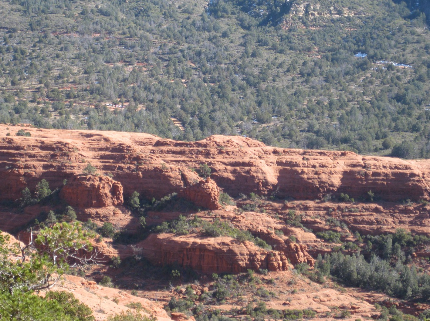
around rock formations along the wall of the cliff. Looking back the way we had come, we had a good, if somewhat hazy, view out the canyon mouth and on to Courthouse Butte in the distance:

Looking down Fay Canyon. The block like formation, extending just to the horizon, in the very middle of the canyon mouth is Courthouse Butte.
We followed the trail up the left canyon branch for about 0.6 miles before it dissipated in a grove of trees hard against the cliff wall. I took a photograph on the way up this branch of the trail, a couple of photographs where the trail ended at the base of the cliff and several on the way back down the trail. These are shown on the following pages.

The trail ahead on the way down The trail ahead on the way down
View back down the canyon from the left branch trail - note the goblet-shaped formation (center)

The end of the trail up the left branch of the canyon
Looking back down the canyon from the upper end of the left fork trail
We had reached the end of the left fork trail a bit past noon and we were getting hungry. However, we had left one hiker back at the canyon fork and decided to return there before stopping to eat. When we reached the fork and settled down to eat, some of the group, perched high up on the rockslide near the brow of the cliff dividing the canyons, were able to see the Fay Canyon Indian Ruins (mentioned in the Forest Service trail description) up the canyon branch that we had not taken. That is when we knew for sure that we had gotten off the main trail.

Rather than exploring the Indian Ruins after finishing lunch, we chose to head back down the trail and visit the Fay Canyon Arch on our way out. We were not sure that we wanted to do both. We did pause for a group photo before heading down the canyon.

Hikers arriving at the arch Sky between the arch and the cliff
When we reached the turnoff to the arch, the entire group decided to make the rather steep climb up the canyon wall to see it close up. We all made it to the arch and several of us climbed further to reach the top of the arch.

Lila atop the arch Dolly and George (upside down) atop the arch
Gordon and George atop the arch Anita and Lila between arch and cliff
The entire group had made the rather steep climb up the canyon wall to to the foot of the arch so as to see it close up. Several of us then climbed further to reach the very top of the formation. From there we could see that it did indeed stand apart from the cliff face proper. The hikers shown atop the ledge in the following photograph can look down into a gap between the cliff proper and the broken-away ledge that contains the arch.

The arch (lower left quadrant) with Dolly and George still on top (upper right quadrant)
We lingered at the arch for quite some time before descending back down to the main trail and returning to the parking area.

And, finally, a photograph of the plant of the day, a gorgeous, perfectly-formed hedgehog cactus noted, needles at the ready, squatting alongside the trail in the upper canyon.

Hedgehog cactus growing alongside the trail in the left branch of the canyon
My unedited GPS file, which was divided into three separate segments due to signal loss, gave the total hiking distance as 7.2 miles. Even after I cleaned the file up by erasing some of the wild swings due to signals bouncing from the canyon walls, the file still showed a hiking distance of about 5.5 miles. A quick measurement using Google Earth, on the other hand, indicated that the total distance was only about 3.60 miles. GPS readings in these deep canyons (Loy, Fay, etc) simply cannot be trusted due to signal reception problems. One can, however, get a pretty good track of the route traveled by erasing some of the wilder swings and just looking at gross data. The GPS track is shown on the included map (below).


Saturday, January 9, 2010

Cowpies-Mitten Ridge Trail

Cowpies Trailhead is located at: 34°52'19.60"N; 111°42'47.31"W; Elevation: 5047

Sixteen Skyliners (Betty Wolters, Anita Jackson, Lila Wright, David Manning, Marvin Alt, Dolly Yapp,George Everman, Jim Manning, Miriam Sterling, Daisy Williams Donna Goodman, Ellis Price and four others) hiked Cowpies-Mitten Ridge Trail off Schnebly Hill Road On 9 January 2010. From Cottonwood, we traveled north on Hwy 89A, turned south on Highway 179 in Sedona and traveled about 0.3 mile to before turning left on Schnebly Hill Road.  We proceeded 3.5 miles on Schnebly Hill Road to reach the Cowpies Trail trailhead.  Schnebly Hill Road is paved for the first mile, but the last 2.5 miles rough, unpaved road. The parking area is located on the right (south side) of the road, directly across from the trailhead.

Shortly after leaving the trailhead we stopped at an open area to look across to the Cowpies and on to the gap in Mitten Ridge that was our destination for today’s hike.

Taken just over a tenth of a mile from the trailhead.  The Cowpies are the relatively flat formations just beyond the hikers shown standing on the edge of a cliff.  The gap in Mitten Ridge (to the right) is where we ended our hike
We continued across the open area to the cowpie formations beyond , climbing to the top of the highest one for a view of the canyons below surrounding area. Looking to the north, we could see see the faint trace of Schnebly Hill Trail making its was diagonally up the mountain, along the original Schnebly Hill Road, to the Mogollon Rim. Visible below the trail was the Merry-Go-Round (or Carousel) formation.

The Merry-Go-Round formation (center right) and Schnebly Hill Trail snaking up the ridge, following the trace of the original Schnebly Hill Road, toward the Mogollon Rim
Turning to the south we had a good view down Bear Wallow Canyon and across Sedona to Mingus Mountain in the distance. Munds Mountain loomed across Bear Wallow Canyon to our left and Cowpies Canyon ran down from our right to join Bear Wallow just below the Cowpie formations. Looking farther down the canyon, and across Sedona, Mingus Mountain was visible in the distance.

Bear Wallow Canyon (left) and Cowpies Canyon (right) running together just below our vantage point
Closer in, was a lone tree (see right) that seemed to be growing from bare rock just below the rim of Cowpie Canyon.

We stopped for a snack and then retraced our way from the Cowpie formations around the head of Cowpie Canyon and rejoined the trail running along the side of Mitten Ridge toward the gap.

(NOTE: According to some reports I have read, the trail is called Cowpies Trail from Schnebly Hill road to the point where we turned to hike on the Cowpies and Mitten Ridge Trail the rest of the way to the gap.  I decided to avoid a decision by just referring to the whole length as Cowpies-Mitten Ridge Trail.).

Along the trail we found a particularly striking view of Arizona Cypress trees against a backdrop of red cliffs.

Arizona Cypress against the red rock.  Note the window in the rock spire at the top left of the tallest tree.  The Schnebly Hill Trail is faintly visible, running up Schnebly Hill to the Mogollon Rim in the upper right.
The trail between the head of Cowpie Canyon and Mitten Ridge Gap is indistinct in some places and the last few hundred yards are a pretty steep climb.  However, don’t be discouraged, as you really can’t go too far wrong if you just keep heading toward the gap, and the view from the gap is well worth the short climb.  At the gap we stopped to enjoy the views while we ate lunch. Some of these views are shown below and on the following pages.

To the east we looked down on the Cowpie formations. Cowpies Canyon runs down this side of the bare red ridge shown here, Bear Wallow Canyon runs down the other side and Munds Mountain, already showing a few scattered patches of snow, looms beyond.

The Cowpies formations from Mitten Ridge Gap. The hump in the middle of the photograph is the highest cowpie
To the west, we could look down into Oak Creek Canyon, across Oak Creek and Midgley Bridge and on to the Cliffs on the other side of the canyon.

A view into Oak Creek Canyon showing Midgley Bridge and looking out across Sedona - Taken from Mitten Ridge Gap
This outcropping from Mitten Ridge forms the south side of Mitten Ridge Gap
This is the cliff that forms the north side of Mitten Ridge Gap
After lunch we returned directly by way of the Cowpies-Mitten Ridge Trail to the parking area.
The total hiking distance for this hike was 3.6 miles according to my GPS log.  The distance from the Cowpies Trailhead at Schnebly Hill Road to the end of the trail at Mitten Gap, without the excursion to the Cowpies, is 1.2 miles.

Our GPS track for this hike is shown on the included map (below)


Saturday, January 2, 2010

Big Park Loop - 100102


On 2 January 2010, thirteen Skyliners (Marvin Alt, Miriam Sterling, Donna Goodman, Betty Wolters, Bob Wakefield, Janet Wakefield, Daisy Williams, Dolly Yapp, Lila Wright, Virginia Driscoll, Ellis Price and two others) hiked Big Park Loop Trail.  From Cottonwood, we traveled north on 89A, turned right on Cornville Road and continued through Cornville to turn left on Beaverhead Flat Road.  When Beaverhead Flat Road ended at State 179, we turned left, continued through the Village of Oak Creek and then turned right into the South Bell Rock Pathway Trailhead parking area just after leaving the village.  This trailhead has a kiosk with maps on display and toilet facilities.  The toilet facilities were very messy and were not stocked with toilet paper at the time of our visit.

From the kiosk in the parking area, we headed east on a trail for about 0.14 miles to intersect with the western leg of Big Park Loop.  We then turned left (north) and hiked about 0.42 miles to intersect with Courthouse Butte Loop.  As we approached the western end of Big Park Loop at Courthouse Butte Loop, we were afforded good views of the butte as well as of Bell Rock.  Photographs of these two formations are included (see below and on the next page).

Bell Rock from the western leg of Big Loop Trail south of Courthouse Butte Loop Trail
Courthouse Butte from the western leg of Big Loop Trail
Turning right (east) on Courthouse Butte Loop, we hiked 0.6 miles to where the eastern end of Big Park Loop connects with Courthouse Butte Loop, just across a wash near the southeast corner of the butte. But it was now time for lunch and we decided to hike north on Courthouse Butte Loop, following the wash, until we found a suitable spot to eat.  After traveling for less than a tenth of a mile, we settled on a sunny spot with a good view part way up the eastern slope of Courthouse Butte. We could see the Rabbit Ears formation in the distance.

Looking toward Rabbit Ears from the eastern slope of courthouse Butte
After we descended from Courthouse Butte and crossed the wash to start our return journey, I paused to look back at the spot where we ate lunch high up on the slope of of the butte.

A red arrow indicates where we ate lunch on the eastern slope of Courthouse Butte
After lunch we descended the slope and followed Courthouse Butte Loop back the way we had come to the intersection with Big Park Loop.  From there we followed Big Park Loop back to where we had entered it and continued on to the parking area.  Actually, most of the group followed a different path by heading up a wash to connect with Courthouse Loop for the return.  Because I wanted a clean track for my GPS record, I stayed on the planned trail.

The total hiking distance, including the side excursion to find a spot for lunch, was only about 3.2 miles.  There was very little elevation change other than the climb up the east slope of the butte for lunch.