Fourteen
Skyliners turned out to hike to the old sandstone quarries on Casner
Mountain and visit Robbers Roost on December 4, 2010.
We
left Cottonwood traveling north on Hwy 89A, turned left onto Forest
Road 525 at the Sedona Water Treatment facility (just past mile
marker 364) and followed FR 525 for two and eight-tenths miles before
turning left onto FR 525C. On FR 525C (Sycamore Pass Road) we drove
seven miles before turning right onto FR 9530, the road leading past
Robbers Roost to the old sandstone quarries on Casner Mountain. FR
9530 is very rough, suitable only for four-wheel drive vehicles. We
drove up the mountain on it for one and one-half miles and parked
across a wash from Robbers Roost, located about half a mile to the
east.
Leaving
Robbers Roost for later, we donned our packs and headed on up the
road toward the old quarry sites. The road, still suitable for
four-wheel drive vehicles, climbed about 500 feet up the mountain in
the first six tenths of a mile.
 |
Skyliners trudging up the mountain beyond Robbers Roost
|
At
this point the road forks, one branch leading straight across the
face of the mountain while the other angles on up the mountain for a
short distance and then turns to cut across the mountain parallel to
the lower road. Neither branch is any longer suitable for vehicular
travel, being overgrown with Catclaw Mesquite in places and littered
with fallen rock. Before leaving the fork we took some time to
investigate the remains of an old structure that had been located
there, probably a building put up by a mining company. The only
signs of a building left now are several pieces of metal roofing, the
remains of an old heater and miscellaneous metal accessories.
We
chose to first explore the lower road. Although we encountered some
Catclaw Mesquite along the way, it was possible to avoid most of it
with a bit of care, and the road was level, a relief after climbing
500 feet in the first six-tenths of a mile up to the fork. A bit
over a hundred yards from the fork we found a makeshift shelter
formed of rocks and a piece of metal roofing scavenged from the
building remains we had noted back at the fork. A fire pit, complete
with a wire mesh top, making it suitable for grilling was constructed
in front of the structure. A pot showing signs of much use was
placed alongside the grill and a supply of fuel was neatly stacked
nearby. The building was just large enough to provide shelter for
one occupant. George climbed in to check it out and we immediately
named the location “George’s Summer Home.”
 |
Shelter with fire pit, fuel and pot
|
 |
George has found himself a new home
|
We
decided to tarry a bit at the area and Donna volunteered to be the
group chef. We were not sure of her culinary skills but no one else
volunteered. We decided that since we were all gathered to watch
Donna pretend cook, this would be a good spot for our group
photograph and George unlimbered our new lightweight tripod for a
group photograph.
 |
Our new chef – photograph by John
|
 |
Gorillapod - our new lightweight tripod
|
watch Donna pretend cook, this would be a good spot for our group photograph and George unlimbered our new lightweight tripod for a group photograph.
 |
Group picture. Posed in front of George’s Summer Home. Back row:
Pauline Ordanez, Marvin Alt (actually in front of Pauline), Betty Wolters,
Daisy Williams, Miriam Sterling, Name Withheld, Jim Manning, Gordon
Bice; Front row: Chef Donna Goodman, Linda Tovar, John McInerney,
the author, Dolly Yapp and George Everman - Photo by George with time
delay
|
The
old road we were following ended a little less than three-tenths of a
mile from the fork and we turned back to try the other fork. Along
the way, we paused often to gaze out on the views spread out before
us across Verde Valley to Mingus Mountain to the southwest, to the
White Mountains to the southeast and across Sedona to the Mogollon
Rim to the east.
 |
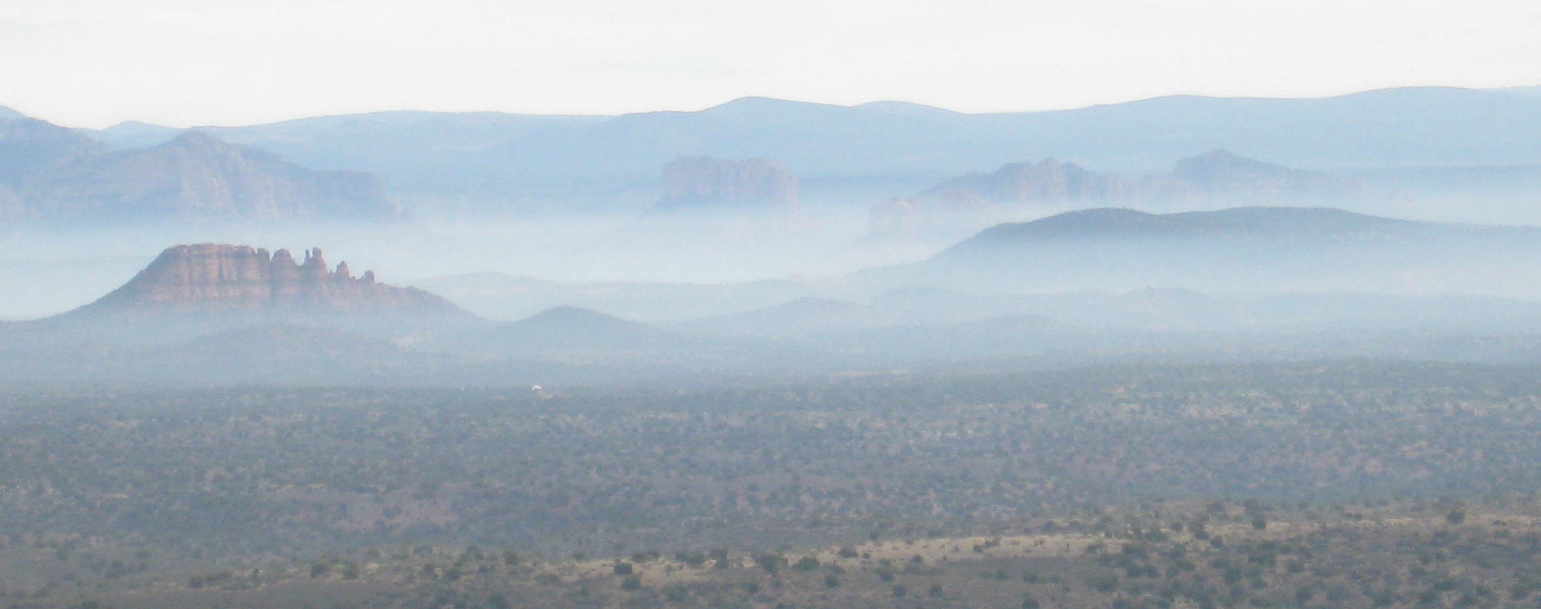
Haze-shrouded Cockscomb (left), Courthouse Butte (center)
and Scheurman Mountain (right foreground) with the
Mogollon Rim in the background
|
We
got several excellent shots of the views as shown following.
 |
Doe Mountain (left), cockscomb), Scheurman Mountain, Rosie’s Volcano
and House Mountain floating in the haze below the Mogollon Rim
(top mountain range) – Photo by John
|
 |
Sugarloaf (center) with Mingus Mountain beyond and Black Mountain
to the right – Photo by George
|
Returning
to the fork and taking the upper road, we found that we were
presented with the same spectacular views. This road ended about
two-tenths of a mile from the fork, and we headed back down the
mountain. As we walked along we were able to look down on the top of
Robbers Roost directly below us with its pools of rainwater collected
in the rock tanks glinting in the sunlight. I wanted to eat lunch
there and, stopping to point out the spot, got agreement from the
rest of the group. We then continued on our way back down the
mountain. As we approached Robbers Roost, we could still view the
haze-shrouded valley laid out beyond our goal.
 |
We stopped to look down at Robbers Roost – Photo by George
|
 |
Doe Mountain, Cockscomb, Scheurman Mountain, Rosie’s Volcano and
House Mountain are lined up above Robbers Roost with the
Mogollon Rim floating just above as a backdrop – Photo by George
|
As
we got closer to Robbers Roost, we could see a road below leading off
to our left that appeared to wind around and pass very near to where
we would begin our climb up the formation. Gordon, John and Linda
decided to take that route just to see how it compared with the
normal trail from the road where we were parked. John took his GPS
and later sent me a track. A comparison of the two different
approaches showed that the alternate route was two-tenths of of a
mile longer; it also involved some bushwhacking.
After
climbing to the top of Robbers Roost we climbed very carefully along
the steep cliff face to reach the cave itself.
 |
Hikers arriving and leaving Robbers Roost Cave
|
The
round window carved in the wall fascinated everyone.
 |
The window – sometimes used by tourists
|
 |
Sometimes by groups of tourists Photograph by George
|
The
cave is quite spacious and has a solid rock wall along the front. At
first glance, it looks like a good place to hole up. However, if one
were a robber it would be extremely difficult to escape once treed
here by a posse. It would take only a few sharpshooters to ring the
entire butte in which the cave is located.
 |
Rock wall fronting the mouth of Robbers Roost Cave – Photo by John
|
Once
everyone was through with the cave we all retired to the top and
settled in for lunch. I found a nice grassy spot for a quick snack
and a nap and some of the group gathered to chat while eating; others
settled in individually at good vantage points from which to enjoy
the views. Robbers Roost has a choice spot for everyone.
 |
The social eaters – photo by John
|
 |
A solitary eater – photo by John
|
As
for me, I slept through it all, not stirring until George came for me
and said that it was time to go.
On
the way back we watched to find where Mooney Trail 12 leaves FR 525C.
I knew that it was somewhere near Black Tank; but was not sure just
where Black Tank was located. We found the trailhead just one and
three-tenths miles from FR 9530, or coming from the other directions,
five and seven-tenths miles from FR 525. I marked the spot for
reference as we plan to hike Mooney Trail in the near future.
My
GPS track disclosed that we had hiked a total distance of three and
one-half miles, that the maximum elevation was 5637 feet and that
our total ascent was 1158 feet.
The track for this hike is shown in red on the included map (below).
The alternate route to Robbers Roost is also shown (see the yellow
track).
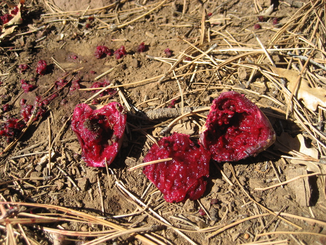
 For
lack of a better name, we call this route Bear Trail for the large
number of rather large bear tracks (right)
we saw during a scouting hike on the trail six weeks earlier.
For
lack of a better name, we call this route Bear Trail for the large
number of rather large bear tracks (right)
we saw during a scouting hike on the trail six weeks earlier.