Friday, January 30, 2015

Powell Spring Trail


The primary purpose of this trip was to verify road conditions between the end of Ash Creek Trail at FR 531 and the beginning of Ash Canyon Trail at FR 123. We are planning a hike down Ash Canyon to Ash Creek and continuing down Ash Creek and Ash Creek Trail to its end at FR 531. We will then drive back to the Ash Canyon Trailhead to retrieve the vehicles left there. Additionally, we are planning a hike on Sheep Trail which starts at Crook Trail west of the Gray Wolf Landfill and runs south to Cienega Creek and wanted to check access to that trail from Hwy 169.

From Cottonwood, we drove east on Hwy 260, took I-17 south to Hwy 169 and continued on Hwy 169 for about 5.4 miles to the intersection with West Cherry Road. There, instead of turning right toward Cherry, we turned left onto S Old Cherry Road and drove 0.4 miles to the Crook Trail crossing. Ample parking is available in the area. As we were turning to head back to Hwy 169, a friendly gentleman of mature years who was camped alongside the road hurried over to provide assistance to the “obviously confused” travelers. We learned that he had stayed overnight in his camper and was now about to sight in a new scope on his rifle. Thankful that we were not hiking in the area today, expressed our appreciation for his offer of assistance and continued on our way.

We returned to Hwy 169, continued west for another 4.9 miles, turned right onto Old Cherry Road (also FR 323) and drove for another 1.9 miles to the intersection with FR 531. From this intersection it is about 2.5 miles up Ash Canyon on FR 531 to the Ash Creek Trailhead. However, having recently driven that road several times, we did not need to verify its condition, so we continued east on FR 323. We found the road from this point on to the intersection with West Cherry Road to be rough but quite passable for high-clearance vehicles. The distance was 3.5 miles. One could avoid this section of rough road by returning to Hwy 169 and driving east to West Cherry Road and turning north. The distance that way is 7.9 miles but is a much easier drive and would probably even be faster.
From the junction of FR 323 with West Cherry Road we drove north for 3.2 miles and turned left into Powell Spring Campground. The purpose of the visit to the campground was to do a scouting hike on Powell Spring Trail, a long-abandoned trail that apparently was once numbered 9027 by the Forest Service. I found one online reference to the trail that gave the trail number and a GPS track. The track was quite obviously estimated rather than being recorded with an instrument. But we could use it as guide.

Powell Spring Campground, built by the Civilian Conservation Corps during the Great Depression, has aged gracefully. Toilet facilities are provided and, like the rest of the facility, were clean and well-kept. A sign was posted precluding the operation of ATVs on the campsite premises. On the other hand an ATV trail appeared to run just across the fence that marked the outer perimeter of the facility. I wondered how that would work; would campers be subjected to the constant roar of ATVs operating just across the fence?

Powell Spring Campground – note the depression era stonework of the table and bench supports

There was only one occupant when we arrived, a gentleman apparently traveling by himself, who “helpfully” provided us with completely erroneous information about how to access the trail. We had parked in Space #1 and had made our way about half way through the campground when he appeared to impart his wisdom. According to him, we needed to return to the information sign near where we had parked and pass between a pair of posts adjacent to the sign. We would then be on the trail. He seemed to know the surroundings well enough, even giving us some additional information about the spring located nearby, so we did as he suggested. Unfortunately, when we had passed between the posts, there was no sign of a trail. Undaunted, we clambered up a small rise, slipped through a barbed wire fence and joined an ATV trail that runs most of the way around the campsite perimeter. We then followed that until we came to a stile in the perimeter fence, the place where we would have emerged without our helpful friend.

The correct route would have taken us past a locked vehicle barrier and on to the stile.

Blocked road at left; trail passage at right

A stile at the upper (west) end of the campground, just to the right of the ancient alligator juniper shown below permits easy passage for hikers. This stile is built like a kissing gate but, rather than swinging, the center piece is stationary. It depends on the narrowness of the passage and a 180 degree turn to prevent cattle from passing.

Ancient alligator juniper with a stile shown to its right

Once through the stile, the trail turns left, crosses a wash and then follows a cattle track a short distance up the opposite bank before dipping into and following along its sandy bed. That set the pattern for the entire hike. Except when we deviated to explore what we thought might be a better way (it never was), we kept mostly to the bed of the washes we followed, occasionally emerging to follow a cattle trail along the bank before returning to the bed of the wash. Once we left the main wash to explore a corral we could see on the mountain slope above. That too was an error, the hiking was more difficult than in the wash and the detour was out of our way.

We climbed gently for about 1.4 miles to a mountain pass located about 0.8 miles south of Medlar Spring. The pass was marked by the remains of a huge dead tree (right).

As we continued westward from the pass the wash sloped gently downhill and its sandy bottom was replaced in some areas with rocks. For a short distance below Walnut Spring, water was flowing and the bottom was muddy in areas. However, despite a few rocks and a little mud, the hiking was never very difficult. As we approached Ash Creek, following a well-worn and easy-to-hike-on cattle trail, we noted that we had deviated significantly from the GPS track. It appeared that we would need to turn rather sharply to the right and climb a hill to reach the end of the trail as indicated on the track. At about the same time we noted what appeared to be an old road running along the slope above, so turned to
intercept it. The old road ended after a very short distance, but I climbed on to the crest of the hill and was able to see where the trail would end. In the photograph (left) the buildings are the headquarters of Bottle Ranch. The trail crosses Ash Creek and ends at FR 531 just to the left of the ranch not far below the end of the row of bare cottonwood trees shown above the ranch buildings.

From my vantage point, it was now obvious that we should have continued along the well-worn cattle trail which would logically have ended at or near the Ash Creek crossing. I later traced the most likely route on to our trails end at FR 531 and found it to be an additional 0.5 miles.

My track to the crest of the hill where I photographed Bottle Ranch is shown in blue on the map excerpt (right). The darker track from the end of the deviation (blue track) on to the junction of the trail with FR 531, a 0.5 mile section, is an estimated track drawn by the author. The light green is the estimated GPS track we used as a guide for the hike. The bright red track is part of our recorded GPS track.

The below photograph shows Collene Maktenieks (left) and Lila Wright (right) returning along the short section of old road that we unwisely left the well-worn cattle trail to follow. They are almost lost in the surrounding expanse of chaparral.

Collene and Lila following an old road along a chaparral-covered hillside

It was now after 1200 and we decided that, if we were to return home by way of FR 132 so as to complete our goal of verifying road conditions between the end of Ash Creek Trail at FR 531 and the beginning of Ash Canyon Trail at FR 123, we needed to start back now. I would just have to estimate the remaining 0.5 miles of Powell Spring Trail. Hence the dark red line on the map insert shown on the previous page.

Because we now had a better grasp of the terrain and could avoid some of the errors we made on the hike from Powell Spring Campground, our trip back was a lot faster. We spent some time on this return hike looking for evidence of past trail-making activities. We did find a few old blazes and some branches that had been trimmed long ago. Otherwise there was little to indicate that the trail had ever existed.

Evidence of long ago trail maintenance
 Ancient blazes showing the way
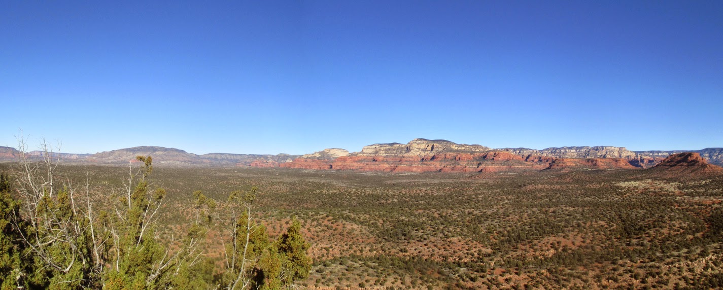
The wash on this side of the pass was sometimes fairly wide and grassy as opposed to the mostly sandy floor enclosed on both sides by close-growing chaparral found on the eastern slope.


Loren Pritzel looking up the wash just below Walnut Spring

On the way up the eastern slope we had seen what we thought might have been an old road (or trail) running along the hillside south of the wash we were following. Then shortly after we started down the wash on the western side of the pass, we had noted what might have been some sort of trail running up a side wash toward the same area. Not wanting to overlook the possibility that the old trail had actually been located above the wash, I insisted that on the return trip we follow the side wash up the hill to investigate. Unfortunately, the old road turned out to have been a mirage. We found only thick chaparral on the hillside where we had imagined an old road.

I corrected sections of track where we deviated from the best route by replacing them with more accurate sections recorded while hiking in the opposite direction. So, for instance, the track recorded on our detour to the corral was replaced by the route recorded on the return trip. Likewise, the detour on the way back to look for an old road was replaced by the track recorded while hiking in the opposite direction.

Although, due to the additional distance added by detours and side trips, we actually hiked about 6.7 miles, the round trip trail distance when cleaned up is only 6.0 miles. The cleaned up GPS track for our hike is shown in red on the included map (next page).

As planned, we returned home by way of FR 132, FR 413 FR 104 and Hwy 89A through Jerome. The road between Powell Spring Campground and Ash Canyon Trailhead on FR 132 was in good condition, suitable for any high-clearance vehicle.


Monday, January 26, 2015

Snoopy Rock and Marg's Draw North


Marg's Draw Trail, according to one source, was “named after a horse that grazed the area in the late 1800s”.1 That surprised me as I had always assumed Marg was a person. The south Marg's Draw Trailhead is located at the end of Morgan Road, about 0.6 miles from Hwy 179. The north trailhead is located at Schnebly Hill Road, about 0.8 miles from Hwy 179. The trail can also be accessed from a spur trail which starts at a parking lot on Sombart Lane, about 0.1 miles from Hwy 179.

For this 24 January 2015 hike we would start at the Sombart Lane Spur and hike 0.5 miles to join Marg's Draw about a mile from its south trailhead. But on reaching the trail we would continue straight across it heading northeast to Snoopy Rock. We would then return to Marg's Draw Trail, using a different route, and follow it on to Schnebly Hill Road. Then to complete our hike, we would return on Marg's Draw and the Sombart Lane Spur to our cars.

We parked in the graveled parking lot on Sombart Lane, donned our gear and crossed the road, heading to a Forest Service kiosk visible directly ahead. Among other things, the kiosk provided a trail map.

Information kiosk at Sombart Lane Spur to Marg's Draw Trail
Just beyond the kiosk we passed through a gate and were in the Munds Mountain Wilderness. As shown in the photograph (right), the first quarter of a mile is quite a steep climb. However, the trail then leveled off and was easy hiking.

Just at the point where the trail levels off at the end of the steep climb from the parking lot, it becomes a bit confusing. The area is heavily used and there are numerous social trails, mostly going nowhere in particular. Luckily, we knew that we must continue generally east and all of the social trails seemed to lead in other directions, so we had no problem and were soon at the junction with Marg's Draw.

Now, we would take one of the social trails that did have a definite destination, Snoopy Rock. Although the trail we wanted was almost directly across Marg's Draw Trail from Sombart Lane Spur, one could easily miss it if not careful. It is offset by about a yard and partly obscured at the beginning by grass. But we knew it was there and continued confidently on our way, soon seeing our goal ahead (left). Snoopy is shown, as so often depicted by Charles Schultz, flat on his back atop his doghouse. His feet are to the left, his nose to the right; the very tip of his nose is white.

The social trail we were following was indistinct in places and, even though I had an old GPS track as an aid, we lost it and wandered around in the wilderness for a while before finding it again.
As I am prone to do when following a GPS track, I had dialed out for an overview of the trail and missed a turn. Someday, perhaps, I will learn to follow the instrument more closely. The rightmost blue line on the map insert (right) shows the route we should have taken. The rightmost red line shows the route we actually hiked. The tracks forking off to the left show the old GPS track I was using as a guide (blue) and the track of our hike today (red).

Our goal was to reach the pass at Snoopy's head and, as we struggled up the steep hillside to that spot, we stopped often to rest and look back at the emerging view behind us. We could look across the floor of the draw below us to the nearby eponymous red buttes and on to Mingus Mountain on the distant horizon. A small section of Sedona was visible just beyond the red shoulder at right.

View to Mingus Mountain on the horizon – as seen from below Snoopy Rock
The wind had been brisk and quite chilly when we started the hike and we expected it to be chillier still and to blow even harder when we reached the pass. To our complete surprise the wind was still and the warm sun made it a most comfortable spot for our morning snack. We lingered for quite some time, basking in the sun and enjoying the view to the north-northwest across Oak Creek and Sedona and into the red rock mountains beyond. Framed by the cliffs on either side of the pass, we had a panoramic view from Chimney Rock on the left to Wilson Mountain on the right, with Capitol Butte (also called Thunder Mountain), Bear Mountain, Soldier Pass, Brins Mesa in between.

Looking across Sedona from Snoopy Rock - photographed by Karl Sink
Our descent from Snoopy Rock was at first along the same social trail that we had followed on the way up. However about 0.2 miles from the top, we came to a fork in the trail. As shown by my old GPS track, the blue line on the map (left), we could take the right fork and intersect the main trail about 0.2 miles further further up Marg's Draw. We chose that option but soon found that the old trail had been blocked off, possibly to protect sensitive vegetation. We continued in the same general direction along a rock ledge and soon were able to rejoin the old track.

Once back on Marg's Draw Trail we headed north, traveling through a forest of pinion pine, juniper and Arizona cypress, with an occasional manzanita thrown in for variety. The trail itself was well-developed and easy to hike.

A typical section of Marg's Draw Trail
We now started to meet other hikers. I think that we must have met around fifteen individuals hiking in small groups of from two to four. As we were in the Munds Mountain Wilderness for the entire hike, we did not meet any bikers.

Although the Forest Service description for this trail indicates that it crosses Schnebly Hill Road and ends at the nearby parking area that serves this trail as well as Munds Wagon Trail and Huckaby Trail, the posted signs indicate that it ends at the road and that Huckaby Trail starts on the other side.
Some of the hikers continued on to the parking area to use the toilet facilities while the rest of us sprawled out in the sun on nearby rocks like so many sun-starved lizards.

When we were all together again we posed for a group photograph.

Left to right: John Veilleux, Sandy Veilleux, Connie Woolard, Rita Faruki, Lucy Acheson, Ed Acheson, Daisy Williams, Joanne Hennings, Anita Jackson, Bill Woolard, the author, Jill Ashworth, Karl Sink, Lila Wright, David Beach, Collene Maktenieks, John Ashworth, Jim Manning and Miriam Sterling – photograph by Name Withheld
Our track is shown in red on the included map (next page). Shown in blue are parts of the old GPS track recorded by the author in 2008.

This hike was 4.9 miles total. The highest elevation was 4952 feet and the total ascent was 1065 feet.


1http://hikearizona.com/decoder.php?ZTN=74

Monday, January 19, 2015

Rosie's Volcano


Fourteen hikers turned out for our 17 January 2015 hike, not as many as last Saturday when we were 18 strong, but more than usual. We normally number somewhere between 7 and 10 and have never had a turnout of more than 21 or 22. We are an informal group with no dues and little in the way of rules. We don't allow dogs because they are just too much trouble on the trail when hiking in groups. Other than that, we just obey such standard rules as avoiding losing contact with the group. This is primarily done by asking each hiker to be aware of the location of the next hiker in line.

For this hike to Rosie's Volcano, an area with a lot of social trails and not one official trail, we would use a tailgater, a hiker who brings up the rear to make sure no one wanders off the trail taken by the main group. Dave Beach and George Everman alternated in performing this task.

I was unable to find any specific information on this volcanic cone but, located about a mile to the north, slightly northeast of the Dry Creek Bridge on Hwy 89A, it is easy. Finding the start of the trail leading to its top is another matter. One continues for another 0.8 miles after crossing Dry Creek Bridge and turns left on the road that runs between Sedona Pines Resort and Sedona Shadows 55+ manufactured home community. The name of the road is Red Moon Drive; however, I don't know that the name is posted in an obvious location. Less than 0.1 mile from the highway one must turn left onto 
Sunset Hills Drive, continue for about 0.4 miles and turn right onto Pine Drive, not obviously marked, at the sign (right). Sunset Hills Drive itself turns slightly left and continues across Dry Creek. Once on Pine Drive you must immediately turn left onto Loop Drive (left). After turning onto Loop Drive continue for 0.1 mile to a small parking and rest area located on the left side of the street. There is room for four vehicles if you squeeze them in tightly. The rest area is clean and orderly like everything else in this well-maintained community.

While we were disembarking and donning our backpacks, a voice greeted us saying, “Have a nice hike.” After some searching we found that the voice belonged to a lady hidden in the shadows on a porch across the street. She then crossed the street carrying a hat that she thought one of the hikers might be able to use. Apparently she was in the process of moving and didn't need it anymore. It was a nice gesture, but we had all brought adequate headgear with us, so we politely declined. Whereupon she hung her hat on a post and left.

A dyke, with a concrete block wall on its top, has been erected along the bank of Dry Creek to protect the community from floodwaters. We needed to cross Dry Creek to reach the volcano so we climbed the provided cross-tie steps (right) to check for a way to the other side.

Atop the dyke, we found a nice walking path, apparently running the entire length of the structure. The concrete block wall served to prevent walkers from falling down the steep bank on the other side and also, I suppose, as an additional protection against flooding. It was immediately obvious that we couldn't safely descend into the wash there, so we turned downstream toward the Sunset Hills crossing where we knew we would be able to descend into Dry Creek Wash. Along the way we could look down onto the neatly-tended back yards (left).

Looking ahead we could see the end of the dyke and a well-worn path leading back up the wash on the other side of the wall.

Walking path and concrete block wall atop the dyke

Just before we turned to descend into the wash we found a very healthy looking prickly pear cactus with odd-shaped leaves (right). Daisy told me it was a variety called cow's tongue or mother-in-law's tongue.

When we had descended into the wash and were headed back upstream, we found a well-worn trail along the wall of the dyke. Along this section of the hike we met a lone hiker out walking two dogs. The hiker gave us a cheery greeting and his dogs were friendly, but each found something to bark at, reminding us again why dogs are not a good idea with large groups.

We had two goals in mind for this hike. The first and primary one was of course to climb to the top of the old volcano. A secondary goal was to visit the small, red butte above the El Rojo Grande Ranch, sometimes known as Wrigley Ranch. We could now see both at a distance . The volcano as viewed from the dyke is shown below.

Rosie's Volcano seen from the dyke along Dry Creek Wash

Looking directly up the wash we could see the red butte marking the El Rojo Grande Ranch (left).

The trail we were following led us on past the area where we had parked and then turned and crossed the wash. Although hardly enough to wet our feet if we tried, we did find water in Dry Creek.

The trail, after crossing the creek, was still well-defined, showing fairly heavy usage by both hikers and equestrians. I did, however, take the wrong fork at one point and did not notice my error until it became obvious that we were deviating widely from a GPS track I had made six years ago. We corrected course and continued toward the saddle just to the right of the volcano (photograph above), judging that the climb from there would be less precipitous than elsewhere. At least part of the way we found that we were following along the track of an ancient wagon road.

Dave Beach, an avid bird watcher, had brought his binoculars and a birding book along to see how many birds he could identify. For the climb from the saddle, to avoid having the main party of hikers scare the birds away before he got a chance to see them, he went on ahead with one other hiker. The rest of us brought up the rear, pausing at each fork in the trail to let the slower hikers catch up and make sure we all kept to the same trail

After a stiff climb we all arrived at the top and settled in to enjoy the view while having an early lunch.

Left to right: Miriam Sterling, Pat McCue, Joanne Hennings, Dave Beach, Daisy Williams, John Ashworth, George Everman, Jill Ashworth, Anita Jackson, Lila Wright, Connie Woolard, Dolly Yapp and Karl Sink – photograph by the author
The below photograph shows the view from Mingus Mountain southwest of us to Black Mountain in the northwest. The mountain in the near distance with the pipeline scar running along its shoulder is, according to Google Earth, Windmill Mountain. Just a bit of Sycamore Gap is visible at the far right.

Mingus Mountain to Sycamore Gap as seen from atop Rosie's Volcano

Below is the view of red rock country from Sycamore Gap (just a sliver of Black Mountain shows at the extreme left) in the northwest to Cockscomb slightly northeast of our viewpoint. Lined up along the way, left to right are: Casner Mountain, Loy Butte, Bear Mountain and Doe Mountain (the flat-topped mesa just to the left of Cockscomb).

Sycamore Pass to Cockscomb from atop Rosie's Volcano

After lunch we headed back down the trail. Several of the faster hikers went on ahead with the agreement that they would wait for us on the saddle. We would be leaving the trail we had hiked in on just below the saddle so as to visit the small butte at El Rojo Grande Ranch. On a previous hike to the butte, we had come out between the butte itself and the red rock outcroppings behind it. But that was a pretty strenuous hike that so far as I could see yielded no advantage over hiking along a fairly distinct trail that would allow us to come out on top of the outcroppings. After all we certainly had no intention of actually climbing the butte and the top of the outcroppings looked to be easily accessible. So it was that we struck out cross country to connect with the trail that would take us there.

Although we probably expended some unnecessary effort by bushwhacking instead of just continuing along the trail we were on until it intersected with the one we wanted, we did find the trail and followed it to a saddle behind the outcroppings. The trail continued through the saddle and probably ended down below at the El Rojo Grande Ranch, but we turned off at the crest and had a fairly easy climb on up to the top. We could now look across a narrow, separating saddle to the red, cylindrical butte and also directly down onto the ranch headquarters buildings.

According to a July 2007 article in the Phoenix Business Journal1, the 173-acre ranch is no longer owned by the Wrigley family but was sold due to a divorce. The article goes on to say that before selling the property one of the Wrigley heirs built a 6,700 square foot circular house there in 1994. The modern-looking stables were probably also constructed then. Sometime after that, the ranch was sold to members of the Hills Brothers Coffee family and was again listed for sale, in 2007, for $29,000,000. The article called it the El Rojo Grande Ranch while Google Earth labels it Dos Leos Ranch but also includes the name El Rojo Grande Ranch on the road leading to it.
We returned using the same trail we ascended on, but continued on past the point where we had joined it before. It led us into a saddle between the butte and a smaller outcropping just below. From that saddle we had our best view of the ranch. We could see very little of the house, located just right of center directly below Scheurman Mountain in the photograph below. Just to the left of the main house is what appears to be the caretakers house and just below that is a large green-roofed building, probably a barn. To the right of that, hidden by the trees, are two additional structures, matching the large building in style, that we presumed to be stables. Below and to the left of what I have called a barn can be seen a green meadow with a cluster of sheltered picnic tables located at its edge. Although the ranch is obviously set up as an equestrian facility we saw nothing to indicate that horses are presently stabled there.

El Rojo Grande Ranch

In summary, this appears to be a meticulously well-maintained “horseless” ranch that could be called Wrigley Ranch, Hills Brothers Ranch, El Rojo Grande Ranch or possible even Dos Leos Ranch.
We next turned our attention to the slender red butte. I had hoped that someone would be able to provide a name for it, but even Lila who has spent most of her life in the area didn't know. It has a very distinctive nose when viewed from the southwest, so we decided to just call it “Who Nose” Butte.

Who Nose Butte at El Rojo Grande Ranch


We followed the trail we were on down the spine of the hill until we intersected with Dry Creek Wash at the upper end of the dyke. We then continued down the wash to the lower end and exited where we had entered. As can be seen by the messy looking track at the bottom of the included map (next page), we returned to the parking area by way of Loop Drive rather than along the top of the dyke.

The red line is our GPS for this hike. The short blue line to the left of Who Nose Butte shows a path to take that should avoid bushwhacking altogether.

This hike was 4.0 miles total. The highest elevation was 4654 feet and the total ascent was 1126 feet.


1http://www.bizjournals.com/phoenix/stories/2007/07/16/daily8.html

Sunday, January 11, 2015

Oak Creek/Verde River Confluence


We hiked to the Oak Creek/Verde River confluence on 10 January 2015. From Cottonwood, we drove north on Hwy 89A, turned right on Cornville Road, continued for about 2.2 miles, turned left onto Forest Road 9816 and parked just through a gate. We had an unusually large group of hikers and I decided to gather them for a group photograph while we were still all together at the trailhead.

Left to right: Chris Jensen, Collene Maktenieks, the author, Terry Johnson, Joanne Hennings, Leon Girdner, Daisy Williams, Anita Jackson, Jim Manning, Joyce Arregui (front), Tamura Laue (middle), Karl Sink, Lila Wright, George Everman, David Beach, Gilliam “Jill” Ashworth and John Ashworth – photograph by Name Withheld.
We left the FR 9816 parking area, walked across Cornville Road, passed through a pedestrian gate on the other side and headed south on FR 9806D, a road now closed to motorized traffic. A sign clearly stated that the road was open only to hikers, bikers and equestrians.

The weather report had called for a 50% chance of rain and, although the sun was flirting with the clouds and occasionally even peeking through, we all knew that we were likely to be donning raingear before the hike was done. Our assorted raingear ran the gamut from at least one raincoat through a variety of ponchos and a lone plastic garbage bag which, by the way, works very well for keeping dry.

I hiked near the rear of the group because, with such a large group, we needed someone to make sure we didn't lose a hiker along the way. An additional benefit was that I could make frequent stops to view and photograph our surroundings. I climbed a small hill just off the trail to a good viewpoint for the following scene. The photograph below shows Mingus Mountain at the left (west). At the right (northwest) Black Mountain and Casner Mountain with Sycamore Gap in between can barely be discerned through the ever more threatening cloud cover. This again brought home the notion that we would surely need our raingear before this hike was done.

View to the west and northwest – Mingus Mountain to Casner Mountain

None of us had hiked this way for several years and we were a little unsure about the best route to take, so we just followed the road. Unfortunately, there were too many roads to choose from and we made a wrong turn about 1.3 miles from the start of the hike. This added close to an extra mile to the hike. When our error became apparent, we changed course and soon were back on the correct road. But, even following the correct road, the one that leads most directly to the conjunction, involves a lot of unnecessary steps for hikers. We later found that by following the road, and including the extra mile added by taking the wrong road, we had hiked 6.1 miles to reach the conjunction. We resolved to correct those errors on the way back.

Eventually, we were close enough that we could see our goal, or at least the general area, including the Thousand Trails RV park just beyond it and across the river.

Looking beyond the conjunction to RVs lined up in the park across the river, just left of center

But we still had a wide loop in the road as it turned east and made its way along a ridge and descended into the Oak Creek Canyon. Although we could see that the road was taking us out of our way again, it was not yet apparent just how much additional hiking that would entail. I measured later and found that we had gone a full extra mile by following the road.

As we approached the conjunction we came to another fork in the road. We turned left so to pass by some ruins located high above Oak Creek. The road we followed led directly to the ruins; however the ruins themselves are located on private property and are posted to prevent trespassing. Below is shown a view from the road.

Ruins near Oak Creek/Verde River confluence

As can be seen from a different angle, specifically from the road farther up the river, there are numerous caves in the cliff just below the visible portion of the ruins. It must once have been a quite sizable settlement.

Just beyond the closed-off entrance to the ruins the road ends but a trail continues on, following closely along the cliff rim above the creek. This trail is quite rocky and steep in places and on this day included a climb up a slick muddy bank to reach the cliffs above the juncture. There is, however, an alternative; if we had continued straight ahead instead of turning toward the ruins at the last road fork we would have come out atop the cliff, just where we wanted to be. The map insert (right) shows these details.

As we made our way along the cliff above Oak Creek toward the river, we could see the creek below and the opposite side of the river between Thousand Trails RV Park (barely visible on the left) and Alcantara Vinyards and Winery (just out of sight on the right).

Looking down Oak Creek and across the Verde River

There are two distinct levels to the cliff at the juncture. The view shown here is of the lower level as seen from the upper one. It rather reminded me of looking down on the bow of a ship from the wheelhouse. Oak Creek flows in from the left and the Verde River brushes the right flank. The prominent land feature on the distant, southern horizon directly ahead is Squaw Peak.

The “bow” between Oak Creek (left) and the Verde River (right)

I descended to the lower level, the “bow” so to speak, for lunch. Looking back up the river from there I had a view along the cliff face of the smoothly flowing river and Mingus Mountain, now partly obscured by a rain shower, in the distance.

Looking north up the Verde River

After some discussion it was decided that six of the hikers would remain in the area while the while the other twelve would hike back to the trailhead. Those who had hiked back would then drive down Tissaw Road, turning from Cornville Road, at Verde Santa Fe to pick up those who had chosen to wait.

As it turned out, the rain began almost at once and, according to reports, much harder along the river where we had left the six hikers than for those of us who chose to hike back to the trailhead. Chilly and uncomfortable, they chose not to wait and had a friend pick them up and deliver them back to Cottonwood, notifying our leader of the change by cellphone.

Meanwhile, those of us returning to the trailhead were soon donning our raingear. We were touched by rain twice on the way back, never very hard but enough for a thorough soaking without raingear.

We did, as planned, take a shorter route back by climbing directly up two hills and avoiding the error we made by taking the wrong road on the way in. As a result, our return trip was only 3.7 miles instead of the 6.1 miles for the trip in.

This hike, based on our return track, is 7.4 miles round trip. The highest elevation was 3588 feet and the total ascent was 626 feet.

Our track is shown on the included map (next page). Our return track is shown in red. The hike to the conjunction is shown in blue but is covered by red except for those areas where the two deviate. The mm 2 notation near where we parked indicates mile marker 2 on County Road 30 (Cornville Road).

The turnoff onto Tissaw road is approximately one mile to the west of where we parked. The road is clearly signed.