On
Tuesday, 03 May 2011, four members of the Skyliners Hiking Group
(Donna Goodman, Dolly Yapp, Gordon Bice and the author) set out for a
three-day backpacking trip down Paria Canyon. Not considering
ourselves to be experienced backpackers, we had spent a lot of time
and effort preparing for the trip. We made multiple 15 mile long
hikes around Cottonwood and actually camped out one night at Twin
Springs on Mingus Mountain, all to ensure that we and our gear were
up to the task.
We
gathered at Gordon’s house at 0800 on 3 May and left for Page, AZ
where we would spend the night at the Super 8 Motel before starting
our trip down the Canyon. We detoured to Lees Ferry on the way to
Page to leave Donna’s truck in long-term parking at the lower end
of the Paria Trail. We then drove in Gordon’s vehicle on through
Page to the Paria Check in Station at White House, UT to pick up our
human waste bags (provided free by BLM and required for the narrows
section of the canyon). After receiving our human waste bags and
getting an up to date report on conditions in the canyon, we returned
to Page and checked into our motel before enjoying an early dinner at
Strombolis. The next morning, Dolly and Donna at breakfast at the
motel while Gordon and I ate at the Ranch House Grille. We then
departed for the Paria Canyon Trailhead where we would leave Gordon’s
vehicle in the long-term parking area until we completed our trip
down the canyon to Donna’s vehicle waiting at Lees Ferry.
Several
other Skyliners (Lila Wright, Kwi and Lynn Johnson and Daisy
Williams) were camping and hiking in the area. We met them at the
trailhead and Lila took the following picture (below) for us just before we started our hike.
Note
that Dolly's backpack is so big and sticks up so far over her head
that it appears she is being followed closely by another hiker. For
the next three days, whenever I looked back to make sure there were
still three hikers behind me, I invariably counted four.
 |
| Left to right: Gordon Bice, Ellis Price, Dolly Yapp and Donna Goodman – Photograph by Lila Wright |
We
left White House at 0820 (Arizona time) on 4 May and almost
immediately found ourselves wading across the river. I had been told
that this section of the river was likely to be dry; however, we
found that it was at least ankle deep.
 |
Donna, Dolly and Ellis fording the river – Photograph by Gordon Bice
|
Descriptions
of Paria trips tend to pretty much start at the “narrows,” five
to six mile section of the canyon that is very narrow with steep
sides hundreds of feet high and no easy way to escape in case of a
flash flood. However, we found some pretty spectacular scenery in
the four miles leading to that section.
 |
| Random shot of the way ahead as we approached the narrows |
By
0926 we were at mile 2 of our hike and by 0942 were passing under the
power lines that cross the canyon before the start of the narrows.
We continued for just over another mile to enter the narrows around
1100.
 |
| Near the beginning of the narrows – Photograph by Donna Goodman |
The
narrows is usually described as being five to six miles long, which
would have it ending about ten miles from the White House Trailhead.
On the other hand, one hike report that I read
(www.arizonahikingtrails.com/hikingpages/pariacanyon.html)
has it ending 16 miles below White House, making it 12 miles long. I
am using the five to six mile figure and assuming the narrows
officially ends somewhere around ten miles from the trailhead. In
any case, it is a section of the canyon that is very narrow with
steep sides hundreds of feet high and with (usually) no way to escape
in case of a flash flood. There are a few places along the way where
one could scramble to higher ground; however, being near one of these
would be a matter of pure luck.
The
Hikers Guide to Paria Canyon published by the Bureau of Land
Management and available at the entry station for $9.00 also shows
three possible camp sites in the narrows, one about one half mile
below the Buckskin Gulch Confluence with no fresh water available,
one just past the nine mile point with an intermittent spring and one
just before the ten mile point with a reliable spring.
As
we entered the narrows, wading back and forth across the ankle- to
calf-deep river, we were awed by the overpowering grandeur of the
scenes that unfolded before us. The sheer size of everything was
overwhelming and it was mind boggling to see the shapes sculpted by
water in the colorful rock.
One
of the first sights pointed out in the BLM guide was Slide Rock Arch,
a chunk of rock that broke off the wall above and now stands on the
canyon floor forming an arch with the wall itself.
 |
| Slide Rock Arch – for perspective note Donna (tiny figure pointed out by red arrow) – Photograph by Gordon Bice |
We
arrived at the Buckskin Gulch junction, about a quarter of a mile
downstream from the arch, at 1325 and lingered in the area for about
thirty minutes.
 |
Gordon standing in Paria Canyon at the mouth of Buckskin Gulch
|
 We
had no intention of camping in the narrows and I really did not
notice any of the three suitable spots shown on the BLM Hikers Guide.
I did, however, note the abandoned meander or oxbow (see
photograph at right),
which indicated that we were within about a mile from our intended
camp-site at Big Spring. We reached the campsite at about 1730. We
had traveled twelve miles on our first day of hiking and were right
on schedule.
We
found a party of six, traveling with three dogs, already at the
campsite. However it was large enough to handle us all with no
problem and we selected a comfortable spot away from the other group,
dumped our packs, and set out to the spring on the other side of the
river to collect water. We had enough containers, including my
two-gallon nylon bucket (provided by my daughter, Diana) that we
would have to make only one trip to collect enough water for the
night and to take with us the next day.
Additionally,
Donna and I each had carried a spare bladder; we filled these and
treated the water with chlorine dioxide pills, letting them sit
overnight for use on the trail the next day. I carried an extra
liter of water in a Nalgene bottle all the way from the start of the
hike, finally using it on the last day when the temperature reached
ninety-five degrees. We were all carrying freeze-dried meals that
could be prepared by dumping boiling water directly into the pouch.
By eating these meals directly from the pouches they came in we
eliminated the need for plates and, because the water had to be
boiled anyway, we could use otherwise unpurified water.
Gordon
and I were both carrying stoves. My stove burns propane while
Gordon’s uses white gas. He was more adept at stove operation than
I and also had a larger pot for boiling water. As a result he
provided most of the boiled water. I did manage to use my stove
enough to prepare my own meals and the hot tea that I drank at night
and in the morning as well as the thermos and mug of tea that I
normally carry with me when hiking. In short Gordon handled three
people with his stove and I took care of myself.
 |
Gordon and Ellis in camp at Big Spring – Photograph by Donna Goodman
|
 |
Donna and Dolly in camp at Big Spring– Photograph by Gordon Bice
|
The
weather was great for camping and I think we all slept pretty well.
I climbed into my sleeping bag at dark, turned over a few times and
thru the night.
We
awoke at daybreak to a fairly chilly morning at our location deep in
the canyon where the sun is late arising. My first thought was: “Oh
no, it is really going to be chilly wading this morning.” However,
by the time we had coffee (tea for Dolly and me), ate our breakfast
and broke camp the sun was peering over the rim in places and the wet
hike ahead didn’t look quite so bad. We got an earlier start than
the other group camped at Big Spring and were on our way at 0740.
Gordon
and I usually hiked ahead, taking turns leading, with Donna and Dolly
lagging a bit behind. I learned that there is a disadvantage to
leading a hike down Paria. The leader may step into a deep hole in
the muddy water or get mired in the sand or mud. Those following
then know to avoid that route across the stream. It was all rather a
guessing game, as the water was a deep muddy brown color from all the
silt it carried and it was impossible to see anything below the
surface. This is where I found a hiking pole to be of great benefit;
in addition to helping one to stay upright, it could be used as a
sounding device to detect deep or otherwise treacherous spots ahead.
At
one point, even after having carefully sounded the area ahead, my
foot became stuck in a mud bank and I fell forward, barely catching
myself to avoid complete immersion in the muddy stream. My fellow
hikers gleefully declared me to be the winner of the “first to fall
in the water” lottery. Luckily none of them were alert enough to
get a picture of the event. In the below photograph I am shown later
carefully sounding the water ahead as I pick a safe route cross the
stream.
 |
Ellis sounding his way across the river – Photograph by Donna Goodman
|
Below
are a few examples of what we saw between Big Spring and Judd Hollow.
 |
| Donna and Gordon heading down the canyon below Big Spring – Photograph by Dolly Yapp |
 |
Looking ahead down the canyon below Big Spring
|
 Not
too far down stream, after we had stopped for a rest break, the other
group that had camped at Big Spring caught up. Their three dogs
(Photograph
at left, by Donna Goodman)
were trotting happily along carrying their own backpacks.
Not
too far down stream, after we had stopped for a rest break, the other
group that had camped at Big Spring caught up. Their three dogs
(Photograph
at left, by Donna Goodman)
were trotting happily along carrying their own backpacks.
We
paused for a few minutes to let the other hikers get ahead of us and
didn’t see them again until we reached Judd Hollow. They were
leaving there just as we arrived.
The
canyon had widened somewhat and the Judd Hollow area seemed quite
expansive after traveling through the narrows and the still rather
restricted seven-mile section below Big Spring. I found a nice shady
spot on the bank of the river and just relaxed, very nearly getting
in a quick nap.
 |
Judd Hollow in Paria Canyon
|
 Judd
Hollow is the site of an old pumping station (See
photo at right),
intended to pump water to the plateau above. Although we didn’t
locate it during this trip we have been told that an old trail, built
by the pump’s owners, leads up the north wall of the canyon
somewhere nearby. From information gathered later, I suspect that
the trail may be about a mile upstream. This is based on the belief
that the pump was originally installed at that upstream location
during a drought in the 1930s. Apparently the drought ended just as
the installation was completed and the owners never used it. It is
said that it sat unused until the late 1940s when it was sold to
another party who moved it by horseback to its present location. It
was tested, but never placed into service by the new owner. (This
information was obtained from:
http://www.clubtread.com/sforum/topic.asp?TOPIC_ID=23471)
Judd
Hollow is the site of an old pumping station (See
photo at right),
intended to pump water to the plateau above. Although we didn’t
locate it during this trip we have been told that an old trail, built
by the pump’s owners, leads up the north wall of the canyon
somewhere nearby. From information gathered later, I suspect that
the trail may be about a mile upstream. This is based on the belief
that the pump was originally installed at that upstream location
during a drought in the 1930s. Apparently the drought ended just as
the installation was completed and the owners never used it. It is
said that it sat unused until the late 1940s when it was sold to
another party who moved it by horseback to its present location. It
was tested, but never placed into service by the new owner. (This
information was obtained from:
http://www.clubtread.com/sforum/topic.asp?TOPIC_ID=23471) |
The old pump in Judd Hollow showing the suction line – Photograph by Gordon Bice
|
We
left Judd Hollow at 1135, having spent about half an hour resting and
looking around. We were over seventeen miles into our journey down
Paria Canyon and had another eight miles to go to reach our next
campsite at Last Reliable Spring (both a name and a description) just
beyond the twenty-five mile point. On the way there we planned to
stop at Wrather Canyon and, perhaps, hike up to see the arch.
 We were now seeing more
and more areas where the canyon was wide enough that trees could grow
alongside the stream (a
fact also noted by beavers living in the area as evidenced by the
gnawed off limb shown at left) and, although we
were still spending much of the time wading, the hiking was now quite
pleasant. Several additional photographs of this section of the
canyon are shown below.
We were now seeing more
and more areas where the canyon was wide enough that trees could grow
alongside the stream (a
fact also noted by beavers living in the area as evidenced by the
gnawed off limb shown at left) and, although we
were still spending much of the time wading, the hiking was now quite
pleasant. Several additional photographs of this section of the
canyon are shown below. |
| Looking down Paria between Judd Hollow and Wrather Canyon – Photograph by Gordon Bice |
 |
| Looking down Paria between Judd Hollow and Wrather Canyon – Photograph by Dolly Yapp |
We
did find the Hole, located just downstream from mile point 19;
however, no one thought to take a picture of the formation, and we
continued on to Wrather Canyon, arriving about 1350.
 |
| Wrather Arch – Photograph by Gordon Bice |
We
lingered in the area for most of an hour while Dolly and Gordon hiked
up Wrather to see the arch and Donna and I cleaned sand from our
shoes and amused ourselves by watching the antics of a large lizard.
While
we were at Wrather Canyon a young lady named Korinda arrived
traveling upstream and asked whether we had seen her companions, an
older couple. She had traveled on ahead to make some side hikes and
was quite angry that they had not met her at the time and place she
thought they had agreed on. In exasperation she had left her
backpack alongside the trail at Shower Spring in case they arrived
and hiked on up to see Wrather Arch. Amusingly enough we later met
the “lost” older couple, also a bit irritated, and learned that
from their perspective Korinda had not complied with the arrangements
made when they separated.
Leaving
Wrather Canyon we found at last a short section of real trail, a
discernible trail with real soil instead of rock, sand or gravel, and
with grass growing on both sides. It really didn’t last very long
before we were once again wading the river. Nevertheless, after a
day and a half of wading the river interspersed with short stretches
of sand, gravel and rock, a bit of real trail, however brief, was a
real pleasure and Donna rushed ahead to enjoy it.
 |
A real trail at last – Photograph by Dolly Yapp
|
We
arrived at Shower Spring at about 1530 and found the other group from
Big Spring already there preparing to set up camp for the night.
Since we planned to hike for another three miles and camp at Last
Reliable Spring, we did not linger there for very long but pressed
on. By camping at Last Reliable Spring we would have only thirteen
and a half miles to go on our last day of the hike. We had
considered going another mile and a half and camping for the night at
Bush Canyon. But that would have required us to hike half a mile up
the canyon to collect water and also would have meant setting up camp
after dark. We decided it would be wiser to stop at Last Reliable
Spring and turn in early for a good night’s sleep. We were all
expecting the last day of the hike to be the most difficult. It
would be about thirteen and a half miles as opposed to twelve miles
the first day and thirteen the second. In addition, the temperature
was expected to be in the middle nineties and we would need to carry
extra water simply because of that. We also wanted to make sure we
had a little extra in the event of an accident that required us to
stay over an extra night.
 |
| In Paria Canyon between Shower Spring and Last Reliable Spring – By Donna |
 |
| In Paria Canyon between Shower Spring and Last Reliable Spring – Photograph by Gordon Bice |
 |
| In Paria Canyon between Shower Spring and Last Reliable Spring – Photograph by Donna Goodman |
 When
pausing to look back and make sure that everyone was still with us, I
was often confused by Dolly’s “bigger than she is” backpack.
Protruding above her head as it did, it appeared at first glance to
be an additional hiker (Photograph
by Donna Goodman at right).
When
pausing to look back and make sure that everyone was still with us, I
was often confused by Dolly’s “bigger than she is” backpack.
Protruding above her head as it did, it appeared at first glance to
be an additional hiker (Photograph
by Donna Goodman at right).
We
arrived at Last Reliable Spring at 1755. The spring is across the
river from the campsite, so we quickly selected a good spot to set up
camp, dumped our backpacks, gathered our empty containers and headed
across the river to collect enough water for cooking that night and
to fill our containers for the hike out the next day.
The
spring is no gusher; the water runs out of the cliff face in a series
of small rivulets. With my nylon pail, I was able to catch two of
the rivulets at once. Even so, it took me several minutes to collect
a bit over a gallon of water. When I had collected all I could
comfortable carry I could find no place at the spring to hang the
collapsible bucket, so I headed back across the river to hang it on a
branch at our campsite, leaving the others to finish filling the rest
of the containers.
My
spare bladder was still across the river with the others and knowing
that they would have their hands full carrying everything back, I
headed back to help. That was when I suffered the most embarrassing
incident of the hike. I was carefully feeling my way across the
stream with my hiking pole when I sounded a deep channel ahead, a
channel that surely would have come up to my crotch. Donna was just
approaching from the other side with a load of water and I stopped to
direct her further downstream to a shallower crossing. I didn’t
realize that my feet were slowly sinking into a mud bar until I
started to back up to move down to the shallower crossing myself. My
upper body backed up, but my feet remained firmly planted in the
sucking mud and I sat down in the middle of the river.
Luckily
I had placed my wallet and cellphone, carried in a zipped pants
pocket, in plastic baggies and they were unscathed. On the other
hand I was soaked to my waist, it was after sundown and getting
rather chilly to be wearing wet clothes. Then, as we were returning
to camp with the rest of the water inspiration struck. My pullover
nylon windbreaker would make a perfect kilt. On reaching camp, I
quickly retired behind a clump of bushes, removed my pants and
underwear and slipped into my kilt, hanging my wet clothing up to dry
in the gentle breeze. Everyone laughed at my attire, but no one
thought to break out a camera. In short, I suffered some temporary
discomfort and a bruised ego but escaped the ignominy of a permanent
photographic record.
We
quickly set up camp, prepared our meals and turned in for the night.
My underpants were already dry and I restored my windbreaker/kilt to
its normal place for the night … pulled over the bottom of my
sleeping bag to keep my feet warm.
The
camp photographs shown below were taken the next morning after
everyone remembered that we had cameras.
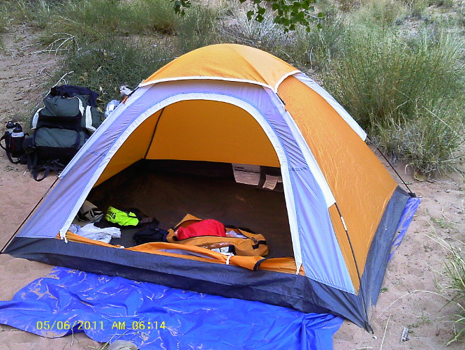 |
Donna’s Tent – Photograph by Donna Goodman
|
 |
Dolly’s Tent – Donna is just stowing hers – Photograph by Gordon Bice
|
 |
| Cooking area after a water spill – Photograph by Donna Goodman |
 |
| Dolly eating breakfast – the spring is located at the bottom of the cliff across the river directly above Dolly’s head – Photograph by Gordon Bice |
 |
It must be the Clampetts – Photograph by Gordon Bice
|
By 0620 we had broken
camp and were headed on down the canyon.
 |
| Looking on down the canyon from the campsite at Last Reliably Spring |
At
the bottom of the small hill we had been camped on, shown in the
lower right of the above photograph just at the dividing line
between and shade and sun, we found a stream descending from a
spring above. It had a much stronger flow than the spring we had
used, although I don’t know whether that is always the case.
Passing the spring we continued on a well-defined trail running
along the bank above the river. A short distance downstream from
our campsite Gordon went ahead and took the below picture looking
back up the canyon. Donna and I were looking ahead trying to find a
trail that would keep us on the bank.
 |
| Do we really have to cross the river again just yet? – Photograph by Gordon Bice |
Our
fears of getting wet again in the chill of the morning were soon
relieved and we found that from this point the trail followed along
the bank of the river, sometimes climbing high above it in order to
navigate over old, weathered rock slides. We joined the high water
route at mile point 28 without again crossing the river. The going
was fairly rough in places requiring a good deal of climbing over
the ancient rock slides along the way, and sometimes we looked back
and found that we had taken the more difficult route when an easier
one was available. Even so we still made pretty good time.
The
canyon soon opened up enough that we had views all the way to the
peaks on the other side of the Colorado. The country ahead was
strikingly beautiful as we emerged into more open country from the
confines of the canyon. In the photograph below the trail is
crossing an old rock slide area and the river itself is to the left.
 |
| Looking ahead along the high water route – Photograph by Donna Goodman |
Somewhere
along the way we came upon the most gorgeous primrose I have ever
seen.
 |
| Primrose growing in south Paria Canyon |
Meanwhile
the sun rose higher in the sky and, no longer sheltered by close
canyon walls and with no trees for shelter, we began to feel the
heat. Finally we found a large rock that offered enough shade and
stopped for a snack.
 |
| Seeking shade for a snack break – Photograph by Dolly Yapp |
 |
| Looking down the long, hot valley toward Lees Ferry – Photograph by Gordon Bice |
Just
past mile point 30 the trail crossed the river for the first time
this day. This was the first of some fifteen to twenty crossings
during the last eight or so miles to Lees Ferry, but now it was hot
enough that we welcomed the crossings as a chance to cool off.
Along the way I learned that there is at least one advantage to
leading a hike down Paria Canyon. If the leader can manage to get
ahead of the group when a crossing is coming up, he is able to stand
in the cool water and wait for the rest of the group to catch up.
We paused occasionally along the way to rest.

Ellis resting – Photograph Donna resting –
by Dolly Yapp Photograph by Dolly Yapp

Gordon
resting – Dolly resting –
Photograph by DollyYapp Photograph by Gordon Bice
Gordon
and Dolly don’t seem to fully grasp the concept of resting.
Gordon is busy marking up his map and Dolly is rearranging her pack.
Just
past mile point 33 we came to the old Wilson Ranch. We found a
solid stream of water flowing across the trail from a spring
somewhere above. I looked closely at the National Geographic Topo
Map loaded in Google Earth and found that it includes a spring at
that spot. I then did a quick Internet search and found the
following information at “AwayFromtheGrind.com:”
There
is water at Wilson Ranch but it flows through soil and where it
collects it is sitting out in the sun.1
The
water we saw was clear and looked quite fresh, so I think the author
of the piece above may have been drinking pond water.
Wilson
Ranch is only about five miles on to Lees Ferry and, refreshed by
the frequent river crossings along the way, it didn’t take us very
long to get there. Approaching the sign out box we found a couple
of old buildings along the way, one apparently an outhouse, and
following the sign out box, a sign pointing us to Lonely Dell Ranch.

Outhouse – Photograph Sign pointing to Lonely
by Dolly Yapp Dell Ranch
As
we approached the house and orchards at Lonely Dell Ranch we passed
an old cemetery (Photograph below)).
 |
| Near the finish now – Dolly, Gordon and Donna at Lonely Dell Ranch and still standing |
We
made the trip right on schedule and were at the parking lot at 1640.
As we had anticipated, GPS coverage was spotty in the canyon and I
did not get a good track. However, since one cannot go wrong when
hiking Paria, it really doesn’t matter.
We
drove back to Page where Donna and Gordon dropped Dolly and me off so
that we could clean up while they drove on to the Paria Trailhead at
White House to retrieve Gordon’s vehicle. After they returned and
Gordon had a chance to shower, he, dolly and I ate a late dinner at
Bonkers Restaurant. We then got a good night’s sleep and were back
in Cottonwood by noon the next day.
Finally,
having found the following chart (next page)
helpful in preparing this report I decided to include it for
information:
Miles landmark
2.5 Power
lines cross over the canyon
4.0 The
narrows begin
7.3 Confluence
with Buckskin Gulch
7.5 Camp
9.4 Camp
and spring (river right)
10 Spring
(river right)
11.3 Abandoned
Meander (oxbow)
12.2 Big
Spring (river right) and camps (river left)
12.8 Camp
14.7 Camp
17.4 Judd
Hollow Pump (river left)
18.4 Spring
(river right) and camp (river right just past the spring)
19.2 'The
hole' (river right) and camp (river left)
20.5 Camp
(river left) and mouth of canyon that leads to Wrather Arch (river
right)
22 Shower
spring (river left) and camp (river right)
25.3 Camp
(river right) and last reliable spring (river left)
26.5 Camp
(river right) at mouth of Bush head canyon. There is also a spring if
you hike about 0.5 miles up the canyon.
28.0 Camp
(river right) and start of high water route (river right)
30.3 Camp
(river right)
31.5 Petroglyphs
33.5 Wilson
Ranch
37.3 Trail
register
37.6 Lonely
Dell Ranch
38.4 Lees
Ferry long-term parking area
From
a Weekend Warriors posting on:
http://www.arizonahiking.org/paria_main.htm
NOTE:
After reading the conflicting opinions as to where the narrows start
and stop I decided to query BLM and received the following response:
From:
"ASFOWEB_AZ@blm.gov"
<ASFOWEB_AZ@blm.gov
To:
Ellis
Price
<ellisprice@ymail.com>
The
Paria
Narrows start at Slide Rock about 1 mile before the confluence and
runs about 1 mile past the confluence.
David
Hullum
Recreation
Technician
Vermilion
Cliffs National Monument
No comments:
Post a Comment