Saturday, March 31, 2012

Flume Trail


On 31 March 2012, we left Cottonwood and drove through Camp Verde on Hwy 260, turned right on Fossil Creek Road (ten miles from the Hwy 260/I-17 interchange at Camp Verde) and continued for another 16.5 miles to arrive at the Flume Creek Trailhead.  We crossed Fossil Creek Bridge about 1.1 miles before reaching the trailhead.  We also passed another small parking area on the left of the road before we reached the trailhead.  The correct spot s distinguishable by the open space that once contained buildings across the creek.  There is limited amount of parking at the trailhead, so plan on an early start in order to beat all the visitors from Phoenix.  However, if you do find the lot full, there are other parking facilities a short distance ahead that might not yet be filled.  I repeat, get there early.  From what I saw, any time before 0900 should count as early.
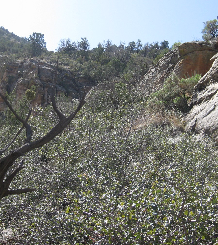
The picture below shows the crossing (just to the left of the sign) and the open space across the creek.  Note that the people in the creek are standing on a wide concrete walkway that is covered by just a few inches of water, making crossing a breeze.

Looking across Fossil Creek from the Flume Trail parking lot 
- Our cars are parked to the left
One can also normally access this trailhead by driving in on Fossil Creek Road from Strawberry; unfortunately, at the present time, that section of road is closed due to a landslide. We crossed the creek, paused to change from waders back into hiking boots and then headed up Flume Trail, following the old flume service road.

I saw no specific spot that was marked as the trailhead.  Some reports I have read place the trailhead across the creek from the parking lot and at least one makes reference to a sign-in sheet located in a box placed there.  Having seen neither a sign-in sheet nor a trailhead marker, I am referring to the exit from the parking lot as the trailhead.  That makes sense to me; that’s where I started my hike.

The trail leads sharply uphill at first then gradually becomes less steep and even having some down sloping sections.  In the end, though, the crossing at Fossil Springs where we turned back was almost 600 feet higher in elevation than the lower trailhead.  The trail profile is shown in the graphic included here (right).  We started our hike at the right side of the graphic and hiked to the left and back.  You can easily see, as I kept repeating to myself during some of the sharp climbs on the way back, “on average, it is downhill all the way."

About 2.6 miles up the trail we came to a place that has been referred to in some reports as “Rope Assist” because a rope had apparently sometime in the past been provided to assist in crossing a gulch where a bridge had been removed.  The rope is no longer there and the trail has been rerouted so that it now continues up the up the gulch a short distance and then switchbacks down to cross over to the other side.  As shown below it is still possible to climb out of the gulch without taking the switchback section of trail.

Hikers taking the shortcut at “Rope Assist” on the return hike
Other reports of this hike give the one-way distance as four miles.  I measured the distance to the old dam site as being 4.4 miles and the distance to where the trail crosses the creek at Fossil Springs as being five miles.  The differences can probably be attributed to the following factors: one, I started at the parking lot whereas others may have started at various points across the creek and two, I counted the 0.6 miles from the old dam site to the creek crossing at Fossil springs as part of flume Trail whereas others ended at the old dam site.  In any case, we hiked a good ten miles.

As we made our way up the trail we climbed high above the creek and then descended again as we approached the old dam site.  At one point after we had passed the “Rope Assist” and had descended close enough to see down into the creek, we noted a place where part of the stream appeared to flow through a rock, creating a spout on the downstream side (see photograph below).

Water appearing to “spout” out of a rock
Several of us had hiked on ahead of the main party and we paused at the old dam site for everyone to catch up.  While waiting we looked around at the site of what apparently had been a caretaker’s dwelling in the early days.  Someone had obviously cared for flowers in the past and we noted a lush stand of irises that, although not presently in bloom, I know from a previous visit when they were are a deep purple in color.  We also noted another very striking flower, shown below, but not yet identified.

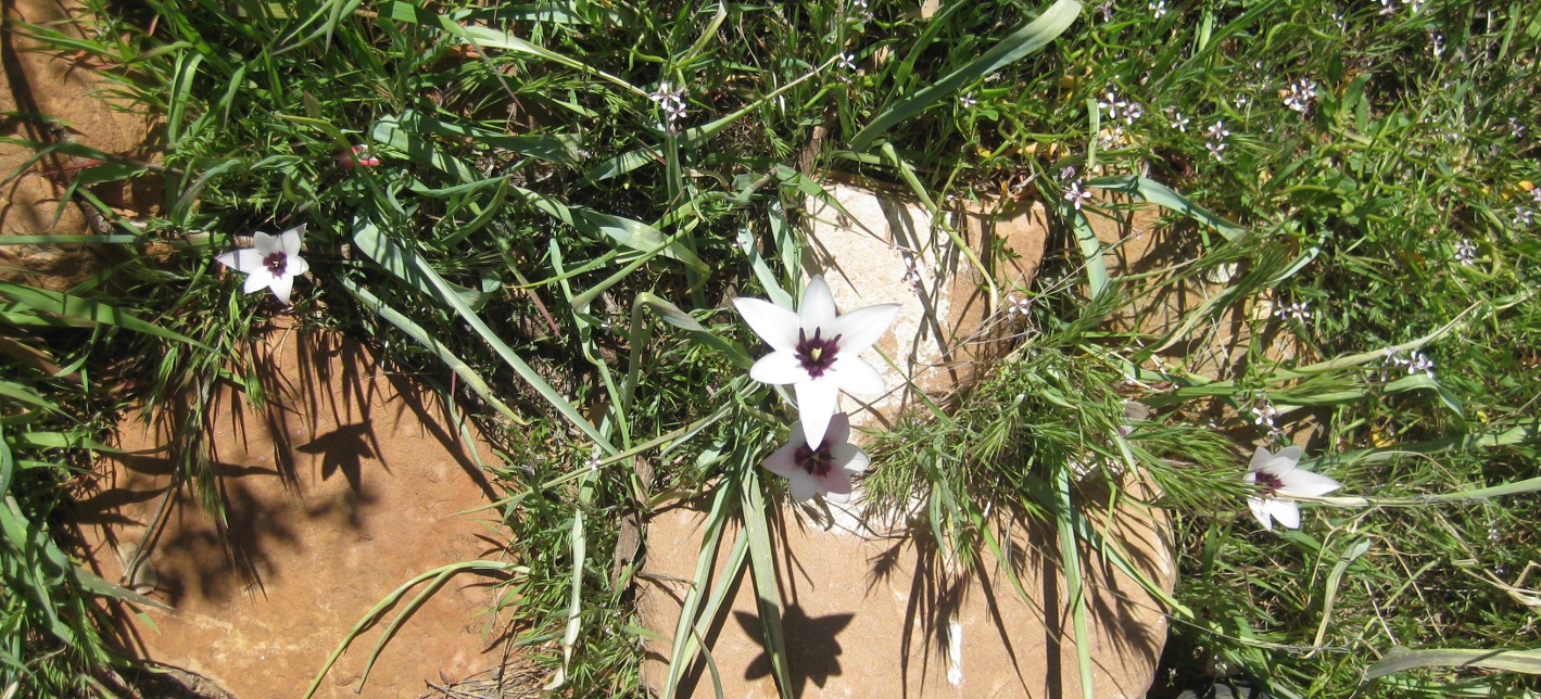
Unidentified flower (perhaps desert onion) found at the old dam site
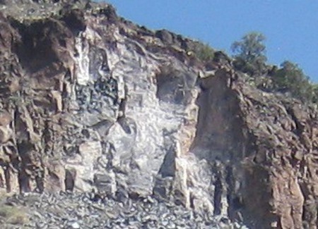
The dam itself is long gone, leaving the foundation to form a very pretty waterfall.

Waterfall formed by the foundation of the old dam below Fossil Springs
After the rest of the group arrived some of the hikers decided to remain here to enjoy the peaceful surroundings and the murmur of flowing water rather than continue on the remaining short distance to the springs.

The main party did continue on to the crossing and then retraced our steps for about two-tenths of a mile to eat lunch at a spot we had noted on the way upstream. The spot was still above the main part of Fossil Springs and the stream was easily crossed (see photograph below) to a spot on the other side where one could choose sun or shade for a lunch break. Also, it must be noted, the rocks provided prime spots for taking naps.

Crossing over for lunch on the stream bank
After lunch we returned to the old dam site, where Daisy spent a lot of time taking pictures, then rejoined the rest of the party who were waiting alongside the stream just below the site and started our “downhill all the way, on average” return hike.  We made good time and were soon enough back at the trailhead.  The following photograph was taken just after we had crossed the creek upon completion of our hike.

Left to right: Jim Manning, Lila Wright, Colleen Maktenieks, David Nelson, 
Dolly Yapp (still shoeless), Mary Gavan, Becky Fowski (sitting) David Beach, 
Daisy Williams (sitting) and Betty Wolters – photograph by the author
The included map (below) shows our hike in yellow.  It also shows (dotted line) Fossil Creek Trail leading in to Fossil Springs from above.

This hike was 4.9 miles one way, the maximum elevation was 4383 feet and the total ascent was 1079 feet.

For those who are interested, the Childs Power Plant produced 2.8 megawatts from the constant 43 cubic feet/second Streamflow.  Arizona Public Service constructed the plant, starting in 1908.  Construction involved 400 mules, 150 wagons and 600 men (all, save the foreman and timekeeper, Apache and Mojave Indians).  The Indians were paid $2 per day and the flume was erected at a rate of 120 to 150 feet per day at a daily cost of about $100: http://en.wikipedia.org/wiki/Childs-Irving_Hydroelectric_Facilities)


Wednesday, March 28, 2012

Walker Basin Trail/Walker Creek Canyon


Jim Manning and I met at the Safeway parking lot in Cottonwood, picked Lila Wright up at the Dollar Store in Cornville, continued on Cornville road to I-17 and drove north to the I-17/Hwy 179 junction.  There, we exited and turned southeast on FR 618 which we followed for 5.4 miles to the sign showing the road to the Walker Basin Trailhead where Mary Gavan and Becky Fowski were waiting for us.  We then turned east on a rough dirt road and followed it for 0.8 miles to the trailhead.

Walker Basin Trail starts out as an easy hike, sloping gently up the mountain.  Soon it becomes moderately rocky and the gradient increases gradually until it becomes very noticeable.  After traveling 1.8 miles we stopped at a great viewpoint from which we could look out over the valley spread out below and ahead to the mountain pass through which Walker Basin Trail makes its way.  Looking to the north we could see the cliff that forms the far side of Walker Creek Canyon.

After a short, but very welcome, break we continued on up the trail, now becoming ever more steep and rocky for about another 0.4 miles (2.2 miles from the trailhead).  We had just climbed over a steep ledge of rock and come out on a small flat area across which the trail leads before rising to make its final assault on the mountain when Mary, who had done this particular hike before and was leading this one, decided that this was where she had left the trail before to climb down into the canyon for the return trip.  We stepped across the remains of an old fence that had paralleled the trail most of the way up the mountain and headed down into Walker Creek Canyon.  Looking across the canyon we could see the scar left by a recent, very visible rockslide on the north wall (photograph below).

Rockslide scar on north side of Walker Creek Canyon
We headed toward the canyon floor below the scar left by the rockslide.  Making our way down the canyon wall involved picking the best path through the cactus and around rock ledges; it was slow going and is not recommended for anyone not in good condition and sure of foot.  When we approached the bottom, the way became even more difficult and we wound up climbing down a steep crevice and then a steep slope littered with loose rocks to reach the bottom. Near the bottom, we bushwhacked our way down along the slanting ledge shown here (right).

At the end of the ledge shown above we were faced with a much steeper climb down through a narrow crevice to reach the final descent into the canyon.

The crevice leads down past in the center of the photograph and goes 
behind the tree
A close inspection revealed several small, solid outcroppings that would provide secure footing during the descent through the crevice and the slope below, although still steep and littered with loose rock, appeared to be passable all the way to the bottom of the canyon.  That was encouragement enough and we started the climb down the crevice, going one at a time and leaving enough space so as to prevent being hit by falling rocks dislodged by the hiker behind.

I climbed down the upper part of the crevice first and waited to receive packs and hiking poles from the other hikers and pass them on.  The upper part of the crevice is shown in the below photograph, taken from my perch, about half way down.

Upper part of the crevice we climbed down
Jim is shown first exiting the last half of the crevice and again making his way carefully down the rock-strewn slope to the canyon bottom.

Jim exiting the last half of the crevice

Jim carefully navigating the rock-strewn slope below the 
crevice

The below photograph was taken as I made my way carefully across the loose rock to join the rest of the party in the dry streambed below.

Left to right: Mary Gavan, Jim Manning, Lila Wright and Becky Fowski 
– photograph by the author
We had reached the bottom just a few yards upstream from where a few large rocks from the slide noted previously had reached the streambed.

Rocks in streambed from recent rockslide
The large red boulder shown above is from the layer that lines the very top of the cliff above; the smaller dark gray boulder, just to the left of Mary, is from the formation underlying the top layer (see magnified view of the slide area, left).

Although boulder hopping was absolutely necessary, the going was at first relatively easy after our climb down the canyon wall and we made good time as we headed down the dry (at this point) canyon.

Along the way we encountered a single cow.  There was a pool of water nearby and a fair amount of vegetation in the area, and we at first thought she might have been stranded in the canyon, unable to find her way out.  However, she soon tired of our presence, crossed the streambed and headed up a hidden trail in a side wash out of the canyon.

Lone cow in the canyon
In some sections the canyon closed in, becoming very narrow.  In the photograph shown here (below) it almost appears that the cliff walls come together above the streambed.

A very narrow section of canyon with the cliff walls almost touching 
near the top
We encountered several deep pools of water along the way and these usually required a bit of effort to climb around.  So, in some places, rock hopping down the streambed became rock climbing rock climbing around obstacles.  In the photograph below hikers are shown climbing down to a pool located in the bottom of a bowl that the rushing water had carved in the canyon floor.

Top to bottom: Becky, Lila and Jim climbing down the canyon wall to 
a pool at the bottom
Once down to the pool, it was still delicate going to avoid falling in while trying to pass it while clinging to the steep wall.

Climbing around the pool … very, carefully
Eventually we came to a riparian section where we found springs flowing from the canyon wall and a wide area of vegetation; for the rest of the trip down the canyon, we had flowing water.

The canyon widened and trees covered the floor
We climbed up the canyon wall on the north side to check for Indian ruins that Mary had told us about.

Indian ruins on the north side of Walker Creek Canyon
We continued on downstream from the ruins looking for some pictographs Becky had seen on a previous hike.  Actually, the rest of us rested while Becky clambered over the face of the cliff looking for them.  Eventually, admitting defeat, she returned and we crossed the canyon to make our way back to Walker Basin Trail.  After crossing Walker Creek we climbed up a steep cliff face on the other side and soon found ourselves back on the trail.  We were just one mile from the trailhead.

According to my recorded GPS track, the total hike distance was six miles, the maximum elevation was 5088 feet and  the total ascent was 1644 feet.  However, the going was pretty rough and it felt like we had climbed more.

The GPS route for this hike is shown on the included map (below). The section of Walker Basin Trail we used is shown in magenta, the road from FR 618 to the trailhead is in green, the trip down into the canyon and back to the trail is shown in light blue and a section of FR is shown in dark blue.  Note that Deadwood Trail is shown leaving FR 618 just north of Walker Creek.  It eventually ends where Walker Basin Trail ends at Cedar Flat Tank.  The estimated length of Deadwood Trail is 8.9 miles, while Walker Basin Trail is 8.3 miles.


Saturday, March 24, 2012

Jacks Canyon


Thirteen Skyliners hiked on Jacks Canyon Trail on Saturday, 24 March 2012.  Eleven of us met at the Cottonwood Safeway parking lot.  We traveled north on 89A, turned right on Cornville Road and continued through Cornville to turn left on Beaverhead Flat Road.  When Beaverhead Flat Road ended at State 179, we turned left toward the Village of Oak Creek and then right on Jacks Canyon Road at the second traffic circle in the village.  About two miles from the traffic circle, Canyon Ridge Circle leads off to the left.  The turn off to the parking area at Jacks Canyon Trailhead is a few yards further along to the right.  The parking area itself is about 0.1 miles from the road.  Mary Gavan and Becky Fowski met us there.

After parking we passed through a gate onto Jacks Canyon Trail and started our hike.

Jacks Canyon Trailhead – the open gate is shown to the right
For about the first 1.35 miles we could see a housing development to the left; after that, there were no visible signs of human habitation, discounting historical signs of ranching.  Vegetation on both sides of the trail still showed signs of the La Barranca forest fire that occurred in 2006.  Recovery from the fire was obviously well along, but the burn area was still marked by charred trees and the absence of any large living trees.

Along the way, not far from the trail’s beginning, we encountered a sign warning those hikers setting out to hike to the top of Jacks Canyon Trail and return by way of the Hot Loop Trail to take plenty of water.

Warning sign set among a stand of dead trees
Interestingly, the sign also nonsensically denies that the two trails it addresses are a loop.  A quick look at the trailhead map posted nearby discloses that they very obviously do form a loop, although the bottom part might be called the Hot Loop Connector.

The La Barranca Fire started on June 1, 2006 at 2 pm. on private property on La Barranca Drive in the Village of Oak Creek.  A workman grinding on a metal gate caused the fire.  The total size of the burn was 836 acres.  About 300 personnel were assigned to fight the fire; the estimated cost was around $1,600,000.  The following structures were lost:

1 primary residence destroyed
1 partially damaged residence
1 guest house/shop destroyed
3 outbuildings destroyed

About 2.35 miles from the trailhead, after crossing the normally dry creek, now swollen by runoff from snow melt, two or three times, we arrived at Jacks Canyon Tank.  The tank had a little water at the time of our hike.  We were now just out of the burned area and the contrast between burned and unburned terrains was clearly visible on the hills.  The two photographs below show the area as it appeared in November 2009 and as it appears today.

The terrain in approximately the right half of this photograph shows 
damage from the La Barranca fire 
– 21 November 2009 photograph by the author
The end of the La Barranca Fire – 24 March 2012 photograph by the author
Mary Gavan and Becky Fowski had arranged to hike all the way to the top of the trail at the Munds Mountain saddle (about 6.7 miles one way) and they wanted to press on rather than wait for the rest of us.  We posed for a group photograph before they left us behind.

Left to right: Colleen Maktenieks, Jo Benkendorf, Betty Wolters, Donna 
Goodman, Jim Manning, Miriam Sterling, David Beach, Becky 
Fowski, Daisy Williams (kneeling), Anita Jackson, Mary Gavan 
– Photograph by the author (not shown)
We paused for a brief rest at Jacks Canyon Tank then pressed on.  Shortly after leaving the tank we stopped on the crest of a hill to look ahead to the saddle at Munds Mountain.

Looking to the head of Jacks Canyon
Looking up the canyon ahead, Munds Mountain is on the left and the faint track, trending up and to the left across the face of the mountain at the head of the canyon, is Jacks Canyon Trail as it approaches the saddle at Munds Mountain.  From the saddle, Jacks Canyon Trail continues for about another 2.3 miles (Shown by a green track on the Jacks Canyon Trail map included at the end of this report) to the upper trailhead at FR 153A, approximately one mile from the intersection of that road with Schnebly Hill Road.

We continued on up the canyon, crossing and recrossing the creek a number of times along the way.  Approximately 0.80 miles from Jacks Canyon Tank we entered the wilderness area and a tenth of a mile into the wilderness stopped to saw through and remove a dead tree that had fallen across the trail.

We then hiked around another 1.1 miles before stopping for lunch at (34°49'52.64"N; 111°42'8.50"W).  Jim Manning, who works with Friends of the Forest to maintain trails in the area, checked a short distance ahead and reported that the trail was cluttered with fallen limbs and trees from recent events (wet snow and high winds).  This had to have occurred since February 29 because Jim and I along with several others hiked all the way to the Munds Mountain Saddle on that date and found the trail clear.

After lunch we headed back down the trail, making very good time and stopping only once for a short rest at Jacks Canyon Tank.

Mary, meanwhile, had called when she had cellphone reception at the saddle to report that she and Becky had reached the top and were starting back down.  She also reported that they had found a number of enchanting waterfalls along the normally dry creek bed.  We, apparently had stopped and turned back just short of the first of these.

The main group of hikers arrived back at the trailhead soon after 1400 and Mary later called to report that she and Becky had reached the trailhead sometime after 1500.

Mary also provided the following input by e-mail.

On our way back down the mountain today, Becky and I began noticing very large paw prints with claws. They started about two miles down and continued along the trail until the last stream crossing before the tank. At this location the paw prints indicated that the animal stayed there and moved around a lot. We both noticed that the prints along the trail were on top of your groups foot prints! Very fresh. Ha - it was stalking your group. The prints most likely were from a mountain lion.
We counted 13 places where very large tree limbs were down and blocking the trail. Also, we removed smaller limbs off the trail. In all, we crossed the stream 21 times - one way.

The total round trip hike distance, according to my GPS was 9 miles; The highest elevation was 5055 feet and the total ascent was 1162 feet. This is based on a one-way distance reading of 4.5 miles.

A map insert of this hike is included (below) and a map showing the entire Jacks Canyon Trail immediately follows the insert.

120324 – Jacks Canyon hike
The included map (below) shows the entire Jacks canyon Trail (in red to Munds Saddle and green on to the trails end at FR 153A.


Saturday, March 17, 2012

Cockscomb and Doe Mountain


Eleven hikers from Cottonwood met at the Safeway parking lot and traveled north to Sedona on Hwy 89A.  We turned left onto Dry Creek Road (Forest Road 152C).  About 2 miles from Hwy 89A we passed Vultee Arch Road, a very rough dirt road leading off to the right.  After about another 0.85 miles (2.85 miles from Hwy 89A) we reached a stop sign.  Long Canyon Road leads to the right from here.  We turned left on Boynton Pass Road.  Actually, according to the Google map, we had been on Boynton Pass Road since passing Vultee Arch Road.  We traveled for another 0.6 miles to reach a second stop sign at the junction with Long Canyon road.  We turned left to continue on Boynton Pass Road for about another 1.25 miles before turning left into the trailhead parking lot for Doe Mountain and Bear Mountain Trails.  We were met at the parking lot by four additional hikers from the Sedona/Oak Creek area.

Donning our gear we left the parking lot on Doe Mountain Trail.  Our intent was to hike Cockscomb first, but the map indicated that we would intersect with Aerie Trail a short distance from the parking lot and that we could follow it to Cockscomb.  The intersection with Aerie turned out to be about 165 yards from the parking lot. The sign (left) indicates that one would go straight ahead to continue on Doe Mountain Trail.

We turned right (southwest) and were on Aerie, which crosses Doe at this point, and followed it toward Cockscomb.

Hiking toward Cockscomb
Aerie Trail, apparently named after a relatively new upscale housing project that lies between Cockscomb and Doe Mountain, is a new trail that seems to circumnavigate Doe Mountain.  I am not sure but I think that we remained on Aerie until we turned off to follow a less distinct, but still well traveled, trail directly up the slope to Cockscomb.  That turnoff was 1.7 miles from where we entered Aerie near the parking lot and after we had crossed Aerie Road (a paved road leading to the Aerie housing project).  The trail we turned onto had a few dead branches placed across it as though to indicate that it was the wrong way, but it worked just fine for us.  Perhaps there is a better way up the slope further along.  However, on the way back we met two hikers coming from the other direction along the main (Aerie?) trail and they asked us where the turnoff to Cockscomb was.  In any case, we proceeded up the mountain, soon arriving at the base of a seemingly unassailable cliff near the top of the formation.  However, not ready to give up yet, we followed along the base, heading southeast.  Along the way we noted some unusual lichen, a beautiful gold in color, on the face of the cliff (see photograph below).

Golden lichen on the cliff face
Continuing on past the lichen we found, at last, a way to the top.  It is little more than a crack in the wall of the cliff, offset from a frontal approach and not visible to the casual observer.  Kwi is shown entering the crack in the photograph (right). The climb up the crack is really less difficult than it looks.  It is wide enough to pass through easily and has good footing all the way.

We did have one more obstacle to overcome before we reached our goal, a final ten-foot high rock wall (left).  However, someone had helpfully built a rock ladder and we were soon on top, free to explore the admittedly limited area on top of Cockscomb.  We wandered around on the ridge that forms the “cockscomb” and viewed scenery spread out all around us.  We could look back north to Bear Mountain, to Scheurman Mountain looming above Red Rock High School southeast of us, and past Rosie’s Volcano and Windmill Mountain and on across Verde Valley to the Black Hills outlined by Mingus and Woodchute Mountains to the southwest.

Looking across the last hump in the “Cockscomb” – Rosie’s Volcano 
(center, left), Windmill Mountain (center) and Mingus and Woodchute
Mountains (on the horizon)
We paused on top for a snack and a group photograph.

Left to right: George Everman, Miriam Sterling, Jo Benkendorf, Lila Wright, 
Becky Fowsky, Anita Jackson, Dolly Yapp, Akemi Tomioka (front) Colleen 
Maktenieks, Daisy Williams, Kwi Johnson (front), Mary Gavan, 
Jim Manning and the author (front)
Following our snack break we all slowly made our way back to the North end of the Cockscomb formation.  From there we could look across the saddle containing the Aerie housing development to Doe Mountain.

View of Doe Mountain from the top of Cockscomb with Bear Mountain 
looming in the distance
With our next goal in view we really didn’t want to follow the trail all the way around Doe Mountain to ascend by the normal route on the north side.  George had climbed up from the south side of the mountain once before, but he didn’t remember the exact route that he took.  However, on examining the view of Doe from across the saddle (shown in the above photograph) it was evident that only one possible route existed.  We would have to skirt along the fence enclosing the development to reach a wooded area (center of the photograph shown above) and follow it to the top.

We returned to the main trail at the foot of Cockscomb and hiked on it for about 0.15 miles back the way we had come before leaving it by continuing straight ahead where the trail made a left turn.  We found ourselves on a less traveled, but still very distinct, trail until we neared the foot of the Doe Mountain.  Just at the end of the private fence we passed through an older, now unused, fence and continued up the mountain; the trail was now less obvious and we had to take care to stay on it.  The climb, itself, was no more strenuous than our climb to Cockscomb had been and we were all pleased that we had avoided the long hike around the mountain to ascend from the north.

When we arrived on top of Doe, we stopped for lunch and I managed to work in my normal noontime nap.

After lunch we hiked counterclockwise around the rim until we reached the point where Doe Mountain Trail descends to the parking lot.  The hike distance 4.8 miles according to my GPS track; the highest elevation was 5074 feet and the total ascent was 1071 feet. The track to Cockscomb was 2.6 miles and the return trip across Doe Mountain was 2.2 miles.

The included map (below) shows the hike to Doe Mountain and the Cockscomb.  The trip to Cockscomb is shown in yellow and the return across Doe Mountain is in blue.


Wednesday, March 14, 2012

Thunder Mt. via West Face Summit Access Route

Mary Gavin led seven members of the Skyliner group on a hike to the top of Thunder Mountain (Capitol Butte) using the West Face Summit Access Route.  (NOTE: This trail name was taken from an Arizona Topomap from www.gpsfiledepot.com that I use with my GPS.)  Hikers from the Cottonwood area drove to Sedona Turned on Dry Creek road and drove to Vultee Arch Road where we met the members from the Sedona area in the parking lot.

We left the parking lot at the junction of Dry Creek Road and Vultee Arch Road on a trail leading east.  About 65 yards ahead we came to a trail junction and had the option of turning right (generally south) or left (generally north); we turned right.  After another 0.1 miles we came to a fork in the trail and turned left (still trending generally south).  According to my Arizona Topomap, the trail that we did not take is called “Unknown Trail east of Dry Creek Rd.”  The left turn kept us on the West Face Summit Access Route and we continued for another 130 yards before again turning left.  This turn is marked by a large Juniper, which is fronted by a slightly smaller dead Juniper.

The correct trail leads between these two trees
The trail, which had started at a relatively modest slope, inclined ever more sharply upward.  When we reached the saddle behind Lizard Head we were all ready for a short rest.  At least I was and I heard no one else complain about the stop.

After resting, we continued on our way.  We had about another 1000 feet to climb and that included the steepest, most precarious part of the trip.

Hikers climbing up a crack in the cliff face
We remembered to take a group photograph, but I think the camera was perched on a shaky branch and the light must have been poor. The picture turned out to be so blurry that I have chosen to leave it out, instead just listing the names of those who made the hike.

The hikers were:

Jim Manning, Kwi Johnson, Lila Wright, Becky Fowsky, Ellis Price, George Everman and Mary Gavan
After the abortive group photograph we continued on, the climbing becoming ever more difficult and the footing increasingly precarious.

The top was surely up there somewhere, but we would never reach it 
without a few cracks in the cliff face – photograph by George
When we finally arrived at the top of Thunder Mountain (Capitol Butte), we had spectacular views in all directions.

Looking down on Sedona and the airport with Courthouse Butte, 
Bell Rock and Cathedral Rock visible in the distance
Well aware of my need for a noon nap when hiking, Mary pointed out the best sunny “sleeping rock” and I settled in for my nap.  But first, I managed to get a very good shot of the rest of the group on the summit rock.

Top to bottom: Kwi Johnson, Mary Gavan, Becky Fowski, Jim Manning, 
Lila Wright, George Everman. Oak Creek Canyon is visible to the right.
Mingus and Woodchute visible across the Verde Valley; closer in 
Cockscomb stands out (see right)
Refreshed by lunch and a good rest we felt up to the descent.

Descending the mountain – photograph by George
Still descending the mountain – photograph by George
The trip down turned out to be a little easier than the climb to the top, at least for me, and the one spot several of us dreaded most was a breeze.  On the way down we just sat on a rock that we had trouble navigating across when headed up and placed our feet on a rock lower down … a maneuver better performed on the way down.  I am not sure the reverse would have worked at all on the way up.

We had a short discussion when we arrived back at the saddle behind Lizard Rock as to whether we should make our way a few yards farther to actually touch the formation, but decided to just declare that we had climbed to Lizard Rock, which indeed we had, and leave well enough alone.  As I said, that was a short conversation.

We all arrived back at the parking lot tired out but in good shape.  The hike was, according to my GPS, the hike distance was 2.6 miles round trip, the highest elevation was 6354 feet and the total ascent was 1742 feet. The GPS route of this hike is shown on the included map (below).

My advice is to not take this hike unless you are in very good physical condition and are sure of foot.

Thunder Mountain was scheduled as a Skyliner’s hike on 14 April 2012. However, in view of the steep rocky trail that would not be suitable for some of our hikers, we substituted another hike from the same parking lot. This alternative hike would be Vultee Arch Road to Devils Bridge and back with, perhaps, a little extra exploration along the way, an estimated 6 miles round trip. Mary, meanwhile, had agreed to lead another hike to Thunder Mountain for the hardy few who still might want to make it.

When the 14th of April arrived, I was on a trip to Ireland, but I understand that bad weather intervened and the Skyliners did not hike at all that day.