Four
Skyliners (Jim Manning, David Beach, Frank Lombardo and the author)
camped at Henderson Flat on 02 November 2013. The purpose of our
visit was to search for three Indians Ruins we had heard were located
in the hills above the flat. I had found the locations of the three
ruins noted on an old USGS map and we were fairly sure that we knew
just where to look, so we set out on this bright and sunny day with a
great deal of confidence.
Leaving
from Cottonwood, we drove to Jerome on Hwy 89A, turned at the
firestation onto Perkinsville Road, crossed the river on the
Perkinsville Bridge and continued for another 3.2 miles before
turning right onto Forest Road 181. Perkinsville Road, from Jerome
to the FR 181 turnoff, although unpaved was in excellent condition;
however, FR 181 turned out to be extremely rough, along with being
crooked and steep. It should not be attempted with other than
high-clearance, 4-wheel-drive vehicles.
 About
6.8 miles along FR 181 we were deep in Railroad Draw. Another mile
brought us to Henderson Flat where we intended to camp for the night.
Jim Manning and I had driven this way just last year to camp out and
visit ruins in Sycamore Basin, but I had remembered the distance to
Henderson flat as being only 5.6 miles. This time, I thought we
would never get there. Later I checked the report for last year's
trip and found that the distance was 7.8 rather than 5.6 miles. So
much for my memory. Our intended camping spot is marked by an old
bunkhouse (above right) and a “trick”
tank, the sort of tank that receives the water it stores from a
collector rather than from natural runoff. In this case, the
collector serves as a roof over the tank itself, as shown in the
below photograph taken from a bunkhouse window in November of last
year.
About
6.8 miles along FR 181 we were deep in Railroad Draw. Another mile
brought us to Henderson Flat where we intended to camp for the night.
Jim Manning and I had driven this way just last year to camp out and
visit ruins in Sycamore Basin, but I had remembered the distance to
Henderson flat as being only 5.6 miles. This time, I thought we
would never get there. Later I checked the report for last year's
trip and found that the distance was 7.8 rather than 5.6 miles. So
much for my memory. Our intended camping spot is marked by an old
bunkhouse (above right) and a “trick”
tank, the sort of tank that receives the water it stores from a
collector rather than from natural runoff. In this case, the
collector serves as a roof over the tank itself, as shown in the
below photograph taken from a bunkhouse window in November of last
year. |
“Trick” tank at Henderson Flat and the hills where the Indian Ruins are
located
|
The
tank shown here with its own collector replaced an older now dried up
tank, located a short distance downslope from the bunkhouse. The old
tank was of traditional earth-dug construction and depended on
natural runoff. The bunkhouse itself had been fitted with guttering
that fed a large metal tank (cistern) installed to hold water for
human habitation. It was all very elaborate for the few cows we saw,
either on this visit or the one last year, and we think the area must
have been much more heavily-grazed in the past. Obviously, the
long-unused bunkhouse indicates that ranchhands were once in
semi-permanent residence at the site.
We
arrived at Henderson Flat, set up camp near the old bunkhouse, and
were on our way to search for ruins by 1000. There wasn't a cloud in
the sky and I planned to just toss my sleeping bag in the bed of my
pickup, so my set-up was minimal. The other three campers all set up
tents.
I
had mapped the locations of the three ruins we were interested in on
my GPS and we set out across country to the nearest one. I had been
told that they were not very impressive ruins, but we were at least
as interested in the search as the ruins themselves and were
undeterred.
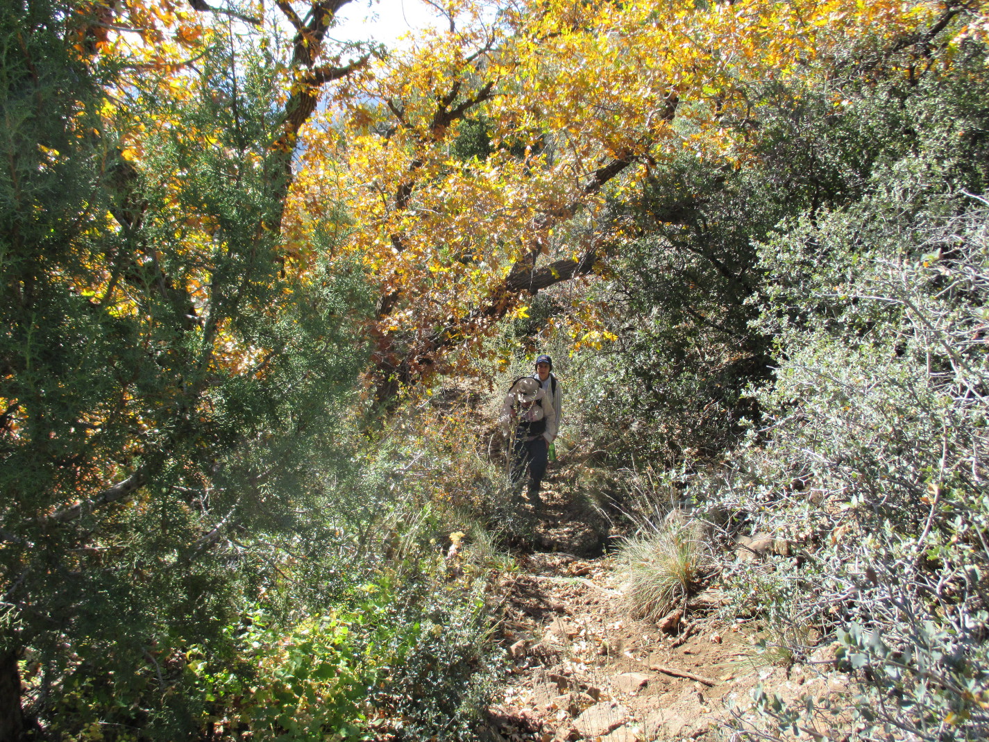
We
crossed into boundary into into the Sycamore Canyon Wilderness area
short distance from camp and continued on up the mountain slope,
traveling at an angle that required us to cross a couple of washes.
The washes were not very deep; however, they were pretty well choked
with catclaws, manzanitas and cacti, making the going very difficult
and slow. The manzanitas were difficult enough, growing thickly as
they tend to do and making passage difficult. The catclaws and the
cacti, however, seemed to actively retaliate, the catclaws jumping
out to catch us and the cacti launching their spines as projectiles
whenever we came near. The catclaws just took a vengeful bite and
let go. However, the cactus spines were another matter entirely.
They immediately penetrated clothing (even shoes) and quickly
embedded themselves into flesh like little heat-seeking missiles.
But,
hey, of what matter are a few inconveniences when one is climbing a
mountain with friends searching for ruins. Anyway, as we climbed
higher we had great views across the way to Mingus and Woodchute
Mountains, although the view was somewhat obscured by smoke from a
prescribed burn on the other side of Mingus. As we climbed higher,
the growth thinned out a bit and we were better able to avoid some
the cacti and catclaws, but the way was now steep and rocky.
About
a mile from camp and some 300 feet higher, we were approaching the
spot where we thought the first ruin was located. It seemed a very
unlikely spot and I thought that my information must be wrong.
 |
Approaching the location of the first ruin
|
However,
just when we were ready to give up and head for the next location, a
member of our party checked behind some heavy growth and we heard him
shout “Indian Ruin.” There they were, a bit more impressive than
expected from the information provided by others.
 |
Frank Lombardo at the ruin
|
A
still-standing wall is shown below. Part of the overhang has
collapsed filling the space behind the wall with broken rock. We
spent some time poking around in the ruin, finding little except a
single pottery shard.
 |
Debris contained behind wall
|
 |
Pottery shard
|
 Quite
pleased with ourselves for having found the first site, we set out
with renewed enthusiasm for the next location I had marked in my GPS.
That site was a mere 0.1 miles and some fifty feet higher in
elevation than the first site. Unfortunately, to get there we had to
climb back across the ridge we were on descend, for over 200 feet,
cross a wash and then climb back up another ridge following a very
steep and rocky course. The total distance by this route was about
0.5 miles. The profile for this section of our hike is shown in here
(above left).
Quite
pleased with ourselves for having found the first site, we set out
with renewed enthusiasm for the next location I had marked in my GPS.
That site was a mere 0.1 miles and some fifty feet higher in
elevation than the first site. Unfortunately, to get there we had to
climb back across the ridge we were on descend, for over 200 feet,
cross a wash and then climb back up another ridge following a very
steep and rocky course. The total distance by this route was about
0.5 miles. The profile for this section of our hike is shown in here
(above left).
We
found this site more easily, actually stumbling over it on top of a
ridge as we were heading to what I thought was a more likely spot. I
had expected it to be tucked under an overhang and was heading to a
rock outcropping which looked like a good place for one when someone
said “here it is.” This one was constructed on the very crest of
the ridge we had climbed, just below a further rise in the ridge
marked by red rocks. The following photograph shows a section of
wall from the old structure and beyond a glimpse of the red rock
marking a further rise in the ridge.
 |
Wall remains at bottom, foot of cliff marking a further rise of the ridge at top
|
We
found a few pottery shards, examined them and, as always, left them
at the site. Just at the base of the red rock cliff shown in the top
right quadrant of the above photograph, we saw evidence of another
smaller structure. For storage?
 |
Pottery shards
|
 |
Remains of small structure … storage?
|
We were doing quite
well. We had found two of the sites we were searching for and were
preparing to head for the third. Suddenly, however, we again heard
the cry of “Indian Ruins” from a member of the party who had
climbed the low red-rock cliff ahead. He had spotted, across the
canyon, an unexpected ruin that we had not known was there. It was
just a little higher than we were and it appeared that we would be
able to reach it by following the contour line around the canyon
instead of hiking down to cross the wash and coming back up the other
side. We could tell from where we were that it was more substantial
than anything we had expected to find today, so we immediately
cancelled plans for the other ruin we had anticipated hiking to and
headed for this one. The photograph below, taken from just above the
second ruin we found shows the unexpected ruin from about 0.1 miles
away.
 |
Looking across the canyon at the unexpected ruin
|
The
hike along the canyon wall to get to the other side proved to be
perilous and difficult. We had to watch carefully to avoid slipping
on loose rocks, all the while dodging cacti and catclaws. By the
time I reached the ruin it was again time to stop and remove spines,
and I must have spent fifteen minutes at the task before I was ready
to hike again.
 This
ruin contained seven rooms (eight if one counts a small subdivision
within one of the larger rooms) and at one time had a second story,
probably doubling the number of rooms. The most substantial,
still-standing wall is shown here (right).
Note that the lower portion of the wall is mortared while the rest
is not. Perhaps it was torn down and rebuilt at sometime in the
past. Or, possibly, the upper part was just constructed at a later
date using a different technique. A pole can be seen extending
through the wall about a third of the way from the top. This marks a
division between floors.
This
ruin contained seven rooms (eight if one counts a small subdivision
within one of the larger rooms) and at one time had a second story,
probably doubling the number of rooms. The most substantial,
still-standing wall is shown here (right).
Note that the lower portion of the wall is mortared while the rest
is not. Perhaps it was torn down and rebuilt at sometime in the
past. Or, possibly, the upper part was just constructed at a later
date using a different technique. A pole can be seen extending
through the wall about a third of the way from the top. This marks a
division between floors. This
photograph (left), taken from the
other side of the wall, shows the top part of wall from the poles
marking the division of floors up. Most of the upper portion of
this side of the wall is mortared. The small section at the very top
of the wall appears to have been added at a later date.
This
photograph (left), taken from the
other side of the wall, shows the top part of wall from the poles
marking the division of floors up. Most of the upper portion of
this side of the wall is mortared. The small section at the very top
of the wall appears to have been added at a later date.
Jim
Manning is seen examining the aforementioned wall in the following
photograph.
 |
Jim Manning examining the large, partially-mortared wall
|
The
below photograph, taken as we were leaving the area, shows the ruin
from the end opposite our entry point.
 |
Photograph taken looking back as we were leaving the ruins
|
As
might be inferred from the number of photographs shown here, we spent
considerably more time at this ruin than at either of the first two
sites. There was, after all, a lot more to see here. When we were
through, we decided to make our way diagonally down the wall to the
bottom of the canyon and then follow along the wash toward the flat
below. We thought we were a bit over a mile from camp and expected
to intersect Henderson Flat Trail #53, running up the valley from
Sycamore Tank, about half way there.
As
it turned out, we were not too far off. We travelled 0.7 miles down
the steep canyon wall, along the wash at the bottom and across
several other brush, catclaw and cactus-infested washes before
finding the trail. The trail itself, although marked by cairns and
relatively easy to follow, appeared to be little used. We followed
it for 0.6 miles back to camp, passing the dyke that had formed the
old tank Henderson Flat along the way. Before it was drained this
must have been a substantial tank; it appears to have covered several
acres and the dyke had a rock-lined sluice at one end to prevent
erosion of the earthen dyke.
We
arrived back at camp at 1600, having been on the trail (or, rather,
struggling through the brush) for six hours. I was tired and
peppered with of cactus spines, but after a few minutes of rest while
plucking the spines from inconvenient places, felt much better.
The
smoke from the prescribed burn had by now largely dissipated, but had
been replaced by a few threatening, clouds that might well be a
harbinger of rain showers. I decided that I would pitch my tent
after all; it was going to be a fairly chilly night and I certainly
didn't want to spend part of it wet. Later during the night, when I
heard the pitter-patter of raindrops on my tent, I snuggled with
great satisfaction deeper into my warm, cozy sleeping bag.
But
before bedding down, we must cook supper and we were all looking
forward to some time around the campfire. I had thought that we
might have trouble finding nearby fuel for our campfire at the flat.
It is an ideal place to camp and shows much evidence of being so
used, so I thought that all available fuel would have been used
already and brought along some firewood. As it turned out, fuel was
plentiful and I wound up bringing my wood home again. There were a
number of fire rings left by previous campers, so we just selected
the most convenient one and soon were gathered around the campfire to
eat, review our day's activities and plan for the morrow.
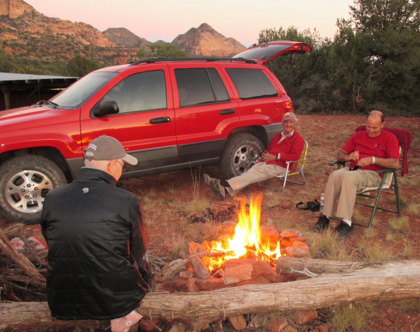 |
An early dinner around the campfire with the setting sun still lighting the
mountains in the background. Does it get any better than this?
|
We
had hiked 3.0 miles, mostly through thick brush and found three
ruins, one entirely unexpected. The total ascent was 949 feet and
the highest elevation was 5231 feet. Our track and the locations of
the ruins are shown on the included map (below).

Henderson Flat – Lonesome
Pocket Trail
 We
got a leisurely start the next morning. We had decided to hike on
Lonesome Pocket Trail #61 which leads generally north from Henderson
Flat. The trail is marked by cairns and we actually saw a few
footprints for the first half mile or so. After that there was no
indication of recent usage. At first the trail leads through a
meadow; it then enters a juniper forest, rises at a fairly gentle
slope, and crosses several washes, gradually becoming steeper and
rockier. Soon after leaving the meadow, we found several fossilized
sea shells, such as the example shown here (above right).
These were found only along a short stretch of the trail. After
that, the composition of the rocks changed and we found we were
moving through an area of broken up sandstone that appeared to have
been deposited in relatively thin layers and was marked by intriguing
designs.
We
got a leisurely start the next morning. We had decided to hike on
Lonesome Pocket Trail #61 which leads generally north from Henderson
Flat. The trail is marked by cairns and we actually saw a few
footprints for the first half mile or so. After that there was no
indication of recent usage. At first the trail leads through a
meadow; it then enters a juniper forest, rises at a fairly gentle
slope, and crosses several washes, gradually becoming steeper and
rockier. Soon after leaving the meadow, we found several fossilized
sea shells, such as the example shown here (above right).
These were found only along a short stretch of the trail. After
that, the composition of the rocks changed and we found we were
moving through an area of broken up sandstone that appeared to have
been deposited in relatively thin layers and was marked by intriguing
designs.
About
a mile from camp we came to a fork in the trail. According to the
trail sign posted sign (left), our
trail continued straight ahead for 2.0 miles while a trail to forking
to the left would lead to Sand Flat, 6.0 miles away.
We
certainly did not have time to hike to Sand Flat as we had decided
that we would leave for home at 1200, so we continued on toward
Lonesome Pocket. Actually we would not even have time to hike all
the way to the pocket, but would just go as far as we could and still
be back at Henderson Flat by noon.
As
we continued on up the trail we noted a volcanic intrusion left
exposed when the softer surrounding material had eroded away, see
photograph below. Meanwhile the trail became ever steeper and
rockier.
 |
Volcanic intrusion
|
 |
Steep, rocky trail to Lonesome Pocket
|
After
some more hard climbing we reached a very narrow section of the
ridgeline and the trail ahead seemed to level off a bit. We paused
there for a snack and I snapped a photograph of my fellow hikers.
 |
Left to right: David Beach, Frank Lombardo and Jim Manning
|
Even
though, as already noted, the trail did level off somewhat for a
short distance, we could see that further ahead was another steep
climb on up to Lonesome Pocket on top of the mountain. It was now
close to 1030, so we decided to return to camp after our snack. We
arrived back at camp at about 1140 and were shortly on our way back
home.
I
recorded the round trip hike distance as 2.9 miles, the total ascent
as 912 feet and the highest elevation as 5760 feet.
Our
track for the hike on Lonesome Pocket Trail is shown following
(below).