Saturday, June 16, 2012

Abineau-Waterline-Bear Jaw Loop


It was a beautiful, shirtsleeve-weather day when eight Skyliner hikers set out from Cottonwood on Saturday, 16 June 2012 to hike the Abineau-Waterline-Bear Jaw Loop on the north slope of the San Francisco Peaks. Seven of us left Cottonwood at 0630 and drove through Sedona to pick up Becky Fowsky.
We drove up Oak Creek Canyon, took I-40 at the airport exit, continued straight on Milton when the freeway ended, passed under the railroad overpass, took the sharp right turn and turned left onto US Hwy 180 (Humphreys Street). We drove 19.4 miles on US Hwy 180 to turn right onto FR 151. (Note that FR 151 could also be accessed at mile marker 235 but that results in a long trip on a dirt road. Pass on by.) About 1.6 miles after turning on FR 151, we came to a junction with FR 418, turned slightly left onto 418 and continued for another 3.1 miles before turning right onto the road (FR 9123J) (aboveright) to the Abineau-Bear Jaw Trailhead parking lot. This road is only about 0.6 miles long and we came to a fork just before we reached the lot; we bore to the left and almost immediately were there. According to my GPS, the elevation at the parking lot was about 8540 feet.

Access is also possible from US Hwy 89. However, that involves a pretty rough 13 mile trip on a dirt road. One of our hikers recently drove both routes and recommended access from US Hwy 180.

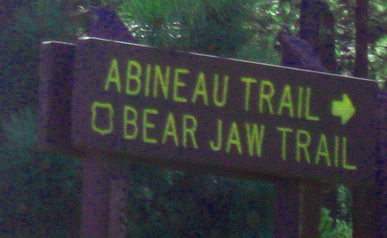
It was warm enough at the trailhead that we felt no need for jackets. We donned our packs and set out up the mountain, walking about 250 feet from our parked cars to the trailhead. A sign warned that Abineau is the more difficult horse trail (a little later we were to see why) and a map (see next page) of the Abineau-Bear Jaw Loop was posted to show the way. For the first 0.4 miles the trails run together, leading into Abineau Canyon (very shallow here). There they split, Bear Jaw leading generally east along the foothills of Abineau and Abineau heading generally south up Abineau Canyon. The trail map posted at the trailhead and the sign where the trails split are shown below.

North-oriented trail map posted at the Abineau-Bear Jaw Trailhead
Trail sign and sign-in box – the small bottom sign points right for Abineau 
and left for Bear Jaw
Because our hike leader remembered sliding down Abineau Trail on a previous hike, he chose to go up it this time. After signing in, we followed him up the trail, at this point, fairly steep but easy to hike. The below photograph shows a typical view of the lower portion of the trail.

Lower part of Abineau Trail
Abineau measures (my GPS) 2.4 miles from the trailhead to Waterline Trail. About three quarters of a mile before we reached the top, we left the treeline and entered an open space that stretched across the bottom of the canyon and continued all the way to the top. Here the trail became even steeper and was strewn with loose gravel on a hard surface, making it very precarious. I could now understand the warning sign for equestrians at the trailhead and why our leader did not want to descend on this trail.

We were now high up the mountain slope and, once we had left the cover of the forest and climbed far enough above the fir trees to see through their tops, we got our first glimpse of the great views of deserts, mountains and prairies to our north.

View to the north from Abineau Trail
By the time our leader, followed closely by me, Lyne and then Becky, reached the top of Abineau, we were all ready to take a good rest. The other four members of our group, in contact by walkie-talkie, had stopped for a snack along the way and were father behind. A jumble of trail signs were posted at the junction to show the way from here.

Trail direction signs at Abineau/Waterline junction
The top sign (above) points back down Abineau Trail, back the way we had come. The lower sign points left for both Bear Jaw and the Inner Basin Trail.

We were actually located on the northwest slope of Abineau, with Humphreys looming over us to the southwest (1960 true), but a nearby sign warned that access to Humphreys from this side was prohibited.

The sun was warm and there was just enough wind to moderate the temperature, so we were in no great hurry to leave this most pleasant spot. That seemed to be a common sentiment as we were soon joined by several other hikers. We, at one time, numbered sixteen sprawled out on the ground and perched on the surrounding rocks as hikers came and went. Looking to our north, we now had an unobstructed view back down Abineau Canyon and on across the jumble of prairies mountains and desert to the northern horizon.

View from Abineau/Waterline Trails junction
Closer up, on the slope just below us was a small fir tree with extraordinary cranberry-red cones. They looked good enough to eat.

Cranberry-red cones on a small fir tree
We ate lunch there (but refrained from sampling the fir cones), enjoying the balmy weather and the great view. But, too soon, it was time to leave, so we again donned our packs and headed down Waterline Trail to the junction with Bear jaw, 2.1 miles (again by my GPS) ahead.

Looking down Waterline Trail toward the junction with Bear Jaw
While still on Waterline Trail, we paused for a group Photograph.

Left to right: Becky Fowsky, Lyne Brousseau, Kwi Johnson, Lila Wright, 
Betty Wolters (front), Name Withheld and Miriam Sterling
This was undoubtedly the easiest and most pleasant part of the hike, as we found ourselves traveling gently downhill along an old road once used to service the now abandoned waterline. Along the way, I found a spot in the trail with a deep luxurious covering of pine needles and was sorely tempted to stop for a nap. Unfortunately, I was overruled and we kept going.

The upper end of Bear Jaw was clearly marked and we had no trouble finding it. As shown in the following photograph, the upper portion of the trail is fairly steep and quite rocky. However, compared to the upper part of Abineau, composed of loose gravel on a steep, hard surface, it was a breeze and we continued to make good time.

Trail junction sign
Rocky upper portion of Bear Jaw Trail
The trail descends into Bear Jaw Canyon and climbs out the other side, runs directly north down the the west side of the canyon for a short distance, then turns to the northwest and descends gently along the slope of Abineau, crossing Reese Canyon on the way. Much of the way along the slope we seemed to be following an old road, probably a logging road. When we arrived back at the junction with Abineau Trail, we did not pause but continued on the short additional distance to the joint Abineau/Bear Jaw Trailhead at the parking lot

We made the 2.6 mile (my GPS) trip from the Waterline/Bear Jaw junction to the trailhead with only two short breaks. Our hike was done. Lila is shown below as she emerges at the trailhead. While the trail sign says the hike is 6.8 miles, my GPS gave the distance as 7.1.

Lila ending the Abineau/Bear Jaw Loop hike
We climbed into our vehicles and headed back to Cottonwood, stopping, at Miriam's urging, at the junction of the road from the parking lot with FR 418 to take the following photograph of prairie and mountains. Thank you Miriam, you have a good eye.

View of prairie and mountains from FR 418
According to my GPS track we hiked 7.1 miles, the highest elevation was 10330 feet and the total ascent was 1879 feet.

The GPS track for this hike, along with some additional information, is shown on the included map (below). At the top of the page, FR 418 is shown in magenta; the short blue track is FR 9123J, the connector to the parking lot at Abineau Trailhead; the GPS Track is shown in red; the green track shows the part of Waterline Trail that was not included as part of this loop hike; and the yellow track is the route of an old road that shows on some maps.


Thursday, June 7, 2012

Humphreys Peak Trail


Nine Skyliners hiked on Humphreys Summit (Peak) Trail on 7 June 2012. We met at the Safeway parking lot in Cottonwood and carpooled from there. One of the hikers took Miriam Sterling, Anita Jackson and Betty Wolters and stopped in Cornville to pick up Lila Wright. I took Kwi Johnson and drove to Becky Fowsky's house in Sedona, where we all shifted to Becky's car and then stopped to pick up George Everman. The two groups met at Snowbowl.

When we arrived at Snowbowl, the other group were waiting for us, having already donned their hiking gear. Most of the hikers carried cellphones which work well enough on this trail and we also had two walkie-talkies with us. We thus made no attempt to stay together on the trail during this hike.

From the lower parking lot at Snowbowl, we followed the trail across a meadow, passing under the lift, and entered the aspen forest a little over a quarter of a mile from the trailhead. At first the trail ascended at a gentle slope through the quiet aspen forest. It then became ever steeper as we left the aspens behind, and entered the conifers growing higher up. Along the way, we passed into the Kachina Wilderness Area. 

Near the tree line, we saw a sign (right) that gave the elevation as 11400 feet.

We finally emerged from the treeline and continued our steep climb toward Humphreys-Agassiz Saddle (usually just referred to by hikers as the “saddle”)

Not being constrained by the need to stay together, we had become widely separated, with Becky ahead, another hiker and I swapping places frequently behind her and the rest of the group far behind.

When the other hiker and I reached the saddle, we paused for a while to take in the view looking out over the inner basin, still clinging to patches of snow along the north-facing slopes.

Looking out over the inner basin from Humphreys-Agassiz Saddle
After a short pause, the other hiker continued on toward the peak while I stretched out on the gravel below a rock outcropping for a short twenty-minute nap. I awoke, refreshed, just as a hiker from Phoenix arrived. In training for a forthcoming hike on Kilimanjaro, he wasted no time in heading up the trail (below)

Looking up the trail toward the peak from the saddle
I followed along behind the hiker who was training for Kilimanjaro, eventually overtaking the Skyliner hiker I had been trading places with.

The hiker from Phoenix forged ahead, leaving David and me (now pretty well winded) behind. As we crossed the last of four false peaks (the sort you climb up only to find there is a higher one just ahead), we met Becky on her way back down. She reported that, having been plagued with a swarm of flies, she had quickly signed in at the peak and left. George had gotten sidetracked on a search for airplane wreckage before reaching the saddle. When the rest of the group reached the saddle, Lila, Betty and Kwi headed on up toward the peak, while Miriam and Anita, shown in the following two photographs, rested awhile and then turned back.

Miriam Sterling – photograph by Anita
Anita Jackson – photograph by Miriam
Three other hikers were at the peak when we arrived, but they soon left and we had it to ourselves. As expected the view from the peak was spectacular, and we took several photographs, a couple to show that we were there and several of the beautiful mountains, valleys and plains laid out in all directions below us. The photograph of the author (below) was taken taken at the peak with my camera by a fellow Skyliner hiker.


The Author at Humphreys Peak on 7 June 2012
I took four photo-graphs (below) from the peak to illustrate the views from Humphreys.

Looking east from Humphreys Peak
Looking north from Humphreys Peak
Looking out across Agassiz from Humphreys Peak
Looking west from Humphreys Peak
As David headed back down the trail, I lingered to photograph the Aldo Leopold bench. I am sure the bench is quite new, both from its pristine condition and from the fact that I don't remember seeing it on a previous visit in August of last year.

The Aldo Leopold bench on Humphreys Peak
Leopold worked for the Forest Service in AZ and NM during the early 1900s. The following is quoted from a biographical entry in Wikipedia:

Aldo Leopold (January 11, 1887 – April 21, 1948) was an American author, scientist, ecologist, forester, and environmentalist. He was a professor at the University of Wisconsin and is best known for his book A Sand County Almanac (1949), which has sold over two million copies. He was influential in the development of modern environmental ethics and in the movement for wilderness conservation. His ethics of nature and wildlife preservation had a profound impact on the environmental movement, with his biocentric or holistic ethics regarding land. He emphasized biodiversity and ecology and was a founder of the science of wildlife management1.

About About two-thirds of a mile from the peak we met Lila, Betty and Kwi on their way up. They told us that George was on a mission to find an airplane crash site and that Anita and Miriam had stopped at the saddle.

Back at the saddle, we stopped for a late lunch and a long rest. After all, there were three hikers behind us and we were not in a hurry. Finally, we did gather ourselves and start the steep, winding descent to Snowbowl. Along the way, we found George, his arduous climb along the rocky slope looking for wreckage having been unsuccessful, sitting on a log alongside the trail waiting for us. He told us that Becky had already passed, followed by Anita and Miriam. Meanwhile, Lila had called to say that she, Kwi and Betty were at the peak, ready to start back.

Left to right: Kwi, Betty and Lila at the peak– photograph provided by Lila
We were all accounted for, and George, David and I continued on down the trail, catching up with Miriam and Anita about a mile from Snowbowl.

By the the time we arrived at the trailhead, Becky had already been waiting for quite a long time and Kwi, who had ridden with her, was still at least an hour away. To get Becky on her way, we arranged for Anita and Kwi to switch so that Anita Rode with Becky and Kwi came home with another driver.

According to my GPS track we hiked 4.7 miles (one way); the maximum elevation was 12615 feet and the total ascent was 3314 feet.

While preparing this report, I learned that the peak was named for General Andrew Humphreys, a Union Army general during the Civil War, and later Chief of Engineers of the United States Army Corps of Engineers

Our GPS track is displayed on the included map (below).


Saturday, May 26, 2012

Butterfly Spring Trail


Nine Skyliners hiked on Butterfly Spring Trail 536 to the Glider Port on Mingus and returned. Actually we hiked on Trail 536, several old logging roads, Trail 105 and Trail 537. We drove through Jerome and on to the top of Mingus on Hwy 89A, turned left on FR 104 and parked 0.9 miles ahead at the Butterfly Spring Trailhead (Trail 536) located at a concrete dam in a hairpin turn of FR 104.

We clambered over the dam, which had no water behind it but did show a seep at the bottom of the dam, and followed the trail up the canyon. The trail is well developed and leads up the canyon at a gentle slope, crossing the streambed four times and passing a second dam (this one retaining a nice pool of water) with a beautiful grassy slope leading between it and the trail before coming to a junction with Trail 537, just above Butterfly Spring and about 0.2 miles from the trailhead. We made a sharp turn to the right and followed 536 along an old logging road, traveling south parallel to FR 104. After about 0.5 miles, when we were within a few yards of FR 104, the trail turned to the northeast. We hiked a short distance further and then stopped for a group photograph.

Left to right: Anita Jackson, Daisy Williams, Miriam Sterling, Colleen 
Maktenieks, Lila Wright, Betty Wolters, Name Withheld and 
Becky Fowski – photograph by the author
Continuing on up the trail we came to a junction with Trails 537 and 538 about 0.5 miles from where we had turned and started northeast (or 1.2 miles from the trailhead). We had changed course and were traveling east at this point. From this junction, Trail 536 headed to the southeast, Trail 538 led to the northeast and Trail 537 headed northwest. A sign was posted alongside 536 warning that it dead-ended ahead. We nevertheless continued for another 500 feet until the trail stopped at an old logging road (right).

The way to the right was marked as private land, so we turned and followed the old road to the left (northeast). About 0.1 miles from the end of Trail 536 the road forked, one path continuing almost straight ahead and then heading east, the other branching off and heading northwest. We continued straight ahead because we wanted to reach the glider port, which lay in that direction before turning back.

After another 0.5 miles (0.1 miles from the end of Trail 536) we came to another fork in the road. The right fork headed southeast and one hiker, having placed a GPS waypoint to mark the glider port on a previous hike, pointed out that that must the way. However, the left fork which led to the northeast, was marked by two cairns and a hiking pole leaning against a tree. We had plenty of time and anyway I wanted to see whether we could connect with Trail 105 near where it dips over the rim to start its zigzag course down the face of Mingus, so we went left. We did connect with Trail 105 and followed it a short distance to the rim before turning back and following it to the glider port. That added about 0.6 miles to our hike, but it was a nice trip through the woods.

We found several people camped out near the glider port although the wind was too high to permit flying. Some were apparently just camping out; others were waiting for more favorable weather, expected tomorrow.

I am always asked about something I left out of the report when we hike to the glider port, so I decided to protect myself this time by providing a picture showing all posted information.

Information posted at the Mingus glider Port
When we had looked up at Mingus earlier, it appeared to be enveloped by a dust/smoke-laden cloud. However on reaching the top we found that the air was now clear and the sun was shining, the haze we had observed earlier having moved down into Verde Valley. In the following photograph, note the clear view of the trees behind the hikers as compared to the hazy view out over Verde Valley visible in the upper right portion of the picture.

Left to right (front): Daisy Williams, Colleen Maktenieks; (middle): Betty 
Wolters, Lila Wright, Anita Jackson; (rear): Becky Fowski, Miriam Sterling, 
Name Withheld
We stopped for a few minutes to chat with the campers, several of our hikers availed themselves of the public toilets located nearby and then we headed back, hiking along an old very faint road that runs northwest from the work center at the radio facilities to connect with our track where we had chosen the left form marked by two cairns and a hiking pole. We then retraced our steps until we came to the next fork; just 0.1 miles from where of Trail 536 had ended. We had intended to return by way of Trail 537, and we thought that if we followed the old logging road running to the northwest, we would surely intersect with it. A very short distance ahead we came to another old road that we (I think correctly) assumed to be Trail 538. We crossed it and continued on our way, but eventually decided by reference to our GPSs that we were traveling parallel to 537. We thereupon turned left (slightly southwest) and crossed a wash, finding Trail 537 on the other side and followed it about 0.4 miles before intersecting with Trail 536, which we followed back to our cars at the trailhead.

We hiked a total of about five miles and the elevation gain was around 600 feet.

The GPS track for this hike is shown on the included map (below).


Sterling Pass to Vultee Arch


Twelve Skyliners hiked the Sterling Pass Trail to Vultee Arch. From cottonwood, we traveled through Sedona on Hwy 89A to the Sterling Pass Trailhead, located 4.55 miles up Oak Creek Canyon from Midgley Bridge. The trailhead is on the left (west) side of Hwy 89A. There is no designated parking lot; however, the road is wide enough to permit parking alongside. Trailhead pictures from a previous hike are shown below.

Returning from the hike
Trailhead Sign at Hwy 89A
The trail starts out climbing steeply, levels out for a bit and then resumes its steep ascent to Sterling Pass. George and I were lagging behind and had a good view of the rest of the party headed up the canyon toward the pass.

Looking up the trail to Sterling Pass – hikers scattered along the way

The dead trees seen along the way in the above photograph bear testimony to the ferocious fire that tore through the area just a few years ago. The lush green of fresh growth shows that recovery is well underway.

About 0.8 miles from the trailhead, if you look carefully to the left, you can see a small white cross, located on the face of a cliff. George, Betty and I, along with two others, investigated the cross in 2009 and found the debris shown here in the wash below.

An Armature
The Face of an Ammeter
We conjectured that an airplane crashed on the mountain above and that the cross was placed there in memory of those who died.

At about the same place on the trail where the white cross is visible (that is around 0.8 miles from the trailhead), a cave is visible on the left (south) side of the trail about 100 yards away. None of us had noticed it before and George and I investigated it on the way back. We found that it was only about 12 feet deep, but was large enough to stand in comfortably, and would make a great shelter if caught in the rain.

The author standing in mouth of cave – by George.
George photographed a drawing found on the cave wall (left) and we spent a lot of time trying to decide what it represented. We considered Itchy and Scratchy from the Bart Simpson Show. Three Air Force hikers we met on the trail first suggested that it looked like a raccoon then decided was probably a panda bear. Someone in our group suggested that it might be a chicken. I like raccoon best, so I am calling the cave Raccoon Cave.

We were apparently a bit late for the best flowers, as they were not nearly as plentiful or colorful as I remembered from past hikes on this trail. However, George and Daisy did a few nice specimens along the way, and George photographed them for us. A Goatsbeard or silverpuff is shown below along with a specimen of Fenders sandwort.

Goatsbeard or silverpuff
Fenders sandwort
Near the crest of the trail, George found and photographed (below) a strange fungus like growth on the side of a tree that had been killed by the forest fire. He identified it as “Bird nest fungus (Nidularia puluinata) or Tree puffball.”

Undisturbed tree puffball – by George
Tree puffball after being opened –by George
When we arrived at the crest, my GPS said we had hiked around 1.7 miles while George’s said it was something less than a mile. We had both lost GPS signals along the trail. I later determined that the distance was likely between 1.2 and 1.3 miles. Without question we had climbed just short of 1150 feet since leaving the trailhead. We took a good long rest before heading down the other side of the mountain to Vultee Arch.

Along the trail, large rock outcroppings provided a very attractive backdrop to the trees, as illustrated in the following photographs.

Large rock outcroppings along Sterling Pass Trail on the west slope
The terrain on the west slope of the mountain, as the trail descended from Sterling Pass, provided more cover from the sun than had the ascent on the east slope. The trees near the top of the slope showed relatively little fire damage. This gradually changed as we neared the intersection with Vultee Arch Trail, with almost all large trees having been lost by the time we reached it.

We encountered a number of other hikers, probably 30 or more, along the trail; one of them was Lynn Johnson, Kwi’s Husband. He drove in on Vultee Arch Road (a very rough route) from Dry Creek Road, hiked up Vultee Arch Trail and joined us for lunch.

After we arrived at the intersection of Vultee Arch Trail, we continued a short distance toward the arch, plainly visible on the slope above, before stopping for lunch just a few yards below the plaque identifying the arch:

Marker at trail junction
Vultee Arch Plaque
I stayed at the lunch spot, opting for a good long nap after lunch while others continued on to the arch. I did stay awake long enough to take the following photograph (next page) showing hikers standing on the arch.

Zoomed-in shot of hikers standing on Vultee Arch
After lunch we all headed back up the trail, basically traveling in two groups. Daisy, George, Dolly and I lingered behind at the lunch stop and then traveled slowly and stopped often to look at flowers and listen to birds. The other eight hikers went on ahead and waited for us at the pass where we would take a group photograph before descending to our cars for the return home.

Left to right: George Everman, Donna Goodman, Anita Jackson (rear), 
Collene Maktenieks (front), Kwi Johnson, Becky Fowski (sitting), 
Lyne Brousseau, Lila Wright (sitting), Betty Wolters, Daisy Williams (peering 
over hat), the author (lounging in front) and Dolly Yapp 
– by George with my camera on time delay
The round-trip hiking distance was an estimated 5.5 miles (my GPS read 5.93, but George and I took a side trip to investigate Raccoon Cave). The total climb was around 2000 feet because we climbed to sterling pass both ways on the trail, and that’s why you felt tired.

The main party, far ahead of George, Daisy and I, waited at the trailhead for a while and then decided to proceed to Dairy Queen for refreshments. We joined them there when we had finally finished our hike.

The included map (below) displays our GPS track for this hike.