Tuesday, June 22, 2010

Mormon Mountain Trail


On 22 May 2010, having canceled a planned campout near Crown King, nine Skyliners (Lila Wright, Miriam Sterling, Betty Wolters, George Everman, Loren Pritzel and Daisy Williams, Ellis Price and two others) hiked Mormon Mountain Trail 58. To get there from Cottonwood we took Hwy 260 to Camp Verde and turned north on I-17. At Flagstaff, we took Exit 339 onto Lake Mary Road, and went 20.1 miles toward Mormon Lake. We then turned right on Mormon Lake Road and traveled 3.7 miles before turning right into Dairy Springs Campground. The trail starts at the campground.

I left the gathering place early and swung through Sedona to pick up George and we arrived at Dairy Springs Campground shortly after the other hikers. George said that we should look for familiar cars to locate the rest of the group. I said, “Forget about cars; it is a nice day and they will be milling about waiting impatiently for us to arrive.” I was wrong. They decided that the wind was too much for them and waited in the cars, and we sailed right on past without seeing them. They did see us, and got out of the cars so that we saw them when we turned around and came back.

The trail started at an elevation of 7207 feet at the campground and climbed rapidly through the forest, reaching an elevation of 8518 at the top (my GPS readings). As we climbed, I lingered in the rear and stopped frequently to look at flowers and snowdrifts and take in the view:


Canadian lousewort
 Creeping Barbary/Oregon-grape
Rocky Mountain pussytoes
Harebell
We decided that one flower we found was a “harebell.” I later learned that it is the symbol of the MacDonald clan and, according to folklore, witches used the plant’s juice to turn themselves into hares, hence the “hare” in the name. I was unable to match the leaves to any plant in the USDA Database. I think that is because the leaves we saw were basil and the database only showed stem leaves, which are different.

At 8000 feet elevation we started to see scattered, unmelted snowdrifts (right).

After we had gained a few hundred feet in elevation from Dairy Springs Campground, we looked back through the trees to find Mormon Lake spread out across the landscape below.


Mormon Lake, visible through the trees, spread out across the landscape
below.
As we approached the end of Mormon Mountain Trail, we dipped down to enter a beautiful meadow marking the trail’s end. (See the photograph on the next page.)

Although the wind was blowing strongly in the meadow and it was a bit chilly, we decided to stop there for lunch before turning back. George, Daisy and I found an old downed tree trunk to shelter us from the wind. The rest of the group just sat on a log, apparently oblivious to the strong wind. I thought that rather strange behavior for a group that had hunkered down in their cars to wait for George and me before starting the hike. The force of the wind at the bottom of the trail had been a mere fraction of what is was now we were at the top.
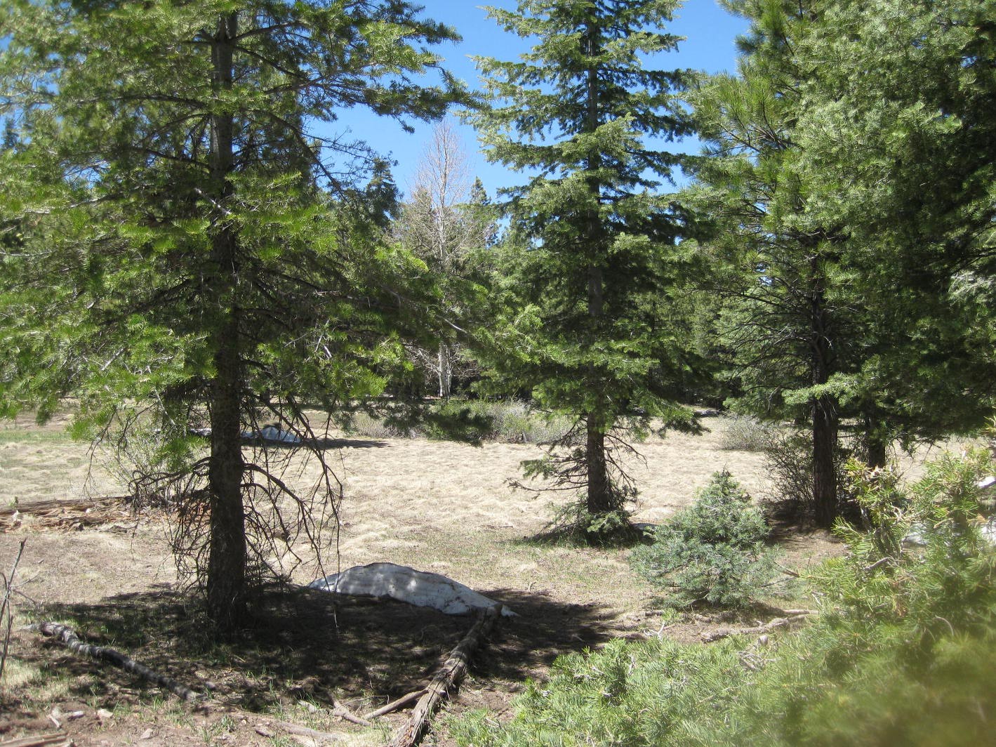
This is the meadow at the top of Mormon Mountain Trail. Note the small

snowdrift lingering in the shadow of the foremost tree.
The GPS file downloaded to my computer indicates that we hiked about 6.4 miles and climbed 1311 feet (lowest elevation of 7207; highest of 8518).

(NOTE: The described route to Dairy Springs is all paved road. If you wish to take Forest Roads, you can turn off at the Sedona Exit or at I-17 at Munds Park. See Google Maps for directions using the Forest Roads.)

The GPS track for the route we took for this hike is shown on the included map (below).


Saturday, June 19, 2010

House Mountain to Paperspine Cactus


This was a 19 June 2010 hike up House Mountain on Turkey Creek Trail to as far as the location of a cluster of Paperspine Cactus viewed on previous hikes. This plant is rare in Arizona and we were trying to catch it in bloom. We drove to Oak Creek Village and turned off Hwy 179 onto Verde Valley School Road. We continued on Verde Valley School Road (and Red Rock Crossing Road - unpaved) for 4.0 miles to a rough dirt road leading off to the left. Parking is available at this point. However, we drove on the rough 4-wheel drive road for about 0.6 miles to reach the parking area at Turkey Creek Trailhead (Location 34°48'34.51"N; 111°49'4.10"W), and stopped there for a group photograph before starting our hike.

Left to right: Donna Goodman, Ellis Price, George Everman, Kwi Johnson,

 Perlina McCombs (Photographer: John McInerney)
We stopped at Turkey Creek Tank where we had previously found some Devil’s Claw plants because I wanted to see whether any new plants had come up this year. Unfortunately, I could not find any.  I am not sure whether that is because none were growing or because I just didn’t recognize the plants when I saw them. From Wikipedia I had learned that it “is a perennial herb growing from a thick, tuber like yellow root. The stem is decumbent, creeping along the ground. The shiny leaves have rounded, oval, or roughly triangular blades up to 7 centimeters long, which are deeply lobed and wavy along the edges. The inflorescence is an array of many showy, fragrant, bell-shaped flowers with five lobes flaring several centimeters wide. The flower is yellow to orange or apricot with an intricate pattern of speckles and streaks, its lower lobe lined with a nectar guide.”  I am still looking for one in bloom.

Disappointed at not finding any Devils Claw plants, we continued on our way to check the Paperspine Cactus, pausing to admire the flowers and plants we found along the way. Before reaching the Paperspine cactus, we paused to admire and photograph two specimens. The first (right) was a stemless four-nerve daisy (Tetraneuris acaulis).

Our second find (left), identified by George as a Greenstem paperflower (Psilostrophe sparsiflora), was located a little farther along the trail.

As we climbed higher toward our goal, we passed a very attractive twisted, gnarled Juniper (below). The sort of thing that simply cannot be duplicated in the garden no matter how hard one tries.

[Utah (shaggy bark) juniper (Juniperus osteosperma) - Photograph 
by John McInerney
On arriving at our destination, we found that the Paperspine Cactus was indeed in bloom; however, it had already passed its prime.  However, we took did get one decent photograph and George declared that he would return the next year a couple of weeks earlier.

Photograph by John McInerney [Paperspine fishhook cactus (Sclerocactus
 papyracanthus)
On the way back I found a really showy Brownfoot plant (see right). It is identified in the USDA Plants Database as: Brownfoot (Acourtia wrightii).

On the way up the trail we had concentrated on close by flowers and plants. Now that we were facing north, we had the red rock country spread out before us and really had an opportunity to enjoy the view. After taking the photograph of the Brownfoot plant, I forgot that I even had a camera, but John stopped along the way to take the following photograph.


Red rock country from the trail above Turkey Tank – by John McInerney
As we neared Turkey Tank, I finally remembered my camera again and took it out for one last photograph (right) of a Soaptree Yucca (Yucca elata).

After cleaning up my GPS file in the computer, I found that we had hiked 6.1 miles round trip, the maximum elevation was 4495 feet and the total ascent was 1070 feet.

Our GPS track is shown on the included map (below).


Saturday, June 12, 2010

Iron King Mine to Deception Gulch


I was joined in my annual birthday hike by eight other hikers. We started this 12 June 2010 hike by driving on Mingus past the animal shelter and continuing on Forest Road 493 to park at a locked iron gate (bar) at the entrance to Iron King Mine, about half a mile from the junction with FR 413 (Allen Spring Road). That is the short version. What really happened is that George, Betty and I met at Deception gulch (the hairpin turn below Jerome) at 0630 and left two of our three vehicles parked there for transportation back after the hike. We then drove in my vehicle back to the Safeway Plaza in cottonwood to meet the other hikers before heading up to Iron King.

As we approached the parking area at Iron King, we began to notice a profusion of Palmer penstemon flowers. I don’t think I have ever seen so many blooming at once. We were traveling in two vehicles and one of them, not equipped with 4-wheel drive, started slipping in the gravel about a quarter-mile short of our intended parking area. As a result, those traveling in that vehicle had to do a little extra hiking. When they had arrived by foot, and before we started our hike, we paused for a group photograph courtesy of John McInerney.

Left to right: Donna Goodman, George Everman (on fence), Gordon Bice,

 Anna Lorenzelli (on fence), Betty Wolters, Perlina McCombs, Kwi Johnson, 

Ellis Price (Photographer: John McInerney
We hiked about half a mile along an old road, climbing just less than 300 feet, to reach Allen Spring Road (FR 413), which would take us to our intended destination in Deception Gulch, at Jerome.

As we left the parking area on the way to Allen Spring Road the penstemons, interspersed by prickly poppies, became ever more profuse.

Pink: Palmer's penstemon – White: Flatbud pricklypoppy
We joined Allen Spring Road at its junction with Trail 106, which leads up Mingus to the overlook. There is another road leading off to the east at the junction and ending several hundred yards ahead at what appears to be an old mine bore site. Some of the hikers were unfamiliar with that road and several of us took the opportunity to follow it and take a look at the bore site. The rest of the group waited at Allen Spring Road. The trip on the side road was just one-third of a mile to the end and back and it didn’t take very long.

After we returned from the old bore site and resumed our hike toward Jerome, we found that the penstemons, while still present, were no longer as prevalent as before. However we were graced with great views of Verde Valley below and we found a multitude of other flowers along the way. These included Colorado four o’clocks, evening primroses, desert globemallows, New Mexico thistles, narrowleaf four o’clocks, larkspurs, Arizona thistle and many others.

Colorado four o'clock
Hooker's evening primrose
Desert globemallow
New Mexico Thistle 
Greenstem paperflower
Narrowleaf four o'clock

Anderson's larkspur
Arizona thistle

Silver Leaf Nightshade
Roving sailor
Field bindweed
Sacred thorn-apple
Alpine aster
Golden columbine
Alkali buttercup
Rocky Mountain penstemon
Looking through my file, I found another couple of pictures taken by John that just beg for inclusion. One is of a badly damaged century plant that just won’t quit and the other is of Kwi and her friend Perlina.

Century Plant (agave)-photo by John McInerney
Kwi Johnson and Perlina McCombs-photo by John McInerney
We stopped at an unnamed Spring for lunch. The spring is located at a sharp bend in the road about four-tenths of a mile south of the concrete bridge in Mescal Gulch at what appears to be an old mine site. I have hiked this way all times of the year and never found the spring to be dry. In hot weather, I always try to time my arrival at the spring for lunch and a nap.

George and Anna eating lunch at Noname Spring, (Anna is visiting from 
Switzerland for a month)
There were fewer flowers to see after we left the spring and the hike on into Jerome was pretty uneventful.

All in all, this is a pretty straightforward hike. It is easy to access and except for the initial half-mile there is essentially no climbing required, as the road runs along the Jerome waterline, ending about 1000 feet lower at Deception Gulch than at our starting point. Allen Spring Road itself ends in Jerome at the intersection with Gulch Road. From there, one can turn up Gulch Road N to come out on 89A below the Methodist Church or down Gulch Road S to come out on 89A at the hairpin turn in Deception Gulch. We had parked our vehicles in the parking lot at the small city building near the intersection with Gulch Road S and 89A and so choose to return there.

The hiking distance, according to my GPS, was 9 miles, and the hike took about 6 hours and 20 minutes, including rest time. I am sure it would have been a lot faster had I not been dawdling and photographing flowers, but I am unrepentant. After all, this was my birthday hike.

When we arrived back at the Safeway Parking lot, John volunteered to take Gordon and Donna to retrieve their vehicles from Iron King Mine where they had driven us to start the hike. Some of us immediately left for home.

However, the day’s adventures were not yet over for some of the group. Anna and George wanted to get some ice cream at the local shop. Unfortunately, after most of had left, Perlina’s car failed to start for her intended return home to Sedona, and attempts to jump start it were unsuccessful, so Triple A was called. The response took 90 minutes, and the tow truck arrived with another car already in tow. The driver couldn’t get Perlina’s car started either and decided that he would have to deliver the one he already had in tow to the shop in Sedona and then return for hers. Perlina arranged to ride with the tow driver to the shop for the first delivery and the shop owner agreed to give her a ride on home. The tow driver would return for her car and deliver it to the shop.

George and Anna did finally get some ice cream and I am told that it was delicious.

It was a most enjoyable birthday hike for me, and I am sure that I speak for all when I say that I enjoyed meeting two new hikers (Perlina McCombs, Kwi's friend from from Sedona and Anna Lorenzelli, visiting from Switzerland).

The GPS track for this hike is shown on the included map (below).


Saturday, June 5, 2010

Bell Trail 12


Parking at Trailhead
Location: 34°40'26.88"N; 111°42'48.49"W
Elevation: 3856

Along with five others, I hiked part of the Bell Trail on 05 June 2010. George and Betty suggested this hike. However, after discussing the weather and the projected presence of “no see ums” (Ceratopogonidae, or biting midges) with a group of naysayers, Betty decided to sit this one out. Donna, Gordon, Loren, John and I met at the normal gathering spot in the Safeway parking lot and then proceeded to meet George at the I-17/Hwy 179 intersection. From there we traveled east on Forest Road 618 for about 2¼ miles before turning left on Forest Road 121 to proceed to the trailhead about ¼ of a mile ahead. The road turns to the right toward a Forest Service complex after a hundred yards or so and one must continue straight ahead to reach the trailhead. It is not hard to find.

On reaching the trailhead, we donned our packs and started up the trail, stopping to read the trail information sign along the way.

Forest Service Trail Description
As we continued on up the trail, we saw a beautiful patch of trailing four o’clocks followed immediately by one of silverleaf nightshade.

Trailing Four O’clock
Silver Leaf Nightshade
After admiring the flowers we paused for a group photograph.

Left to right: George Everman, Donna Goodman, Gordon Bice, Loren 
Pritzel and John McInerney (Photographer: Ellis Price)
A raven perched high on a dead limb alongside the trail, called a welcome to us as we passed -- or perhaps it was a curse. I stopped for a shot of the raven and to admire a honey mesquite bush growing nearby.

Raven sentinel posted alongside the trail
Western honey mesquite (Prosopis glandulosa)
John told us there was an Indian ruin ahead and we found it, about 1.75 miles from the trailhead, by following a faint trail leading toward the creek.

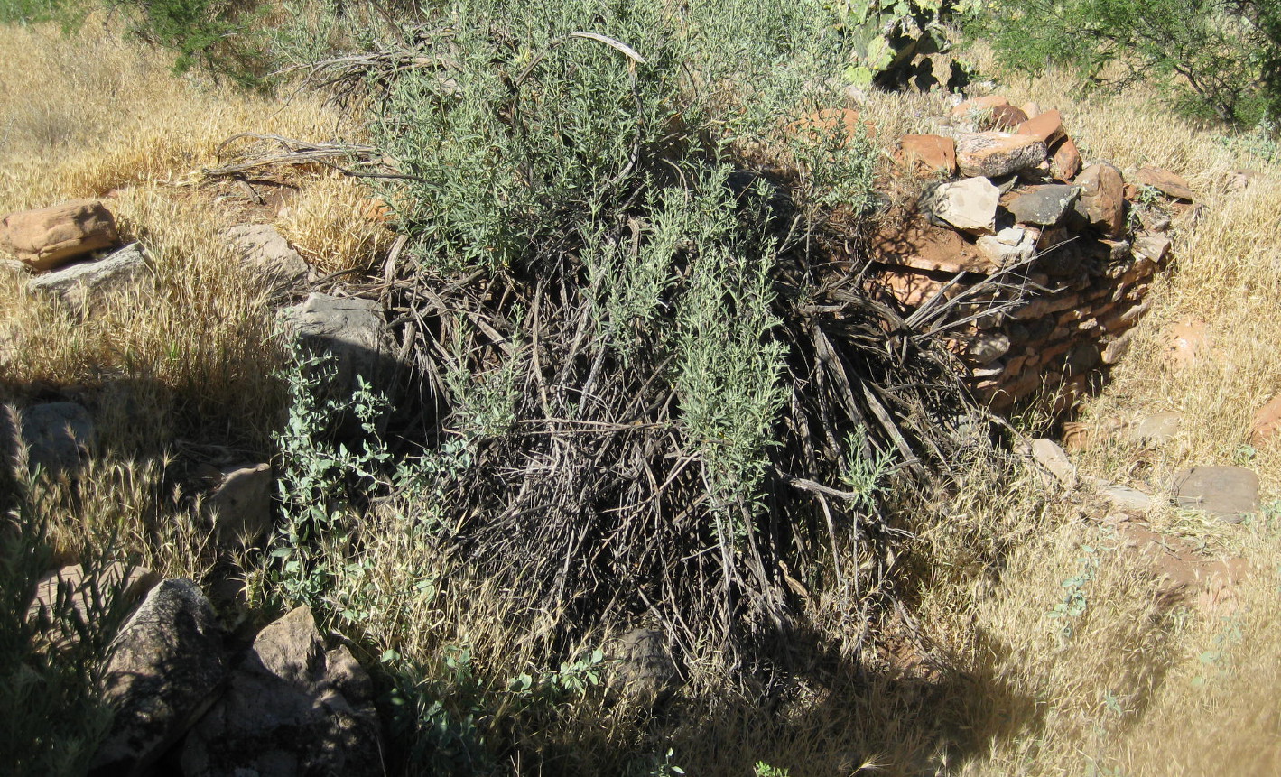
Indian ruin just off trail about 1¾ miles from the trailhead
Leaving the Indian ruin, we continued for just over ½ of a mile further before turning toward the creek on Weir Trail. This is an excellent place to stop alongside the creek to rest and dangle ones feet in the water or, if getting your feet wet is not your thing, just relax for a spell in a shady spot and listen to the rippling stream.

This is a pool just below the weir
I wonder if the fish will bite his toes?
Donna doing some rock hopping
A cable car is installed to cross the creek at the weir. While it appears to be maintained in good condition, we were not able to determine what it is used for. It was locked to prevent unauthorized use, but we decided that did not preclude a bit of posing.

Ready to go, but all locked up
When we were ready to continue, Gordon, George and Donna returned to Bell Trail by way of Weir Trail. Loren, John and I took a shortcut, scrambling up the mountain to reconnect with the trail and waited there for the rest of the group. While waiting, we were passed by at least 35 or 40 other hikers, many of them on a bus tour from Colorado. Apparently Bell Trail was recently written up in Arizona Highways magazine and it is currently much in vogue. Everyone was headed to the swimming hole at the crossing. Most of the group from Colorado, all apparently of high school age, were ill-prepared to for a 3½ mile hike on a day when the temperature reached 103% F. Most of the boys were shirtless and the girls were mainly wearing bikinis.

One poor girl appeared to be in the early stages of heat exhaustion when they reached where were waiting. Someone talked her into staying in the shade with us until the group leader, wisely hiking at a more leisurely pace, arrived. When the rest of our party arrived, the girl still didn’t look much better, but she was now in the care of the group leader, and we continued on our way.

The crossing area does have a great swimming hole I one cars to dive in from a high rock ledge; however at this particular time the tour group from Colorado were there in full force and they sounded, as one might expect, like a bunch of high-school students on vacation.

Nevertheless, by continuing a short distance on up the creek, I found a shady spot on a rock where the noise from the swimming hole was bearable and settled in for lunch and an hour-long nap. It seemed that I had barely dozed off when I heard the group calling me for the return trip.

We saw the following flowers on the stretch of trail between the Weir and the swimming hole at the crossing.

Prairie spiderwort 
Prickly Pear Cactus or Cactus apple
Ocotillo
Brownfoot
The round trip hike was about 6.2 miles except for George, Gordon and Donna who didn’t take the shortcut from the weir. I estimate that they hiked about three-quarters of a mile further. The elevation change was only about 300 feet and, while he temperature reached 1030 F, we did not get overheated, perhaps because we stopped to rest several times along the way.

Our GPS track is shown on the included map (below).