Saturday, April 10, 2010

Return to House Mountain – Indian Ruins and Cave


This was a return trip hike on Turkey Creek Trail to House Mountain and to Indian Ruins and a cave running through a butte. We drove to The Village of Oak Creek and turned off Hwy 179 onto Verde Valley School Road. We continued on Verde Valley School Road (and Red Rock Crossing Road - unpaved) for 4.0 miles to a rough dirt road leading off to the left. Parking is available at this point. However, we drove on the rough 4-wheel drive road for about 0.6 miles to reach the parking area at Trail 92 (Turkey Creek Trail).

Left to right: Gordon Bice, Dolly Yapp and Kwi Johnson (Photographer: Ellis Price)
We stopped at Turkey Creek Tank where we had previously found some Devil’s Claw plants because I wanted to see whether any new plants had come up this year.

Although no new plants were out yet, we did find a couple of well-preserved claws from last year’s crop. I took a photograph of two of these and have included that along with a picture of a blooming Devil’s Claw plant that I found on Flickr.

                   Devil’s Claws                                                                  Desert unicorn-plant (Devil’s Claw)
We continued on our way up the trail heading to House Mountain and shortly after passing the tank began to notice the sweet, faintly cloying, not quite lilac scent of Ceanothus. It never really left us for the remainder of the hike. After crossing two distinct washes, the trail starts switchbacking up House Mountain and the going becomes moderately difficult. About 1¼ miles along from Turkey Creek Tank, the trail makes a sharp turn to the right. A cairn alongside the trail followed a few yards further by a second cairn marks the spot.

Kwi and Dolly resting at the turn in the trail near the patch of Grama Grass Cactus
We ate our mid-morning snack and then turned of the main trail to follow a fainter track along the side of the mountain for about 45 yards to check on a patch of Grama Grass Cactus (paperspine fishhook cactus) we had found on a previous hike.

I have learned that this cactus blooms from April to June and we had hoped to see flowers. Alas, no blooms were in evidence; however, we did find that the plants were quite healthy. Perhaps another trip in early June would find them in bloom. The weather will undoubtedly be much warmer than it is now, but it is only a 6-mile round trip hike from the trailhead to this point and back. I took a few photographs of the plant, the best of which are shown here.

        Grama Grass Cactus (paperspine fish-               Grama Grass Cactus (paperspine fish-      
         hook cactus)                                                              hook cactus)
We returned to the main trail and proceeded on up the mountain, coming out on top in a saddle about 260 yards and one more switchback ahead.

We planned to turn off the main trail and climb up the east side of the saddle to the peak above John Lee Tank and then turn north and come out on top of the cliff where we had previously explored an overhang (cave) containing Indian ruins. We found that a faint trail, marked by cairns along the way, made finding our way relatively easy.

As we made our way up the mountain and then down the north slope we found a variety of plants and flowers, including Nevada Biscuitroot (white), Pancake Prickly Pear Cactus, Scarlet Hedgehog Cactus, Ceanothus, Biscuitroot (yellow), Indian Paintbrush, Thistle Cholla Cactus, Walking Stick (Cholla) Cactus, Creamcups, Desert Hyacinths, and several others not yet identified.

Photographs of the plants and flowers we saw while climbing to the peak and descending the north slope of the mountain above the Indian ruins are displayed on the following pages.

Nevada biscuitroot (Lomatium nevadense)                Pancake Prickly Pear Cactus

(Yellow flower) Lindley's silverpuffs            Desert Hyacinth (Dichelostemma
(Microseris lindleyi)                                         capitatum)
Lindley's silverpuffs                                         (Echinocereus coccineus)
   Desert Ceonothus (Ceanothus greggii)          Biscuit root (Lomatium foeniculaceu)
              Unidentified                                                  Indian Paintbrush (Castilleja                  
                                                                                       angusti- folia)
Thistle cholla (Cylindropuntia tunicata)          Walkingstick cactus (Cylindropuntia
Cactus                                                                      spinosior)
Creamcups (Platystemon californicus            Desert Gold (Leptosiphon aureus –
Benth)                                                                   Golden Linanthus)

From our position on the mountain above the Indian Ruins we had a clear view across Sedona and on to the San Francisco Peaks (barely visible just above the horizon in the center of the photograph).

Looking north across Sedona to the San Francisco Peaks from House Mountain above the Indian Ruins
We misjudged the location of the Indian Ruins and came out on top of the cliff about 100 yards north of the Ruins. We had to make our way back along the cliff edge until we came to the point that we had previously identified as the best place to descend to the ledge containing the ruins.

We spent a few minutes there and then headed on to the cave that runs through the butte for our lunch stop. To get there we traveled south then southwest along the ledge the ruins are located on until we came to a saddle that connects the butte that has a cave running through it to the cliff face of House Mountain. It is an easy 50 yards from there across the saddle to the butte. (NOTE: For more information and pictures of the Indian ruins and of the cave in the butte please refer to the report for our February 17, 2010 hike.)

After stopping at the cave in the butte for lunch and a nap, we bushwhacked out way directly down the mountain slope to a wash which we followed all the way down to rejoin Turkey Creek Trail.

Trail crosses wash below Indian ruins and Cave
Location: 34°47'24.36"N; 111°50'19.83"W
Elevation: 4095

The point where we rejoined the trail is is just over 2.25 miles from the trailhead. Below is a Mormon Tea bush in full bloom and several flowers that had bloomed since our passage over this section of the trail on the way in, some 6 hours earlier.

Mormon tea (Ephedra viridis)                             Unidentified
Blackfoot Daisy.                                                 Desert Gold (Leptosiphon 
                                                                              aureus – Golden Linanthus)
The total hiking distance for this hike was about 8 miles. My GPS batteries went out on near the top of the peak above John Lee Tank and I had to estimate our route from there to the Indian Ruins (See the yellow line on the GPS map.). From the Indian Ruins back to the main trail, I used the GPS track from our previous trip (February 17, 2010) to this location.

It appears that we total elevation change for the hike was about 1150 feet. Again, I can’t say for sure because I really don’t know that we had quite reached the high point before my batteries went out.

The GPS track for this hike is shown (with some interpolation) on the included map (below). Note that the green section of track is approximate, having been drawn by hand after my GPS batteries failed.


Saturday, April 3, 2010

Chasm Creek Trail


On 3 April 2010, eleven members of the Skyliner's group (Marvin Alt, Miriam Sterling, Lila Wright, Gordon Bice, Daisy Williams, Donna Goodman, Betty Wolters and Dolly Yapp, Ellis Price and two others) hiked on Chasm Creek Trail. We took Salt Mine Road from Camp Verde to Forest Road 574 and followed it for about three miles before parking at the trailhead.

As we started our hike, we found a profusion of light blue and yellow flowers (stock and bladderpod from the mustard family) along the way and a fiddleneck among the other flowers.

Stock and Bladderpod Fiddleneck                               Stock and Bladderpod
The trail passed through a gate and descended into Chasm Creek Canyon and crossed the creek about one-tenth of a mile on. Along the way, the Barberry bushes were in full bloom.

Barberry bushes                                                           Descending to Chasm Creek
On reaching the creek, the trail follows it upstream for about a tenth of a mile, crossing several times before climbing up the east wall of the canyon. We paused near a small waterfall to take a picture before starting the climb.

Magnified view of waterfall on Chasm Creek
The climb from the creek is quite steep for a few hundred yards, after which it levels off and crosses a wash that drains into Chasm Creek Canyon. One can climb down the wash into the canyon below and follow the creek downstream to rejoin the trail at the waterfall where it starts the climb up the east canyon wall. We would choose to do that on our return. For now, we headed on up the trail with the goal of reaching the saddle at Table Mountain, about three miles from the trailhead, by lunchtime. From the wash the trail climbs up the mountain to the northwest for about two-tenths of a mile before making a sharp turn to the southwest and continuing to climb toward the saddle ahead. About 100 yards to the north (slightly east) of the turn in the trail, at the brow of the ridge formed by Chasm Creek Canyon to the north and the wash just behind us, are located some old Indian Ruins and an excellent overlook, with views down into the canyon, across Verde Valley and the Mogollon Rim to the San Francisco Peaks above Flagstaff. We deferred a visit to the overlook and ruins to the return trip and continued on up the trail, noting several flowers along the way.

Eastern Mojave buckwheat (?)                                          Spring Parsley
Anemone Mock Vervain                                                 Wild Geranium or Phlox
Upon reaching the saddle at Table Mountain, several of us turned off the trail in favor of climbing to a viewpoint, located northeast of our position in the saddle, and at the top of Table Mountain. Others stopped to eat in the saddle itself and a couple of this group traveled a short distance on along the trail to the southwest after eating. I chose to join the group climbing Table Mountain and, on reaching the top, we wandered around a bit searching for a view to the north. However, we soon determined that the flat top of the mountain (the table, as it were) was larger than we had anticipated and returned to eat lunch at a viewpoint overlooking the saddle where the rest of our group had stopped to eat.
The photograph included here (right) provides a view of the saddle from where we ate lunch.

The next photograph (left) shows Donna enjoying lunch on Table Mountain.

After lunch we started back down the trail at a good clip, becoming a bit spread out and traveling in three loose groups. This made our hike leader a bit cranky, although I thought we were relatively well behaved. The first group did, after all, stop to wait at the intended turnoff where we were to go down the wash; and when the second group left the trail, before reaching the wash, to explore the Indian Ruins and the Chasm Creek Canyon overlook, we did leave a sentinel at the trail to alert the leader.
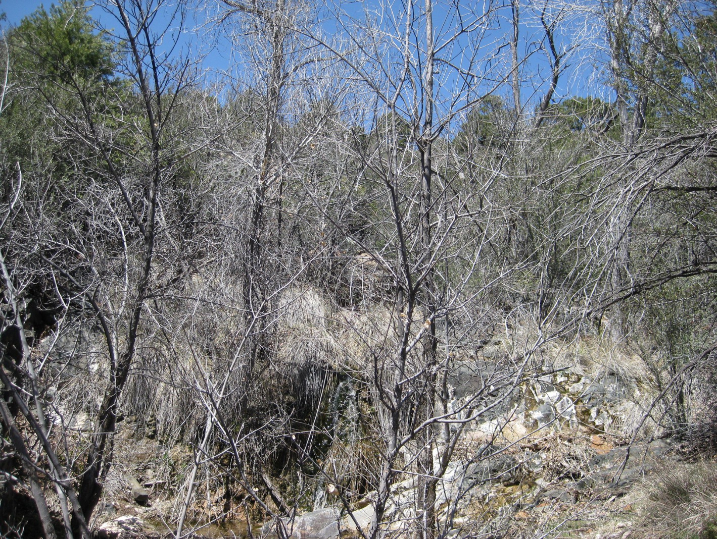
In any case, all except the first group visited the overlook. From there we could see Chasm Creek flowing down the canyon several hundred feet below and we got a close up look at the ruins.

View down into Chasm Creek Canyon
Not much is left of the ruins; just the barest outline of stacked stones that must have compartmentalized what appear to have been living areas.

Indian Ruins
Leaving the overlook, we joined the rest of the group waiting for us at the wash we intended to use to descend into the canyon. Climbing down the wash and traveling along the bottom of the canyon proved to be relatively easy as rock hopping goes. The only really rough spot was getting around the waterfall that we had stopped to photograph on the way in. There was simply no way to travel safely along the bottom of the canyon past the fall and we just had to climb around that section. But that was a minor inconvenience and the nice views (see photographs below) along the way down the wash and the canyon certainly made the detour worthwhile

In Chasm Creek Canyon

Looking up Chasm Creek Canyon
Sycamore at the mouth of a side canyon just below the waterfall
After climbing around the waterfall, we reconnected with the trail, traveled down the stream, climbed out of the canyon and returned to our cars. Along the way, I found a couple of flowers that I had missed on the way in – a fiddleneck (below left) and fringed redmaids (below right).

Fiddleneck                                                              Fringed Redmaids
According to my GPS file, the total hiking distance was 6.6 miles and the elevation change, low point to high point, was 1630 feet.

Our GPS Track for this hike is shown on the included map (below)


Saturday, March 27, 2010

Lower Black Canyon Trail


On 27 March 2010, ten members of the Skyliner's group (Lila Wright, Anita Jackson, Virginia Driscoll, Dolly Yapp, Marvin Alt, Daisy Williams, Donna Goodman, Jim Manning, Ellis Price and one other) hiked on Black Canyon Trail. From Cottonwood we took Camino Real (and then Old Hwy 279) through Verde Village to Ogden Ranch Road at Montezuma School. We turned toward the mountain on Ogden Ranch Road and traveled three miles to the end of the road at the Black Canyon Trailhead.

Shown below are three members of the group as we prepare to start the hike. Look carefully and you will the snow-covered San Francisco Peaks on the horizon.

Virginia, Marvin and Lila with the Mogollon Rim and the San Francisco
Peaks in the background
One enters the trail from the trailhead by passing through a barrier erected to block all-terrain vehicles and then walks alongside a wash for just less than one-tenth of a mile before dipping into and crossing the wash. The turn into the wash is not obvious and the trail appears to continue along the bank of the wash. I have temporarily lost the trail at this point more than once and others have told me of having the same experience. After crossing the wash, the trail follows along a hillside for something like one-third of a mile and then dips down to cross another wash. After that it passes through two wire gates fairly close together and continues a steady, but rather gentle climb up the mountain. We paused frequently along the way to look at flowers and take in the view back across Verde Valley to the Mogollon Rim and the San Francisco Peaks beyond. The only clouds in the sky were hovering just above the rim, clustered mostly around the peaks.

Clouds clustered around the San Francisco Peaks – zoom shot
Although the height of the flower season was yet to arrive, we did find Primroses, Deer Vetch, Filaree, Desert Hyacinths, Indian Paint Brush and Ceanothus along the way.

Primrose                                                                     Deer Vetch
In the left photograph the primrose has two current blossoms, three buds can be seen (middle top to center) waiting their turn for glory and two old, shriveled blossoms are visible (upper right and bottom center). A couple of stray Filaree blossoms (reddish purple color) are faintly visible in the lower right. The Deer Vetch shown in the right photograph appears again in the left photograph below

Filaree plant                                                              Desert Hyacinth
In the left photograph above, the reddish purple at bottom center is new growth Filaree. Deer Vetch is visible to the upper right the upper right in the photograph (See single yellow blossom just above/behind the Filaree).
Indian Paint Brush hiding in the grass                Ceanothus


Around one and a-third miles from the trailhead we came upon a faint trail leading down toward what appeared to be an overlook near the bottom of the canyon and decided to explore.

The faint trail descended some 250 feet in a distance of about a third of a mile to a point overlooking the bottom of the canyon just opposite a side canyon with a small waterfall.

Looking across Black Canyon from the overlook to a barely discernible
waterfall (center) in a side canyon
We climbed back up to the main trail and, after a pause to rest from the effort, continued on our way toward the halfway point on Black Canyon Trail where we planned to eat lunch and turn back. After hiking about another 1.45 miles on up the trail, we arrived at a wash leading down the mountain to drain into Black Canyon. I have previously determined that this spot is at about the halfway point on Black Canyon Trail. Just after crossing the wash on the way up the mountain, the trail enters a Manzanita forest. There are actually two separate washes that run together at this spot and continue on down to the canyon below. The trail crosses both of them just upstream from the juncture, passing through first one then, less than 50 yards further on, the other. We stopped for lunch at the first wash. It is always a most pleasant place to pause, with sunny exposures for the cooler months, plenty of trees for shade during hot weather and, for a large part of the year, the pleasant trickle of running water.

Manzanita forest through which Black Canyon Trail runs
This is a view up the wash from where we ate lunch. The rippling, greenish-

white cascade directly below center in this shot is a small waterfall.
On the way back down the trail, just below where we ate lunch, a couple of very attractive cacti caught my attention.

Large Prickly Pear Cactus                                      Hedgehog Cactus


Mexican Gold Poppies, barely open on our way up the trail, were now showing in all their glory and we noted several more examples of Indian Paint Brush.

California Or Mexican Gold Poppy                        Indian Paint Brush
In places the trail was lined with flowers, primarily Indian Paintbrush and Mexican Gold Poppy.

Indian Paint Brush lining the trail
Mexican Gold Poppies strewn along the trail
The total hiking distance was, according to my GPS, 8.5 miles. That includes the side trip (about six-tenths of a mile down and back) on the faint trail to the overlook near the canyon floor. Without the side trip, the hike to the spot where we ate lunch would have been about 3.25 miles. A rough estimate of the distance from our lunch stop to the upper trailhead is 3.3 miles. The elevation gain for this hike was about 1325 feet from the trailhead to where we turned back. The total ascent with the extra climbing of our side trip and climbing up and down to cross washes was just over 1900 feet according to my GPS.

Our track is shown in red on the included map (below)


Black Canyon Trail

On 27 March 2010, ten members of the Skyliner's group (Lila Wright, Anita Jackson, Virginia Driscoll, Dolly Yapp, Marvin Alt, Daisy Williams, Donna Goodman, Jim Manning, Ellis Price and one other) hiked on Black Canyon Trail. From Cottonwood we took Camino Real (and then Old Hwy 279) through Verde Village to Ogden Ranch Road at Montezuma School. We turned toward the mountain on Ogden Ranch Road and traveled three miles to the end of the road at the Black Canyon Trailhead.

Shown below are three members of the group as we prepare to start the hike. Look carefully and you will the snow-covered San Francisco Peaks on the horizon.

Virginia, Marvin and Lila with the Mogollon Rim and the San Francisco Peaks in the background
One enters the trail from the trailhead by passing through a barrier erected to block all-terrain vehicles and then walks alongside a wash for just less than one-tenth of a mile before dipping into and crossing the wash. The turn into the wash is not obvious and the trail appears to continue along the bank of the wash. I have temporarily lost the trail at this point more than once and others have told me of having the same experience. After crossing the wash, the trail follows along a hillside for something like one-third of a mile and then dips down to cross another wash. After that it passes through two wire gates fairly close together and continues a steady, but rather gentle climb up the mountain. We paused frequently along the way to look at flowers and take in the view back across Verde Valley to the Mogollon Rim and the San Francisco Peaks beyond. The only clouds in the sky were hovering just above the rim, clustered mostly around the peaks.

Clouds clustered around the San Francisco Peaks – zoom shot
Although the height of the flower season was yet to arrive, we did find Primroses, Deer Vetch, Filaree, Desert Hyacinths, Indian Paint Brush and Ceanothus along the way.

Primrose                                                                                Deer Vetch
In the left photograph the primrose has two current blossoms, three buds can be seen (middle top to center) waiting their turn for glory and two old, shriveled blossoms are visible (upper right and bottom center). A couple of stray filaree blossoms (reddish purple color) are faintly visible in the lower right. The Deer Vetch shown in the right photograph appears again in the left photograph below

Filaree plant                                                                                Desert Hyacinth
In the left photograph above, the reddish purple at bottom center is new growth Filaree. Deer Vetch is visible to the upper right the upper right in the photograph (See single yellow blossom just above/behind the Filaree).

Indian Paint Brush hiding in the grass                                     Ceanothus
Around one and a-third miles from the trailhead we came upon a faint trail leading down toward what appeared to be an overlook near the bottom of the canyon and decided to explore.

The faint trail descended some 250 feet in a distance of about a third of a mile to a point overlooking the bottom of the canyon just opposite a side canyon with a small waterfall.

Looking across Black Canyon from the overlook to a barely discernible waterfall (center) in a side canyon
We climbed back up to the main trail and, after a pause to rest from the effort, continued on our way toward the halfway point on Black Canyon Trail where we planned to eat lunch and turn back. After hiking about another 1.45 miles on up the trail, we arrived at a wash leading down the mountain to drain into Black Canyon. I have previously determined that this spot is at about the halfway point on Black Canyon Trail. Just after crossing the wash on the way up the mountain, the trail enters a Manzanita forest. There are actually two separate washes that run together at this spot and continue on down to the canyon below. The trail crosses both of them just upstream from the juncture, passing through first one then, less than 50 yards further on, the other. We stopped for lunch at the first wash. It is always a most pleasant place to pause, with sunny exposures for the cooler months, plenty of trees for shade during hot weather and, for a large part of the year, the pleasant trickle of running water.

Manzanita forest through which Black Canyon Trail runs
This is a view up the wash from where we ate lunch. The rippling, greenish-white cascade directly below center in this shot is a small waterfall.
On the way back down the trail, just below where we ate lunch, a couple of very attractive cacti caught my attention.

Large Prickly Pear Cactus                                                            Hedgehog Cactus
Mexican Gold Poppies, barely open on our way up the trail, were now showing in all their glory and we noted several more examples of Indian Paint Brush.

California Or Mexican Gold Poppy                                       Indian Paint Brush
(Eschscholzia california or mexicana)
In places the trail was lined with flowers, primarily Indian Paintbrush and Mexican Gold Poppy.

Indian Paint Brush lining the trail
Mexican Gold Poppies strewn along the trail
The total hiking distance was, according to my GPS, 8.5 miles. That includes the side trip (about six-tenths of a mile down and back) on the faint trail to the overlook near the canyon floor. Without the side trip, the hike to the spot where we ate lunch would have been about 3.25 miles. A rough estimate of the distance from our lunch stop to the upper trailhead is 3.3 miles. The elevation gain for this hike was about 1325 feet from the trailhead to where we turned back. The total ascent with the extra climbing of our side trip and climbing up and down to cross washes was just over 1900 feet according to my GPS.

Our track is shown in red on the included map (below)


Saturday, March 20, 2010

Etta Mine Hike

On 20 March 2010, eleven Skyliners hiked from Cherry Road to Etta Mine and back. We took Hwy 260 toward Camp Verde and turned onto Cherry Road at the County Complex. We followed Cherry Road for about 6.5 miles and parked at the junction with Forest Road 361. The junction is located approximately at mile marker 11.9 on Cherry Road.

Our intended goal for this hike was Monarch Mine. However, we made a wrong turn during the hike and wound up at Etta Mine instead. We then decided to rename this the “Etta Mine Hike” and turn back, leaving Monarch Mine for another day. Hikers included Jim Manning, Donna Goodman, Marvin Alt, Fran Lind, Daisy Williams, Collene Maktenieks, Dolly Yapp, three unnamed hikers and Ellis Price (the photographer, not shown).

We were a bit taken aback to find that the road led downhill at the start of the hike. We generally prefer to do our climbing at the beginning of a hike while still fresh and do the easier downhill part on the way back. This hike turned out to have many ups and downs as we wound our way through the foothills. About one mile from Cherry Road where FR 361 crosses a wash, we thought we could hear water running. A little investigation showed that water was indeed running in the wash above the road but that it all sank into the bed of the wash before reaching the road. Later reference to a topo map revealed that we were at Blue Monster Spring. The map also showed another spring, called Pfau Spring, about two-tenths of a mile further along FR 361. We did not see a spring at that location, so assumed that it must be located below the road. However, we did find some old mine ruins with quite elaborate stonework alongside the road.I couldn’t find a name for this mine and have just labeled it “mine near Pfau Spring.”

Mine near Pfau Spring. This mine is located along FR 361 about 1.25 miles from Cherry Road.
After passing the mine near Pfau Spring, we continued on FR 361 for just over another mile and a half (about 4.5 miles from Cherry Road) before we came to a road leading of to the left that we thought might be the road to Monarch Mine.

Taking that road we soon found that it did not lead to Monarch Mine. However, we could see another road running along the mountainside above and to the northwest of us. We took a short side road that led us up a wash in the direction of the road we could see ahead and, when that road ended, bushwhacked our way on up the mountainside.

Upon intercepting the road running along the mountainside, we followed it on up the side of the mountain until it ended at an unidentified mine that I later identified as Etta Mine. We stopped there for lunch.

After lunch I gave up my customary noon nap in favor of climbing to the top of the ridge above the Mine. Dolly, Jim and I climbed through a manzanita grove that was in full bloom to come out on the mountaintop in one of those sandy, open spaces that look more like an ocean beach than something to be expected on a mountaintop.

The views from the top were spectacular, well worth the extra climb from the mine below. Laid out before us was a slice of Mingus Mountain to the northwest, the upper reaches of Verde Valley to the north, the San Francisco Peaks to the northeast beyond Sedona and, further toward the east, a view of the red cliffs of the Mogollon Rim directly across Verde Valley:

From atop the ridge above Etta Mine facing northwest. A slice of Mingus Mountain is shown in the center
From atop the ridge above Etta Mine facing north by northwest. A bit of Mingus is shown at the left edge
From atop the ridge above Etta Mine facing north. The San Francisco Peaks are visible to the right
From atop the ridge above Etta Mine facing northeast. The San Francisco Peaks are visible the left
From atop the ridge above Etta Mine facing northeast. A magnified view of the San Francisco Peaks
After looking at the far off views, I focused on the always-beautiful manzanita nearby.

Large Manzanita above Etta Mine                Large Manzanita above Etta Mine

After lunch, we started our trek back to Cherry Road. However, when we reached the point where we had entered the mountainside road after bushwhacking up the side of the mountain, Carol and I continued along Etta Road to map the route to FR 361. The rest of the group bushwhacked their way back down the mountainside the way we had come. When Carol and I arrived at the junction with FR 361, we found that four roads actually come together there. It could have been a bit confusing; however, there were signs posted and we knew that we would need to turn south to rejoin the rest of the party.

Later reference to a topo map showed that roads marked as FR 361 lead in three directions from this junction: to the northeast to end at Old Hwy 279 near Hwy 260 at Thousand Trails, to the northwest to end about 0.6 miles ahead, and south to end at Cherry Road. At the junction we were about two-thirds of a mile from where we had turned off on the way in. To reach Monarch Mine, our original goal for this hike, we should have continued on FR 361 to this junction, taken the road leading east (labeled as FR 361 on some maps) and followed it for about seven-tenths of a mile. The road runs between what is apparently two separate claims that constitute Monarch Mine and continues on up the mountain for a short distance before ending.
NOTE: I have have shown the road to Monarch Mine as a green track on the included map (below).

The total distance for this hike as shown on my GPS was nine miles. That includes the climb to the top of the ridge above Etta Mine and the extra distance (over a mile) hiked by Carol and me to follow the Etta Mine Road on to the junction with FR 361. The change in elevation from the low point to the high point of the hike was about 900 feet; however from a quick look at my GPS file, I estimate that the additional climbing, going up and down to cross the foothills along the way, added another 1000 feet. In other words if you went on this hike and then felt that you had climbed closer to 2000 feet, you were not far wrong.

The GPS track of this hike is shown on the included map (below) along with the road to Monarch Mine.