This
La Quinta Inn appears to be one of the original inns built by the
chain; it has small rooms and tiny bathrooms. However, it has
recently been refurbished and was quite comfortable. The continental
breakfast provided by the motel, served from 0600 to 0900 the next
morning, consisted of the standard fare – a selection of cereals,
oatmeal, fruits, waffles and yogurt.
The
motel shuttle delivered us to our terminal at the airport just after
0700 the next morning, three hours before our scheduled departure
time. US Airways, the airline we were using, had suggested an
arrival time of at least two hours before scheduled departure, but we
like to be safe.
Curbside
baggage check in, although costing us an extra $2 each, did not
appear to be any quicker or more convenient than the normal baggage
check in procedure, just a way to charge another fee.
During
the security screening process trace chemicals were detected on my
hands and I had to undergo a more thorough screening that involved a
very intimate pat down and closer inspection of my carry on bag.
They also checked my shoes and hat for trace chemicals. But the TSA
personnel were friendly and professional and it all went quickly.
We were through screening and in the waiting area within an hour of
our arrival at the airport.
Our
departure terminal at Sky Harbor was packed solid. However, we had
brought reading material and were early enough to get convenient
seats in the waiting area, so we settled in for an hour and a half of
reading and people watching.
 On
the flight to Vancouver Rosemary and I were seated in separate rows.
I had told the travel agent that we wanted an aisle and a window
seat, never imagining that they would be in separate rows. I
traveled with a couple from Texas on their way to visit Vancouver and
then cruise to Anchorage while Rosemary drew a group of college
students on their way to celebrate a wedding. The lady from Texas
spent much of the last hour of the flight leaning over and excitedly
taking pictures from the window. She was quite apologetic about
invading my space and I was intrigued by her obvious enjoyment of the
scenery below. She seemed absolutely enthralled by the snow-capped
mountain peaks visible below us (above right)
as we passed over the Cascades on our approach to Vancouver. I guess
she doesn't see much in the way of mountains where she lives in
Texas.
On
the flight to Vancouver Rosemary and I were seated in separate rows.
I had told the travel agent that we wanted an aisle and a window
seat, never imagining that they would be in separate rows. I
traveled with a couple from Texas on their way to visit Vancouver and
then cruise to Anchorage while Rosemary drew a group of college
students on their way to celebrate a wedding. The lady from Texas
spent much of the last hour of the flight leaning over and excitedly
taking pictures from the window. She was quite apologetic about
invading my space and I was intrigued by her obvious enjoyment of the
scenery below. She seemed absolutely enthralled by the snow-capped
mountain peaks visible below us (above right)
as we passed over the Cascades on our approach to Vancouver. I guess
she doesn't see much in the way of mountains where she lives in
Texas.
Our
flight arrived in Vancouver around 30 minutes early, continuing an
unbroken string of early or on-time flights for me this year. After
passing through Canadian customs, we took a taxi directly to the Days
Inn on Pender Street, chosen primarily because it is located just a
few blocks from where the cruise ships dock.
 Our
room was even smaller than the one at the Phoenix Airport La Quinta,
however, the bathroom was a bit larger. The small room was made up
for by the quality of the neighborhood as exemplified by our next
door neighbor, shown in a photograph (left)
taken from our window
Our
room was even smaller than the one at the Phoenix Airport La Quinta,
however, the bathroom was a bit larger. The small room was made up
for by the quality of the neighborhood as exemplified by our next
door neighbor, shown in a photograph (left)
taken from our window
Since
we were boarding a ship to Alaska in a Canadian port, it was
necessary to clear American customs, but this was relatively
straightforward and went quickly. We were soon enough through the
customs line and headed for our ship. We had chosen staterooms on
the main deck near the center of the ship so as to minimize the
possibility of motion sickness. Our luggage would be delivered to
our staterooms without our needing to be present, so we dropped the
small items we had carried aboard with us and headed directly to the
cafeteria-style dining area on the Lido Deck, the ship's eighth deck.
This is my favorite place to eat on Holland America ships. The food
is always excellent and the dress is casual; for me casual means
jeans.
The
Zaandam, built in 2000, is a diesel-electric driven ship designed to
carry 1432 passengers and a crew of 620. She is 785 feet long and
106 feet wide with a draft of 26 feet.
Following
the mandatory lifeboat drill, we set sail for Juneau at 1655. The
skies were clear and the temperature was a comfortable 700 F.
We sailed through the straight between Vancouver Island and the
mainland, continued between the coast and Queen Charlotte Islands,
passed outboard of the Prince of Wales Island and then continued
north between Baranof and Kulu Islands, continuing outboard of
Admiralty Island to Juneau at its north tip. Except for the short
distance from the north end of Queen Charlotte Islands to the south
tip of Baranof Island, about 150 miles, we could see land on both
sides of the ship for the entire trip. We spent our waking time
during the 44 hour trip to Juneau watching the coastline slide by,
enjoying the sunset and participating in shipboard activities.
 |
Sunset from the deck of the Zaandam – photograph by Julia
|
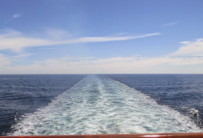 While
the others were otherwise engaged, I renewed an old habit and
pastime, studying the ship's wake (left).
Comfortably settled with a cup of hot tea, I can imagine all of
life's cares and tribulations disappearing with the wake as it fades
into the distance and a new beginning awaiting in the next port.
While
the others were otherwise engaged, I renewed an old habit and
pastime, studying the ship's wake (left).
Comfortably settled with a cup of hot tea, I can imagine all of
life's cares and tribulations disappearing with the wake as it fades
into the distance and a new beginning awaiting in the next port. Among
the activities provided by the ship were regular bar trivia sessions
and training in the use of the Microsoft 8.1 computer operating
system. Rosemary and Julie were regulars at the trivia sessions and
I, sometimes along with Rosemary, took in some of the computer
lessons. Along with all these choices, food and drinks were always
available in the cafeteria on the Lido Deck where the tables were
graced with orchids (right).
Among
the activities provided by the ship were regular bar trivia sessions
and training in the use of the Microsoft 8.1 computer operating
system. Rosemary and Julie were regulars at the trivia sessions and
I, sometimes along with Rosemary, took in some of the computer
lessons. Along with all these choices, food and drinks were always
available in the cafeteria on the Lido Deck where the tables were
graced with orchids (right).
The
ship docked starboard side to in Juneau at 1255 on 13 July. From the
ships upper decks, the city was laid out below us.
 |
| City of Juneau – photograph by Julia |
 |
Celebrity Millennium at Juneau – photograph by Julia
|
Juneau, named after
gold prospector Joe Juneau, has been the capital of Alaska since
1906, when the government of the then-Alaska Territory was moved from
Sitka. The population estimate for the City and Borough in 2013 was
32,660. Before European settlement in the Americas, the area was a
favorite fishing ground for local Tlingit Indians who called the town
Dzántik'i Héeni "river where the flounders gather."1
Juneau
has a humid continental climate (noted
for variable weather patterns related to cyclonic storms and large
temperature ranges due to interior location in mid-latitude
continents2),
though with a climate much milder than its latitude may suggest, due
to the influence of the Pacific Ocean. Winters are moist, long but
only slightly cold: temperatures drop to 20°F in January, and highs
are frequently above freezing. Spring, summer, and fall are cool to
mild, with highs peaking in July at 65°F. Snowfall averages 84
inches and occurs chiefly from November to March. Precipitation is
adequate year-round, averaging 58.3 inches at the airport, but
ranging from 55 inches to 90 inches, depending on location. The
spring months are the driest while September and October are the
wettest.3
We
didn't have a firm commitment to do anything in particular until a
salmon bake excursion at 1700. So Rick and I set out to find a free
wi-fi connection and Rosemary and Julia went shopping and visited the
library.
I
had tried the pay-to-use satellite-based wi-fi system aboard ship and
found it excruciatingly slow, but I remembered connecting at a
McDonald’s in Juneau during a 2010 cruise. Unfortunately, that
restaurant had since gone out of business, so we tried our luck at
the public library. We did get a free connection there, but it was
barely better than the system aboard ship. I gave up in disgust and
decided to just let my e-mail accumulate until we returned to the
Days Inn in Vancouver.

Although
we saw several whales, we really did not get any good photographs
during this cruise. I have instead inserted the two photographs
below, taken by our daughter Diana on a 2010 shore excursion from
Juneau called the "Photo Safari by Land & Sea".
Looking back at the whale pictures from the 2010 cruise, I wondered
whether this “showing of the flukes” might be the whale
equivalent of a finger wave, telling us just what they think of human
whale watchers.
.jpg) |
| 2010 - photograph by Diana |
.jpg) |
| 2010 - Photograph by Diana |
To
reach Salmon Creek one drives six or seven miles north from Juneau on
Hwy 7. See the below map.
 |
| Map showing area from Juneau to Salmon Creek |
 |
Salmon Bake at Salmon Creek – photograph by Julia
|
 |
| Salmon Creek Waterfall – photograph by Julia |
 At
the end of the trail we found an old abandoned mine (right)
located alongside the waterfall. The barriers, placed haphazardly
across the opening, wouldn't really serve to prevent entry. That was
surprising as the area must often be visited by children. It
would appear that mine safety standards must be either very low or,
if they exist, not enforced.
At
the end of the trail we found an old abandoned mine (right)
located alongside the waterfall. The barriers, placed haphazardly
across the opening, wouldn't really serve to prevent entry. That was
surprising as the area must often be visited by children. It
would appear that mine safety standards must be either very low or,
if they exist, not enforced.
I
think that despite the fact that the name, Chilkoot, is displayed
prominently at the mouth of the mine, the actual name is Wagner (also
listed as Boston King and as Salmon Creek Mining Company). The “mine
consists of over 1,600 feet of underground workings including 3 adits
and a shaft at least 250 feet deep (Eakin, 1915). The mine processed
gold ore with a 20-ton tubular mill and a 15-stamp mill but there is
no documentation of the amount of gold produced (Redman and others,
1989). The deposit was discovered in 1889”.5
Located
on the bank of the stream near the mine and just below the waterfall,
we saw the remains
 of a Pelton wheel water turbine (left,
photograph by Julia) used to drive a cross-compound
air compressor used at the mine. Note that there are actually two
Pelton wheels, one is almost hidden by the foliage on the right.
Each of these wheels drove a single stage of the cross-compound
turbine. I really don't know specifically what the air was used for
at the mine.
of a Pelton wheel water turbine (left,
photograph by Julia) used to drive a cross-compound
air compressor used at the mine. Note that there are actually two
Pelton wheels, one is almost hidden by the foliage on the right.
Each of these wheels drove a single stage of the cross-compound
turbine. I really don't know specifically what the air was used for
at the mine.
The
following two pictures were taken along Salmon Creek by Julia, or by
others using her camera.
 |
| Rick – photograph by Julia |
 |
| Julia – photograph with her camera |
By
the time we had finished eating the rain had stopped and we were
essentially rain-free for the rest of the cruise. My poncho is still
in the original package.
The
bus was waiting at the parking area and we were soon on our way back
to the ship, well before our scheduled sailing time. We undocked at
2136, a few minutes early, and continued our way up the Lynn Canal
(actually an inlet, not a man-made canal, into the Alaska mainland).
After an overnight cruise, we docked in Skagway at 0658 on 14 July.
Skagway
(…from the Tlingit name for the area, "Skagua" or
"Shgagwèi" meaning "a windy place with white caps on
the water”) is located on the Alaska Panhandle. It was
incorporated as a city in 1900 and re-incorporated as a borough on
June 25, 2007. As of 2013, year- round residents numbered 920.
However, this number doubles during the summer tourist season to deal
with around a million tourists.6
According to an entry in Wikipedia:
The port of Skagway is a popular
stop for cruise ships, and the tourist trade is a big part of the
business of Skagway. The White Pass and Yukon Route narrow gauge
railroad, part of the area's mining past, is now in operation purely
for the tourist trade and runs throughout the summer months. Skagway
is also part of the setting for Jack London's book The
Call of the Wild.7
William
"Billy" Moore, a member of an 1887 boundary survey
expedition, “and his son
Ben claimed a 160-acre homestead at the mouth of the Skagway River in
Alaska in the belief that
it provided the most
direct route to the potential Klondike goldfields. They built a log
cabin, a sawmill, and a wharf in anticipation of future gold
prospectors passing through.”8
Gold
was found in the Klondike region of Canada's Yukon Territory in 1896
and the first boatload of prospectors arrived at Moore’s Wharf in
July on July 29, 1897. Following that, thousands of additional
prospectors poured into Skagway, determined to make
the 500-mile journey to the gold fields in Canada. Lot
jumping prospectors overran Moore’s property and his land was
stolen from him “and
sold to others.”9
According
to the Wikipedia entry, the population of the general area rapidly
increased to an estimated 30,000 people. Meanwhile the population of
Skagway is thought to have been about 8,000 by the spring of 1898 and
it was the largest city in Alaska by June with between 8,000 and
10,000 residents. An estimated 1,000 miners (or would be miners)
passed through on the way to the gold fields each week.10
Some
of the miners chose to stay behind and offer services, such as
transportation, to those passing through rather than take their
chances in the goldfields. These services were often at exorbitant
rates and a town council was organized to protect the miner's
interests. Unfortunately, the members of the council “moved
north one by one”, leaving the town under the control of an
unscrupulous group controlled by Jefferson Randolph “Soapy”
Smith.11
Soapy
was born in Georgia, traveled west and became a cowboy, but growing
tired of the hard work and low pay, he moved on to a less strenuous
and more lucrative life as a con man. He joined the gold rush and
arrived in Skagway in 1897.12
According
to accounts I have read, Soapy was a sophisticated swindler who,
while providing aid to widows and stopping lynchings, operated a gang
of “thieves who swindled prospectors with cards, dice, and the
shell game.” Among other
swindles, he is reported to have operated a telegraph office offering
to send telegrams anywhere in the world for five dollars, this well
before the telegraph lines even reached Skagway. He had his own
private militia and controlled the newspaper and the U.S Marshall.13
His
reign was brought to an end on 8 July 1898 when he was shot to death
by Skagway city engineer Frank Reid. Reid was himself mortally
wounded and died 12 days later.14
However, I have also read that Reid was accompanied by one Jesse
Murphy and that he, not Reid, actually fired the shot that killed
Soapy.15
Located
in the temperate rainforest of the Inside Passage, Skagway has
consistent precipitation throughout the year. High temperatures
average in the 60's throughout the late spring and summer tourist
seasons. This is also the driest time of the year with average
precipitation of 1 inch per month.16
We
had all four arranged for a city tour of Skagway to see the graveyard
where Soapy Smith and Frank Reid are buried. Additionally, Julia,
Rick and I would take the White Pass and Yukon Route (WP&YR)
Railroad
to the summit. Rosemary, not enthralled with the idea of being
confined to a railcar for more than three hours, would entertain
herself in Skagway and aboard the ship.
Preceding
construction of the WP&YR Railroad, access to the Canadian
headwaters of the Yukon River which led to the Klondike gold fields
was afforded by two trails from the north end of Lynn Canal: the
Chilkoot Trail from the town of Dyea and the White Pass (or Dead
Horse) Trail from Skagway. Skagway had the advantage of a deepwater
port. Additionally, although the White Pass Trail was somewhat
longer than the Chilkoot, it was less steep. Even so, one adventurer
who had hiked both trails was heard to say, “no matter which trail
you take, you'll soon decide you should have taken the other one.”
In the end Skagway won out over Dyea because it was chosen as the
Alaska terminus of the WP&YR Railroad. A decision that must have
been strongly influenced by the presence of the deepwater port at
Skagway.
Construction
of the WP&YR Railroad, intended to connect Skagway with
Whitehorse in the Yukon, began on 28 May 1898. On July 21, 1898, an
excursion train for invited dignitaries traveled the first four miles
of completed track from Skagway, pulling three flat-bed cars with
wooden benches. The first train to White Pass ran on 20 February
1899, just nine months after construction had begun, and the last
spike was driven at Whitehorse, Yukon Territory, on 8 June 1900. The
White Pass and Yukon Route Railroad, now extended extended 110 miles
from Skagway in the United States to Whitehorse in Canada, with 20.4
miles of track in Alaska, 32.3 miles in British Columbia and 58.1
miles in the Yukon Territory.
The
day was overcast and low-lying fog was visible when we boarded the
train for our three-hour excursion to the summit and back. However,
as we left Skagway, heading up the glacier-carved valley down which
the Skagway River flows, the clouds began to lift and the fog
gradually dissipated so that we could see across the valley.
 |
Looking across the valley from the WP&YR railroad - photograph by Julia
|
 |
| Pitchfork Falls |

The
Klondike Highway which runs parallel to the railroad, but along the
other side of the valley all the way to White Pass, and then
continues on to Dawson City in the Yukon, is shown in the below
photograph. The highway can also be seen, just below the low-lying
clouds in the Bridal Falls photograph (above,
right). If you stay in Skagway very long, someone is
sure to point this road out, noting that the town is thus connected
by road to the rest of the world.
 |
Klondike Highway seen across the valley – photograph by Julia
|
Between
18 and 19 miles upstream from Skagway the canyon (valley) forks with
the main branch making a 90 degree turn to the right while the White
Pass Fork continues straight ahead. At this point it was necessary
for the builders to cross over the narrow, v-shaped, 215-foot-deep
canyon carrying the main branch of Skagway River, to continue on to
White Pass Summit. That problem was solved by constructing a
400-foot cantilever bridge across the canyon.
 |
| Cantilever bridge constructed by WP&YR Railroad in 1898 – photograph by Julia |
 |
| Remains of the old White Pass Trail seen across White Pass Fork |
The
North West Mounted Police were stationed at the summit of both
passes. Their assignment was twofold, collecting duty on incoming
goods and ensuring that every stampeder was adequately outfitted to
survive one year in the Klondike. "Adequate" translated
into one ton of goods per person, including food, tents, cooking
utensils and tools. When possible, stampeders used animals and sleds
to move their goods along the trail. But long portions of both trails
were so narrow or in such poor condition that goods had to be carried
in 50 to 60-pound packs strapped to the Klondikers' backs. Packs of
goods were moved slowly, about five miles at a time.
Many
of those using animals to drag heavily laden sleds had never really
worked with horses before and treated their animals with harsh
brutality. The stampede was fatal for many of the animals as they
were beaten and driven along the thin, sloppy trail.
There
were so many dead animals left along the way that White Pass Trail
became known as “Dead Horse Trail.”
When
we reached the summit, passengers were instructed to do the “seat
shuffle”. This involved flipping the seat back over to the other
side of the bench so that we were all seated as before, but facing in
the opposite direction for the trip back down the mountain. We also
had the chance to move to the other side of our railcar if we chose.
The
views back down were much the same as on the way up, just approached
from a different angle. However, it give us a chance to concentrate
on things we might have overlooked on the way up. For
 instance, the
close granite cliffs that appeared near enough to touch as we rolled
past. The photograph (right),
taken by Julia, shows the overhanging roof of the railcar in front of
ours along with a waterfall spraying over the cliff.
instance, the
close granite cliffs that appeared near enough to touch as we rolled
past. The photograph (right),
taken by Julia, shows the overhanging roof of the railcar in front of
ours along with a waterfall spraying over the cliff.
We
arrived back at the station in Skagway with just about enough time
left to eat lunch aboard ship and pick up Rosemary before catching
the bus (or street car as they called it) for our Skagway tour,
starting at 1315.
Rosemary
and I had both taken this tour in 2010 and thought it good enough to
repeat. The driver/tour guide on that trip was most entertaining and
informative and we expected no less on this tour. We were not to be
disappointed. Our guide this time turned out to be a recently
married young lady from San Diego who had worked in Skagway during
the tourist season before signing on with the tour company. She and
her husband, both working for the same company, have decided to stay
over in Skagway this winter. She was very much looking forward to
that new adventure, and was already planning her excursions to the
local supermarket, an IGA, when the once-a-week barge arrives
carrying fresh supplies.
According
to information provided by the company, they have been providing
tours of Skagway since “the local undertaker, Ford dealer, coal
deliveryman, and the town’s most celebrated storyteller”,
Martin Itjen, used his coal truck to take visiting President Warren
Harding on a sightseeing tour in 1923. Itjen is said to have
jokingly referred to his truck as a “street car”, hence the use
of that name to refer to what is essentially a bus. However, the
buses are quite distinctive, being either restored versions or
replicas of 1920s vehicles. In keeping with the use of vintage
buses, the drivers/tour guides are all dressed in period costumes.
Shown
below, being maneuvered into place for the next load of passengers by
our driver, is the “street car” that took us on our tour.
 |
| The "Street Car" we rode |
 Shown
here (right), as displayed on the
dash, is information identifying the manufacturer and the restorer of
the vehicle.
Shown
here (right), as displayed on the
dash, is information identifying the manufacturer and the restorer of
the vehicle.
We
first made a quick tour of the town while our “conductor” pointed
out such points of interest as schools, the post office, historical
sites and the housing provided during the tourist season for her
company's seasonal workers. Oh, yes, we did see the early childhood
home of Sarah Palin, but we couldn't see Russia from there. We then
continued on to the old town cemetery or “boot hill” where such
historical figures as Soapy Smith and Frank Reid were buried.
 Soapy
Smith's grave (left) is located just outside the boundary of the cemetery (the
boundary may have been moved later so as to exclude his grave site)
to avoid offense to those with friends or relatives buried in the
cemetery. The offending grave was still right there, the same
distance from all the others, so I am not sure how that works, but
then logic doesn't normally enter into such decisions.
Soapy
Smith's grave (left) is located just outside the boundary of the cemetery (the
boundary may have been moved later so as to exclude his grave site)
to avoid offense to those with friends or relatives buried in the
cemetery. The offending grave was still right there, the same
distance from all the others, so I am not sure how that works, but
then logic doesn't normally enter into such decisions.
In
contrast to the modest tombstone provided for Soapy's grave, Frank
Reid's (right) was quite impressive; we were told that it was erected from
the proceeds of a collection taken at his funeral.
No
mention was made of Jesse Murphy, the man said by some to have
actually fired the shot that killed Soapy Smith. That might be
because there is no grave to show tourists, a fact that would
certainly make him less interesting to the tour company.
Our
next stop was the Skagway overlook from which we had a panoramic view
of the town, the airstrip and the cruise ships in the harbor.
 |
Panoramic view of Skagway
|
 Looking
across Skagway, we could see the figure of a watch (left)
painted on a cliff above the town. We were told it was placed by
Herman Kirmse to advertise the Pioneer Jewelry Store. According to a
publication by the National Park Service the store was founded by
Kirmse in 1897.18
According to one source, Herman Kirmse is said to have placed the
advertisement there himself with the aid of a friend.
Looking
across Skagway, we could see the figure of a watch (left)
painted on a cliff above the town. We were told it was placed by
Herman Kirmse to advertise the Pioneer Jewelry Store. According to a
publication by the National Park Service the store was founded by
Kirmse in 1897.18
According to one source, Herman Kirmse is said to have placed the
advertisement there himself with the aid of a friend.
Julia
used Rosemary's camera to take a picture of the two of us with the
harbor in the background. Shown docked in the harbor are the
Celebrity Millennium and the Holland
America Zaandam.
 |
| Rosemary and Ellis at the Skagway viewpoint |
Back
aboard the Zaandam I climbed to the sky deck for a last look around
before we sailed later that evening. Beyond the Millennium docked at
the next pier I saw the colorful paintings adorning the bare rock of
the mountainside. I had noted these on the 2010 cruise when our ship
tied up where the Millennium was now docked. At that time I had
photographed the area and had learned that the “art work” had
been created over the years by the crews of visiting ships who
painted the graffiti to record there presence. I was also told that
according to local legend, every ship that has entered the port since
the late 1800’s is registered on these rocks. Most list the ships’
name, the date, and the name of the Captain. I guess they just
wanted the world to know that they were there … sort of a “Kilroy
Was Here” thing. It looked a lot like graffiti to me. In any
case, I took a picture in 2010 from the deck of the MS Volendam, the
ship we were traveling on for that cruise. It is shown below.
 |
| The “we were here” signs at Skagway – It looked a lot like graffiti to me - 2010 |
 |
Glacier visible through a mountain saddle
|
 |
| Waterfall and ice floe in Tracy Arm Fjord – photograph by Rosemary |
 |
Sawyer glacier as the ship slowly inches closer – photograph by Rosemary
|
 |
| Sawyer Glacier in Tracy Arm Fjord – photograph by Julia |
Whether
on a cruise ship or a small boat, there is a good chance of seeing
whales on the trip between Juneau and the fjord. Whales avoid Tracy
Arm itself because the ice interferes with their sonar, but mountain
goats, bears, harbor seals and birds may be seen.
After
spending about eight hours slowly cruising in and out of Tracy Arm
Fjord, we continued on our way to Ketchikan, arriving just before
1000 on the 16th of July.
Ketchikan,
incorporated in 1900 with a population of 800, was dependent on the
salmon fishing industry. It then became an important trading place
for mines in the area. Later, the decline of mining was offset by
growth of the timber industry. Now logging has almost disappeared
and is being replaced
by tourism.19
There
were more than 30 different shore excursions available in Ketchikan;
from those we all chose to visit a native village. Julia and Rick
would then attend what was billed as a “lumberjack show” while
Rosemary and I would take a walk down Creek Street, the site of the
bordellos and saloons during the mining boom. The tour bus for
Saxman native village was waiting for us when we disembarked at 1030
and we soon on our way.
Saxman
Village, located on the South Tongass Highway
two miles south of Ketchikan, was “named
for Samuel Saxman, a Presbyterian teacher who was lost at sea.”
The population in 2012 was 419 (American Indian: 204; Caucasian: 118;
mixed race 67; Hispanic: 17; Black: 3; Asian: 2)20.
The villagers, mostly Tlingit, lead a subsistence lifestyle. A
large auditorium at the village headquarters, a recently constructed
community center and a totem pole carving center provide tourism
opportunities.21
The
native villagers belong to clans named after animals; the clans are
further divided into two groups (Eagle and Raven). For marriage
purposes Eagles must pair with Ravens and Ravens with Eagles. Upon
marriage the husband moves in with the wife's family. We were told
that, because of this arrangement, which has the married couple
living with the wife's relatives, husband on wife spousal abuse is
non-existent. Nothing was said about wife on husband abuse.
We
stopped first at the village headquarters auditorium where we found
prominently displayed on the stage a traditional boat. A beaver clan
totem. Various other totems and clan symbols (both drawings and
carvings) were also displayed around the room. Some of these are
shown in the following photographs.
 |
| Beaver totem |
 |
Traditional canoe
|
 |
| Clan symbol drawings – photograph by Rosemary |
 |
| Clan symbol drawings – photograph by Rosemary |
 |
Native dance with audience participation – photograph by Rosemary
|
 |
| Villager in costume |
 |
| Community Center |
 |
Alaska Highway Department sign at Saxman Village
|
With
a bit of patience and some careful editing, I came up with a
relatively tourist-free photograph of some of the poles.
 |
Totem poles at Saxman Village
|
 After
a relatively brief stop at the woodcarving center where the artisan
(right) paused to show us examples
of the products created in the shop and some of the tools used,
Rosemary and I headed back to the ship for lunch. Rick and Julia
stayed with the guide for the rest of their tour, the lumberjack
portion.
After
a relatively brief stop at the woodcarving center where the artisan
(right) paused to show us examples
of the products created in the shop and some of the tools used,
Rosemary and I headed back to the ship for lunch. Rick and Julia
stayed with the guide for the rest of their tour, the lumberjack
portion. After
lunch Rosemary and I walked to Creek Street, not really a street at
all, but rather a boardwalk built alongside Ketchikan Creek. It was
a bordello area in the early 1900s but is now given over to bed-and
breakfasts, cafes, tourist shops and apartments, along with Dolly’s
House (a museum named after Dolly Arthur, one of the Creek Street
madams). To get there one turns off Stedman Street immediately after
crossing the bridge over Ketchikan Creek going south. The entrance
is marked with a sign (left, 2010 photograph)
mounted over the boardwalk.
After
lunch Rosemary and I walked to Creek Street, not really a street at
all, but rather a boardwalk built alongside Ketchikan Creek. It was
a bordello area in the early 1900s but is now given over to bed-and
breakfasts, cafes, tourist shops and apartments, along with Dolly’s
House (a museum named after Dolly Arthur, one of the Creek Street
madams). To get there one turns off Stedman Street immediately after
crossing the bridge over Ketchikan Creek going south. The entrance
is marked with a sign (left, 2010 photograph)
mounted over the boardwalk. Just
ahead is a second sign (right) which succinctly describes the area's original
purpose. The boardwalk continues along the creek which, during
spawning season, is thick with salmon and then crosses back over the
creek. Just before it does, there is a sign pointing to Married
Man's Trail. This trail climbs steeply up the hillside and then
continues parallel to Ketchikan Creek for about a hundred yards
before ending at Park Street. During the heyday of Dolly Arthur and
the other sporting women of Ketchikan’s infamous Creek Street,
police raids on the brothels were frequent. Spouses looking for a
quick exit to avoid hefty fines for being caught at one of the
brothels found the Married Man’s Trail to be the perfect escape
route.
Just
ahead is a second sign (right) which succinctly describes the area's original
purpose. The boardwalk continues along the creek which, during
spawning season, is thick with salmon and then crosses back over the
creek. Just before it does, there is a sign pointing to Married
Man's Trail. This trail climbs steeply up the hillside and then
continues parallel to Ketchikan Creek for about a hundred yards
before ending at Park Street. During the heyday of Dolly Arthur and
the other sporting women of Ketchikan’s infamous Creek Street,
police raids on the brothels were frequent. Spouses looking for a
quick exit to avoid hefty fines for being caught at one of the
brothels found the Married Man’s Trail to be the perfect escape
route.
The
“hefty fines” undoubtedly would have applied to unmarried as well
as to married men, so I suspect that the name given to the trail has
more to do with the double penalty suffered by married men who were
caught in the bordellos. Not only were they fined, but also had to
go home and explain to their wives what happened to the grocery
money.
I
took several photographs while standing alongside Stedman street and
pieced together a panoramic view of the the boardwalk. A bit of the
Stedman Street bridge is visible at the right and, although not
visible here, the point where the boardwalk crosses over Ketchikan
Creek, and where Married Man's Trail begins, is at the extreme left.
 |
Panoramic view of Creek Street
|

Two
Indonesian stewards, Sam and Ipin, serviced our room. They were on
an extended eight-month tour of duty aboard the Zaandam, rather like
the Western Pacific cruises I made while on active duty with the
Navy. They very happy that provisions had been made for them to vote
aboard ship in the recent Indonesian presidential election. Although
they never expressed any political preference, I gathered that they
were happy to see Jakarta Governor Joko Widodo (or as they referred
to him Jokowi) win.
Our
Ketchikan stay was relatively short, a little under eight hours; we
got underway for Vancouver at 1739. The cruising time from Ketchikan
to Vancouver was just over 35 hours and, since we left Ketchikan in
the evening, we would spend two nights and one day at sea. While
others participated in various shipboard activities, of which there
was a wide selection (bingo, trivia, movies, dancing, poker, etc), I
read a book and managed to get in another two computer sessions.
About
0630 in the morning of 18 July 2014 we were approaching Vancouver
Harbor.
 |
Vancouver harbor approach
|
The
general track of the ship's course on this cruise is shown below
(below). It is not very
detailed but does show the ports we visited.
 |
| Ship's Approximate Sailing Route |
 That
evening Julia and I walked down to the Gastown district to see the
old steam clock (right). The clock
was designed and built by Raymond L. Saunders in 1977 for Vancouver’s
then newly renovated Gastown district. Since then Saunders has
installed others, including one in Japan, one in the US
(Indianapolis) and two others in Canada. The Gastown Steam Clock
weighs two tons, cost $42,000 and was funded by local merchants. It
is now owned by the city of Vancouver. It operates on steam supplied
from an underground central heat system.
That
evening Julia and I walked down to the Gastown district to see the
old steam clock (right). The clock
was designed and built by Raymond L. Saunders in 1977 for Vancouver’s
then newly renovated Gastown district. Since then Saunders has
installed others, including one in Japan, one in the US
(Indianapolis) and two others in Canada. The Gastown Steam Clock
weighs two tons, cost $42,000 and was funded by local merchants. It
is now owned by the city of Vancouver. It operates on steam supplied
from an underground central heat system. The
plaque at the base of the clock shown here (left)
provides a brief history of the Gastown area.
The
plaque at the base of the clock shown here (left)
provides a brief history of the Gastown area.
It
had started raining on our arrival in Vancouver and continued on and
off for most of the next two days. Julia and Rosemary visited the
aquarium and took the Vancouver Hop-on Hop-Off Tour, but Rick and I
mostly just hung around the hotel. I finished a book I was reading
and downloaded and read most of the current edition of the Economist.
Julia
and Rick caught a flight back to Missouri very early in the morning
and were already gone when Rosemary and I got up the next day. We
caught a flight at 1105 and flew directly to Phoenix, arriving around
1400. As previously noted, our return trip to Cottonwood was already
booked with the Ace Express Shuttle. We had a fairly long wait for
the shuttle to arrive and then had to drive to different terminals to
pick up other passengers. By the time we picked up all the other
passengers the shuttle was pretty well packed, but it did drop us off
at our doorstep with only one intervening stop.
We
arrived home in time to eat dinner at Stromboli's before stopping to
pick up the house keys from Miriam who had kept an eye on the house
while we were absent.
1
From: http://en.wikipedia.org/wiki/Juneau,_Alaska
2
Ritter, Michael E. The
Physical Environment: an Introduction to Physical
Geography.http://www.uwsp.edu/geo/faculty/ritter/geog101/textbook/climate_systems/humid_continental.html
3
From: http://en.wikipedia.org/wiki/Juneau,_Alaska
4
http://www.traveljuneau.com/listings/moreInfo.php?ID=44425
5http://www.mindat.org/loc-202801.html
6From:
http://en.wikipedia.org/wiki/Skagway,_Alaska
7From:
http://en.wikipedia.org/wiki/Skagway, _Alaska
8Ibid
9Ibid
10From:
http://en.wikipedia.org/wiki/Skagway, _Alaska
11Ibid
12http://www.history.com/this-day-in-history/soapy-smith-killed-in-skagway-alaska
13http://en.wikipedia.org/wiki/Skagway,
_Alaska
14http://www.history.com/this-day-in-history/soapy-smith-killed-in-skagway-alaska
15From:
http://en.wikipedia.org/wiki/Skagway, _Alaska
16Ibid
17http://postalmuseum.si.edu/gold/trail.htm
18http://www.nps.gov/history/history/online_books/klgo/hpd1/app1.htm
19http://www.ketchikanalaska.com/history.html
20http://www.city-data.com/city/Saxman-Alaska.html
21
http://nativeamericanencyclopedia.com/saxman-indian-tribe-of-alaska/
you must enjoy travel to Alaska i recommend you at-least one time travel in Michigan and you will have that travel best in your life make it more attractive hire metro airport taxi at 10% and enjoy you trips in Michigan
ReplyDelete