Monday, May 2, 2016

A Hike on FR9602G, Trail 513 and FR9603E


On 30 April 2016 we hiked on Tomkins Trail #513 in the Black Hills south of Copper Canyon. We had hiked the lower part of the trail, starting at Copper Canyon, on 12 February 2008 and again on 27 November 2010. Our aim now was to hike the rest of the trail, starting at Box T Spring and ending at the terminus of the 12 February 2008 hike. To do this we would hike on Forest Road 9602G from FR 732 to the Trail 513 Trailhead at Box T Spring, follow Trail 513 for 1.5 miles to Durfee Tank and continue for another mile on Trail 513 to the end of our 12 February 2008 hike, about 0.3 miles above Tomkins Tank. There we would turn back, retrace our steps to Durfee Tank and then follow FR 9603E back to FR 732.

We left Cottonwood at 0700, drove on SR 260 to Camp Verde, turned south on I-17 and drove to the SR 169 Exit. There we turned east onto Forest Road 732 and drove 2 miles to the junction with FR 9603E where we left one of our four vehicles. We then continued on for another 0.9 miles to park the remaining three vehicles at the junction with FR 9602G to start our hike. But first we posed for a group photograph on the bank of Cienega Creek

Left to right: Lila Wright, James McGinnis, Valerie Hillyer, Ellen McGinnis, Terry Johnson, Daisy Williams, Karl Sink, Anita Jackson, Betty Wolters, Jim Gibson, Collene Maktenieks, Gilliam Ashworth, Jim Manning, Loren Pritzel and John Ashworth – author not shown
The weather report had predicted a 30% chance of rain and possible wind gusts of up to 33 mph for the area and we were all carrying or wearing raingear as we started our hike, under an overcast sky, with a brisk climb on FR 9602G.

Starting the hike with a brisk climb

We had hiked this way just two weeks ago while completing a section of Box T Trail #511 and had found a number of interesting flowers along the way. This time the most colorful thing I saw a single, forlorn groundsel that I didn't bother to photograph. I did, however, more closely examine a metal, skid-mounted, tank (right) that we had seen on that previous hike. It was tucked under a tree on the bank of the wash that runs downstream from Box T Spring and had a plastic pipe coming from that direction tucked into an opening at the top. A discharge pipe was mounted near the bottom on the downstream end of the tank. Although the tank was completely dry at the time, we assumed that it must have been installed to regulate the flow of water to some downstream location. The letters, “U S Army,” stenciled on one end, indicated that it was an Army surplus tank.

Just a short distance above the tank we came to Box T Spring. Some of today's hikers had not been to the spring before, so they lingered for awhile examining it and the surrounding area. The spring is a major junction as trails and forest road junctions go. The map insert (below) shows the road/trail system at the spring. The red track, leading in from the west (FR 9602G) and leaving heading north (Trail 513), shows our track today. The magenta track, leading in from the south and leaving to the east before turning back south, is Trail 511.

The trail/road junction at Box T Spring
Trail 513, on which we were hiking today, runs between Box T Spring and FR 136 in Copper Canyon, a distance of 4.5 miles; Trail 511 runs between FR 68D at Joe Best Spring and Salt Mine Road, a distance of 11 miles, looping north to pass Box T Spring on the way.

While the other hikers were looking around, I took the opportunity to photograph the view looking back the way we had come. Although we still had cloud cover and light mist, I could see across Prescott Valley to the distant mountains beyond. The scene (below) is actually composed a of several photographs stitched together.

Looking back the way we came from Box T Spring
We had recently been at the spring several times without seeing anything more than a friendly jackrabbit. However, several cows (below left) were milling about today. I also noted an old overgrown branding chute (below right) that I had missed before.

 Cattle at Box T Spring             Old disused branding chute
From the end of FR 9602G, we turned north and followed Trail 511 about 175 yards to the beginning of Trail 513. We stopped on this short stretch of trail for a snack break and then continued on our way. The trail at first dips into a shallow wash and then climbs up a low hill. As we started up the hill I saw a very pretty groundsel (below left) , its bright yellow flower rising above a bunch of dark red and green leaves and a contrasting patch of silvery grass growing alongside. A few yards farther along the trail was a lonely aster (below right) stubbornly growing from the baked and cracked earth.

 Groundsel bouquet        Aster                              


As we ascended the gentle slope, the trail (actually an old road) became quite rocky and when we came to the top we saw another low hill with a steep cliff running along its side. Luckily, nature had provided a break with a gentle slope up which our trail ran.
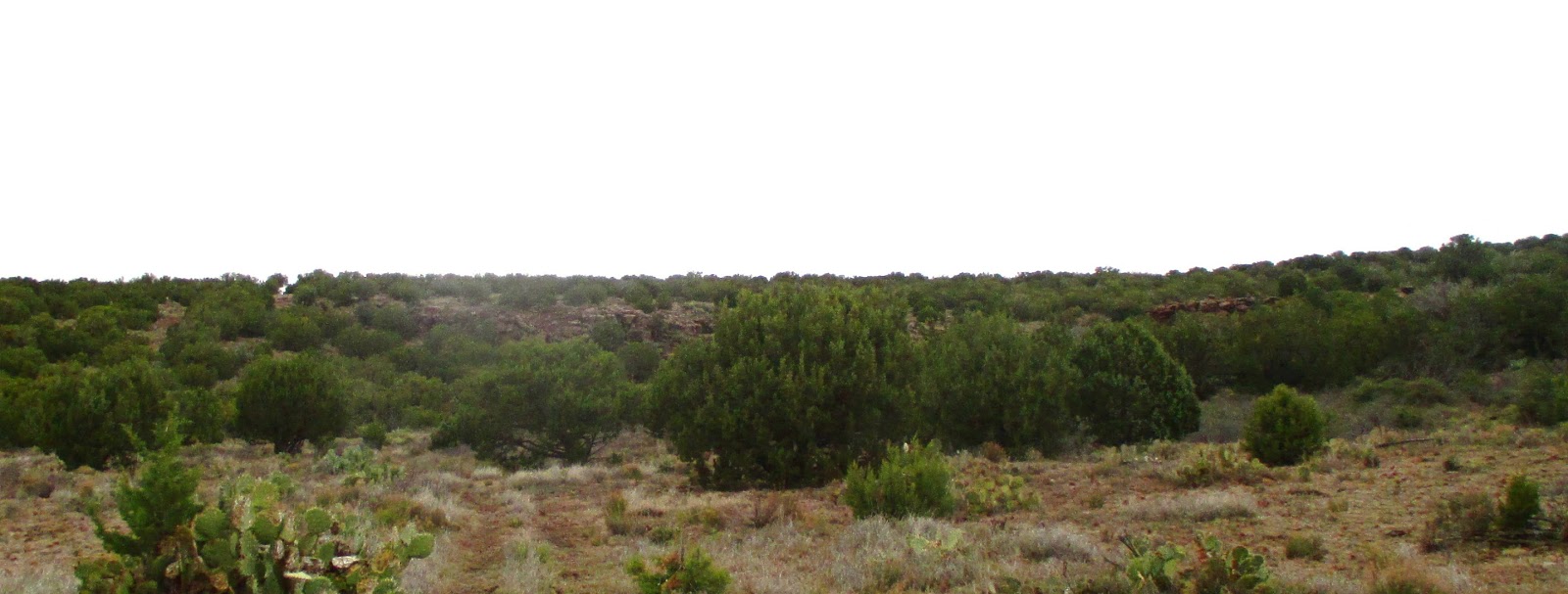
Second low-lying hill between Box T Spring and Durfee Tank
The trail, still quite rocky, made its way up the slope in the break between the two sections of rock cliffs and then turned downhill for a short distance to arrive at the junction with FR 9603E. We were at the eastern rim of Durfee Tank which lies at the head of a side canyon that empties into Copper Canyon at the site of an old stage station on General Crook Trail, now FR 136 at this point. A year-round spring Is located in the lower part of the canyon near the old station. I call it Copper Canyon Spring; but all the maps I have seen just refer to it as “Copper Canyon Water.” We paused for a few minutes and then turned east on Trail 513. We hiked for another mile, stopping along the way to admire the strikingly beautiful red flowers of a hedgehog cactus (above right), to reach the terminus of our February 2008 hike the crest of a ridge about 0.3 miles above Tomkins Tank. We stopped there to eat lunch before turning back.

I made myself a cozy nest in the gravel just under a cliffrose shrub (left) and settled in for what I intended to be a lengthy post-lunch nap. From my perch, I could look north-northwest along the Black Hills Range to Pinto Mesa directly across Copper Canyon. To the right of the mesa, I could see a slice of the Verde Valley; to the west was Prescott Valley. I contentedly settled in for my nap; alas, I had barely closed my eyes when the first raindrops fell. It never rained hard, just enough to ensure that we all donned our raingear. Trying to stay dry while napping in the rain is a tedious business, so I raised no objection to a quick departure and we headed back.

The trail back to Durfee Tank was generally downhill and from the tank we just followed FR 9603E back to FR 732. Meanwhile the rain stopped and the sun came out briefly; however we could see more clouds moving in and we hurried along at a good clip. I did pause to photograph a spring beauty (right) that I spotted alongside FR 9603E.

We passed through two gates on the way from Durfee Tank. The first gate had a quite deceptive latching mechanism. It was one of those mechanisms where a lever moves a bolt carried on the gate into a slot in the post, normally a quite secure arrangement. However, in this case, the post had moved and the bolt barely caught in the slot; the slightest gust of wind would spring it open. As a fix, the rancher had fastened a chain with an easily-operated bolt snap to the post. The chain could be wrapped around the frame of the gate to secure it. Unfortunately, once the chain was loosened it hung unobtrusively against the post and the unwary passerby was likely to just use the more obvious but insecure latch. We were pretty well strung out by now and I had to wait until the last hiker had passed through to make sure the gate was secured, so I was the last hiker to finish the hike.

We were all back at the junction of FR 732 and FR 9603E by about 1300. However, having decided that it would not be advisable to drive the non-high clearance passenger car we had left there over a pretty rough section of road to where we had started our hike, the three drivers continued afoot to pick up their cars. The distance was only about a mile; but the incident did remind us that we should be more careful in future about the vehicles we choose to drive.

Our hike is shown by the red track on the the included map (below). The yellow track shows our drive along Forest Road 732 to the junction of FR 732 and FR 9603E and on to the junction of FR 732 and FR 9602G. The short sections of green track (upper right) are portions of Trail513 hiked on 080212 and the magenta-colored sections of track (bottom center and bottom right) are portions of Trail 511.

The hike was 7.7 miles in length (8.7 miles for our three drivers Lila, Jim and Collene), the highest elevation was 5223 feet, the total ascent was 1053 feet and the total descent was 958 feet.


Tuesday, April 26, 2016

Little Coyote-Martin Canyon Loop


Last November, while hiking on Coyote Spring Trail, we had noted a road running along the mountain above the head of Little Coyote Canyon. The road seemed to be a likely possibility for a hike, so a few of us scouted it on 24 February of this year and found that if we started at the south Woodchute Trailhead the hike to the end of the old road and back was 7.4 miles.

This was quite suitable for a regular Skyliner hike, so we scheduled it for 23 April 2016. From Cottonwood we drove south on SR 89A through Jerome to the summit of Mingus Mountain. There we turned right onto Forest Road 106, drove 0.3 miles, angled left at the presently-closed entrance to Potato Patch Campground and continued for another 0.10 miles to a the end of the pavement at a roughly circular graveled area with toilet facilities. After a brief pause to use the facilities, we gathered for a group photograph by Name Withheld.

Left to right: Donna Goodman, the author, Collene Maktenieks, Anita Jackson, Joanne Hennings, Jim Gibson, Lila Wright, Daisy Williams, Gary Jacobson, Floyd Gardner, Mark Purcell and George Everman – not shown is Jim Manning
Leaving the rest area, we continued for another 0.7 miles to the south Woodchute Trailhead, passing Powerline Tank along the way. This brought us to the end of FR 106.

At this point we split into two separate groups. The main group of hikers would park here to start their hike. Both groups (one afoot, the other in a 4-wheel drive vehicle) left the trailhead traveling west on FR 106D. At first this road was well-maintained and had even been graveled recently. After about 0.2 miles, however, the road passes through a fence and is unmaintained beyond that point. Although still passable for high-clearance, 4-wheel drive vehicles, it is very questionable for other vehicles. In February the gate had been open and was indeed in such a state of disrepair as to be useless. Now it had been repaired, sort of, and was closed. However, there was a large enough gap at one end of the gate to allow any determined cow to pass through. I guess it worked because the grass, instead of being “greener on the other side of the fence”, was absent altogether.

Note the large, cow-sized gap at left

About 0.6 miles from the parking area, FR 106D passes Hickey Tanks (plural because two tanks are located close together at the site) at an unsigned fork in the road (right). The forest road continues by way of the right fork. The left fork just provides access to the tanks.

Approximately 0.4 miles west of Hickey Tanks, we came to another fork in the road. Here FR 106D turns to the left (south) and continues to Mingus Tank, passing the turnoff to Hickey Mountain on the way. Leaving FR 106D at this point, we continued straight ahead, now on FR 106E and, after another 0.2 miles, arrived at the junction with FR 9710W which leads down the mountain to end at Little Tank (just above Turkey Tank) where the old unnamed road starts. We usually refer to area where FR 9710W ends as Turkey Tank, although it is actually located at the much smaller Little Tank. I suppose that is because Turkey Tank, located about 0.2 miles to the east, is the more prominent landmark. This figure (below) shows the end of FR 9710W at Little Tank; it also shows Turkey Tank and Martin Canyon Tank.

End of FR 9710W at Little Tank near Turkey Tank
The group of hikers who had started their hike at Woodchute Trailhead would continue along the old unnamed road to its end at a tank located on the ridge above Martin Canyon and then would return by the same route. The smaller group (George Everman, Gary Jacobson, Donna Goodman and the author), having driven this far would park and follow the same path as the other group to the end of the old road. However, instead of returning by the same route, we would bushwhack our way down the ridge into Martin Canyon and follow Martin Canyon Trail #103 back to where we had parked at the end of FR 9710W. Because our small group would do some bushwhacking we referred to ourselves as the “bushwhackers.”

For it's first 1.2 miles the old road, starting at Little Tank, curved gently around the upper watershed of Little Coyote Canyon. As we hiked along we wondered where the canyon got its name. Since it appears to be a bit larger than Coyote Canyon, the next canyon to the south, we finally decided it must have been named after a small coyote. It was a bit hazy and the normally great view out across Prescott Valley was obscured. Closer in, other than a sad looking cactus or two, I didn't note any flowers along the way. Meanwhile, a brisk, chilly wind was blowing and becoming ever stronger as we moved along, so we really didn't spend a lot of time looking around.

As we passed between a lofty 7280 foot peak on the right and a smaller 6920 foot one on the left, leaving the Little Coyote Canyon watershed behind, we could see a saddle in the ridge on our right that formed the south rim of Martin Canyon.

Gap in the ridge after we left the upper Little Coyote Canyon watershed

The end of the road we were following lay at a tank located partway up the eastern shoulder of that saddle. The distance along the road from Little Tank to the unnamed tank in the saddle is 1.8 miles.

The main group of hikers turned back at this point while the so called “bushwhackers “ followed a faint old cow down into Martin Canyon to connect with Trail 103 at the bottom. I had followed that faint old trail for a short distance when we did the scouting hike and then had sketched a probable course for it the rest of the way down the slope, basically just using contour lines to draw a track along what appeared to be the easiest slope.

My hand-drawn track worked well for only about 160 yards; then the cow trail deviated to cross over a low ridge and pass along the top of a sheer rock ledge before descending into the canyon. We were then able to follow old cow and elk trails down the worst of the slope. At the descent from the rock ledge, we stopped for a snack. As shown in the photograph (left), the other side of Martin Canyon is in view across the way and the bottom of the canyon along which Trail 103 runs is just below us.

The series of faint trails we were following lasted until we were clear of most the scrub oak and other assorted vegetation that grows higher up on the canyon wall. By then we were almost to the bottom, descending along a gentle slope covered with scattered ponderosa pines and little undergrowth. We came out about 0.6 miles upstream from where I had intended and about 0.1 miles above Smiley Rock. Determined to see and photograph that often-mentioned landmark, we shed our packs and hiked downstream to find it. Looking for something much larger than a medium-large stone close by the roadside, I walked right by Smiley Rock. Luckily the other hikers were paying closer attention and called me back. Although the head is tilted to the right (Smiley's right, that is), it is easy to discern the features of a smiley face in the rock. I took a photograph (below left) for my report and George then gave Smiley some eyeballs and took another (below right).

        Smiley Rock                     Smiley Rock with               
                   eyeballs
This figure (below) shows the planned, hand-drawn track (green) along with the actual track that we followed from Unnamed Tank (where the main group of hikers turned back) to Trail 103.

Planned and actual tracks from Unnamed Tank to Trail 103 in Martin Canyon
After spending a little time admiring Smiley Rock, we returned to where we had left our packs and, although it was still a little early, stopped for lunch. The photograph (below) shows the hikers enjoying the warm sun before continuing up the canyon.

Left to right: Gary Jacobson, Donna Goodman and George Everman – author not shown

According to the forest service description, Martin Canyon Trail follows along an old road that was bulldozed to provide access for the construction and maintenance of stock tanks located in and above the canyon. The trail is 6.3 miles long, starting at the end of Forest Road 9710W and ending at James Tank in the valley below the mouth of the canyon. The forest service says that full size vehicles are allowed on the trail “but it has been our experience that only modified high clearance vehicles are able to negotiate this trail, standard factory high clearance 4x4s are not recommended.1

The old road is also a part of The Great Western Trail, a north-south long distance multiple use route, running from Canada to Mexico through Arizona, Utah, Idaho, Wyoming, and Montana. The trail is 4,455 miles long and “has access for both motorized and non-motorized users”2. The photograph (below) shows a section of the road between Smiley Rock and Rick Tank. Several areas were much rougher than the section shown.

Martin Canyon Trail above Smiley Rock
Rick Tank is located about 0.3 miles above Smiley Rock. To me it appears that the tank may have been an afterthought. It seems to have been constructed right in the middle of the original road, which was then rerouted. What must have been the original road, running straight through the tank, is now blocked off both below and above it.

I had hiked down Martin Canyon as far as Rick Tank Cutoff Trail #104 in 2009, followed it to Woodchute Tank and then returned by way of Woodchute Trail #102. For that hike we had also parked at the south Woodchute Trailhead and followed today's route to the end of FR 9710W at Little Tank. We had then turned down Martin Canyon on Trail 103 to access Rick Tank Cutoff Trail #104.

In 2009 a trail sign (right) was posted at the junction and we started looking for it as soon as we left Rick Tank. This time we saw no such sign and completely missed the trail junction. I think the sign must have been torn down and I had not bothered to place a marker on my GPS track. It is a good thing we were not planning on taking the trail to complete this hike.

We did, however, find a few other things to draw our attention. For instance, although there were not nearly as many flowers on this hike as we saw in May 2009, we did find a New Mexico raspberry (below left) and and a sugar sumac (below right), both photographed by George.

New Mexico raspberry           Sugar sumac

Earlier during this hike, between Little Tank and Unnamed Tank, we had seen several metal tank-like objects scattered about at various locations along the trail. We were not sure what they were used for until, deep in Martin Canyon, we found another one just to the side of the road and stopped to examine it more closely.

The top of the tank, as shown in the photograph (left), had a cover with an oval-shaped opening big enough for cattle to reach through but with enough lip around the opening to prevent solid objects from falling out in the event the tank were turned on its side. Additionally, drain holes were drilled in the bottom to prevent liquid accumulation. The purpose of the objects was now clear: they were salt/mineral block holders.

New Mexico raspberry Sugar sumac

We passed by Martin Canyon Tank without seeing it and soon were passing Turkey Tank. This was the first of the tanks that we saw today that was not bone dry and a small herd of cattle were milling about.

Cattle at Turkey Tank – photograph by George
Finally, as evidence that turkeys or other game must also use the tank, we saw that a hunting stand had been installed in a nearby tree. As shown in the photograph (right) taken by George, one couldn't call it a blind because it was in plain sight.

The hike by the larger group of hikers, from south Woodchute Trailhead to Unnamed Tank, is shown in copper (to Little Tank) and red (on to Unnamed Tank) on the below map. That hike was 7.4 miles in and out; the maximum elevation was 7245 feet and the total ascent was 1246 feet.

The loop hiked by the smaller group is shown entirely in red, starting and ending at Little Tank. It was 5.6 miles long, the maximum elevation was 6903 feet and the total ascent was 1107 feet.


1 http://www.fs.usda.gov/recarea/prescott/recreation/horseriding-c

2 https://en.wikipedia.org/wiki/Great_Western_Trail

Tuesday, April 19, 2016

Trail 511 to Box T Spring and FR 9602G


Trail 511, running across the Black Hills Mountain Range from Joe Best Spring on Forest Road 68D to Salt Mine Road at the Verde River, is about 10.5 miles long (10.7 miles if one visits Box T Tank on the way). On 2 March 2016 we did a scouting hike on the 7.7-mile section of the trail between Box T Spring on the southwest side of the mountain range and the trails end near Ryal Canyon at Salt Mine Road on the northeast side of the range. That section of trail rose from 5025 feet at Box T Spring to 5867 feet at the crest of the mountain and then descended to 3284 feet at Salt Mine Road. As well as being very steep, the trail was also quite rocky, so we decided it was not a suitable candidate for a Skyliner hike.

We later scouted the rest of Trail 511, the 3.3-mile section between Joe Best Spring and Box T Spring and found it to be suitable for a Skyliner hike if combined with Forest Road 9602G, a short road 2.3 mile road that connects Box T Spring to FR 732 just east of Bald Hills Ranch, 2.9 miles from I-17. We would park one vehicle there and then drive on the trailhead at Joe Best Spring to start our hike.

Leaving Cottonwood at 0700, we drove on SR 260 to Camp Verde, turned south on I-17 and drove to the SR 169 Exit. There, instead of turning west toward Dewey-Humboldt, we turned east onto Forest Road 732 and drove 2.9 miles to park at the junction with FR 9602G. This section of road was described in my report of the 2 March 2016 scouting hike as follows:

Forest Road 732 (also shown on some maps as FR 68D or even as SR 169), although dirt, was in first class condition for the first 2.5 miles. At that point it crossed a cattleguard and turned down a short, steep hill, becoming a lot rougher as it descended. It was still usable by a regular passenger vehicle.1
At the bottom of the hill, the road passes the entrance to Bald Hill Ranch and then continues through a community of several houses, scattered along Cienega Creek, before reaching the intersection of FR 732 and FR 9602G. About a hundred yards beyond the junction, water springs forth from the otherwise dry creekbed at the foot of an ancient sycamore tree.

Water emerging from the dry bed of Cienega Creek

Some delicate blue flowers grew on the bank (below left) while a larger, bright bright yellow clump grew at the very edge of the water (below right).


Maiden blue eyed Mary            Monkey flower

Before sinking again into the dry bed of Cienega Creek, the running water created a small but lovely oasis-like area.

A small oasis in the dry desert
A fence runs across the stream about 100 yards below the water source, preventing stock in a downstream pasture from entering and trampling the area shown in the photograph (above).

There is a wide grassy area alongside the road above the creek and plenty of room to stop for an impromptu picnic. We parked our shuttle vehicle here and stopped to photograph the trail, actually a little-used forest road (left) from which we would emerge at the end of our hike. We then piled into the remaining two vehicles and continued on to the trailhead at Joe Best Spring, about another 3.2 miles.

About 1.1 miles from where we had parked the shuttle vehicle we left the course of Cienega Creek, angled away from the creek and passed between two small hills. Another 0.7 miles brought us to Wire Gold Tank and the inevitable question, “Where did the tank get its name”?. Eventually, I found that Google Earth, with the National Geographic overlay installed, shows a “mines” location about 0.9 miles southeast of the tank and that Mindat.org provides the names Escondido Mine and Moon Anchor Mine. It is listed as a wire gold “mine with underground workings2”; no other information is provided.

A short distance after passing Wire Gold Tank we came to a fork in the road. FR 732 turned sharply to the left while the road straight ahead became FR 68D; a sign was posted indicating it would lead to Dugas. We continued straight ahead on FR 68D for another 0.8 miles to the 511 Trailhead at Joe Best Spring. We donned our packs and posed for a group photograph before starting the hike.

Left to right: Jim Manning, Anita Jackson, Floyd Gardner, Betty Wolters, Joanne Hennings, Collene Maktenieks, Roger Fenske, Lila Wright, Daisy Williams, George Everman and the author – photograph by Name Withheld, author's camera

There is a large, flat parking area where the forest road crosses the presently-dry wash just above Joe Best Spring. Mounted at the bank of the wash was one of the largest wire-bound cairns (right) I have ever seen. Although we saw no trailhead sign, it was obvious that Trail 511 left the parking area on the opposite side from the cairn.

For the first 0.7 miles, the trail led us down the wash, past the mapped location of the spring. The wash was bone dry and we saw no indication of water as we passed close by. Meanwhile, a brisk, quite chilly wind was blowing up the wash and we were happy to still be wearing our jackets. The wash ended at Cienega Creek where we had crossed the creek on our way to the trailhead and then continued northeast, climbing the hillside at a gentle slope.

We were hiking through an area covered with junipers and pinon pines along with a large number of cliffrose shrubs, some manzanita and an occasional squaw bush. The trail was a little rocky in places but easy to follow and we now began to see more flowers along the trail. For instance the claret cup cactus (below left) and the delicate filaree (below right), found near Box T Spring.

Claret cup cactus                     Filaree                                  
About 1.7 miles from the beginning of the hike we came to one of those gate bypasses designed for the uninterrupted passage of ATVs and hikers. There are several of these gates installed along Trail 511 between Joe Best Spring and the top of the mountain above Box T Tank. The photograph (below) was taken looking back after we had passed through the gate.

Cattleguard for ATV and hiker passage
We arrived at Box T Spring at about 1035 and stopped to rest, look around and examine an old branding chute (left) installed at the site. Although generally called branding chutes, such devices could also have been used for dehorning and spraying.

We could find no open spring at the site. It appears that the spring has been filled in and the water piped to a lower point down the hillside where it emerges into the bottom of a tank. The tank then overflows and the water runs on downstream for a short distance before being reabsorbed by the thirsty soil. My report of our 2 March 2016 hike to the spring describes it as follows:

...no spring was visible, just a large rectangular metal tank setting in an open grassy area. However, a closer look disclosed that the tank actually formed part of the spring. There are no above-ground pipes feeding water to the tank; it has apparently been fitted over the mouth of the spring so that the water flows into the bottom of the tank and fills it up before overflowing from the top...3.

We left Trail 511 at the spring and followed FR 9602G back to the shuttle vehicle at FR 732. We found numerous flowers along this road and George and I again lagged behind examining and photographing them. Shortly after leaving the spring we came to an area that was literally covered with a carpet of delicate blue flax (below left). A close up photograph (below right) is also shown.

Area carpeted with blue flax  Close up of blue flax           
We saw a number of bright yellow groundsels along the way and then a nicely bunched group of four (below left). This was followed closely by a clump of deer pea vetch (below right) just past its prime.

Groundsels                                 Deer vetch                         
Cliffrose has been especially abundant this spring and I had thought that I had photographed it and the always abundant Indian paintbrush enough for the season until I came upon a small cliffrose intertwined with an Indian paintbrush and a single yellow groundsel.

Cliffrose, Indian Paintbrush and a single groundsel
We had noted several instances of squawbush (oak-leafed sumac) along the trail and I decided, even though it was not blooming, to include a photograph of one (below left). It would go nicely alongside a Utah serviceberry, pointed out by George that, itself, had just two blossoms (below right).

                            Squawbush (oak-leaved           Utah serviceberry                                       
                                                            sumac)                                                                                                             
We found a single aster blossom growing all by itself (below left), looking as though it were straining to get as far away from the main body of the plant as possible, and then a dandelion seed head (below right).

Single aster blossom               Dandelion head
Eventually, George and I had fallen far behind and the rest of the group stopped to rest while we caught up. However, we soon fell behind again when the hike resumed.
I have never been very enthralled by fleabane and usually don't bother to photograph it. However, the very attractive clump shown in the photograph (below left) drew my attention and I decided, after all, to include it in my report. I also finally found some decent Easter daisies (below right) near the end of the hike and decided to delete the Easter daisy photographs I had already taken in favor of this single example.

Fleabane                                    Easter daisies
We found one unusual plant (below left) that we were unable to identify. I am including it here as “unknown” and George will attempt to identify it later. I also photographed a fine leaf wooly white (below right).

Unknown                                   Fine leaf wooly white
As we were traveling along the top of the ridge before starting our descent at the end of the hike to FR 732 near Bald Hill Ranch, we saw an almost perfectly round rock (below left) that appeared to be in the process of being peeled as though like an onion. A little farther along we came upon a patch of lichen-colored rocks (below right) that we took from a distance to be flowers.

                             Round rock being peeled        Liken-covered rocks                                         like an onion                                                                             
We were back at the shuttle vehicle just after noon, so we chose to eat there, in that oasis-like spot, before retrieving the vehicles parked at Joe Best Spring.

Our hike is shown by the red track on the the included map (below). The blue track shows part of our drive along Forest Roads 732 and 68D to the trailhead at Joe Best Spring.

The hike was 5.6 miles in length, the highest elevation was 5113 feet, the total ascent was 650 feet and the total descent was 857 feet.


1FR 9602G and Trail 511 from FR 732 to Salt Mine Road, dated 2 March 2016, available at http://ellisfprice.blogspot.com/2016/03/from-squaw-peak-road-to-salt-mine-road.html
2 http://www.mindat.org/loc-144691.html

3 FR 9602G and Trail 511 from FR 732 to Salt Mine Road, dated 2 March 2016, available at http://ellisfprice.blogspot.com/2016/03/from-squaw-peak-road-to-salt-mine-road.html