Saturday, May 9, 2015

Taylor Cabin Trail


As part of a two-day camping trip, we hiked on Taylor Cabin Trail on 3 May 2015. On the previous day we had driven through Sedona on Hwy 89A, continued up Oak Creek Canyon to turn left onto Forest road 535 between mile markers 390 and 391. From there we followed FR 535 for about 5 miles and then turned onto FR 536 and continued for around 4.5 miles before turning onto FR 538. We then followed FR 538 for approximately 5.5 miles to its junction with FR 538G. From there we followed FR 538G to Kelsey Trailhead where we started that day's hike. After completing a hike to Geronimo Spring on Kelsey and Little LO Trails, we returned to FR 538 and followed that road south for about 3.8 miles, turned right onto FR 538B and followed it for an estimated 3.1 miles to a good camping spot in a bend of the road.

Before settling in for the night, we took one vehicle and continued south on FR 538B for about 0.5 miles and parked at a wide turnaround. From there we walked for another 0.2 miles to the trailhead, passing a locked gate that marked the official end of FR 538B. The road does continue, although used only for servicing a power line, all the way down Casner Mountain to connect with FR 525C. Although closed to public vehicular traffic, the road does serve as Casner Mountain Trail #8 which ends at the saddle between the ridge running northeast from Casner Mountain and Buck Ridge which continues to the northeast before turning sharply to the northwest. Casner Mountain Trail, Mooney Trail and Taylor Cabin Trail all come together at this saddle. Mooney Trail can be seen (above right) running up the slope from the canyon while Casner Mountain Trail follows closely along the power line running along the top of the ridge.

We returned to the campsite, set up our tents, ate dinner and sat for awhile by a campfire. I had brought the same two bundles of wood that I have been taking on camping trips for more than six years. Once again wood was plentiful and I returned home with my wood bundles intact. The sky was clear when we turned in for the night and for the first part of the night a bright moon made the night almost as clear as day. I was aware of this because, very abnormally for me, I had trouble sleeping and lay awake for much of the night. I did finally go to sleep but was soon awakened by an unexpected rainstorm.

We awoke the next morning, 3 May 2015, to partly overcast skies and at first thought we might be starting our hike wearing raingear. But by the time we had eaten breakfast, which for me was an old packet of instant oatmeal, the weather was improved enough that we eschewed our ponchos. I was a bit tired from lack of sleep and not entirely satisfied by my breakfast when we set out but felt better once I got moving.

After breakfast we again drove the 0.5 miles from where we were camped to the parking area near the end of FR 538B and started our hike from there, still 0.2 miles short of the official trailhead. We passed the locked gate and continued on to the official Taylor Cabin Trailhead, arriving shortly after 0630, thus completing the easiest 0.2 miles of the entire hike.

The trailhead is marked by one of those sturdy old rusty but almost indestructible metal trailhead signs (left) erected by some interest group a number of years ago. Taylor Cabin Trail makes a sharp turn to the right shortly following the sign. A trail does lead straight ahead but dead ends after about a hundred yards.

Our trail, shown below in a photograph taken on the return hike, dropped steeply and followed closely along the sheer shoulder of Buck Ridge.

Looking to the distant mountains across Sycamore Canyon

Closer to hand (right), phlox, the most predominate flowering plant we saw on this hike, grew in abundance on the trailside slopes, seemingly intent on filling in any empty spaces along the way.

As we rounded the corner of Buck Ridge and descended to loop along the north side of a massive rock formation ahead, there was still enough light rain to form a beautiful rainbow. The near end looked so close that Lila, shown in the below photograph, and I discussed abandoning the trail to see if we could find the legendary pot of gold.

Rainbow in Sycamore Canyon – Lila Wright shown on the trail

As we switchbacked our way down the mountain slope, curving to the right to avoid the massive rock butte shown above, we passed through a forest of ponderosa pines mixed with smaller trees, shrubs and vines. One of the vines, a New Mexico raspberry I think, is shown here (left).

Along here the trail was not only very steep, a large number of dead trees had fallen across it. In some places, creating a veritable maze of trunks across the trail. For the most part there was no easy way to bypass blocked sections of trail and we just had to crawl across or under the fallen trunks. It did appear that some effort had been made at the very start of the trail to clear the fallen trees; alas, the effort didn't extend very far down the trail.

As for the slope of the trail, I later measured the last mile of our return hike ending at the trailhead and found the total ascent for that section of trail to be 911 feet, ending at an elevation of 6310 feet.

After about the first mile, the trail mostly followed along the bed of washes. It did occasionally climb out to follow along the bank for a piece before returning to the wash. Although, these departures from the wash were usually (and recently) well marked by the placement of cairns, it was not always clear why they existed. More often it was easier to just continue along the bottom of the wash.

When we reached Sycamore Creek and crossed over we found ourselves at what appeared to be a very good spot for a cabin. It was a flat, relatively open space well above the danger of flooding; there were two ancient signs placed at opposite ends of a cleared space. No sign of lettering was any longer visible on the signs but they likely marked the junction with Sycamore Basin Trail which we must take downstream to Taylor Cabin. Also we had been told that Taylor Cabin was still standing and in good condition, so this couldn't be it.

We soon came to a point where it was not clear whether we should continue along the west bank of the creek or cross over to the other side. As luck would have it, while we were pondering the situation, a couple who had parked at the same place we had and hiked to Taylor Cabin to stay overnight arrived on their way back up the trail. They informed us that we were still 1.7 miles from the cabin but were on the right track.

Most of the flowers shown below were photographed as we hiked the last 1.7 miles down Sycamore Creek, crossing back and forth along the way, to Taylor Cabin. Only the bottom two were photographed higher up the mountain.


After traveling more than a mile and a half downstream, we came to a flat, relatively open, area well above the creek. Posted along the trail was a sturdy post carrying several cryptic signs, the sort that require some advance knowledge to interpret. In the example shown here (right), the two signs taken together would imply that we were on Trail 66 (Packard Mesa Trail). In fact Packard Mesa Trail 66 actually starts farther downstream, near Sycamore Tank, and runs south across Packard Mesa before joining Parsons Trail near Sycamore Creek's junction with the Verde River.

Another sign, labeled Sycamore Basin Trail 63, seemingly pointed more toward the track for Dutch Kid Tank Trail 54 track than in the direction of Trail 63. The Dutch Kid Tank Trail was identified correctly by the number 54 (left). Although the sign, posted at a cockeyed angle above, and perpendicular to, the two Trail 66 signs, pointed more to the sky than to the trail, it did get the general direction right.

The single word “Cabin,” sprawled in hand lettering on the bottom of one of the Trail 66 signs, correctly pointed us toward Taylor Cabin which turned out to be tucked neatly, out of sight, against a sandstone cliff just below us. The distance by trail was less than 150 yards from the post with the confusing signs.

According to Don Godard of Verde Valley as later told to Lila Wright, Taylor Cabin was built by the “Perkins' from Perkinsville and the Millers from Windmill Ranch.”

According to a letter from Zeke Taylor, dated January 18, 1986, to the District Ranger at Chino Valley Ranger District, brothers Ben (Zeke's father) and John Taylor, used the Sycamore Basin as winter range for their cattle. They “camped at, and kept their supplies in, a beautiful cave a short distance from the site of present Taylor Cabin.”1 Zeke goes on to report that the Taylor brothers later built a rock room in front of the cave, making a more comfortable camp for his mother, Florence, who accompanied them to the site.

The present “Taylor Cabin” as shown below, was constructed in the early 1930s, partly of rock from the old rock room, is located about 200 feet from the site of the cave.2

Taylor Cabin in Sycamore Canyon
The interior of the cabin is indeed very cozy. It was also, at least at the time of our visit, well-stocked with emergency supplies (right). We saw canned goods, snacks, condiments, assorted snacks and camping propane tanks. I wondered if some organization has possibly taken on the task of periodically restocking the cabin. On the other hand, perhaps the items were just left by other campers who found that they had a surplus. One could easily be motivated to lighten the load for the hike out while possibly helping other travelers.

Tucked neatly in a back corner (left) I saw an old-fashioned wood cookstove, much like the one my mother used when I was a child. The stove is shown at bottom left with the stovepipe running up the corner of the cabin. The cabinet and shelf at the upper right in the photograph contain cooking utensils.

It all brought back memories of my mother as she bent over her old stove to stir a pot or add an ingredient. She with her old stove always produced excellent meals, often scraped together from little more than leftovers, rare though these were, augmented with whatever could be caught in the woods or plucked from the garden.

One not so fond memory is of the old stove's voracious appetite for wood. As I grew older, feeding that monster became my job. Truth be told, however, I did eventually manage to pass the task on to my younger siblings.

Stepping back out of the cabin we took a look at the chimney (right). At first glance, bending and twisting as it rose above the roof to the rim of the cliff above, it looked as though it were on the verge of collapsing. However, a second look revealed that it had been constructed that way in order to take advantage of a natural corner in the cliff.

Less than a hundred yards from the cabin and closer to the creek, was located a still-sturdy pole corral that must have been used to hold the work horses.

Pole corral at Taylor Cabin

I had smoked trout for lunch and I think it had been lurking in the closet with my camping gear for a bit too long; I felt slightly sick after eating it. But feeling somewhat better after a good drink of water, I quickly settled in for an intended 45 minute nap. Alas, that was not to be. Other members of the group had other schedules to meet and someone roused me after about 20 minutes. Although still feeling the effects of a night of very little sleep, two less-than-satisfactory meals in a row and a shortened nap, I started out at a brisk pace. However I became slower and slower as we retraced our path back up the creek and started the climb back up the wash. By the time we reached the steepest part of the trail, the last mile or so, I was stopping to rest about every 200 yards. Those hikers who had other commitments continued on ahead while the rest of the contingent lingered with me. We arrived back at our parked cars at about 1740, still well before dark.

The hike, measured using my cleaned-up GPS track for the trip out, was 5.1 miles one way (10.2 miles in and out). The highest elevation was 6458 feet and our total ascent was 2280 feet.

Our track is shown in red on the attached map (next page). The short section of green track is the 0.5 mile of road between our campsite and where we parked to start the hike.

The hikers who accompanied me on this hike were; Lila Wright, Dave Beech, Jim Manning and Chris Jensen.


1Taylor, Zeke. (2004). Reflections of the Past as it Rolled Along (pp 18-20). Cottonwood, AZ: Focus on Graphics. (Original work published in 1987).
2 Ibid, p 20.

Kelsey and Little LO to Geronimo Spring


We hiked on Kelsey Trail in Sycamore Canyon on 2 May 2015. Leaving Cottonwood at 0600, we drove through Sedona on Hwy 89A, continued up Oak Creek Canyon to turn left onto Forest road 535 between mile markers 390 and 391. We followed FR 535 for about 5 miles and then turned onto FR 536 and continued for around 4.5 miles before turning onto FR 538. We then followed FR 538 for approximately 5.5 miles to its junction with FR 538G.

Today we planned to hike on Kelsey and Little LO Trails to Geronimo Spring and the site of a homestead where Leon Girdner, who hikes with us on occasion, lived as a child. Leon was unable to join us today, but he did provide the name of a relative who lives in Flagstaff. We were to meet that individual and some of his friends at the FR 538/538G junction at 0830. On arriving at the junction a few minutes late, Lila called the number provided by the Flagstaff contact to determine whether he had continued on toward the trailhead, about 1.7 miles from the junction. Unfortunately his cellphone was turned off and she got no answer, so we continued on hoping to meet at the trailhead.

We had been warned that FR 538G was rough and we did find it unsuitable for other than high clearance, 4-wheel drive vehicles. One of our hikers, having driven a regular pickup because we were camping out and he intended to sleep in his vehicle, had to park before we reached the Kelsey Trailhead. But that wasn't a problem as we had room for him in another vehicle and would be returning this way before we camped for the night.

We found the trailhead deserted when we arrived and waited for a short while, still hoping to meet with the party from Flagstaff. Lila tried calling again and still got no answer. We finally started our hike just after 0900. Later, we determined that the Flagstaff group had shown up at the appointed meeting place after we left, being even later than we were, and waited for us there until 1000.

We, meanwhile, after spending some time arranging our packs and investigating the area around the trailhead, passed through a stile and started our hike down Kelsey Trail into Sycamore Canyon. The stile was built on the model of a kissing gate but instead of a swinging gate to prevent the passage of cattle, it depends on a narrow opening and a 180 degree turn.

Stile at Kelsey Trailhead. A sign-in box is shown at right

About 0.5 miles from the trailhead we came to Kelsey Spring, marked by a wide green, seep area and a clump of wild irises (right).

A metal tank is provided near the upper edge of the seep area to provide a wildlife watering hole.

The trail was mostly clear and easy to follow as it descended into Sycamore Canyon. We did, however, come to one relatively short section that required a bit of care as it dipped into a wide wash and followed the rocky bottom for awhile before emerging on the other side.

About 0.8 miles below Kelsey Spring and shortly after crossing the wash, we came to Babes Hole Spring (left). This spring is encircled by a rock wall to prevent its being filled in by collapsing dirt walls and has boards placed across the top to protect it from debris that might fall from above.

An opening, obscured by the covering boards, allows water to flow freely from the spring to collect in a pool (right) just below the spring. Wildlife is indeed endowed with an unusual amount of water in this area.

Not more than 130 yards from Babes Hole Spring, we came to the junction of Little LO Trail with Kelsey Trail. From here one could continue south along the slope of Sycamore Canyon for about 2.9 miles to connect with Dorsey Trail. From that point one could return to the rim following Dorsey Trail or, using a series of trails, continue on down the canyon toward Taylor Cabin and Sycamore Basin and even on to the mouth of Sycamore Canyon at the Verde River.

Not being ambitious enough to embark on such an extended venture, we turned onto Little LO Trail and descended to the bottom of the canyon at the junction of Sycamore Canyon and Little LO Spring Canyon, about 1.5 miles away. This was the steepest part of our hike but the trail is well-developed. and not overly difficult. As we descended we could look across the canyon to the rocky cliffs on the other side of Little LO Spring Canyon.

Bare rocky cliff across the canyon from Little LO Trail above Geronimo Spring

On arriving at Geronimo Spring, located within the mouth of Little LO Spring Canyon about 300 yards upstream from the juncture with sycamore Canyon, we found that early settlers had left their mark in the form of domestic irises and an apple tree.


As was true of the other two springs we had visited, camping within 200 feet was forbidden. However, a sign pointed toward a camping area located downstream. Although we didn't intend to camp there, opting instead to drive closer to the hike we had planned for the next day and camp at our vehicles, we followed the sign on to the junction with Sycamore Creek. There we found a long flat meadow stretching up the creek.

We hiked for a short distance up the meadow where we found bits of old fencing, some sections of iron piping that may have been used to bring water from the spring, an old rock wall, the bottom section of an old discarded wood-burning stove and another patch of domestic irises, this time with a single, lingering white blossom. While this must have been, in some ways, a very appealing place for the Girdners to homestead, it was also extremely isolated.


Although still short of midday it was turning hot when we headed back up the steep trail from Geronimo Spring. We had decided that we would hike until noon and stop along the trail for lunch. About a mile up the trail, just a few minutes before noon, we found just the right spot, a tree-shaded place that was swept by a gentle, undulating breeze.

While still on Little LO Trail we passed a group of hikers heading down to camp near Geronimo Spring.

In addition to the irises already shown, we saw many other very attractive flowers along the way. Some of these are shown below.


We arrived back at the parking lot sometime after 1330, loaded our gear and drove south toward Taylor Cabin Trailhead where we planned to hike the following day.
Our round-trip hike to Geronimo Spring and the Girdner homestead site was 4.4 miles in length. The highest elevation was 6647 feet and the total ascent was 1514 feet.

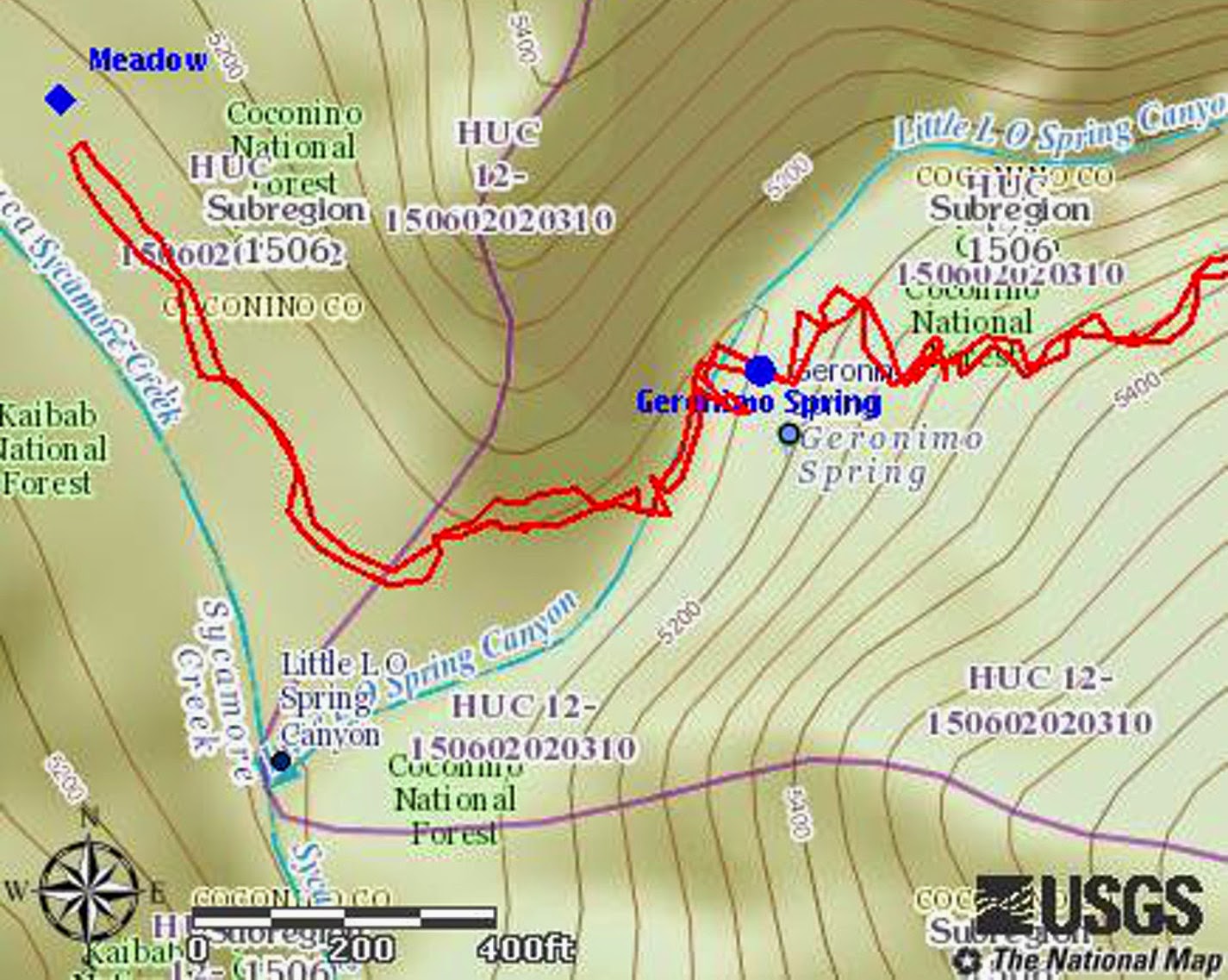
The area around Geronimo Spring and the Girdner homestead site is shown on the map insert shown below. The red line is our GPS track in and out.

Showing the area around Geronimo Spring and the site of the Girdner Homestead

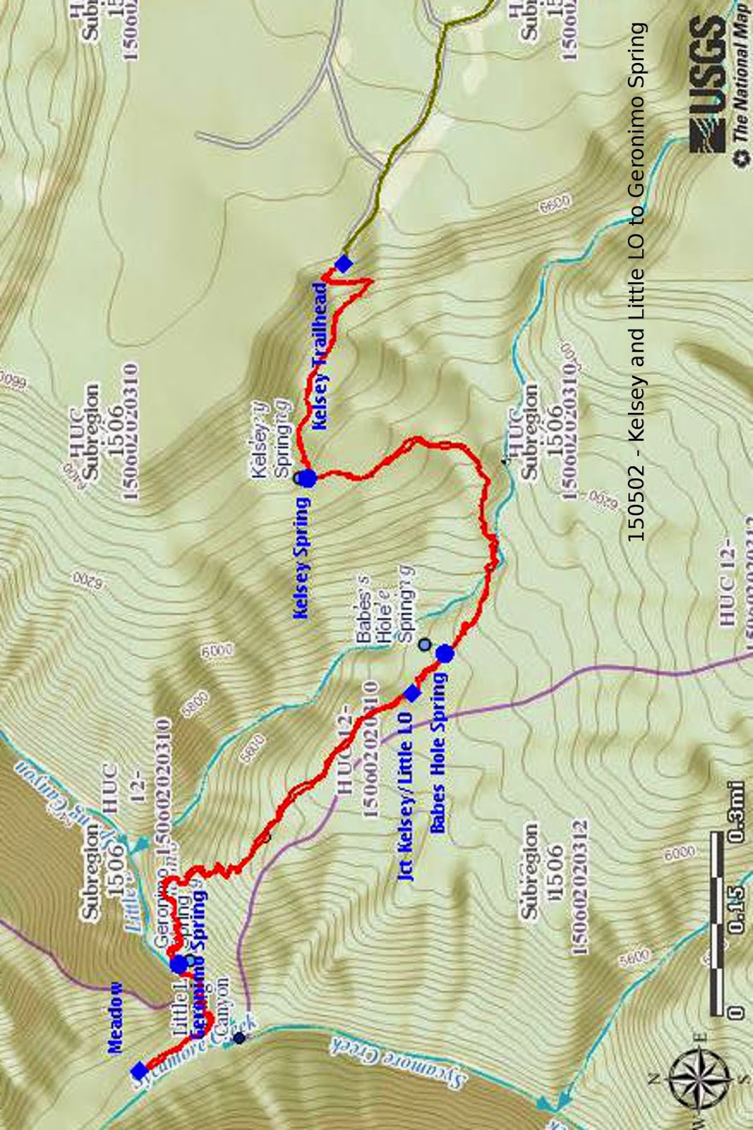
Our complete GPS track for the hike is shown in red on the included map (next page). The green track seen leading to the Kelsey Trailhead is a section of Forest Road 538G.

Accompanying me on this hike were: Lila Wright, Jim Manning, Karl Sink, Chris Jensen and Dave Beech.


Monday, April 27, 2015

Hiking Boyntons Backyard


The weather forecast called for a 50% chance of rain when we met at 0700 on 25 April 2015 for our hike in Boynton Canyon. Generally cloudy skies reinforced the forecast, but we decided to proceed anyway. After all, this hike had been scheduled in part because we wanted to prove to ourselves that we were ready for a campout and strenuous hiking on the Mogollon Rim scheduled for the next weekend. If it rained today we would just don our ponchos.

Leaving the Safeway parking lot, we drove to Sedona, turned left onto Dry Creek Road, drove 2.9 miles to the stop sign at the junction with Boynton Pass and Long Canyon roads (Boyntons Pass Road to the left; Long Canyon Road to the right), turned left onto Boynton Pass Road, continued for 1.6 miles to a stop sign, turned right onto Boynton Canyon Road and continued for about 0.1 mile before turning right into the Boynton Canyon Trailhead parking lot.

We donned our packs, posted our Red Rock Passes (actually in our case Golden Age Passes), checked to make sure our ponchos were ready at hand and headed up the trail.

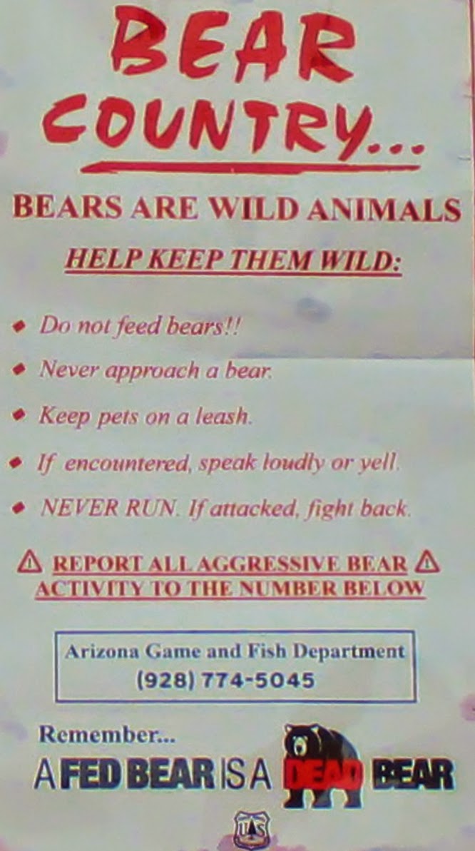
Displayed prominently at the trailhead we found a sign (right) reminding us that we were in bear country. However, the largest animals we saw during our hike were a solitary rabbit, not too bothered by our presence, and a single squirrel that scampered away as soon as we approached. But we did notice several rocks that bears had overturned in the search for grubs.

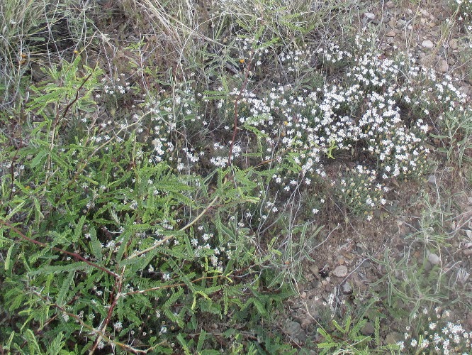
Boynton Canyon Trail and Deadmans Pass Trail share a common track for about 0.1 mile from the parking lot before Deadmans Pass Trail turns to the right and eventually joins Long Canyon Trail. We continued on Boynton Canyon Trail, entering the Red Rock Secret Mountain Wilderness and passing a small area virtually covered with primroses, such as the example shown here (left).

Shortly after the primroses, we came to a flower-covered hillside sporting a variety of flowers The colorful flowers stood in stark contrast with the dull red dirt of the otherwise bare hillside.

Flowers on a bare red hillside

The trail climbed sharply up the rocky north slope of the canyon, wending its way through manzanita, scrub oak, juniper and other low-growing plants, as it bypassed Enchantment Resort which sprawled, like a cancer, across the mouth of the canyon.

Enchantment Resort spreading across the mouth of Boynton Canyon

The rocky but well-maintained trail (right) continued its course along the hillside above the resort for almost a mile before returning to the canyon floor. The hiking was easy as we followed the gently sloping trail up the canyon for the next mile to the point where our trail, loosely called Boyntons Backyard, turns off Boynton Canyon Trail. That does not mean that our trail left Boynton Canyon. On the contrary, Boynton Canyon Trail leaves Boynton Canyon here, turning up a box canyon and ending hard against Bear Mountain. Boynton Canyon, meanwhile, continues essentially straight ahead to end at a steep mountain saddle between Secret Mountain and Lost Mountain. What we call Boyntons Backyard Trail which ends at that saddle is apparently part of an old trail called Boynton-Hart Well Combo that continues around the north side of Lost Mountain and leads down Hart Well Canyon to Taylor Tank.

The turn off from Boyntons Canyon Trail is a bit obscure and I have had to search for it both times I have hiked this trail. A couple of dead limbs are placed across the turnoff to prevent hikers on Boynton Canyon Trail from getting lost.

Spot where we turned off to take Boyntons Backyard Trail

At first there is no discernible trail at the turnoff but it becomes obvious after a few yards and continues along the left bank of the wash for about 0.7 miles before dipping into the wash at a cairn and following it upstream. The cairn (left) was photographed while standing in the streambed. Except for two major obstructions, described below, that had to be bypassed, hiking in the wash was relatively easy. Footing was good with very few loose rocks and we encountered no areas that required climbing.

As for the two major obstructions, the first was about 0.2 miles upstream from where we first entered the wash. Consisting of a jumble of boulders and tree trunks blocking our way, it would have been very difficult to climb over. However, just a few yards downstream, we found a faint trail that allowed us to climb out of the wash and bypass the area by hiking along the bank for about 100 yards.

Obstruction in the Boynton Canyon wash

Back in the wash we continued upstream for another 0.2 miles before encountering another obstruction at a sharp bend in the wash and bypassed it by traveling along an obvious if little used trail for about 75 yards. Back in the wash, we continued for another 0.3 miles before exiting again. Both previous exits had been to the right, were quite short and occasioned by specific obstacles in the wash. This time, on the other hand, we exited to the left bank and climbed along a gently-sloping, fairly well-defined old trail for about 0.6 miles before entering the wash for the fourth time. This time we basically just crossed the wash and started a steep climb, at first close against the face of a rock cliff, following a faint trail that leads steeply up the mountain slope to end about 0.2 miles ahead at the pass between Lost Mountain and Secret Mountain.

This photograph (right) shows Jim Manning looking for trail markers.

The signals to my GPS played hop scotch between the canyon walls in the upper reaches of Boynton Canyon, making any GPS track and any resultant track drawn on a map useful only for general guidance. That is the track points the hiker to the pass where the trail ends but doesn't really show how to get there. That is true for a track I downloaded from the internet as well as for the one I made myself on a 25 February 2015 scouting hike. As we had done for that hike, we just watched closely for the occasional cairn, evidence of long-ago trimming and other signs of passage.

In spite of those disclaimers, finding our way did not turn out to be too difficult even if it was often tedious and time-consuming.

At 1230 we were still about 0.1 mile below the pass, but the weather was looking more and more threatening and I already had a GPS track to the top from my February hike, so we decided to eat lunch where we were and head back.

Before starting our return hike, I snapped a photograph of Lila admiring the down-canyon view. In the center, above and just to the right of Lila's head, is Thunder Mountain (shown on older maps as Capitol Butte).

Lila looking back down Boynton Canyon from just below the pass

Having lingered to look at flowers on the way up the trail, we didn't bother with them on the way down. We just hurried along trying to beat the rain, a futile effort as it turned out. By the time we had crossed the wash just below the extremely steep upper 0.2 miles of trail, I was striking the bushes with my hiking pole to shake the water off the leaves before passing. We were pretty well protected by our ponchos anyway, but our lower legs did get very wet. Water ran into my boots and my socks were thoroughly soaked when I got home. Surprisingly, however, I was still quite comfortable. The bamboo socks I was wearing did a great job of protecting my feet.

Although, as noted, we didn't stop to sniff the flowers on the way back, we had admired our share on the way up. George Everman was not with us on this hike, but he later identified many of the flowers shown below for me. Daisy Williams, who was along on the hike, was able to tell me the names of others.


We easily found all of the places where we had entered and exited the wash on the way up the trail and thus avoided any waiting time trying to decide which way to go or time recovering from taking wrong turns. We were also able to find the junction with Boynton Canyon Trail (left) without any trouble. Note that the blue track continuing to the left from the junction is Boynton Canyon Trail as it leaves the main canyon and turns up a box canyon. The red track is the route we followed. It is composed of Boynton Canyon Trail below the junction and Boyntons Backyard Trail the rest of the way up Boynton Canyon.

We paused, still in our ponchos, at the trail junction for a group photograph.

Left to right: Lila Wright, Joanne Hennings, Daisy Williams, Karl Sink (rear) and Jim Manning – author not shown


After uploading my GPS track and removing a lot of noise (extraneous cross-canyon hops), I measured the round trip hike as being 9.2 miles. The maximum elevation was 6065 feet and the total ascent was 2049 feet.

Our track is shown in red on the included map (below). But beware, as already noted GPS signals are highly inaccurate in the narrower parts of the canyon. A location may be shown on one side of the canyon when it is actually on the other. The blue track on the map shows Boynton Canyon Trail as it leaves Boynton Canyon and continues up a box canyon.


Tuesday, April 21, 2015

Black Canyon Waterfall


On 18 April 2015 fifteen Skyliners hiked to Black Canyon Waterfall. This hike involves following Black Canyon Trail for about 3.3 miles from Ogden Ranch road and then turning off on a well-worn side trail to descend steeply into the canyon at the waterfall.

We drove from the Cottonwood Safeway parking lot to the Black Canyon Trailhead at the end of Ogden Ranch Road and were on the trail by shortly after 0730, having paused at the parking lot for a group photograph.

Left to right: Gary Brooks, the author, Mary Gavan, Daisy Williams, Dolly Yapp (kneeling), Phil Sullivan, Betty Wolters, Floyd Gardner, Karl Sink, George Everman, Lila Wright, Joanne Hennings and Marianna Hartsong – two hikers chose to remain anonymous and one of them used my camera to take the above photograph
Two or three years ago Ogden Ranch Road was blocked off about 0.7 miles short of its original ending at the old Black Canyon Trailhead near Quail Springs. Concurrently, the trail was rerouted to start at a new parking area at the end of the shortened road. The total effect of these changes was to add one mile to the Black Canyon Trail, the one-way distance along the trail between Ogden Ranch Road and Allen Spring Road is now eight miles.

The trail leaves the parking area at about the 11 o”clock position, just where Betty Wolters and Karl Sink are standing in the above photograph. When I last hiked this way, there was a trail sign marking the trail as # 114; however, I did not see it today. I may have overlooked it or, more likely, it has been torn down by vandals.

From the parking lot the trail now follows along the course of an old road, passes through a gate and crosses Quail Springs Wash about 0.7 miles below the springs. When the trail reaches the rim on the other side of the wash, it leaves the old roadbed and begins a gentle climb, wending its way across a series of ridges and joins the original Black Canyon Trail after another 1.9 miles and an elevation gain of 1050 feet. This new section of trail is very well engineered and a pleasure to hike on. The hike today was especially enjoyable for those of us who like to pause and admire flowers along the way. We had expected to see a large number and variety and were not disappointed. Unfortunately, about half of the group were more interested in speed than flowers. But George Everman, who was leading the hike, solved that problem by splitting us into two separate groups. This allowed everyone to enjoy the hike.

George also came up with an ingenious game to entertain us along the way. He passed out pictures of a desert star flower and challenged us to find one, with a prize, a fake gold bar, going to the first to do so. As it were George himself was first to spot a desert star and, apparently deciding it would be untoward to accept the prize himself, presented it to Dolly in recognition for her diligent effort to photograph flowers for him while he sorted out the disparate hikers.

The strawberry hedgehog cactus, below left, was photographed on the way back after it was fully opened. The water jacket plant with pale yellow to white flowers, below right, is noticeably cool to the touch, always several degrees below the temperature of surrounding plants. George had searched for this plant during the entire hike and finally found it when we were almost back to the trailhead.

Strawberry hedgehog cactus
Water jacket plant
We saw several globe mallow plants along the way. For the most these were scattered among other plants and, too spread out to be individually noticeable, they just blended into their surroundings. However we did find one patch, below left, that was thick enough to make a dramatic statement all on its own. Meanwhile, silvery goat's beard plants, sometimes alone, sometimes in clumps of two to five plants, shouted out for attention.

Globe mallow 
Goat's beard
After the first few minutes we never saw the faster hikers again until we approached the waterfall. We didn't worry about that; we were having our own hiking experience.


About half way along the new section of trail I found a single larkspur (right) hiding in the undergrowth, the only one we saw on the entire hike.

The section of forest that we were passing through had apparently not been pastured for some time and flowers nestled attractively in the untrammeled grass. See for example the blackfoot daisies and mariposa lilies below.

Blackfoot daisies and mariposa lilies nestled in the grass
Yellow blossom – prickly pear cactus
Pink blossom – prickly pear cactus
We saw the occasional Indian paintbrush along the way, but they all appeared somewhat bedraggled and faded, so I never really bothered to photograph them. We saw altogether too many flowers on this hike to include them all in one report, so I have selected just those that most appealed to me. Prickly pear cactus blooms were sparse; however there were isolated examples that I couldn't resist including.

About 0.3 miles after passing through a second gate we reached the end of the new section of trail and continued up the canyon on old Black Canyon Trail. Apparently, there has been a problem with hikers taking the old, closed off, section of trail instead of turning onto the new section. Each time I pass this way, it appears that more brush has been placed on the old trail (left). One could now most certainly not take it in error.After hiking for around 0.7 miles up the old trail we came to a sharp turn in the trail. Located alongside the trail at the bend is a good-sized tree that can always be depended upon for a bit of shade. From here one can enjoy an expansive view out over the valley below. I always pause here when hiking Black Canyon Trail.

Just beyond the sharp bend in the path we came upon a section of trail lined with colorful California poppies. The photograph shown below was taken looking back down the trail.

California poppies lining Black Canyon Trail

The last time I saw such a profusion of poppies along this trail was in March 2010, but I think it is likely an annual display. A close-up photograph of this beautiful flower is shown here (right).

At about 3.3 miles from the trailhead we left Black Canyon Trail to follow a side trail that runs down the mountain to the waterfall at the bottom of the canyon. The easy part of the hike was now over. From here the trail is at first steep but well worn and easy to follow. Then, after around 0.4 miles, it becomes very steep and is rocky and sometimes hard to follow. The below photograph shows the trail forking left and heading for the waterfall.

Follow the left fork to the waterfall

Shortly after turning off the main trail, we came upon a single prickly poppy (left) thrusting its snow-white blossoms above the surrounding growth.

The path descends along a mountain ridge that slopes down toward the bottom of the canyon before ending at a sharp drop off above the narrow canyon floor. The trail follows along the left (downstream) side of the ridge and crosses under the ridge point.

It then descends precariously along the upstream slope of the ridge to a side wash (right) that feeds into Black Canyon. A thin stream of water can be seen flowing along the bottom of the wash. The stream shown here still has another 20 or so feet to drop before reaching the bottom of Black Canyon. Look closely straight ahead beyond the stream of water and close alongside the rocky cliff at the right and you will see, faintly, the trail that will lead us across a low ridge and down into the canyon at the waterfall shown in the below photograph.

Black Canyon waterfall seen from where we ate lunch
We found ourselves on a solid rock floor at the bottom of Black Canyon. The canyon here is very narrow; however, there was room for trees to provide shade and plenty of sun-drenched rock surface for those who preferred it. It was, in other words, just about a perfect place for lunch and a nap. A little looking around revealed that we were actually between two waterfalls, the one pictured above and another just a few yards downstream. Some of the hikers who had previously visited the site told us that a larger waterfall was located about a quarter of a mile upstream, but we were satisfied with where we were.

I ate lunch resting on a soft bed of dry sand just above the trickling stream and then drifted off to sleep admiring the stone spires rising above the trees located just upstream.

Looking upstream from Black Canyon Waterfall
After lunch we gathered our packs and headed back up the ridge, sustained, as we climbed sections such as that shown here (right), by the thought that once we reached Black Canyon Trail the rest of the trip would all be downhill.

The climb back to the main trail went surprisingly fast and we were soon enough heading back downhill. We didn't spend a lot of time looking at flowers on the way back. Mainly we just checked to see which ones might have opened since we passed that way earlier. As already noted George did find a desert star, in fact a large clump of them They are shown below along with a close up of a brownfoot flower. I cannot remember ever having seen one of these in full bloom before and was surprised to find that the blossoms were pink.

Brownfoot closeup
Desert star 
When we arrived back at the parking lot, the fast hikers were, of course, long gone. However, they had apparently counted noses and made sure we had enough room in the remaining vehicles to take everyone back to Cottonwood.

After uploading my GPS track and cleaning it up a bit, I measured the hike as being 8.4 miles. The maximum elevation was 4968 feet, the total ascent was 1270 feet and the descent was 658 feet. These figures were determined using the return portion of the GPS track. For some reason the hike in was much less accurate, with a lot of signals bouncing off canyon walls along the way.

Our GPS Track is shown in red on the included map (below)