Thursday, February 13, 2014

Medlar Spring Trail


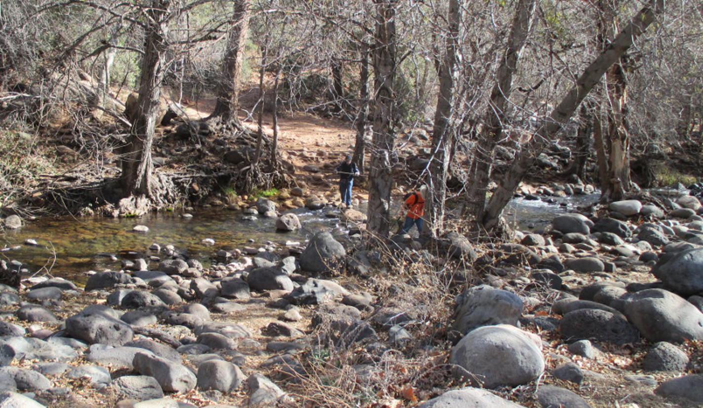
This 13 February 2014 outing was originally planned as a scouting hike for both Ash Creek and Medlar Spring Trails. However, like many of the trails in Prescott National Forest, there is little available information from the Forest Service. The web page just says, “The Medlar Springs trail is 2.4 miles long. It begins at Forest Road 531 and ends at Medlar Springs.” A web search disclosed an unverified GPS track. But this track showed the trail running through the private property of Bottle Ranch. Finally, we decided to just drive to the area and search for the trailhead.

We drove east on Hwy 260 to Camp Verde, took I-17 south to Hwy 169 and followed it for 10.3 miles, turned right onto Old Cherry Road and continued for 1.73 miles then turned left onto FR 153 and drove 3.8 miles to Bottle Ranch.

As we approached the ranch we came to a sign (right) warning that the road ended ahead. There was a nice, spacious shoulder at the spot, so we parked there and proceeded on foot toward the ranch. After about 100 yards we found a gate (see below) in the fence alongside the road that appeared to be designed for pedestrians. Although large enough to drive stock through, it was too narrow to permit other than perhaps all terrain vehicles. In any case, the gate was still on Forest Service land, as opposed to private property, and we decided that it was probably the trailhead. Someone had securely tied the gate with many turns of rope. Perhaps to discourage its use? We retied it just as securely.

Gate in the fence alongside the road
We were unsure as to the Bottle Ranch private property boundary, so we went far out of our way to avoid it on the trip up the canyon. This was partly because we hesitated to cross a fairly new fence, thinking that the other side might be private property. The red track on the map (left) shows our path. Later we learned that the actual private holdings were much smaller than we had thought and that the fence we had hesitated to cross actually runs through National Forest land.

The blue track shows the way I returned from the hike. See also the magenta line running close to the creek. I actually hiked about half way down this magenta track on my return, but decided that I might have entered private land and turned back in favor of continuing the track shown in blue. However, I have since checked the Western Ownership topographic map and found that I likely could have hiked the entire length of the magenta track without entering private land. I will give it a try the next time I hike this way. It would be a little shorter than following the blue line all the way. Finally, note the “bearing tree” shown near the top of the map. That marks the northwest corner of the plot of private property.

But back to the hike at hand. We followed the circuitous red track shown above until we joined a road, apparently used for ranch maintenance, running through Forest Service land. We then followed this road upstream to Ash Creek Well, a site marked by the ruin of an old windmill. At this point the trail forks with Ash Creek Trail leading straight ahead and Medlar Spring Trail turning right up a wash. I think of the two trails as running together from FR 531 to this point; however, I believe that, technically, the Ash Creek Trail may start here at the well with the trail below this point being just part of Medlar Spring Trail. The following photograph shows the old windmill as we approached.

Old windmill ruin at Ash Creek Well
As already noted, Ash Creek Trail continues straight ahead while Medlar Spring Trail turns to the right, passing through a wire gate. The old road essentially ends just beyond the gate and one is left to basically bushwhack ones way up the wash below Medlar Spring. We had decided that we would do Medlar Spring Trail today and leave Ash Creek Trail for another day. The area is pastured and cattle traveling up and down the wash have served to keep the trail from completely disappearing. We also noted that the trail had been trimmed sometime in the past (photograph above). In places this was the only indication that it had ever existed.

About half way up the wash we came to an old galvanized watering tank. It had once been fenced so as to permit use by cattle in two separate pastures. It does not appear to have been used for some time.

Long unused watering tank
We arrived at Medlar Spring to find no sign of water and soon headed back the way we had come.

We found no water at Medlar Spring
The return trip down the wash went a bit faster as we were now familiar with the trail and wasted less time finding our way. We paused again at the old windmill on the way back to take a group photograph.

Left to right: Lila Wright, Collene Maktenieks, Frank Lombardo and Jim Manning
While milling about someone discovered a stone fire pit (left) built on the stream bank.

The actual hike to Medlar Spring and back is about 5.8 miles. We did at least another mile due to the circuitous route we took hiking in. The trailhead elevation was 5266 feet and the elevation gain was 494 feet. The Medlar spring Trail is shown in blue on the attached map (below).


Saturday, February 8, 2014

13-mile Rock to Clear Creek on Crook Trail


On 08 February 2014, thirteen Skyliners hiked on General Crook Trail from 13-mile Rock to West Clear Creek at the junction of Forest Road 626 and Hwy 260. This was a second hike for several members of our group, as we had scouted the trail on 30 January.

We drove east through Camp Verde on Hwy 260 and turned left onto Forest Road 626 near MM 227, just before the highway crosses West Clear Creek. We drove about 0.8 miles on FR 626, passing the turn off for the Clear Creek Campground, and parked one vehicle at the day use area. A large parking area and a toilet are provided. We then returned to Hwy 260 in the other two vehicles and continued east for about seven miles, dropping some of our hikers off at the junction with FR 9243B (above), just past MM 234. At this point we were about 0.5 miles southwest of 13-mile Rock and this is where we started our 30 January scouting hike. However, for this hike, I wanted to drive another 0.6 miles along the highway to a point just past the rock and pick the trail up there. Several of the hikers went with me and we drove to just east of the rock, parked alongside the road, and hiked along the slope above Hwy 260 for about 0.7 miles to intersect with FR 9243B where the rest of the group were waiting.

As we followed along the original General Crook Trail (actually a wagon road), we were guided by chevrons (left), old rock cairns, an occasional post set in a supporting circle of rocks, a few places where trees had been trimmed to permit easier passage and the faint trace of the old wagon road itself. Some of the rock cairns had been knocked over by cows and were little more than piles of rock. A few were wire bound and still in pristine condition.

Looking back from the trail, we had a clear view of 13-mile Rock, looming in the near distance.

13-mile Rock seen from Crook Trail
For a good part of the way, we were able to follow along old dirt roads that ran parallel to the original Crook Trail and between it and Hwy 260. These roads, constructed later than Crook Trail and before Hwy 260 was completed appeared to be primarily sections of the road that was replaced by the present highway. I am not sure when this section of AZ 260 was built. However, we did note a highway survey marker dated 1971 located along the slope below 13-mile Rock.

In many places the dirt road was just yards away from the original trail and we followed it because it was much easier to hike on. The original Crook Trail was largely washed out, overgrown in places and often very rocky. The dirt roads were, on the other hand, mostly clear and free of rocks, In several places, we saw the remains of old corrugated iron culverts that had served to carry water under the dirt road. When no better route was available, we just followed the original trail as closely as possible. The following two pictures show sections of the old wagon track.

Section of the original Crook Trail running down the center between the trees
Note the large rock cairn, just above the black stump in the middle of the photograph above. The 

old wagon road ran just to the left of the cairn.
A little over four miles from the start of our hike someone noted that it was noon and we stopped at a nice overlook for lunch. I had a thermos of hot tea, but opted to forego the tea in favor of a quick nap. After lunch, we posed for a group photograph. West Clear Creek runs down the far canyon visible above the hikers in the below photograph.

Left to right: Gary Jacobson, Ruth Frazier, Daisy Williams, Frank Lombardo, Connie Woolard, the

 author (sitting), Terry Johnson, Lila Wright, Collene Maktenieks, Dave Beach, Beverly Sass and 
Jim Manning  – photograph by Name Withheld
We had been following closely along the Hwy 260 for most of the hike. However, about 5.5 miles from 13-mile Rock, we turned away from the highway and headed down the slope toward the West Clear Creek crossing, located about 1.3 miles upstream from where Hwy 260 crosses the creek. After turning away from the highway, we descended sharply toward the creek and found that the old road was very badly washed out in one place, leaving little but loose rocks for footing. Luckily, the really bad section was short and soon ended at a gate alongside the creek. The gate was wired securely shut and would have required pliers to unwire, so we descended the creek bank along the fence just to the left of it and and found a place to slip through.

Pedestrian gate at West Clear Creek
Beverly, Ruth, Jim and Gary are shown crossing the creek. I was on high alert with my camera 

to record any mishaps, but no one cooperated by falling.
After the crossing, it was only 0.7 miles downstream to the day use area where we had parked one vehicle. When we reached it, the three drivers left to retrieve the two vehicles parked at 13-mile Rock. The rest of us hiked another 0.8 miles to the Hwy 260 and waited for their return.

According to my GPS the one-way distance from 13-mile Rock to the West Clear Creek Crossing was about 6.0 miles and the distance from there to Hwy 260 at Clear Creek was 1.5 miles, so the total hike distance was 7.5 miles. Those hikers who were dropped off at FR 9243B, hiked about 6.9 miles. The highest elevation was 5069 feet and the elevation difference was 1869 feet. This hike was basically downhill all the way.

The included map (below) shows the entire trail from 13-mile Rock to the West Clear Creek crossing and then on to the junction of FR 626 with Hwy 260 at Clear Creek.


Saturday, January 25, 2014

Hike on Huckaby Trail


On 25 January 2014 thirteen Skyliners hiked Huckaby Trail from Schnebly Hill Road to Midgley Bridge and returned. Although Huckaby is a very well-known trail, I had never before hiked it.

From Cottonwood, we drove north on Hwy 89A to Sedona, turned onto Hwy 179 south and proceeded 0.3 miles before turning north onto Schnebly Hill Road. The trailhead parking lot, signed for Margs Draw and Huckaby trails, is located just 0.8 miles ahead, where the pavement ends and Schnebly Hill becomes a rough dirt road. On parking we walked to the end of the parking lot and found a sign for Huckaby Trail (above) posted sign near the kiosk.

This trail leaves the parking area heading in a westerly direction and is at first generally level. However, after about 0.2 miles, Margs Draw trail leads off to the left and Huckaby descends rather steeply into Bear Wallow Canyon and then switchbacks up the other side to top out on a ridge overlooking Oak Creek and Sedona. We arrived on the ridge just as the sun was struggling to break through a light cloud cover and the view was fantastic.

Looking across Oak Creek and Sedona from Huckaby Trail
Just over a mile from the trailhead we found ourselves following generally along a contour line on the southern slope of Mitten Ridge about 250 feet above Oak Creek. Sedona was still spread out below us and the morning sun, gradually winning its battle with the clouds, highlighted the red rock formations, rendering them in shades of pastel. We decided to stop for a group photograph with that view for a background.

Left to right: Gary Jacobson, Jim Manning, Terry Johnson, Kwi Johnson, Collene Maktenieks, Pete 

Bolinger, Bob Coates, Daisy Williams, Dave Beach, Frank Lombardo, Felicia Coats, and Ruth Frazier 
– author not shown
As we continued along the slope of Mitten Ridge we gradually drew closer to Hwy 89A and its steady roar of traffic as the road made its way up Oak Creek Canyon toward Midgley Bridge. This is the down side to hiking on a trail so close to a populated area. One can never escape the crowds and the noise. But we did have excellent scenery to enjoy and we had started our hike before most of the tourists were stirring, so mostly had the trail to ourselves for the first part of the hike.

Soon we came to the descent into Oak Creek Canyon. From here we could look up the canyon to Midgley Bridge, the end of our trail.

Looking up Oak Creek Canyon to Midgley Bridge
Also along this stretch of trail we had a good view of Steamboat Rock (left). I think I would have named it Tugboat Rock, but someone else got there first.

The descent to Oak Creek was fairly steep, Some 200 feet in about 0.5 miles. After reaching the creek, the trail follows it upstream for about 0.6 miles to the creek crossing. Along here, the trail winds up and down the slope of the canyon wall, never rising or falling very far, but also not the expected easy stroll along a gently-sloping streambank.

There are actually two crossings, as the creek is split into two flows at this point. The first crossing, carrying the major part of the stream was the most hazardous and several of our hikers chose to stop there for lunch rather than attempt the crossing.

First crossing when hiking the trail from Schnebly Hill Trailhead
The second crossing, located about 0.2 miles from the first, carried less water and was much easier. Both crossings (above and below) are shown here in photographs taken on the return trip.

Second crossing when hiking the trail from Schnebly Hill Trailhead
After the first crossing, Huckaby Trail continues upstream on the other side of the creek for a little over 0.1 mile to the second crossing. It then switchbacks up the canyon wall almost to Hwy 89A, turns south and continues parallel to, and just below, the roadway to pass under the north end of Midgley Bridge. After crossing under the bridge it climbs steeply via stone steps to the parking lot. We found another trailhead sign (above) posted there.

The below map shows the trail from the first creek crossing to the parking lot at Midgley Bridge.

Showing Huckaby Trail from the first creek crossing to the parking lot at Midgley Bridge
The below photograph shows Midgley Bridge from the parking lot. The trailhead sign is visible at lower left. Kwi has just passed under the bridge and started up the stone steps.

Midgley Bridge from the parking lot. Kwi has just started climbing the stone steps.
We had taken a bit longer to reach the bridge from the crossing than we had supposed and there was no cellphone reception deep in the canyon, so one of our number turned back to tell those waiting at the crossing that we were eating lunch at the bridge and suggest that they start back to the Schnebly Hill Trailhead. We would catch up after we finished lunch. The rest of us ate a leisurely lunch at a nearby picnic table before starting the return hike.

According to my GPS the distance from the trailhead at Schnebly Hill Road to the trailhead at Midgley Bridge is 3.3 miles, so the hike was 6.6 miles round trip. The distance from the first creek crossing to the parking lot was 0.6 miles, so those who stopped at the creek hiked 5.4 miles. The highest elevation was 4525 feet and the elevation difference was 396 feet. However, with all the interim ascents and descents along the way, we climbed a total of about 900 feet as we hiked the trail both ways.

The included map (below) shows the entire trail from the Schnebly Hill Road Trailhead to the Midgley Bridge Trailhead in red.


Saturday, January 18, 2014

Pink Caves and Jerome Del Monte Shaft


There are two caves located in Del Monte Gulch (actually, one of the mines is located in a side wash that empties into Del Monte). They are known as the “pink” caves because of the pinkish tint to the rock walls they are located in. A few of us had hiked to both caves in 2009, but decided that now would be a good time for a return hike. This time we would also hike to the old Jerome-Del Monte shaft, located about 0.3 miles farther up the gulch from the northmost of the caves.

We took Black Hills Drive to Yavapai College and turned in at the easternmost drive near the winery. After turning in, we followed the road slightly to the right and drove for about 100 yards before parking on our left. After parking, we returned to Black Hills Drive and followed it west for around 0.3 miles to where it made a 90 degree turn to the south and became Haskell Springs Road. We continued south, made a slight jog to the west and then, about 0.3 miles from Black Hills Drive, continued straight ahead (south) on Windmill Lane where Haskell Springs Road makes a 90 degree turn to the west. We continued south on Windmill Lane and then on a faint trail running along the fence delineating a private property boundary for another 0.3 miles and crossed a fence at a locked gate. A large boulder was provided to assist in crossing the fence (above).

After crossing the fence, we turned generally west and angled toward the wash at the bottom of Del Monte Gulch. The trail along here is very faint, but look carefully and you can see that it follows the track of an old road.

About 0.4 miles from the fence crossing, we entered the wash and then followed it upstream for something like 0.3 miles to a junction with a side wash. Del Monte Gulch appears to lead straight ahead (southwest); however, as I had previously determined from a map, it actually turns to the right (northwest), so we continued up that fork for another 0.2 miles toward the north cave. The south cave is located a like distance, about 0.2 miles, up the side wash.

Our path along the bottom of the gulch was pretty rough and we took a good deal of care to navigate safely, but we soon arrived at the north cave (left).

Luckily, the area below the cave slopes gently down and we found it easy to climb up to within a few feet of the mouth. By carefully placing our feet on stone outcroppings, we were then able to climb into the cave.

We thought that the cave was too perfectly shaped to have occurred naturally and that it must have been created by miners, perhaps as a prospective dig. On the other hand, there were no tailings in the canyon below the cave opening. It is possible that it was a natural cave that was extended by prospectors, leaving only light tailings that were carried away by flood waters.

The front of the cave is high enough to stand in, but it rapidly becomes lower and, at first, seems to end altogether about 30 feet in. However, on closer examination, a small opening does extend further and Dave continued on hands and knees for about another 10 feet before turning back. To go farther than that would involve traveling on ones belly like a snake, so we really have no idea how far it actually extends.

We took our time examining the cave, with 16 hikers climbing into and out of the rather small space, and then paused in the wash for a midmorning snack before leaving the site. The photograph included here (right) shows hikers leaving the cave.

Following our snack we proceeded on up the wash toward the old mine site known as Jerome-Del Monte shaft. None of us had hiked this far up the gulch before and we were utterly surprised to find, less than a hundred yards ahead, what at first seemed an insurmountable barrier, a sheer rock ledge about 10 feet high.

Closer examination, however, disclosed a series of small indentations along one side that would serve as steps. These “steps” were close against the canyon wall and for safety required some support to avoid toppling sideways while climbing up. I braced myself against the rock ledge and offered my shoulder for this purpose. Even so, 5 of our hikers decided to turn back, climb the canyon wall just below the cave, and hike along the rim.

Once past the rock ledge and a smaller, cactus-infested ledge just above it, the way was relatively clear the rest of the way to the old mine site. That is it was clear except for rocks and cacti. In what proved to be a miscalculation, I angled up the slope toward our goal, located above the gulch on the right (northeast) side of the wash. Every few yards we had to change direction or backtrack to avoid another patch of prickly pear cactuses. These seemed to have been strategically placed in transverse bands so as to obstruct our path. Meanwhile, each step required great care to avoid loose rocks hidden in the grass. By contrast a few of our hikers who had continued up the bottom of the gulch had a much easier time of it and were waiting for us when we arrived a the site.

The site has a main shaft which, according to mindat.org, is of unknown depth, about 60 feet in diameter and “has been backfilled by weathering and erosion.”1 In the below photograph, the main shaft in marked by the tailings at center while the smaller dumps seen to the right (below) are “Quartzite, Chert, Sandstone and other discard.”2 Minerals listed for the site include Calcite and Hematite.

Main shaft at center, smaller dumps running to the right – from across the gulch
Just upstream from the shaft are located some large concrete blocks (left) with reinforcing rods running through them. We could not determine their purpose.

When we were through examining the mine site, we continued on an old road that crosses the gulch just above the site and then leads back down the other side. Meanwhile, only one of the 5 hikers who had chosen to climb out of the gulch below the cave and hike along the rim, had continued all the way to the mine. The other four were waiting for us on the old road across the gulch, just about at the location from where the photograph of the mine was taken.

We followed the old road down the other side until it turned away from the gulch. From that point, we just bushwhacked toward where we thought the south pink cave was located. Our intent was to descend to the cave from above and slightly downstream. This had proven, during our 2009 visit, to be the easiest approach. Unfortunately, we aimed too far upstream this time and had to either travel back downstream along a steep rocky slope or descend to the bottom of the wash, travel downstream and then climb back up to the cave. Some chose one way, some the other, and some of those who descended to the wash just chose to eat lunch there, viewing the cave at a distance. The rest of us ate in the cave.

As seen below, as befits a naturally-occurring formation, the south cave is more irregularly-shaped than the north cave.

South pink cave – located up a side wash about 0.2 miles from Del Monte Gulch
This cave shows what appears to be smoke discoloration, possibly indicating Native American use. The opening and the main chamber of the cave are larger than those of the north cave. The chamber is about 20 feet deep and there is room to stand upright in most of the area. As was the case in the north cave, this one also has a small opening in the rear that runs for an undetermined length. The two caves are located in the same strata about 0.1 miles apart, and I have heard that they are connected by the small opening. That doesn't seem reasonable to me, and I am certainly not going to test the theory by slithering further into the small opening in either of them.
Indicating possible use by early settlers, we found the date 1897 painted in yellow (right) on the wall.

After lunch we hiked the short distance down the wash to the junction with Del Monte Gulch. Some of the hikers had traveled directly down the bottom of the wash, while others had angled down the slope toward the junction, so we all paused there to regroup. This was the opportune time for a group photograph.

Left to right: Terry Johnson, Anita Jackson, Don Kling, Dave Beach, Ruth Frazier, Teresa Schnack 

(kneeling), Kwi Johnson, Collene Maktenieks (kneeling), Lila Wright, Pete Bolinger (rear), 
Connie Woolard, Bob Coates, Felicia Coates Daisy Williams (front) and Jim Manning 
– author not shown
We made good time back down the gulch and were soon again crossing the fence by use of the big boulder at the locked gate. Rather than return by way of Haskell Springs Road and Black Hills Drive, we took a trail that runs roughly diagonally from the end of Windmill Lane to where we were parked near the Yavapai College Winery. Another alternative would have been to turn east immediately after crossing the fence and follow another trail that runs roughly parallel to the way we went.

The GPS Track for this hike is shown of the included map (below). The red track on the map shows the way (by Black Hills Drive and Haskell Springs Road) from the parking lot to the north cave, on to Jerome-Del Monte shaft, across to the south cave and back to the junction of Del Monte Gulch and the side wash. This track has been edited to remove the extra distance we hiked due to misjudging the location of the south cave. It now shows the correct path. The alternative return path we took from the gate, is shown in blue and still another alternative return path is shown in yellow.

Because of inaccuracies due to erratic readings while entering the caves and traveling in the narrow gulch, my GPS showed a total hike distance of 7 miles. We actually hiked only 5.3 miles and, had we not misjudged the location of the south cave, it would have been 4.3 miles. Our highest elevation was 4378 feet and the elevation difference was 809 feet.


1 http://www.mindat.org/loc-63506.html

2 Stet

Saturday, January 4, 2014

Lime Kiln Trail from Red Rock to Dead Horse


Lime Kiln Trail was listed as a Centennial Trail by the USDA Forest Service in 2005, in celebration of the 100th birthday of the US Forest Service and we had discussed hiking it since that time. A few of us had already hiked the entire length of the trail and others had hiked various portions. We would now all hike the entire length, but split it into two separate hikes. The section of trail from Red Rock State Park to Hwy 89A at the Sedona Wastewater Treatment Facility was scheduled for today, 4 January 2014.

In the mid 1880s brothers Charles and G. M. Willard constructed a lime kiln in the White Hills above Cottonwood. The kiln was actually excavated out of a limestone ledge. It was originally about 20 feet high and had a solid, closed top. Today, the remains are about 6 feet high and the top is open. Lime Kiln Road was constructed at the same time to bring lime from the kiln to the construction sites for the Willard and Strahan houses. The Willard House is still standing; the Strahan house was demolished in 2007.1, 2

Later the road was extended beyond the kiln to connect with the Oak Creek Road. Known as the Lime Kiln Cut-Off, It became a favored route for early settlers and was continued in use until the advent of the automobile.3

For our 4 January hike we drove two vehicles to the trailhead just beyond the turnoff from Lower Red Rock Road Loop into Red Rock State Park, leaving a third vehicle at the wastewater treatment facility on the way, and parked alongside the road. There is a wide shoulder at the trailhead, providing ample room to park three or four cars.

We like to take a group photograph sometime during each hike, and I forgot to do that on the last hike, so we paused at the trailhead for a group photograph before starting today's hike.

Left to right: Jim Manning, Donna Goodman, Betty Wolters, Gary Jacobson, 

Kwi Johnson, Collene Maktenieks, the author and Connie Woolard 

– photograph by Name Withheld
We were in the shade at the start of the hike and it was pretty chilly, but the first mile to the lower saddle at the south end of Scheurman Mountain is essentially all uphill and we soon warmed up. In the saddle, Lime Kiln Trail intersects with the lower end of Scheurman Mountain Trail (right) which leads across the mountain and ends at Red Rock High School.

At an elevation of 4280 feet, the saddle was the high point of our hike and, as shown in the following photograph, we could see far across the plain to Sycamore Gap at the edge of Sycamore Canyon Wilderness area.

Looking northwest from the lower saddle of Scheurman Mountain.
We followed Lime Kiln Trail on through the saddle, descended the western slope of Scheurman Mountain, crossed Lower Red Rock Loop Road and continued through the hills south of Elmerville. The following photograph shows the view looking north from the hills above Elmerville.

Looking north from Lime Kiln Trail as it crosses the hills above Elmerville
After passing Elmerville, the trail followed a dirt road and continued on past Dry Creek where we stopped for a snack. We were 3 miles from the trailhead at Red Rock.

Dry Creek Crossing
We were pleasantly surprised when George Everman met us at Dry Creek. He had decided to hike in from the wastewater treatment plant on Hwy 89A and meet us. He then accompanied us back to Hwy 89A and, on his way back home to Sedona, transported the two drivers back to the Red Rock to retrieve our vehicles.

After our snack, we continued on along the old road for about 0.8 miles to where the road made a turn to the right. At this point, the trail continues straight ahead through a locked, green gate and follows along another old road, now closed to vehicle traffic. The trail was now leading south by southwest up a gentle slope. A wash that had several weirs installed along its course ran parallel to the trail most of the way up the slope. Such structures are normally used for the purpose of measuring water flow; however, why so many weirs would be needed along the course of the same wash is a puzzle. In any event, they now serve only to control erosion. The trail reaches the top of the slope after about 0.4 miles, continues across a large level area and then turns to the southwest down a gentle slope, skirts the reclaimed water spray area, crosses Forest Road 89B4 and continues parallel to that road for a short distance to the Deer Pass parking area. 

Someone, obviously referring to the use of wastewater, had posted the following whimsical sign on the fence.

Whimsical sign
Looking north across the spray area from FR 89B, we had an excellent view of the Red Rock Country west of Sedona.

View north from FR 89B at the Sedona Wastewater Treatment Facility
According to my GPS track, we hiked 5.7 miles today. Our highest elevation was 4255 feet and the elevation difference was 584 feet. A single map showing the entire trail is included later in this report.
Having hiked on Lime Kiln Trail from Red Rock State Park to the Sedona Wastewater Treatment Facility the previous week, we set out on 11 January 2014 to hike the rest of the trail from the wastewater facility to Dead Horse State Park.

For last weeks hike we had parked at the Deer Pass (FR 89B) parking lot on the east side of Hwy 89A. For today's hike, because we had been told the HWY 89A underpass was clogged with mud and tumbleweed, we drove to the same area but turned onto FR 525 and parked a few yards ahead. Both are shown on the below map. A bathroom is provided at the Deer Pass parking lot. The green track at right shows a portion of the 140104 hike; the red track at left shows the beginning of the 140111 hike.

Map showing parking at the Sedona Wastewater Treatment Facility
We started our hike at about 0845 by heading southwest from the parking lot and crossing a wash to connect with Lime Kiln Trail about 0.2 miles from the underpass. We were now hiking down a gentle slope with the country ahead spread out before us with Mingus and Woodchute Mountains on the horizon.

View to Mingus and Woodchute Mountains from Lime Kiln Trail west of Hwy 89A
About 0.7 miles from the highway we passed Triangle Tank on our right. Now following an old road, we continued down the slope and crossed Spring Creek after about another 0.5 miles. Spring Creek runs down from Mooney Canyon and, even in dry weather, isolated pools of water can often be found along its length in the canyon. The trail continued along the old road for a short distance and then left it and headed cross-country in a southwest direction toward the Coffee Creek crossing, around 0.8 miles from Spring Creek. This section of trail is well-marked and easy hiking, except that we had to kick a lot of tumbleweeds aside.

Coffee Creek originates on Casner Mountain. In fact, the lower Casner Trailhead is located at Coffee Creek where it crosses Sycamore Pass Road (FR 525C). The creek runs into Spring Creek a short distance below the Lime Kiln Crossing. This is my favorite spot to stop for lunch when hiking the entire Lime Kiln Trail from Red Rock to Dead Horse; it is just over half way and is a pleasant place to stop. A stubborn old willow tree, shown in the following photograph, hanging on despite grievous injury adorns its bank.

Stubborn old willow tree
Crossing the creek, we found ourselves on another old road which the trail followed up a fairly steep slope to the top of a ridge. Except for a short section within Dead Horse Park, this was the steepest part of today's hike and we rewarded ourselves with a short rest at the top of the ridge. Looking northwest from here, we could see into Sycamore Gap, framed by Casner on the north and Black Mountain to the south.

Sycamore Pass to the west framed by Black Mountain and Casner Mountain
After a short rest we posed for a group photograph before continuing our hike.

Left to right: The author, George Everman, Gary Jacobson (rear), Collene Maktenieks, Dolly Yapp, 
Dave Beach (front), Miriam Sterling (rear), Anita Jackson, Connie Woolard, Kwi Johnson, 
Daisy Williams, Ruth Frazier, Felicia Coates, Lila Wright, Bob Coates and Jim Manning 
– photograph by Name Withheld
Figuring that the Bill Gray Road crossing would be about half way to Dead Horse Ranch, we stopped there for lunch and George, who had parked there and hiked back to join us at Coffee Creek, left us, taking three other hikers with him.

We still had about 4.7 miles to go, but the Black Hills beyond Dead Horse Ranch looked deceptively close.

Looking to the Black Hills beyond Dead Horse Ranch
The trail soon left the old road shown in the preceding photograph and started dipping in and out of washes along the slope of the hill. We were higher than the track of the old Lime Kiln Road, and we had much better views. The trail was not by any means level, dipping into and out of washes as it followed along the slope. However, neither was it very steep. It did have a fine powder surface that made walking a little difficult, somewhat like walking in loose sand.

Along the way we passed the spot where Brian Mickelson, former Cottonwood City Manager, died on the trail on 18 August 2007.5 The spot, 1.9 miles along the trail from Dead Horse, is marked by the two memorial plaques shown below, one on either side of the trail.

Brian Mickelson memorial plaque
We were all getting a bit tired now and the boundary of Dead Horse Ranch State Park (right) was a welcome sight. From here it was just 0.3 miles to the end of the trail.

The most difficult part of the entire Lime Kiln Trail is, in my opinion, the short section Inside Dead Horse Ranch. But even this part of the trail is not overly difficult, just a little rocky as it follows the route of the old, washed-out road above the kiln site. And, in any case, we were soon at the site of the old kiln (left) and the rest of the trail was easier.

We had parked one vehicle at the trailhead. However, most of us would have to hike another 0.8 miles to be picked up at the gate. The cost to park vehicles within the park is $7.00 each, so we had left all but one at the Safeway parking lot.

The State Park Service hands out a patch (right) to those who complete the entire Lime Kiln Trail. I did not know about the patch the last time I hiked the trail, so I made sure to get one this time.

According to my GPS track we hiked 9.0 miles today. Our highest elevation was 3948 feet and the elevation difference was 656 feet.

For the entire Lime Kiln Trail, from Red Rock State Park to Dead Horse Ranch State Park, the distance is 15 miles, the highest elevation is 4255 feet and the elevation difference is 863 feet.

The included map (below) shows the trail from Red Rock to Hwy 89A (Deer Pass parking lot) in green, the trail from Hwy 89A (FR 525 parking lot) to Dead Horse Ranch in red in red and the 0.5 mile section connecting the two by way of the Hwy 89A underpass in blue.


1National Forest Service Trail Description for Lime Kiln Trail #82
2The Verde Independent, October 15, 2009
3National Forest Service Trail Description for Lime Kiln Trail #82
4Forest Road 89B (also known as Deer Pass Road) starts at Hwy 89A, directly across the highway from FR 525, and leads east.

5 http://www.dianejoens.com/bmickelsen_memorial.htm