Saturday, June 5, 2010

Bell Trail 12


Parking at Trailhead
Location: 34°40'26.88"N; 111°42'48.49"W
Elevation: 3856

Along with five others, I hiked part of the Bell Trail on 05 June 2010. George and Betty suggested this hike. However, after discussing the weather and the projected presence of “no see ums” (Ceratopogonidae, or biting midges) with a group of naysayers, Betty decided to sit this one out. Donna, Gordon, Loren, John and I met at the normal gathering spot in the Safeway parking lot and then proceeded to meet George at the I-17/Hwy 179 intersection. From there we traveled east on Forest Road 618 for about 2¼ miles before turning left on Forest Road 121 to proceed to the trailhead about ¼ of a mile ahead. The road turns to the right toward a Forest Service complex after a hundred yards or so and one must continue straight ahead to reach the trailhead. It is not hard to find.

On reaching the trailhead, we donned our packs and started up the trail, stopping to read the trail information sign along the way.

Forest Service Trail Description
As we continued on up the trail, we saw a beautiful patch of trailing four o’clocks followed immediately by one of silverleaf nightshade.

Trailing Four O’clock
Silver Leaf Nightshade
After admiring the flowers we paused for a group photograph.

Left to right: George Everman, Donna Goodman, Gordon Bice, Loren 
Pritzel and John McInerney (Photographer: Ellis Price)
A raven perched high on a dead limb alongside the trail, called a welcome to us as we passed -- or perhaps it was a curse. I stopped for a shot of the raven and to admire a honey mesquite bush growing nearby.

Raven sentinel posted alongside the trail
Western honey mesquite (Prosopis glandulosa)
John told us there was an Indian ruin ahead and we found it, about 1.75 miles from the trailhead, by following a faint trail leading toward the creek.
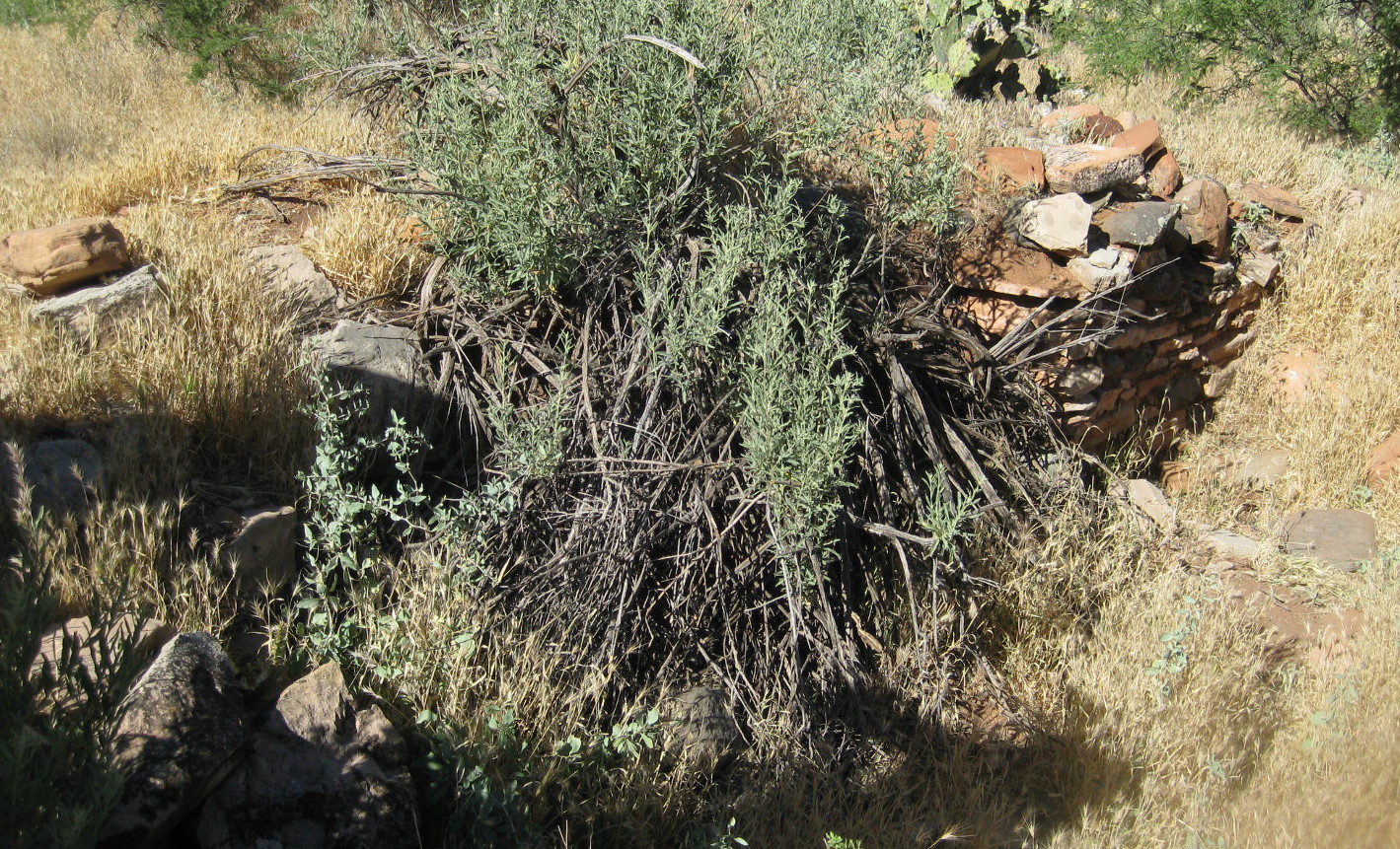
Indian ruin just off trail about 1¾ miles from the trailhead
Leaving the Indian ruin, we continued for just over ½ of a mile further before turning toward the creek on Weir Trail. This is an excellent place to stop alongside the creek to rest and dangle ones feet in the water or, if getting your feet wet is not your thing, just relax for a spell in a shady spot and listen to the rippling stream.

This is a pool just below the weir
I wonder if the fish will bite his toes?
Donna doing some rock hopping
A cable car is installed to cross the creek at the weir. While it appears to be maintained in good condition, we were not able to determine what it is used for. It was locked to prevent unauthorized use, but we decided that did not preclude a bit of posing.

Ready to go, but all locked up
When we were ready to continue, Gordon, George and Donna returned to Bell Trail by way of Weir Trail. Loren, John and I took a shortcut, scrambling up the mountain to reconnect with the trail and waited there for the rest of the group. While waiting, we were passed by at least 35 or 40 other hikers, many of them on a bus tour from Colorado. Apparently Bell Trail was recently written up in Arizona Highways magazine and it is currently much in vogue. Everyone was headed to the swimming hole at the crossing. Most of the group from Colorado, all apparently of high school age, were ill-prepared to for a 3½ mile hike on a day when the temperature reached 103% F. Most of the boys were shirtless and the girls were mainly wearing bikinis.

One poor girl appeared to be in the early stages of heat exhaustion when they reached where were waiting. Someone talked her into staying in the shade with us until the group leader, wisely hiking at a more leisurely pace, arrived. When the rest of our party arrived, the girl still didn’t look much better, but she was now in the care of the group leader, and we continued on our way.

The crossing area does have a great swimming hole I one cars to dive in from a high rock ledge; however at this particular time the tour group from Colorado were there in full force and they sounded, as one might expect, like a bunch of high-school students on vacation.

Nevertheless, by continuing a short distance on up the creek, I found a shady spot on a rock where the noise from the swimming hole was bearable and settled in for lunch and an hour-long nap. It seemed that I had barely dozed off when I heard the group calling me for the return trip.

We saw the following flowers on the stretch of trail between the Weir and the swimming hole at the crossing.

Prairie spiderwort 
Prickly Pear Cactus or Cactus apple
Ocotillo
Brownfoot
The round trip hike was about 6.2 miles except for George, Gordon and Donna who didn’t take the shortcut from the weir. I estimate that they hiked about three-quarters of a mile further. The elevation change was only about 300 feet and, while he temperature reached 1030 F, we did not get overheated, perhaps because we stopped to rest several times along the way.

Our GPS track is shown on the included map (below).


Saturday, May 29, 2010

Woody Mountain Hike


On 29 May 2010, the Skyliners hiked on Woody Mountain. The hike got off to a rather rocky start as our normal hike leader. who had planned the hike, was absent. I had previously asked her for a description of the hike to publish in Google Calendar and learned only that we would “drive to Woody Mountain and hike up it.”

Someone suggested that we just hike somewhere else; however, we had arranged to pick Loren up at Flagstaff on the way to Woody Mountain. Then Lila showed up with a map and we learned that she had hiked in the area some years ago. We immediately put her in charge and headed toward Flagstaff. Unfortunately the roads had changed since Lila had last hiked in the area and we had a lot of trouble finding the turnoff from FR 231.

We took I-17 north to the Flagstaff Airport exit (Exit 337). We left the freeway there, turned back over the freeway and then turned right on AZ 89A (going toward Flagstaff parallel to I-17). About six tenths of a mile after turning onto AZ 89A, we turned onto Forest Road 532 (Purple Sage Trail) and followed it for 1.8 miles before turning left on FR 231 (Woody Mountain Road).

From there things became rather confusing. We should have followed FR 231 for 3.1 miles and turned left on a side road to park near a tank (Location 35° 9'10.44"N; 111°45'1.47"W). However, we went too far, passing FR 231C, which we later learned is the access road to the Lookout Tower on top of the mountain. When we reached the next turnoff beyond FR 231C, we decided that we had gone too far, so we turned around and drove back to FR 231C. But that still didn’t seem quite right, so we continued on until we finally came to the unmarked road at the tank where we actually parked for the hike.

As it turned out, although this road would have provided easy access to Woody Mountain a few years ago, a locked gate now blocked the way a little over one-tenth of a mile from where we parked. On encountering that obstacle, we returned to the parking area and discussed our next move, finally deciding that we would return to the locked gate and follow a power line that ran along the edge of the private property beyond the gate. We would simply go around the private property. Finding that an ATV trail followed the power line to the edge of the property and then turned back toward the top of the mountain we hiked along that.

Following along the ATV trail, we came to an aspen grove and decided to leave the trail there to head directly toward the Lookout Tower, barely visible over the top of the trees ahead. Soon, we came to the same old road that had been blocked by a locked gate at the start of our hike; also we had by now realized that we had inadvertently entered onto the plot of private property.

However, a gate marking the upper boundary of the private holding was visible just ahead, so we crossed there and followed the old road on up the mountain. It was now obvious that we could easily avoid trespassing on the way back by turning at the gate and cutting through the open forest to rejoin the ATV trail just a few yards beyond where we had left it on the way up.

Continuing on up the mountain, we soon came to a rather well traveled road and discovered that it was FR 231C, the road that we had earlier rejected. A meadow with a tank was located just below the junction of the roads. It was an altogether pleasant spot and we decided to stop for a snack before continuing our journey to the top of the mountain.

Following our break, we continued along FR 231C on up the mountain for about seven-tenths of a mile to reach the Lookout Tower. A plaque is located at the foot of the tower showing that it was constructed in 1936. Another plaque indicates that it has been placed on the National Register of Historic Places. There is an old pit type outhouse located among the trees just north of the tower and also a more modern toilet located nearby. Although the shack at the top of the tower was locked we could climb as far as the next level down, and we found that we had excellent views from there: The San Francisco Peaks to the northeast, Rogers Lake to the west and Mingus and Woodchute Mountains to the southwest.

Looking northeast: San Francisco Peaks and Lowell Observatory (visible to
 the left of and below the peaks)
Looking west: Rogers Lake
Looking southwest: Mingus and Woodchute
On the return trip, we stopped again at the spot where we had eaten our snack for a group photograph.

Left to right: John McInerney, Loren Pritzel, Betty Wolters, Daisy Williams,

 Miriam Sterling, Carol Burtt, Lila Wright, Gordon Bice and David Nelson 
(Photographer: Ellis Price)

After eating lunch and taking time for my customary noon nap (I think Gordon participated, too), we headed back down the trail. When we reached the junction of FR 231C with the old road, most of the group decided to continue on FR 231 with the understanding that they would be picked up at the junction of FR 231C and FR 231. I went back the way we came to make a GPS track around the section of private property we had crossed on the way up.

We noted a few flowers along the way and I have included a couple of samples below.


Phlox
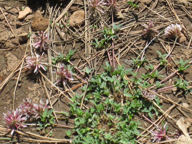
Clover
Those who choose to take FR 231C arrived at the junction with FR 231 at almost the same time we arrived back at the parking area. We measured the distance between the two locations when we drove to the junction to pick them up and found that they were about 1.6 miles farther along FR 231 from where we parked.

The round trip hike was about 4.9 miles according to the GPS file I downloaded to my computer. However, measured in Google Earth, it appears to be only about 4 miles. Had we hiked from the junction of FR 231 and FR 231C instead it would have not been significantly different. The elevation change was about 750 feet. I measured the highest elevation as 8107 feet and the lowest at 7349. The 8107-foot reading would have been at the top of the tower.
I have shown the route of the group who returned from the tower by FR 231 (along with the distance we drove to pick them up) in yellow on the included map (below). Additionally, the part of the hike that we inadvertently made on private property is shown in blue. Note that by following the red track on the way back we managed to avoid private property altogether.

A good future hike would be to park where we did this time, hike to the tower following the red track on the included map (below) then return to the cars by FR 231C and FR 231. That would be about 5.5 miles, or a bit more.


Saturday, May 15, 2010

Milk Ranch Point


Ten Skyliners (Daisy Williams, Betty Wolters, Miriam Sterling, Carol Burtt, Loren Pritzel, Marvin Alt, Lila Wright and Virginia Driscoll, Ellis Price and one other) hiked at Milk Ranch Point on 15 May 2010. From Cottonwood we took Hwy 260 through Camp Verde and turned left on Hwy 87. We continued for about 2.65 miles toward Winslow on Hwy 87 before turning right onto FR 300 (Rim Road). When FR 300 made a sharp turn to the left, just 200 yards from Hwy 87, we left it and continued straight on FR 218A. After following FR 218A for about 1.3 miles we turned right onto FR 218 (Milk Ranch Point Road) and followed it for 2 miles before parking at a beautiful meadow containing a clear, reflecting tank.

Reflecting tank located in the meadow where we parked
Hiking south on Milk Point Ranch Road for about 1.3 miles, we came to a faint trail, marked by a bare wooden post supported by rocks piled around the base, leading off to the left. About 50 yards along the trail and not visible from the road is posted a sign identifying it as West Webber Trail 228, leading to Turkey Spring Trail 217 (1.75 miles ahead) and Geronimo Trail 240 (2 miles ahead). A tank is located on the left (east) side of Milk Ranch Point Road about 50 yards beyond the West Webber Trailhead.

West Webber Trail sign
To this point, the hike was along a very well maintained dirt road, suitable for travel by passenger cars. From here it got a bit rougher and travel by passenger car would require care. A truck or other high-clearance vehicle would be advisable. With a high-clearance vehicle the road is passable all the way to the point.


During the hike, we saw several interesting plants and flowers. I photographed some of these and am including them here:

Common dandelion (Hypoxis hirsuta)

Pineland dwarf mistletoe (Arceuthobium vagin-atum)


Spring Beauty (California Rosea)

Common goldstar (Hypoxis hirsuta)

Unidentified

Prairie thermopsis (Thermopsis rhombifolia)
We continued on Milk Ranch Point Road for about another 2.1 miles before coming to the point. From our position on the Mogollon Rim, the forested, cloud-dappled country was spread out before us like undulating waves in a choppy seascape.

View from Milk Ranch Point on the Mogollon Rim
Leaving the road, we made our way along the rim for something less than two-tenths of a mile before stopping for lunch. I paused along the way to photograph a lonely tree (right) growing, in splendid isolation, on a rock spit jutting out from the rim. Following lunch, we continued along the rim for around another third of a mile before turning away to rejoin Milk Ranch Point Road about one-half mile ahead. We were never very far from the rim and stopped several times to allow various members of the group to travel to the rim for another view of the country below. We rejoined the road about 2.4 miles from where we had started our hike.

According to the file I downloaded from my GPS, we hiked 8.1 miles. The direct reading from the GPS instrument was only 7.85 miles when we finished the hike. I don’t know what causes the difference, but I have noticed it on other hikes. The Total ascent was recorded as 873 feet and the difference in elevation between the low point and the high point of the hike was a bit less than 400 feet.

The included map (below) shows the GPS track for this hike


Saturday, May 1, 2010

Jim Thompson Trail 124


On 1 May 2010, we hiked on Jim Thompson Trail at Sedona. Eight of us (Carol Burtt, Anita Jackson, Betty Wolters, John McInerney, Lila Wright, Miriam Sterling, Ellis Price and one other) drove from Cottonwood to Sedona and then turned left onto Jordan Road, about three-tenths of a mile past the junction of Routes 89A and 179. We followed Jordan Road into the Jordan Park subdivision, turned left onto Park Ridge Drive at the "T" and continued four-tenths of a mile before parking near a gate at the end of a short stretch of unpaved road.

We had originally planned to camp out overnight at General Springs on the Mogollon Rim this weekend. However, the rim road is still closed to the area because of bad weather and it was too cold anyway. Jim Thompson Trail was the alternative.

As the trail leads out of Mormon Canyon from the Jordan Road trailhead, it passes through a forest of Arizona cypress, Manzanita and the ever-present juniper. It continues along the side of the mountain above Sedona, passing Steamboat Rock and Steamboat Tank along the way, to connect with a trail leading into Wilson Canyon about 2.5 miles ahead and approximately one-half mile from Midgley Bridge.


Plants and flowers were abundant along the trail and I spent a lot of time photographing flowers. Although I didn't know what very many of them were, George Everman identified most of them later. I also sent a lichen picture to Bob Wakefield for identification. Specifically we found Blackfoot daisies, ragwort, banana yucca, sego lilies, Indian paintbrush, cliffrose, Nevada dalea, irises, western wallflower, cliff Fendlerbush, Nevada goldeneye, pincushion cactus, narrowleaf yucca, Torrey’s milkvetch and the earth scale soil lichen identified by Bob Wakefield.


Plains blackfoot daisy  
Smooth threadleaf ragwort
Sego lily
Indian paintbrush

Mexican cliffrose


Nevada dalea 
      
Iris
wallflower
Cliff fendlerbush 

Nevada goldeneye

Pincushion Cactus/Whipple's fishhook

 Narrowleaf yucca 
Bladderpod spiderflower

Torrey's milkvetch

Earth scale soil lichen (genus Psora) -- Identified by Bob Wakefield
On reaching the junction with the trail leading into Wilson Canyon, we turned up the canyon and traveled for about three-quarters of a mile until the trail became very indistinct. We then stopped in a nice sunny spot for lunch before heading back.

A few of the scenes that struck my fancy along the way are shown in the following photographs.

Looking down on Midgley Bridge from Jim Thompson Trail.
From Jim Thompson Trail. Looking across Oak Creek to red rocks backed by
white rocks
Sun playing in the branches of an ancient Arizona Cypress tree along Jim
Thompson Trail
This was an easy hike. The round trip distance was just about 7 miles and the total elevation change was a bit over 400 feet.

The GPS track of the path we took is shown on the included map (below).